Tuesday, June 22, 2021

Roswell Riverwalk Full-Moon Urban Hike along the Chattahoochee (Fulton County, Georgia)


Summer in the south is pretty miserable. Soup-like air thickened by extreme humidity makes most outdoor activities a pretty terrible experience. That said, today is not suppose to be as humid as normal and given the near full-moon and clear skies predicted for this evening, it seemed like a great night to explore the Roswell Riverwalk with one of the local hiking groups. 

Meeting at Don White Memorial Park around 8 PM we do a quick round of introductions before heading off down the paved walkway along the Chattahoochee at a brisk pace. Along the way, we chat about other hikes, the phases of the moon, and whatever else comes up in pleasant conversation. One of the hikers is from near my near my hometown near St. Louis and even when to the same University as I did. We talk of the glories of baseball and hockey quite a lot.

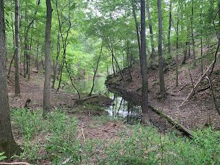
As we are only a couple of days past the summer solstice, we have lots of daylight to work with, though the moon (at about 98% full) makes an early appearance in the sky to the south of us. As we leave the paved trails for the boardwalk and head into some swampy areas, we see a few deer standing in the shallow water and grazing on their favorite flora. It's very picturesque. 

When we reach the far end of the hike and make our turn, it's still is not quite dark. In fact, I only pull out my headlamp a couple of times the entire time and then, just to inspect something or other along the way. On the way back, myself and another hiker seem to be on the same page with regard to pace and we quickly leave most of the group behind with our very nearly 4 mph speeds. 

Arriving back at the parking lot we started at, the others soon catch up. The weather has been terrific this evening. Not too hot and not too cold - just right. I check my tracking app and see that we walked right at 7.6 miles. Not a bad way to spend the evening. The calm waters of the Chattahoochee reflecting the moonlight made for a wonderfully enjoyable fitness walk. I hop in the jeep and head for home.

Saturday, June 19, 2021

Vineyard Mountain (Bartow County, Georgia)


I've got a busy day panned today. First, leading a hike for the Meetup group, followed by a wine festival, and a baseball game to cap it off. I sort of planned all of these things around each other since I was going to be on the north-western side of town. That said, the remains of a tropical storm are currently heading our way and may put a damp damper on my plans. Lets see how it goes. For the hike today, I planned to hike Vineyard Mountain near Lake Allatoona. I had originally posted it to start at a small parking lot near the Red Top Mountain fishing jetty, but after some discussion with other members of the group, I changed it to a larger parking area on the opposite end of the trail near the Riverside Day Use Area. Hopefully, everyone got the message.

Arriving a bit earlier than the posted 8:00 AM start time, I didn't realize that the gate to this area doesn't open until the top of the hour and also that a $5 parking fee is required. Poor planning on my part, but we'll make do. When the gates finally do open, I pull into the large parking area and begin looking for the trail itself. When I return to my jeep, I've been joined by a couple of hikers fro the group. With the gate, fees, and change in location, I decided to (uncharacteristically for me) give people a few extra minutes to arrive. However by 8:10, only three of the registered fifteen are here. Perhaps, they didn't read the instructions or perhaps the potential for rain drove them off. Either way, we've waited long enough and quickly start making our way into the woods.


The first section of this trail is extremely steep and we're all getting a really good workout, especially in this soupy, humid air. I'm glad we started early this morning. This could be unbearable if it were warmer. As we make our way up the side of the small mountain, we chat a bit about the group and other hikes in the area. We also find a decent overlook to view the Allatoona Dam, which stores water from the Etowah River to form this large lake. This first mile or so is really challenging, but eventually, we reach the summit and take a short water break near the cell phone tower here.

Coming down from the summit, the trail descends and maintains a nice rolling hill style terrain for the remaining distance. Other than a few fallen trees across the trail, it's pretty well maintained and seeing the fields of grapevines all over the place, I have no doubt no how this small mountain was named. When we finally reach the far end, near my originally planned starting point, we wander out among several families fishing off of the man-made fishing jetty. Here we take a second short break on the tip if the peninsula. One of the other hikers mentions what a wonderful spot this would be for a meditation group and I have to agree. The setting and serenity of this place is quite relaxing. That said, we get some water and start heading back.

For most of the return trip, we follow a similar route, but since we've already summitted, I suggest an alternate route back to the parking lot, which hugs the side of the mountain and eliminates the need for the super steep section again. Just as we reach the cars, the sky starts to drop a light rain on our heads. I wish my fellow hikers a wonderful day and head to the restroom. I take a few minutes to rinse off some of the sweat and change clothes, before heading to my next stop. I'm sure the other wine enthusiasts will appreciate my efforts. Looking at my tracking app, I see we've covered 7.6 miles, which is more than I expected, but still makes for a good day.

Sunday, June 13, 2021

Clinton Nature Preserve (Douglas County, Georgia)


With the Grand Canyon trip now behind me and a couple of marathons in front of me, I've switched my fitness focus more to running in preparation for those grueling miles. That said though, I'll still continue to hike as new opportunities present themselves. The first of which is to explore the Clinton Nature Preserve with the Meetup group. This park is about twenty miles southwest of the I-285 loop around Atlanta, which is diagonally opposed to where I live, but still it seemed like an interesting hike.

I arrive slightly before today's organizer and assure the other hikers that he will be along. And as predicted, he arrives with about ten minutes to spare. After a quick round of introductions, we head off into the unknown on this hot and very humid day. The trail starts out on a gravel road, but quickly turns into well eroded single-track as we enter the Georgia woods . . . or jungle, as I have come to think of it. There are a number of bike trails cutting through the landscape and we select one to explore. Very early on, it takes us to a deserted pavilion that was likely host to several weddings and other festivities in years past. At this point though, the foliage has started to reclaim the building.

Continuing on, we select different trails to explore as we encounter multiple junctions. The group is going at a pretty good clip today and not until we hit a small water crossing do we really stop. Here, we spend some time trying to find a good place to cross. The water is shallow and myself and one other hiker decide to just go for it and wade across to the other side. It wasn't really any hardship. The others find some place to cross a little downstream and we quickly regroup.

Having done a rough figure eight over the course of about five miles (5.2 to be exact), I note the time is approaching and as I want to get home in time to run a couple of errands, I decide to break from the group and head back to my jeep. A few others join me, but the majority of the group continues on. It was a good trail to explore, but hiking in Georgia in the summer is just nasty with this tactile humidity.

Sunday, June 6, 2021

Stone River Battlefield (Rutherford County, Tennessee)


Final stop for the day before making the last push towards home is the Stone River National Battlefield, which served as a pivotal engagement during the Civil War. The battle was ultimately inconclusive, but with the Union army repelling not one, but two Confederate attacks, it could have lead to a Confederate campaign into the north via the western arena of the war. As it stood, that campaign never happened in great part thanks to the Union troops that fought in this place. That said though, this was one of highest causality totals for both sides.


The battlefield itself commemorates the soldiers of both armies that fought here. The open fields of the park were the site of much back and forth during the three day battle. The fact that was the field has been left in this form is a tribute to the rich history of this place and how seriously the citizenry takes it.

In addition to the field of battle itself, a museum has been erected and a number of cannons and other period-appropriate equipment decorate the park. I've learned much about the Civil War since moving to Atlanta, but I never cease to be humbled by the aura that surrounds these places. After a quick walk through the museum and the nearby cannons, we head back to the jeep and continue on the final leg of our journey home.

Limestone Sinks Trail (Wilson County, Tennessee)


Next stop on this road trip home is a short trail in the Cedars of Lebanon State Park. This one caught my attention due to it's name and the geological implications. After driving a short distance into the park, I find the trailhead for the Limestone Sinks Trail. As we pull into the parking area, a gentleman that is just getting ready to leave informs me that the trail is covered with water. In fact, he says that water is actually streaming over the trail just a hundred or so feet from this trailhead. As I'm in some waterproof hiking shoes, I decide to go ahead and check it out, but I warn my mother, who is traveling with me to stay with the jeep. If it's not too dangerous, I'll come back for her.

He wasn't kidding. There is about an inch of water on the trail and it is flowing across it in places. Luckily, my shoes are waterproof to about that depth and I make my way along the left fork of the small loop trail. Beyond the standing water, there are a number of limestone boulders that have been flattened, either by nature or by man, that make up much of the trail's surface. The rain has made these incredibly slick. It's probably best that my mother doesn't attempt to hike this trail.

Being this far, I decide to continue on around the loop before heading back to the jeep. It's only about a half mile in total. Along the way, I find several examples of the sinks for which the trail is named. The largest of which is almost like a small cave, while others appear more like fissures that have opened up in the earth. I don't know the history of the geology of this place, but it certainly makes for a nice diversion from the long drive. After I complete the loop, I head back to the trailhead and depart for my next stop.

Winding Stairs Cascade (Macon County, Tennessee)


For the next stop on our drive home from Kentucky, we decided to stop and eat some lunch at a new park near Lafayette, TN. The road leading to he parking area doesn't even appear on Google Maps yet. After a quick bite to eat under a well-constructed pavilion, I decide to explore the main trail, which leads down a number of steps and into the small lush canyon cut by small tributary creek. As it has been sprinkling rain all day long, the wooden steps are slick and covered with mud in some places. The stairs wind around the contours of the canyon and lead down towards the cascading creek.

As I descend towards the creek, I'm thankful for the strategically placed railing, as it prevents me from falling on the slick surface in a couple of places. Reaching the bottom of the stairs, I'm presented with a small wonder of nature. The lush greenery of the sloping canyon walls hide a gorgeous limestone formation that has been carved by the creek into a multi-level cascade. The waterfalls continue further down the creek and out of sight. While it's certainly not the biggest cascade I've seen, it is a nice feature to see on this long road trip.

While I could continue hiking the rest of the trail, I think I've seen the primary feature and with my mother waiting at the jeep, I don't want to be gone for too long. I head back and we continue along our journey home.

Sand Cave (Mammoth Cave National Park, Kentucky)


I spent the weekend attending one of my cousin's wedding in Owensboro, KY, which is about a six hour drive from my home near Atlanta. My mother joined me for the trip and we spent Saturday night at my aunt's house, before going to a breakfast with several family members that had traveled to the wedding. From there, we started the long drive home, but as it is a long drive I wanted to find a few places along the way to stretch our legs a little bit. Given that my mother was with me, we couldn't do anything to strenuous, but I think I identified a number of good spots to check out. 

The first is just on the outskirts of Mammoth Cave National Park. The trail to the Sand Cave overlook is a slightly elevated boardwalk through the woods. It's only about a third of a mile long and mom seems to do okay with it. Once we reach the overlook, we peer down into the large cave entrance. The cave is notable due to an early cave explorer of the area dying while trying to enlarge a passage. Floyd Collins spent four days wedge in a passageway before a collapse further trapped him. He passed away approximately two weeks later from a combination of starvation, dehydration, and hypothermia . . . not a pleasant way to go. We're not going to go spelunking today and so, hopefully, we'll survive this very short hike. After we take a few shots, we head back to the jeep and continue on our way home, with a couple of other stops along the way.