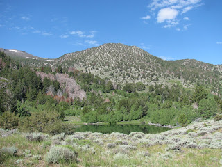
Mount Rose is the jewel of the Reno horizon and the third tallest peak in the Lake Tahoe Basin, rising to 10,785 ft. I've hiked to the top of this mountain many times over the years via the standard trail approaching from the southwest. With that said, I've known another route was possible ascending the northwestern side of the mountain from Galena Park. I've always wanted to hike this route, but for reasons passing, I've never gotten around to it.
When the meetup group I often hike with posted a hike following this route, I jumped on the opportunity. I was excited in the days leading up to the planned out. Until the day before, that is. On Saturday, I received a call from life-long friend. He explained that another member of our brotherhood had passed from this life earlier that day. The news hit me like a ton of bricks. I was not prepared for such news and it weighed on me well into the next days. When Sunday morning rolled around and time to go for this hike, my wife suggested it might be good for me to get out and clear my head.
I met up with the small group of hikers, many of whom I have hiked with before, at the Galena Park Visitor's Center and we quickly started making our way up to Church's Pond. I've also done this hike a few times before and remember it being a pretty steep and challenging uphill, but I'm feeling strong this morning and have very little difficulty with the uphill.
Reaching the turn-off to the pond, we depart the main trail and begin bushwhacking in search of a route up to the northwestern ridge of Chocolate Mountain. It takes a couple of attempts fighting our way through the thick growth, but we eventually carve out a path through the brush and after a short distance pop out on the other side where we find a feint use trail. It seems we're on the right track.
As we push, we gain some elevation above the pond and are treated to a wonderful view of the small water hole from above. The trail meanders through a large scree field before hitting a higher treeline, where large patches of snow remain from the long winter. Even now, in late July, the white carpet covers sections of the this northerly-facing hillside. We make our way through the mess until we reach the steepest part of the route, which has us climbing about 400 feet of scree at a 35-40 degree incline. While challenging, this class 2 terrain is much easier than the class 3 I did last weekend.
Reaching the final ridge-line, the summit of Mount Rose comes into site. A number of other hikers sit and admire the view. I noticed them wondering where we had come from as we approached them from the completely opposite direction they must have taken to reach this high Sierra peak. No matter, we relax at the summit and enjoy some lunch before planning our return. One of party had left a car at the standard trailhead and as I have someplace to be in a couple of hours I ask if he would mind my coming down the standard trail to his car and then catching a ride back to my jeep at the park. He graciously agrees.
We bid the other members of our party, who intend on returning the way we came, goodbye and being making our way down the mountain. This route is about a mile-and-a-half shorter and only looses about 2,500' of elevation as opposed to the 4'600 we gained coming up the way we did.
I check my tracker and see that this mixed route carried us about 11.5 miles total (6.5 from the park to the summit and another 5 from the summit to the trail head). We pack ourselves into the car and head back down the mountain. It was a nice hike and I'm glad to be able to check that route off of my to-do list, but it doesn't ease my soul any and the pain of loss continues to well up inside me.


No comments:
Post a Comment