For the past few weeks, I have been taking some off-road excursions in my jeep looking for a remote waterfall I have read about, Jumbo Falls. Unfortunately, I have not had any luck locating the correct trail in those hills. Over the years, a number of jeep and dirt bike trails have been cut all through the area, forming a crisscrossed network.
This morning, I decided to take another crack at it. The trail starts at the Jumbo Grade trailhead off of Eastlake Blvd. near Washoe Lake. Different from many of my blogs, this trip was a combination of off-roading in the jeep and some hiking when the terrain got a little to rough for my confidence on 4-wheels. On my previous trip, I had discovered what little remains of the abandoned mining town of Jumbo, for which this 'road' is named. Jumbo Grade actually connects Washoe City to Virginia City, and Jumbo was at one time the midpoint. The road is still navigable with a 4x4, as I traveled the whole distance on that trip.
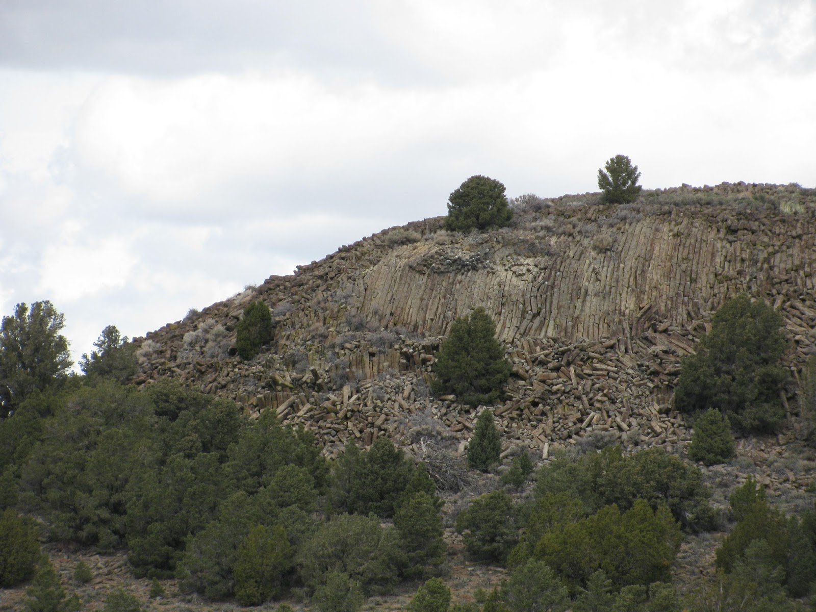
The difficulty though, came at Jumbo last time as there are a number of trails leading into the hills north of the ghost town. Today though, I got luck and chose the correct one. Shortly after leaving Jumbo, another site which I was expecting to find on the way came into view. I had read that a rock formation similar to the columnar basalt that makes up Devils Postpile National Monument (and many other similar sites around the world) was visible along the correct path. Of course, I had to to explore it. Luckily, I spoke with a dirt biker at a trail fork on the way and he suggested the correct route. He also mentioned he had always heard the feature referred to as Eagle Rock. While I can't find much information on the internet about, I did find one other reference to it using this name. So, Eagle Rock, it is.

Parking the jeep on something of a clearing, I search for a path up to the top of the formation. I don't find one, but luckily, enough of the columns have crumbled to make it possible to climb/scramble to the top. This is probably the fourth or fifth columnar basalt formation I have visited and none of them disappoint. Though, the top of this one is not polished as Devils Postpile is, there is little doubt that it is the same type of geology. The broken 'posts' give testament to the volcanic history of this place. The wind is blowing hard on top and with only a vague idea of where the falls is located, I decide to start back to the jeep and continue my search.
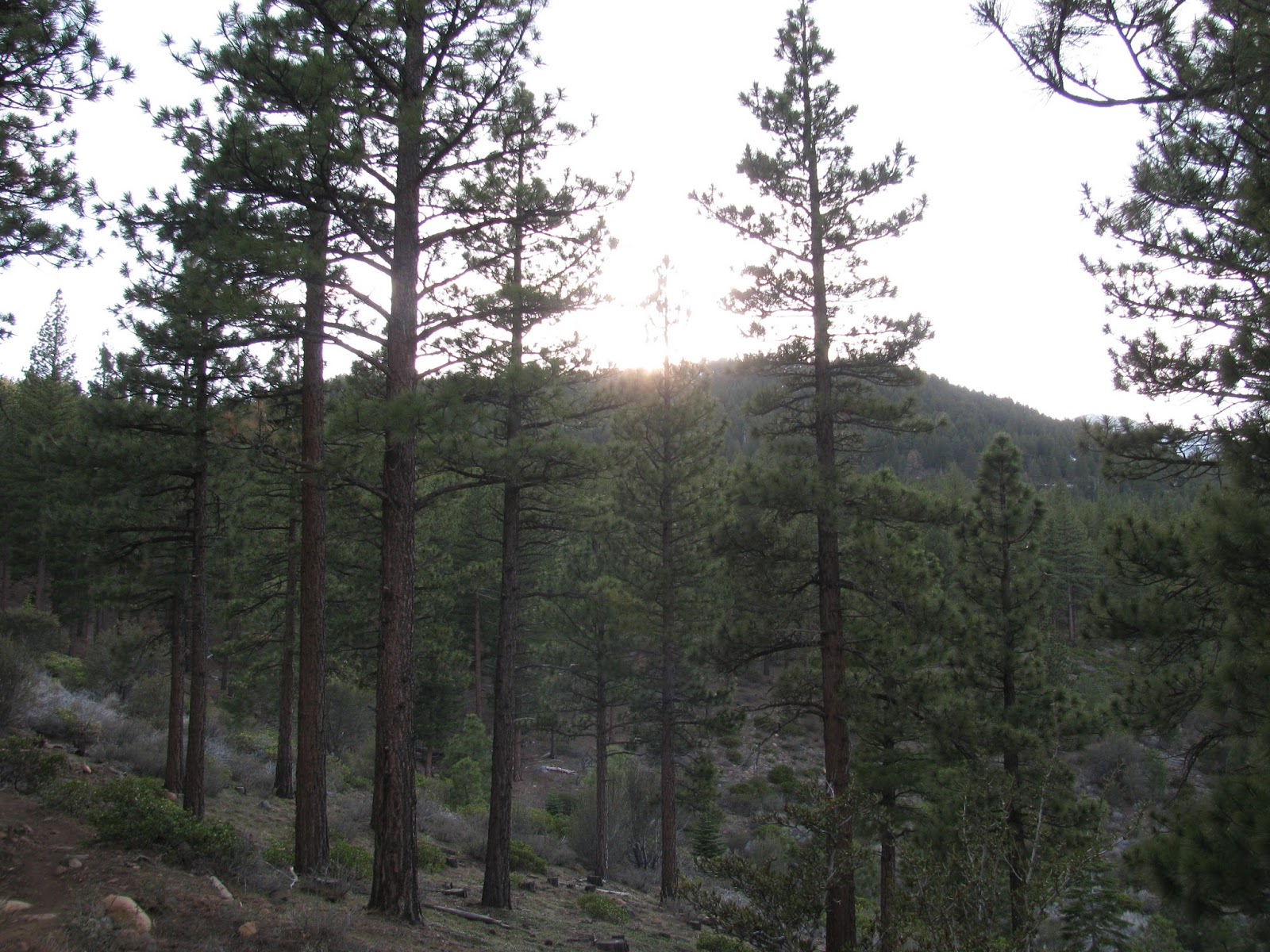
The trail gets even rougher as I continue onward. Large rocks liter the ground, fallen trees lean over the trail, and rutted, muddy tracks lead the way down steep slopes towards an unknown destination - hopefully, the one I'm looking for. Eventually, I reach a point where I am unsure of being able to turn around and I decide to leave the jeep to continue on foot.
I'm actually pretty glad I left the jeep where I did. While, it probably could have made the trip, it would not have been easy, nor sure and I would hate to get stuck all the way out here. On foot, the trail is pretty steep as I make my way up to a ridge. From the top of the ridge, I can see an obvious creek running alongside to the east. I decide to follow the creek. After all, a waterfall must get water from somewhere.

Soon, the two-track jeep trail turns into a single-track foot trail. I continue, but start to question my direction, as the trail begins to head back the opposite direction up a hillside. I decide to go off trail in order to continue following the creek. Carefully making my way down the side of a stony, but brittle cliff, I see water dribbling of the rock below. As I finally reach the water and turn to my left, I realize that I have finally found Jumbo Falls, and even with a little water in it. Unfortunately, this approach does not offer any great views of the falls as it pours into a narrow canyon. I do my best to maneuver to get a good shot, but fearing a fall into the deep canyon, I decide to accept the shots I got. Perhaps another time, I will try to approach the falls from below.

Making my way up the rocky terrain, I arrive back at the trail and start heading for the jeep. The trail is surprisingly steep even from this direction, but I eventually get back to the jeep, and with the winds picking up even further and a storm blowing in, probably just in time. I drive back the way I came in and head for home. While there isn't much to be found on the internet about these two sites (probably because of the remoteness), they are certainly with a visit and in truth, the entire trip could be hiked, though it would be a day of 12-ish miles.
The weather has been amazing these past couple of weeks and I'm going to take advantage of it. Though I should have spent the evening studying for an upcoming exam, I decided to tag along with the Reno Hiking Meetup group to do a new trail (to me), Browns Creek Loop.
Meeting at the trail head off of Joy Lake road just before 6:00 PM, the four of us almost immediately hit the trail. The trek was pretty easy as we followed a number of switchbacks through the forest and up the rolling hills. Eventually, we reach the loop itself and decide to go counter-clockwise.
While there are some very mild uphills, the trail is overall well-maintained and easy to traverse. The stimulating conversation moves from Jack London to Aokigahara Forest to Ayn Rand, as we make our way across the swift moving creek on a small wooden bridge. The setting sun bodes of a cool evening breeze, but as we have almost completed the loop and made it back to the trail head, it is of little concern.
As we approach the end of the trail, the four of us decide to stop at BJ's Brewhouse for a beer and continue the conversation. It was a quick 5 miles over some easy terrain, but its always nice learning some new trails in the area and meeting some fellow hikers.
This is going to be a busy week for me, as I'm studying for a professional certification exam, but I had to take a break from the books and after seeing a posting on the Reno Hiking Meetup group for a moonlight hike up Peavine Peak, I knew it would be a great distraction.
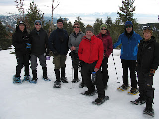
Tonight is a full moon and there is a cold breeze blowing; I can't think of a better time to run to the hills. Meeting fellow hikers Nick, Dean, Kristine, and Jeff at the trail head at 6 PM, we almost immediately started putting in the miles. Luckily, Nick knows the trails in this area very well and leads us through the sagebrush-laden terrain. The going is pretty easy with some mild inclines, and we take advantage of it to push the pace. For most of us, this is simply a training hike and so, the harder we can push ourselves the better.
Reaching the first small summit, we stop at a park bench and Nick takes a snapshot of the crew. As the sun sets in the west and the moon begins to rise in the east, we continue to push the miles. The views of the city from up here are always fantastic, but the idea of getting some shots of downtown at night was really the draw for me.
As darkness sits in, the trail is still nicely illuminated by the full moon above us. Jeff and I get a bit ahead of the others and miss a turn. We quickly recognize our mistake and turn back, catching our fellow hikers a few minutes later. Eventually, we all arrive safely back at the trail head, saying our thanks to Nick for organizing. The distance for the evening was only a meager 7.6 miles, but the views were well worth it.
With snowfall in the Sierra Nevada at the highest levels in the last 5 or so years, I decided to take advantage of a Snow-camping 101 class offered by the Tahoe Rim Trail Association. The class was originally scheduled for last weekend, but with 80-100 mile wind gusts over the ridges, the guides decided to postpone until this weekend. Luckily, the weather this weekend was forecast to be fairly warm, while winds and precipitation aren't expected until later in the day on Sunday, by which time we should be well on our way home.
Saturday morning started at about 8:30 AM at the Aspen Grove Community Complex in Incline Village, where our guides Gerry, Jordan and John were joined by Wayne, who has lead many of the expeditions in the past, but is unable to camp out tonight. The well-versed guides covered a number of important topics from the layering of clothing to using the snow to build comfortable (and warm) living quarters.
We departed for Tahoe Meadows about 1:00 PM and donned our packs and snowshoes for a short hike into the woods, finally arriving just below Chickadee Ridge. In total, there were eleven of us sharing the woods overnight. We immediately started picking sites to plant our tents. The trees made a nice windbreak, but on this ridge, we knew that would not be sufficient. We started by flattening out a spot to pitch our respective tents and using the shoveled snow to construct something of a snow wall in on the side of the prevailing winds. Jordan had warned us that another VERY necessary step was to spend a significant amount of time packing the snow down below our living area. This would allow us to walk around the small area without the need for our snowshoes.
As the snow here is about six feet deep with the occasional drift reaching upwards of fourteen feet deep, the stamping to pack the snow turned out to be sage advice. When putting my tent up, I decided to remove my snowshoes to prevent poking any holes in the fabric, but having not packed the snow enough, I 'post-holed' a couple of times while I did my work. In the end, it wasn't any great disaster, but lesson learned.
With most of the tents up, we next set ourselves to carving out a sort of camp kitchen, which would allow us to have a shelf and seat while we prepared dinner. The great thing about snow is that it is malleable and can be shaped to server our purposes. The kitchen was a team effort and it turned out great. Before dinner though, we decided to take a short snowshoe hike up to Chickadee Ridge just above our campsites.
The ridge is named for the small snow birds that live in the trees and foliage. Unfortunately over the years hikers, have taken to feeding these small dive-bombers and now the birds will often land on hikers hands in search of hand outs. I've hiked and snowshoed up here many times before and experienced this first hand. The views of Lake Tahoe from up here are especially breathtaking this time of year with a beautiful snowfield between the ridge and the giant blue lake a few miles below.
Returning to camp, we made dinner and discussed all kinds of things from past backpacking trips to artificial intelligence. We really had a great crew of individuals on the trip, and it made for an entertaining evening. With dinner in bellies and the cold night air starting to blow in, we decided to turn in. The guides had advised us to dig a cold sink just outside of our tent hatches, which served amazing for removing snowshoes, gaiters, and boots.
The night was cold, but not truly frigid. I think the thermometers dipped down to around freezing, but I was warm in my sleeping bag and the snow walls I fashioned on the south and west sides of my tent did a fantastic job of keeping the wind off me. As always, I tossed a turned a bit, but sleeping on the snow is actually more comfortable than on granite or earth, as it gives a little bit under the weight of the body.
I awoke finally at about 6:00 AM, but the cold morning air kept me in my sleeping bag for another thirty or so minutes. Eventually, I decided to crawl out and start breaking camp. We ate breakfast and then helped each other break down the snow walls at each site and the kitchen, as we wouldn't want any cross-country skiers to run into them. Finally packed and ready to go, we headed back to the cars at about 10:00 AM. It was a great experience and while the night was not bitterly cold, I think I've learned some tips and tricks that would help me survive such a night, should I be out in one in the future.