Saturday, July 25, 2020

Millstone Bluff Petroglyphs (Pope County, Illinois)


My next stop for the day is at Millstone Bluff, which was the site of a late Mississippian village several hundred years ago. As I leave my truck in the gravel parking area, I first head towards the stone bluff face itself directly ahead of me. It's overgrown, but rises sixty or more feet straight out of the ground. It seemed the obvious place for the ancient inhabitants to have created rock art, but after scanning the wall and not finding anything, I return to the parking lot, only to notice a trail heading off the far side of the lot.

Here at the start of the trail, a number placards describe the hike, the ancient culture that lived here, and plead with visitors to care for this historical place. Of course, that last point sets well with me. As an advocate and practitioner of the Leave No Trace principles, I am always extremely careful to protect such sites. I'm glad that others share my views and I hope everyone who visits such places will consider how they may protect the rich heritage they are visiting.


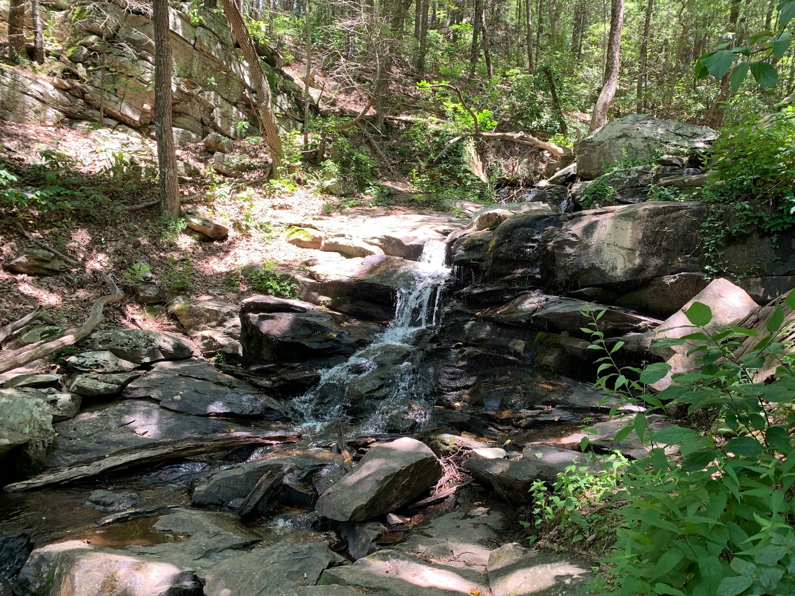
The trail meanders through the thick southern Illinois woodlands and circles around to the back of the bluff, climbing gradually before taking a sharp left turn to reach the plateau on which the village once stood. I'm all alone out here and given the humidity, I decide to loose my shirt. As I wander around the loop trail that encircles the former village, I note signs indicating a graveyard (pillaged by treasure-seekers in decades and centuries past), the remains of a stone wall fortification, the depressions that are indicative of former structures, and finally a maze of natural stone corridors, on top of which in one particular section, an ancient artist carved images.


While the image of a large thunderbird is quite obvious, I utilize the tools I have at hand to enhance the image. D-stretch is a mobile app I have used before with great success, but it normally works better on pictographs than on petroglyphs. In this case tough, it certainly does help as you can see by the included image comparison. A number of figures, including a spider-like creature, a humanoid, turkey prints, and most obviously the thunderbird all begin to pop with the right color filter.

After spending a little time with the petroglyphs, I finish the loop and head back to the parking lot. I still have a lot of driving yet to do today and I might as well get started. That said though, it was nice to get a little in a short hike, which was right at 1 mile, to stretch my legs on this long road trip, to say nothing of being able to experience the richness of this ancient culture.

Kincaid Mounds (Massac County, Illinois)


The drive between Atlanta and St. Louis is a long one, and on such drives I often find the need to get out and stretch my legs a bit. As I'm on my way to relocate my mother to live with my wife and I, I sought out a couple of interesting stops to do just that. My first stop is at an Kincaid Mounds State Historical Site. After driving for the last five or six hours on interstate highways, the switch to gravel roads is a noticeable change in the way my truck handles.

As I approach the ancient earthen mounds constructed sometime between 1050 and 1400 C.E., the first that strikes me is the location. This site is located within a few hundred feet of the massive Ohio River and likely in its flood plain. I can imagine that the river behaved any differently during the Mississippian Culture than it does today. Perhaps these tall mounds offered some relief for the indigenous peoples by functioning as islands during such floods. Either way, the four obvious mounds are quite striking as they rise up thirty to forty feet above the tall sea of grass. A set of historical markers have been placed near the parking area and describe the site as it may have been in the distant past. While this site is considerably smaller than Cahokia, 150 miles to the Northwest, it's still an impressively large site and worth a visit.

Sunday, July 19, 2020

Dunbar Cave (Montgomery County, Tennessee)


Returning home from a visit to see some of my family in Western Kentucky, I decided to stop by for a ranger-guided tour of a well-known cave near Clarksville, TN. Dunbar Cave is the centerpiece of a state park, which is named accordingly. There a huge number of caves in this part of the world and while I'm not much of a caver (or spelunker), I do enjoy the occasionally journey into the depths. 

I arrive well before the tour's start time and speak briefly with some of the rangers before walking around Swan Lake, which is fed by the creek flowing from the cave and was once home to a very popular resort. In recent times though, the state park service has allowed the lake to return to a more natural state of swampy wetlands. It attracts quite a few waterfowl, or so it seems. That said though, the heat is crazy and I return to the visitors center to wait for my tour in the cool air.

At the appointed time, two of the three rangers call the group together and we wander outside. As he tells us a little of the history of the park and cave, we being to stroll down towards the entrance. The cave has been known for thousands of years to the indigenous peoples, but gained some celebrity in the 1950's after Country Music Legend Roy Acuff purchased the land and begin holding concerts at the cave entrance. The cool air blowing out of the cave must have been a big part of the attraction, but apparently many musical stars of the period would perform here later in the evening after having put on shows at the nearby Grand Ole Opry.

The park service respects the local Cherokee's view of the cave as sacred and does not allow pictures inside. They also removed all electrical lighting inside the cave and require visitors to bring flashlights (face masks are also required at this time due to the pandemic). As soon as we approach the entrance, the cool air offers a nice break from the intense heat and humidity of a July summer day in Tennessee.

The entrance is locked by a steel grate, but the rangers quickly unlock it and we begin our tour. It's unfortunately, but it seem that the last century or so has not been kind to the cave. During it's time as a resort destination, visitors were encouraged to enter the cave and scratch their name or break off a stalagmite or stalactite to take home as a souvenir. The early part of the cave is so damaged, that the Native American pictographs and petroglyphs inside were not even discovered until 2005, well after the park had been established. 


*Note: Photo courtesy of Google

During the tour, our guide highlights three panels. The pictures included here were borrowed from a Google search. The first panel, drawn with charcoal, would seem to represent the sun and an unknown object, perhaps a meteor or comet. The ranger states that carbon dating showed it to be between 800 and 1000 years old. Given the time frame, I also wonder if it could be a representation of the 1054 CE Crab Supernova, which was documented elsewhere in the world and would have been visible for some months.

The second panel is a series of thirteen circular pictographs and four circular petroglyphs. Each circle contains other small circles within in varying patterns. As the group discusses it's meaning, I'm forced to think of the 13 Moons Petroglyph near Bishop, CA. I suggest that perhaps the thirteen pictographs represent the lunar cycles of the solar year, and were drawn independently of the four pictographs. We may never know, but speculating is rather fun.

Finally, we reach an anthropomorphic pictograph. This one is a life-sized humanoid with a triangular head and what appear to be bear-like feet. The figure holds objects or tools in each hand, but they are difficult to discern. Perhaps this was a burial place or this was a spirit guarding ancient travelers as they explore the cave. It's an interesting depiction, but we likely never know the artist's true intent.


*Note: Photo courtesy of Google

The next section of the cave requires some amount of squatting to get to, but in days past would have only been accessible by crawling on our bellies. The park service or one of the entities that owned the cave previously carved out a walkway to a much more manageable height. As we enter the last room of the tour, Independence Hall, it's clear that this room wasn't accessed nearly as much as many of the previous areas. Here numerous columns and flow-stones have formed at the meeting of stalagmites and stalactites. It's quite a beautiful area. 

The cave extends some eight miles in total, but for today, this short tour will have to suffice. As this is the last room we visit, we do an about-face and return the the cave entrance the way we came. It was well worth the stop and I'm glad to have had the opportunity. 

Saturday, July 18, 2020

Foster Falls (Marion County, Tennessee)


I'm heading up to Kentucky to spend some time with my aunt and uncle this weekend. Of course, that doesn't mean I can't find some interesting places to check out along the way. It is a 6-hour drive after all. After having reviewed the route a bit on Google Maps, I decided to make a quick stop at Foster Falls near the Fiery Gizzard Recreation Area. The Fire Gizzard Trail is on my to-do list, but I don't have enough time for that today and so the waterfall will have to suffice.

After finding a parking spot, I wandered over to the overlook platform, which looks down on the waterfall and it's pool, but the view is somewhat obstructed by trees. I saw a sign indicating a trail down the cliff side to the base of the waterfall and decided to follow it. While only a short half-mile hike, it's very rock and pretty steep in a couple of sections. It climaxes with a short walk over an extension bridge spanning the creek outlet from the waterfall pool. As I cross, a father tells his young children to watch how the bridge bounces.

There are a few people wading and swimming in the large pool created by the creek water's eighty foot plunge over the cliff side. The water is fairly tame today, but it's quite a beautiful waterfall. With the heat and humidity being what it is here today, I'm very tempted to go for a swim myself, but I have a lot of miles to cover before reaching my destination. My jeep's air-conditioning will have to suffice.

Tuesday, July 14, 2020

Mulberry Riverwalk and Waterfall (Barrow County, Georgia)


Another of my psuedo-urban hikes takes me to the Mulberry Riverwalk in Braselton this morning. It's nice being able to get a few trail miles in before I start work and more importantly, before the Georgia summer heat kicks in for the day. The trailhead is just a few miles from my home and when I arrive on this early Tuesday morning, there are only two other cars in the small lot.

Quickly departing the parking lot, the trail starts out as a paved path, but soon turns to a single track that is not yet overgrown, but certainly on its way in that direction in places. The trail runs parallel and above the Little Mulberry River, which is really nothing more than a shallow creek twisting and turning its way through northeastern corner of the Atlanta Metro Area. It's flat and I'm able to keep a good pace. I start out with some headphones and listening to a podcast, but as I see the number of places along the way for a snake to be laying and given the proximity to water, I decide to remove them from my ears and focus on my surroundings.

At several points along the way, the foliage opens up for a view of the river twenty or so feet below the trail. I can see the bottom and it's a bit muddy, but it has washed out this canyon in such a way that it reminds me of the creeks in western Kentucky that I used to play in as a kid.


As I continue along, I arrive at the "waterfall". It's not really much of a fall, but a natural slab of granite stretches across the width of the river here and forces the water into a chute situation. If the water were cleaner, it would be probably be fun to slide over this "waterfall" on a tube or one's rump. Still though, it's a nice scene so close to the city.


Further down the trail, I encounter a little friend. A small (7-8 inches long) eastern box turtle has made his way out onto the trial. Cute little guy. I stop for a picture, but quickly move on, as I need to finish the hike and start work pretty soon. 

Eventually reaching the loop on the end, which follows a sharp 180-degree bend in the small river, I'm put turned around and headed back towards my jeep. I do encounter a few folks on the way back. The trail comes near a few neighborhoods and I imagine it offers some great opportunities for morning runs or walks. Arriving back at the jeep, I check my distance I was able to get in just over 5.4 miles this morning. Not a bad way to start the day.

Sunday, July 12, 2020

Yellow River (Gwinnett County, Georgia)


The Yellow River flows very near my house, northeast of Atlanta, and continues south. A few miles from my home a park has been dedicated and named after this small river and offered another opportunity for me to get out with one of the local Meetup Groups. The parking lot we chose to meet up was somewhat secluded and caused a few issues with people finding it, but I think that is only because they didn't read the directions provided. 

Our large group does a quick round-robing describing a television show we've recently watched and enjoyed before hitting the criss-cross of wooded trails in this park. At first, we really don't see the river, but as we progress, we eventually hike a section right next to the water. I can certainly see where the name Yellow River came from, as the water here is quite muddy and almost has a yellow hue to it.

As we make our way through the woods, I have a number of conversations with my fellow-hikers. Some of whom I have met before and others who are brand new to the group, including one very nice lady who has never hiked before today. She's been steadily building up her endurance walking around her neighborhood and chose to take to the trails for the first time today. I try to give her some encouragement as she's doing very well for someone who has never hiked this far. 

The trails are very nice and well maintained here, but generally, not very exciting. We return to the parking lot after about three hours, having completed just over 8.4 miles. I think it's time for me to go home and rest now, between the three hikes I've completed this weekend, I've put in almost 25 miles and I'm ready to put my feet up.

Johnson Ferry North (Cobb County, Georgia)


It's going to be a good weekend for getting trail miles in. I hiked about 11.3 yesterday and have two more hikes planned today with different organizations. The first is in the Johnson Ferry North Unit of the Chattahoochee National Recreation Area. I hiked a short trail in another unit of the park last weekend, but each unit seems to be quite distinct.

Following the directions provided in the posting, I met up with the group just before 8:00 AM before the heat has really had to time to settle in. After a quick round of introductions, we hit the trail. It seems this trail system consists of three main sections all parallel to each other and the river with a few shorter sections connecting them. Between the sections, a small creek provides some very interesting scenery and a few obstacles.


Among the obstacles are a few stepping stone crossings, which pose no really challenge for anyone and a couple of large water pipe crossings. While the creek is low enough that most of the hikers in our small group could have simply made their way across the flowing water, nearly everyone, myself included, opt to walk across the large black pipes, which are approximately three feet in diameter. It's a short distance and not really challenging, but certainly adds some entertainment value.

After looping around, we return to the parking lot having completed about 4.4 miles. It was an extremely easy hike, but the scenery was very nice. Now to get a quick sandwich before meeting up with the other group and getting more miles.

Saturday, July 11, 2020

Gahuti Trail on Fort Mountain (Murray County, Georgia)


Fort Mountain State Park sets in the northern part of Georgia and is named for an ancient stone fortification near the summit. I've visited the stone wall previously, but didn't really get to do too much hiking here last time. When one of the local meetup groups planned to hike the park's longest trail, the Gahuti Trail, I thought it would be a great opportunity to see more of the park.

Arriving at Cool Springs Overlook, it seems I'm the first to arrive and take the opportunity to walk out to a constructed wooden overlook offering a magnificent view of the rolling green foothills at the southern end of Appalachia. A short time later, other members of the group begin arriving and we start chatting and getting to know one another. The group leader posts that he is running late, and while we wait, the small parking lot quickly fills to capacity. The last couple hikers to arrive are forced to park at a different lot a short distance away. It's only a slight delay and we quickly regroup and head off into the woods.

It's going to be a hot one and so, I've brought 3 liters of water for myself, which is quite a bit more than I would have carried out west, but I seem to require more here in the southeast, likely do the intense amount of sweating the humidity forces my body to do. I also chose to wear long pants today. I don't want to risk another bout with poison ivy.

The first part of the trail is well maintained and we seem to be keeping a pretty good pace. Essentially making a loop around the mountain, near the summit, the trail is supposed to be about 8.2 miles long. However, this group is prone to taking some detours, which I actually appreciate. I love exploring out of the way places. Though the trail is pretty easy, there is a quite a lot of up and down as we wind our way through the woods.


Everything is so green and lush here, and with the humidity, I wonder if it is anything like the tropical rain forests. At one point, we pass along a hillside covered with the greenest ferns I think I've ever seen. It's quite pretty.

Before too long, we arrive at the first of two small waterfalls. As the rains have been coming less frequently, there isn't a lot of water flowing over the eight or so foot drop, but it's still nice to see a small trickle. The second waterfall, just a half-mile further or so, is a bit larger and more active. We take this opportunity to stop for lunch near the cool, flowing creek water.


After a few minutes of rest, we pick up and get back to the business at hand. At one point, as we cross another creek some of our group members spot a black bear. As our paces have varied a bit and the group has stretched out, those at the front and rear seem to have missed the bear, while those in the middle grouping all commented about him. Apparently, he was not impressed with their attempts to scare him away and stood his ground as they yelled at him. I'm sorry to have missed my first chance to see a black bear in this part of the country, but I'm confident it won't be my last.

As we make our way up the final uphill section to the overlook I visited upon first arriving at the trailhead, we start to say our goodbyes and make our way to our respective cars. This was a pretty good hike. A nice workout on a hot summer day, but worth the effort. Total distance was just over 11.3 miles.

Sunday, July 5, 2020

Stone Mountain at Sunset (Dekalb County, Georgia)


Amidst all of the social unrest and removal of confederate monuments, one that hasn't escaped attention is the large carving on the side of Stone Mountain just outside of Atlanta. Due to the immensity and placement of the carving, removal would be difficult to say the least. I'm not taking a side on this particular issue, but time will tell what happens to this landmark. In the meantime though, I decided to take advantage of another hike with one of the Meetup groups to do a sunset hike to the top of Stone Mountain. I've been to the top a couple of times over the past few months and generally don't like to repeat hikes, but a sunset hike a new perspective. 

Meeting up with the ten other participants at the Walk-up Trailhead, we do a round of introductions begin making our way up the granite behemoth. Along the way, we note many of the carvings place here by settlers more than a century-and-a-half ago. This climb is always a pretty good workout, but I'm feeling strong today, even after hiking Gold Branch earlier this morning. 

Arriving at the top, we find a good spot to park ourselves and then begin snacking and enjoying great conversation as the sun sets in a cloudy sky behind the Atlanta Skyline some miles west of us. It's a pretty view, but would have been better with fewer clouds. As darkness approaches, we put on our headlamps and make our way back down the mountain and say our goodbyes. 

Gold Branch Trail (Cobb County, Georgia)


The Chattahoochee National Recreation Area consists of a number of detached land units in and around the river for which it is named. I've taken to explore them when I can, and when the opportunity came up to visit a new one with one of the local hiking groups, I signed up.

Arriving at the Gold Branch Unit to meet up with the group, I find that parking is quite an issue. All of the spots are taken, and driving back out to survey the surrounding streets for an option, also yields no results. I drive back down to the trailhead and while chatting with the group members from my jeep, note a parking spot open up, which I quickly claim.

After some quick introductions, the nine of us head into the woods. The trail is well maintained and parallels the river for some length. The woods here looks very much luck other wooded areas I have explored in Georgia, since moving here, but the shallow and muddy river does add some unique character. Wherever a fallen tree or branch has made its way to the river, small turtles have climbed up onto the protruding limbs to sun themselves in the July heat. 


As we make our way around one small cove, someone notes a snake curled around a fallen tree branch near the shore (just a few feet from us). One hiker says it is a copperhead, but after getting a good look, I note the head does not have the common viper appearance and inform the group that while I'm unsure of the species, I am confident that it is not a copperhead. We take a few pictures and continue on around.


The next section requires a bit of rock scrambling, but nothing too difficult. This trail was rated as an easy hike and it offers a lot of time to chat with my fellow adventurers, which is always part of the fun. It's also a great source of information for areas that I may want to explore in the future. One such tidbit concerns a sunset hike in Acadia National Park, which I plan to visit this fall.

After weaving a number of loops in the hike, we finally arrive back at the trailhead, having logged about 5.7 miles. It was hot and humid, but perhaps my body is starting to adjust a bit, as I didn't sweat as much as I have on previous adventures. Still though, I'm trying to get in the habit of drinking more water while living here in the south.

Friday, July 3, 2020

Brasstown Bald (Towns County, Georgia)


Three-day weekends are the best (except for weekends that are more than three days), and I'm hopeful of getting this one started right with a hike up to the highest point in the state of Georgia. Near the state's northern border, Brasstown Bald rises 4'784 out of the southern end of the Appalachian Mountain Range. There are a number of trails that lead to the summit and my plan was to about seven miles from the Jack's Gap Trailhead to the summit of the mountain. 

As I drove through Helen, GA and got closer to my destination, the skies started turning gray and rain seemed to be in my future. I had looked at the forecast before leaving home, but this time of year, rain clouds seem to appear without warning. I decide to abandon my original plan and simply hike up the final half-mile from the forest service trail head. 

On my way up, I do indeed encounter several light showers. Nothing terrible though. Arriving at the top, a large construction offers viewing decks and even a theater (which I don't bother investigating). It kind of irritates me that the general public feels the need to scar these amazing places with the touch of civilization. I wander around the observation deck gazing at the stormy horizon in all directions. It is a magnificent view from up here, but it's spoiled by our "improvements". After a few minutes, I hike back down the way I came and return to the jeep, totally about 1.4 miles. While I can knock this high-point off of my list, I think I would like to return and summit using one of the other trails at some point.