Thursday, December 31, 2020

Kennesaw Mountain National Battlefield - Full Loop (Cobb County, Georgia)


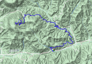
Almost exactly one year ago I hiked to the summit of Kennesaw Mountain as one of my first hikes in the area, after moving to Atlanta, GA. Little did I or any of us know what a tempestuous year 2020 would be. With that said, I decided to send it out with a bang in the hopes of better times in the coming new year. Also, I have a lot of big trips planned in the year (some were cancelled in 2020 and got pushed to 2021) and will be steadily increasing my trail mileage and difficulty leading up to those trips. With that said, today I will be leading the meetup group around the entire Kennesaw Mountain National Battlefield.

As always happens, a number of people dropped off the event as the date approached. I think much of this was due to the predicted storms, but also, some may have had second thoughts about knocking out 17+ miles in a single hike. Either way, when I arrived at the trailhead near the park's visitor center, I met up with the five other brave souls that wanted to conquer this trail today.

We did a quick round of introductions and I explained the plan. With the possibility of thunderstorms approaching a bit later this morning or early afternoon, I wanted to get the summits out of the way first to minimize our risk of lightning strikes. I also explained that while this was a long trail, it should not be terribly difficult and the vast majority of the elevation gain will be right at the start as we climb to the summit of Kennesaw Mountain and then immediately afterwards the summit of Little Kennesaw Mountain. Give the holiday today and the proximity to metro-Atlanta, I did not post this as an advanced hike, but I did explain that a number of options were available to bail out if the mileage became too much for anyone. And with all of that, we hit the trail.

From the visitor's center, the trail begins the steep climb of approximately 650 feet to the summit almost immediately. As of right now, the weather is holding, but it's foggy and there's a lot of moisture in the air. Hopefully, we'll get luck and the rain will hold off for a few hours. Most of the group makes it to the summit with little or no issues, but one individual is a bit slower than the rest. While I often post in my descriptions that we will not hold up the group pace for those unable to keep up, this being something of a beginner's hike, I did not post any such warning and feel some obligation to wait for the last person. Additionally, I have hiked with her before and I know that it's really just the uphill sections that challenge her. While we wait, some of the group decides to push forward, but after only five or so minutes, we have all reached the top and continue towards the next small summit.

The trail is well maintained, being within a National Historic Park, and the mountainside is littered with large boulders and even some granite slicks. The occasional civil war-era cannon placed in their approximate historical positions adds character to the site and reminds of the terrible death and destruction that took place here a century-and-a-half ago. It's a somber reminder of tenuous our fragile union truly is.


After we descend from Little Kennesaw Mountain on a couple of long switchbacks, the trail flattens out with just the occasional rolling hill. The slower hiker suggests that she may take one of the bail-out trails and do less mileage. She encourages me to continue on and catch the faster group. I have already discussed the trail system with her and I know that this is not her first time doing this trail. I check to make sure she's comfortable with my leaving, but she re-confirms and we part ways. She says she'll check-in on the event site once she makes it back to the parking lot. I thank her and wish her well before picking up my pace substantially.

Just a short time later, I and the one other hiker that stayed behind catch up with the other three. It's kind of nice to have a larger group to converse with now and to be able to hike at a quicker pace. Everyone here is pretty comfortable maintaining 3-3.5 mph and so, we do.

As we we approach the southern-most point of the loop, it's nearly noon and most of us are beginning to get a little hungry. One gentleman wants to continue without the lunch break. He lives nearby and has hiked these trails many times. We wish him well as the rest of us find a couple of trees cut down by the park service that will service nicely as benches and stop for a few minutes to enjoy some snacks. With nine or so miles to go, we can use the refuel. I enjoy some portobello mushroom jerky flavored with balsamic vinegar and golden figs, which my wife put in my Christmas stocking. It's quite tasty and I share a sample with the others.


The return section of the loop is still pretty flat and does not require us to re-climb the two small peaks from the beginning. There is a slight drizzle, but nothing to dampen our spirits or slow our progress. We make pretty quick work of the last half of the hike. Along the way, we take notice of a pair of owls in trees on opposite sides of the trail. They sound as if they are communicating something to each other, but unfortunately, none of us speak owl. It's a nice diversion.

The final couple of miles go by quickly and we soon find ourselves back at the trailhead. My GPS track shows that we've completed 17.6 miles today.Two members of the group have just set new personal records for miles hiked on a single trail - congratulations! Before departing, I check the event site and see that both of the hikers that left the main group have posted their safe completion of the trail. I thank everyone for braving the weather and completing this monster mileage hike before getting in the jeep and heading home. What a great day!

Tuesday, December 29, 2020

Medlock Bridge (Gwinnett County, Georgia)

It's a chilly morning, but I talked my mother, who now lives with us, into taking a short hike this morning. The exercise does her good, but I have to be fairly selective with the trails I take her on. She's not able to do big mileage or strenuous climbs at her age. I've got a list of a few options and this morning, we decided to visit the Medlock Bridge Unit of the Chattahoochee River National Recreation Area, which is only a few miles from home.

We arrived shortly after the park opened and easily found a parking spot. There was only one other car on the parking lot. After walking down the muddy boat ramp to see the river close up, we headed into the woods on the well marked and well worn trail. The first section follows the river closely. The light fog this morning, coupled with the rising sun, made for some interesting shots.

I told Mom to keep an eye out for turtles on the floating logs, but I think its a bit cold for them this morning. After about half-a-mile, we turn back. I'm generally letting her lead to set her own pace, but when we get to muddy sections or areas with a lot of roots, I tend to move to the front to guide her over the rougher terrain. After returning to the parking lot, I see we've hiked about 1.5 miles total, which is pretty good for her. She comments about how much fun it was - mission accomplished!

Sunday, December 27, 2020

Tribble Mill - Full Loop (Gwinnett County, Georgia)


After feasting with family and friends for the Christmas holiday, I felt the need to get some trail miles in today. The Meetup group that I hike with most frequently had planned to do seven to eight miles at the nearby Tribble Mill Park. Though I've hiked at this well maintained park in the past and rarely like to hike the same trail more than once, it was a convenient opportunity to work off a few of those holiday calories. 

Arriving at the parking lot a few minutes before the scheduled departure time, we did a quick round of introductions before hitting the trail. About twenty of us in all. Starting first on the paved trails, we make our way around the larger of the two lakes in the park. When we reached the far side, the track switched to dirt as we entered the woods tracking at a pretty good pace, but as often happens a few people started falling behind.

As we made our way up the hill on the far side of the lake, the trail becomes a series of long switchbacks and in order to help some of the slower hikers catch up, the organizer cuts a couple of switchbacks. Soon afterwards, we stop for a short snack break and discuss how we want to proceed. It's decided that some want a bit more mileage and I offer to lead the smaller group on some additional switchbacks, while the main group heads back towards the parking lot. 

As my group gets started, I ask if they are okay with a faster pace. With everyone's agreement, I bump up our pace to right around four miles an hour. At every trail junction, I choose to take the option leading away from the parking lot, but we still only add a short distance to the hike and actually arrive at the cars before the main group - likely do to our very quick pace. I check our distance and see that we've hiked nearly 7.7 miles. While the trail was easy, the quick pace on the last section allowed me to get a pretty good workout in and to feel as though some of those calories have been burnt away.

Sunday, December 20, 2020

Pinnacle Knob via Bartram Trail (Rabun County, Georgia)


or a while now, the organizer of one the meetups that I frequently hike with has been talking to me about occasionally leading some more challenging hikes a bit further from Atlanta than the trails the group normally hikes. I appreciated his faith in me to lead hikes for his group and decided today would be the first outing. Not far from the Georgia-North Carolina border, Pinnacle Knob rises approximately 3,140 feet above sea level and towers over the nearby town of Clayton. We'll be hiking a section of the Bartram Trail to reach the summit.

Arriving well before the noon start time, I took the opportunity to scout out a report of a bridge wash out I had been made aware of. After hiking up the first section of the trail, I see what the report is talking about and while the creek is still crossable here, it will require jumping from and to some slipper rocks. Luckily, I see an alternative path that I'll talk to the group about when they arrive. 

Returning to the parking area of the trail head, my first two hikers have arrived. I introduce myself while we wait for the others to join us. In total, six of us show up for the hike. There may have been more, but I made it very clear in my description that we would be departing promptly at noon and after a very quick round of introductions, we do just that. Additionally, I had set pace and elevation expectations with the group and let them know that if they were unable to keep up, they should either turn around and come back the way we came or wait for us to summit and return. Everyone agreed and actually thanked me.

Leaving the parking area, the trail follows a muddy path alongside some concrete trout beds constructed by the Civilian Corps many decades ago. While they have been in use for a long time and are now covered with moss, it still adds some interesting history to the area. From here, the trail follows some short switchbacks as we climb back up to Warwoman Road. 

Crossing the road, we had up the trail on the right side of the creek, as opposed to the one on the left, which I had scouted previously. By going this way, we still get a great view of the first waterfall on the trail, but can avoid the somewhat sketchy crossing. From here, it's a long push up hill as the trail winds around the hillside. We gain and loose a little elevation as we go, but the predominate direction is up.

We drop down into another small hallow cut by Martin Creek and then cross a well constructed bridge just in time to see the second noteworthy waterfall. Both are flowing well today and we take a couple of minutes for pictures. Quickly though, we return to the trail. From here, it's mostly straight up.


The trail follows the curves of the hillside as we gain elevation, and while some short sections are pretty steep, it's really not bad overall. Finally reaching the home stretch, we follow a number of long switchbacks as we make our way up the side of the mountain. The trees here have all lost there leaves and we are granted a terrific view of the leaf-covered hill stretch out below us. Someone mentions how much fun it would be to slide down this giant hill on the leaves, until I remind them of how much fun it wouldn't be to hit one of the many tree trunks on the way down.

Arriving at the top, three of us summit a few minutes before the others. I've been keeping an eye on everyone's progress and I know they are just now on the long switchbacks and will join us soon. We take a few minutes to enjoy the views from the top and a quick snack. Our remaining hikers summit just a few minutes afterwards and we all enjoy a few moments together. It's a bit brisk up here and there is one small patch of ice on the rocks we are sitting on, but after putting my puff jacket on, I don't even notice the cool breeze.


A couple of the slower hikers decide to depart earlier to get a head start on the rest of us. We tell them we'll catch up shortly. After finishing my clif bar, taking another swig of water, and seeing to a thirsty tree away from the other hikers, we get underway. Obviously, going downhill is normally faster, but we quickly hit a really comfortable pace of just about four miles per hour and we are able to maintain it for the remainder of the hike back. We do eventually catch other other hikers and even pass them on the way down, but once we reach the trail head, I tell those that were with me that I'm going to wait for everyone to make it back before heading out myself.

A short time later, the remaining two hikers find their way to the finish line and I congratulate them on their accomplishment. We hiked about 9.2 miles and with a net elevation gain of just under 1,700 feet. Discounting our break a the top, we were able to just barely exceed 2.5 mile per hour pace I had set as the expectation. The weather holding as it did for us and the marvelous waterfalls and view from the top, it turned out to be a great day. Everyone thanks me for organizing before we go our separate ways. I look forward to leading the next one.

Saturday, December 19, 2020

Cherokee Bluffs (Hall County, Georgia)


Since it's still early in the day, I decided to get a few more miles in at a nearby park that I've been meaning to explore. Cherokee Bluffs Park is named for the rock formations at the top of a ridge on which the parks sits. A few miles of trails weave through the park and around the formations. After finding a parking spot in the large parking lot, I head out on the trail along the top of the bluffs. 

The line of boulders create a small cliff approximately twelve feet high that runs about thirty yards. I imagine it's a lot of fun for children to explore and climb around on the formation. After exploring this area, I head off into the woods along the loop trail. There are quite a few people out enjoying the outdoors today and this park is a fine place to do it.

Completing the loop, I pass through a large field at the entrance to the park before returning to my jeep. It's been a pleasant stroll and I was able to get in an additional 2.3 miles for the day. Now it's time to head home and complete more of those pre-Christmas chores.

Bowmans Island Trail (Forsythe County, Georgia)


The Chattahoochee River National Recreation Area is composed of a number of disconnected land units along the shoreline of the river as it passes through the greater Atlanta area. Since living in Georgia, I've hiked through many of the sections, but one I had not yet visited was the Bowmans Island unit. It's a beautiful late autumn day out, which seems like the perfect time to add this one to my list.

The trailhead is at the end of a short drive just after passing over the Buford Dam, which holds back the waters of the winding river to create Lake Lanier. I quickly find a parking spot and hit the trails. The early part of the trail follows very close to the shoreline and offers views of some of the waterfowl that visit the river, including blue heron and Canadian geese. It rained a bit a couple of days ago and the trail is muddy in places, but still very passable. The views of the river are pretty nice, but the shallow nature of the waters is evident here as a number of rocks and fallen trees can be seen in the waters. 

The trail eventually forks and heads uphill and away from the river, leading into an area behind a residential neighborhood. The hillsides of this section are gently sloping and covered with the fallen leaves of the season making for a pleasant hike. Completing the small loop, the trail then returns to the section by the river and I had return the way I came. Though it was a bit brisk, this was a great way to start a Saturday morning. I was able to get in just about 4.4 miles along this trail.

Sunday, December 13, 2020

Mount Tabor Park (Paulding County, Georgia)

I've been busy the last couple of weeks with the Thanksgiving holiday and then a recertification class that I'm required to take every couple of years, but it's time to get out on the trails again. I decided to join one of the Meetup groups to explore a newer park on the western side of Atlanta, Mount Tabor Park. None of us, including the group's organizer, has ever been to the park and so it should be something of an adventure.

After meeting at the trailhead, we quickly make our way into the woods along the well groomed blue trail. I snapped a picture of the map at the trail head to help us with navigation. According to that map, there are three interconnected loops trails, blue, green, and yellow. As we make our way down the trail, we head off on side trail and quickly hit a private property sign. After turning around and we get back to the trail we started on. There are numbered markers along the way that presumably correlate to numbers on the map. I attempt to plan our route.

Continuing further on, we find ourselves on the green trail, but I never saw the marked junction. I'm beginning to think the maps and markers are inaccurate. Though some of us at the front of the pack have been maintaining a pretty good pace, several new members are falling way behind and we are forced to wait for them occasionally at the many junctions we encounter. Like many parks in region, these trails were designed for mountain bikers and simply twist and turn back on themselves to provide more distance. I can't say I enjoy this type of trail very much. I prefer trails that actually lead somewhere and are not just cut randomly through the woods for the sake of making a trail. That said though, the trails and area are very pretty and it's nice to be outside.

I finally decide to give up on the map, as I conclude it must have been made by a drunken cartographer exploring the Amazon, rather than this park. The markers have zero correlation to the map and landmarks, such as bridges, that are marked on the map are no where to be found in the real world. Regardless, we finally make our way back to the trailhead and several people decide to call it a day. 

Having only hiked about 7 miles though, a few of us decide to re-enter the maze of trails to add a bit more distance. While we fair no better than the first foray, we do manage to add another 2.5 miles or so. When we arrive the trailhead the second time, we've managed to hike a total of about 9.7 miles, which is not a bad day. We say our goodbyes and head home.

Wednesday, November 25, 2020

Island Ford on the Chattahoochee (Fulton County, Georgia)

With Thanksgiving tomorrow and a lot of my colleagues already on vacation, I don't expect today will be a very busy day in the office and so, I decided to get a short hike in prior to starting. I've been meaning to check out the trails at the Island Ford unit of the Chattahoochee River National Recreation Area and today seemed like a good time to visit this nearby park.

Arriving early and just after the park opened, I quickly make my way down the autumn trails around a small pond, across the road, and then down to the river. Several large rocks emerge from the shallow river and a number of Canadian geese and other waterfowl have taken advantage of them to stand on against the river's currents. As I approach, a great blue heron spreads its wings wide and takes flight just over the river's surface. 

Continuing on down the strangely vacant trails, I encounter a number of rock outcroppings at the river level. Almost all of them contain some sort of large overhang and could easily be used as a shelter. I wonder if the indigenous peoples or later European settlers took advantage of this natural lodges in their travels. Surely they must have.

Heading up hill away from the river, the trail enters a large wooded area with nearly all of the leaves stripped from the trees. While I do encounter two other people out here this morning, I'm somewhat surprised there aren't more. Perhaps, I'm just too early - good for me.

Returning to the area where I parked, I see that I've hiked 2.5 miles this morning. That's a pretty short hike, but it's nice to get out during the week when I can.

Sunday, November 22, 2020

East Palisades to Bamboo Forest (Fulton County, Georgia)


I hiked the East Palisades trail several months ago, shortly after moving to Atlanta. However, I was unable to find the famous bamboo forest that is supposedly nearby. That was a little disappointing as it was an appealing feature that I was very interested to see. When one of the local Meetup groups scheduled another visit to this area, including a trip to the bamboo forest, I decided to revisit this trail and find that which had escaped me before.

It seems parking is always a problem at any of the Chattahoochee River National Recreation Area units, and today is no exception. When I arrive, the lot is completely full and several cars are just waiting for a spot to open up. As the group start time is approaching, I decide to head back out to the main road and find parking there, which results in another 1/3rd of a mile walk, but I need the exercise. Finally, meeting up with the group, we do our standard quick round of introductions before heading out.


The trails here are well maintained, but very similar to most of the trails in the area. Fallen leaves cover the trail in many places and as we are now in late fall, the nearly barren trees allow clear views of the landscape. The large group begins to fragment based upon each hiker's pace. This isn't normally an issue, but many of the slower hikers have positioned themselves closer to the front, forcing those behind to hike at a lesser pace. I see several people ask to pass and things sort of adjust naturally as we make or way through the woods.

After stopping at the observation deck to allow people to take in the sweeping view of the river far below, we make our way down a steep hill along one of our group leader's "secret trails", which takes us down near river level. From here, we follow the well worn trail north and into the bamboo forest. There seems to be a fair amount of bamboo growing in and around Atlanta, even some near my house, but the "trees" here are enormous. Many of the trunks are 6-8 inches in diameter and reach heights of 40-50 feet. The whole grove covers an area of roughly ten thousand square feet, but even at that small size, it's the largest example I've seen of a bamboo forest.

We spend a little time here before moving on. Several of the hikers in our group opted to take a different and less steep path to the forest and are only now reaching it as we depart. Not wanting to wait very long, we tell them to take a quick look and then rejoin us. The trail we take then leads us into a somewhat residential area that our leader has hiked before, but there is some amount of route-finding necessary as much of it has been overgrown since his last visit. I think some of the slower hikers get frustrated and begin asking for a route back to their cars. We eventually turn around and head back the way we came before rejoining the main trail.

Arriving back a the parking area, I catch a ride back to my jeep and while doing so, see we only covered about 5 miles today. It's a short hike, but I got to see what I came for. Several of us decide to visit a local tap room for drinks and snacks. Okay, just twist my arm, why don't you.

Saturday, November 21, 2020

Providence Canyon - Backcountry Trail (Stewart County, Georgia)


When I visited Providence Canyon State Park a few months ago, I was amazed by the color palette of the continually collapsing canyon, but I was a bit disappointed in the short distance of the hike, knowing that that there was a longer option available. When one of the Meetup groups posted this hike again, and specified they would be doing the Backcountry Trail, I decided to return to the park and take care of that unfinished business.

After driving the 2.5 hours south to the park, I arrived at the visitor's center just a few minutes before the scheduled start time and began looking around for any familiar faces. It didn't take long to identify the group, even though the park is extremely crowded on this beautiful Saturday morning.

With a quick round of introductions, we start the trail heading clockwise around the rim of the canyon. Unlike many canyons out west, this one was created by poor farming practices during the last century or two. Uncontrolled erosion ate into the soft soil that was formerly a sea bed and began cutting this network of canyons through the orange and yellow earth that makes up this area. Looking into the canyon from above, it looks something like a miniature Grand Canyon, but on a much smaller scale.

The trail takes us through the area that was a former homestead and the rusted hulks of vehicles they left when they relocated. We then enter the wooded area to the south and west of the main park's main attraction. There area couple of somewhat steep climbs, but just enough to get the heart pumping a bit - nothing to strenuous.

After rounding the long finger of the trail on the western side of the park, we head back towards the eroded depressions that we saw from above earlier. Here the trail has a stead stream of water running over it carry even more soil from the canyons beyond. This is a continual process that will one day carve the canyons even deeper into the landscape. The sandy red soil mixed with clay doesn't hold the water very well and it makes for a bit of a muddy hike. Along the way, we note a couple of interesting trees - one with enormous leaves, which after some research, I'm still not able to identify.


Making our way back into the main area of the park, we explore a couple of the finger canyons, some of which require a small amount of climbing to access. This is where most of the people concentrate, but surprisingly, many are wearing masks and practicing social distancing. It's good to see.

The climb out of the canyon is a little steep and I notice my breathing is a bit more labored while wearing this face mask and ascending the trail, but it's all for a good cause, not to mention, I need the workout. As we say our goodbyes, I check my mileage and find that we've hiked about 8.1 miles - pretty good. This park is very interesting, but now that I've explored the Backcountry Trail in addition to the main canyon area, I don't know that I'll have any reason to return.

Sunday, November 15, 2020

Blood Mountain via Jarrard Gap and Slaugther Creek Trails (Union County, Georgia)


Today will mark my third trip to the summit of Blood Mountain, and I believe along the final path to the top. It will also be my first trip completely during daylight, as my previous two were either evening or overnight hikes. When my friends in one of the local Meetup groups mentioned hiking this route from Jarrard Gap, its seemed only fitting that I should complete the trifecta and visit this high-point on the Georgia section of the AT from all possible angles.

Leaving the trailhead near Lake Winfield Scott around 11:00 AM, the twenty-or-so of us immediately encounter some rain on our ascent. We knew there was a chance of this and the thick fog driving up the mountain should have been another clue of things to come, but we decided to persevere and do the hike anyway. We're stubborn like that.

The trail is covered with leaves, but fairly easy to find. The rain fluctuates between a light mist and a steady pour, but never gets too bad. However, the combination of wind and rain do make for some thermal challenges and we stop a couple of times on the way up to shed and later add layers. 

Eventually meeting up with the AT near the summit, we quickly find the Blood Mountain Shelter and begin climbing the rocks to see what kind of views are available on this foggy day from 4,459 feet. The answer is really none. We surrounded by a thick bank of fog blocking the view in all directions. It's fine though. I've been here before and seen the wonderful views available from this mountain top.


We take a few minutes to get a quick snack in the shelter before heading back down the slippery trail. Instead of returning the way we came, we take a different route along the Slaughter Creek as we make our way back to our starting point. This path provides some outstanding views of the creek and the path our leader takes us on, which is not well known, actually crosses the small creek several times over a series of small wooden bridges and planks. Some of which turn out to be very slippery.

*Note - Photo courtesy of the Hiking League Meetup

After returning to the parking lot cold and wet, many of us do a quick change into some dryer clothes and decide to head to one of the nearby wineries to enjoy a little vino and celebrate our triumph over this nasty weather. Total mileage for the day was about 8.5 miles and while there was some elevation gain, it really didn't feel like much at all.

Thursday, November 12, 2020

Old Stone Fort (Coffee County, Tennessee)

While moving my mother to Atlanta a couple of months ago, I drove past a sign for the Old Stone Fort State Archaeological Park in central Tennessee. It caught my attention enough to research it a bit and what I found intrigued me. Set on the peninsula at the confluence of the Duck and Little Duck Rivers, the park protects a stone enclosure built by the Native Americans that inhabited this area during the Middle Woodland period around 1,500 years ago. Though early European settlers of the area that came many centuries later saw the structure as defensive in nature and called it a fort, this is probably unlikely.

As I'm passing back through this area to take my mother to visit my aunt in Kentucky, a quick hike around the ancient structure and park seemed a good way to stretch my legs on the long drive. We arrived at mid-day, but as it is a Thursday, there are only a few others in the parking lot at this time. The trail quickly departs and heads between two entrance mounds before opening up to the area enclosed by the fort wall, which is actually quite stunning. A large flat clearing of yellow grasses surrounded by a halo of orange and red trees showing their autumn plumage.

The trail follows the perimeter of the peninsula with options to hike below or above the wall. I choose to follow below for a better view of the river and waterfalls. The "fort wall" itself was created by piling stones to a height of four to six feet and then covering the pile with earth. After almost two millennia the wall now appears as a strange ridge line that encloses the plateau of the peninsula and reinforces the cliffs that drop off most sides of the area, as the two rivers cut gorges to descend to their confluence at the point of the area. Why did the indigenous peoples choose this place for their structure? It is quite beautiful to be sure, but what purpose the wall served is unclear.

Making my way around the peninsula in a clockwise direction, I'm amazed at the ruggedness of the terrain here in the middle of Tennessee. The gorges cut by these small rivers are pretty jagged and display several gorgeous waterfalls. I do a little rock scrambling on the cliff in attempts to get some good shots, but there are some pretty precarious situations to be found here and still wearing the splint on my broken finger doesn't help much. 

As I round the corner of the peninsula, I see that the wall actually has some intentional breaks in it. Again, I wonder why they didn't build it all the way around instead of in these long sections. We'll likely never know. 


Rounding the other side of the structure, I find the ruins of the Stone Fort Paper Company, built shortly before the Civil War. Now only a few crumbling stone walls remain, but apparently, there were three main structures back in the day utilizing the power of the river to produce paper and other products. It certainly adds even more history to an already historically interesting place, but I suspect visitors too preoccupied to read the informative signs will mistake these stone walls for those constructed by the much earlier inhabitants of this area.

After a great hike in the brisk fall air, I feel recharged and ready to continue our trip to my Aunt's house. I hiked about 1.8 miles around this very interesting ancient site and it was well worth it. The fall colors and colorful history of this place make for a great diversion, and the waterfalls are just a cherry on top of an already delicious ice cream sundae.

Sunday, November 8, 2020

Chicopee Woods (Hall County, Georgia)


Sundays are normally great days for a hike and I often hit the trails with one of the local Meetup groups. Today, we are hiking Chicopee Woods and around the Elachee Nature Center just a few miles north of my home. After the short drive, I arrived at the parking lot and trailhead just a few minutes before the scheduled start time. With this broken finger of mine still in a splint most of the time, getting ready can be a little slower than normal. After a quick round of introductions, we entered the autumn-colored woods.

Following the green trail around the northern perimeter of the nature preserve we were able to maintain a pretty healthy pace. In fact, myself and a couple of other hikers got too far ahead of the main group and had to wait for them to catch up at one of the junctions. The trail has very, very little elevation gain though and so, it's just to easy to go fast. It's well maintained and cuts nicely through this beautiful wooded area. The fall colors are in full display, and shades of gold, orange, and ocher can be seen everywhere.


There are a few minor creek crossings, but well constructed foot bridges make them a non-issue. Eventually, we reach the junction of the green and orange trails and in order to add more distance, we switch to the orange trail, which will follow the southern perimeter of the area. This part of the trail does have a couple of very easy climbs, but nothing too strenuous. 

Finally nearing the end of the trail, we follow the read trail to the Nature Center, which also serves as a preschool. One of my fellow hikers, explains the "story trail", which we follow around the facility. It combines exercise and learning for the youngsters by placing a story panel every thirty or so yards, each contain the next lines of a story and encouraging the children to walk the trail to read the entire thing. It's actually pretty cool and we quickly walk around it. With this being a Sunday and in the middle of a pandemic, there are no children to be seen out here today, but hopefully, things get back to normal and the children are able to take advantage of this facility again soon.

Returning to the parking lot, I see from my GPS app that we have hiked about 7.1 miles on this glorious day. The weather was amazing and it was really great to get outside. Some of my fellow hikers suggest hitting a nearby brewery for a post-hike pint. Who am I to turn something like that down. Slante!

Friday, October 30, 2020

A Vampires Tale - Full Moon Night Backpacking on the AT Woody Gap to Blood Mountain (Union County, Georgia)

I've had a number of backpacking trips cancelled this year due to the ongoing COVID-19 pandemic. Additionally, I tripped, fell, and broke one of my fingers while on my morning run a few days ago. So, when one of the local groups I've been hiking with posted a moonlight overnight trip to Blood Mountain on Halloween Eve, I couldn't help myself from signing up. This particular group tries to strictly define and record their members past experience, which I can completely understand. It gives trip leaders some basis to determine who is capable of the tougher outings, of which this is one. Since I have only a few outings with the club, the trip leader contacted me in advance to ensure I knew what I was getting myself into. I explained that I was a recent transplant to the area and listed off some of my experience out west, which put his mind at ease.

We met, all eight of us, at the Woody Gap Trailhead, which is on the Appalachian Trail (AT) around 8:45 PM. At elevation and with a brisk wind blowing in, it was pretty cold up there, but the brilliant full moon above our heads inspired us and our thirst for adventure kept us warm while we assembled our gear. After a quick round of introductions, we hit the trail promptly at 9:00 PM as scheduled. It seems many of these folks have been on trips together in the past, but they welcomed me with open arms.

The first mile and a half or so up to Preachers Rock is somewhat steep, but bathed in full moonlight the trail was easy to follow. As we got to moving at a pretty good pace, our bodies heated up quickly and it was soon time to strip off some layers. Along the way, a couple of my fellow hikers inquired about the splint on my left hand protecting my broken finger. I think they thought I was a little crazy for doing such a crazy backpacking trip in such a condition, but they kept their thoughts to themselves. In truth, the splint only proved to be a minor inconvenience during the trip. I think the worst part was not be able to put a glove over that hand when we stopped for longer breaks such as to take in the view from Preachers Rock. The cold air had a numbing affect.

The next several miles undulated as we followed this section of the AT over some smaller mountains on our approach to Blood Mountain, which is the highest point along the Georgia section of the long trail. We did see a few tents along the way, but no other hikers. Only crazy people would be out hiking during the midnight hour of a full moon on Halloween . . . or vampires . . . 

Arriving at the Blood Mountain Shelter, we removed our packs put on additional layers and sat or layed out on the bare granite to take in the cloudless night sky, of which the full moon was the centerpiece. After laying on the cold stone for a couple of minutes, I decided to pull out my foam sleeping pad, which was easily accessible from my pack and lay on that instead - good call. The combination of comfort, cool air, and the fact that I had now been awake for nearly 24-hours straight began to weigh on me and I could feel myself starting to slip into slumber. Luckily, we didn't stay long and soon headed back down the mountain to our planned campsite, the Woods Hole Shelter.

Now feeling much like a zombie as the clock nears the 3:00 AM hour, we trudge a half-mile off trail only to find the shelter full of other campers. After a quick discussion, we make the group decision to return to the fork in the trail and camp there at a decent spot we saw earlier. The only real concern is food storage in this bear-populous area. I packed my bear can and so, I felt okay about. After we got our tents set up, I offered up the additional space in my can for others to use, which they thank me for and took advantage of. For just an overnight trip, I didn't pack a lot of food and was happy to share the ample storage remaining in my bear can.

While I told everyone good night and quickly traveled off to dreamland, some of my fellow hikers decided to get a fire going and have a few beers, which they had packed with them. I would have loved to joined them, but now after 4:00 AM, but body was having none of it. I crawled into my sleeping bag and was out like a light.


I was the first one out of my tent at about 9:00 AM, but others rose shortly afterwards. Apparently some of them were up until nearly 7:00 AM. Even so, they were quick to rise and get some breakfast going around the campfire. The sun is shining brightly this clear Saturday morning, and while there is a chill on the air, it's manageable. Some hot tea and a warm breakfast certainly help. As we finish our breakfast and chatter around the fire, some of the hikers that had stayed at the shelter drop off some snickers bars for us on their way out. It's a nice breakfast desert.

Soon afterwards, we break down our tents, load our packs, and start the trek back to our cars at Woody Gap. I don't remember this being quite so steep last night, but with the dark and my groggy state, maybe I just didn't notice. The group spreads out over a pretty good distance, but our group leaders are good about waiting for everyone to occasionally catch up. 

Finally arriving back at the trailhead, I thank my fellow adventurers for an excellent time. We hiked 11.3 miles last night and another 7.5 this morning, for an 18.8 mile total trip distance. They all wish me well and we look forward to meeting again on the next trek. As for me, I've got an hour-an-a-half drive between me, my shower and my bed.