Monday, February 26, 2024

Everglades Kayak Tour (Everglades National Park , Florida)

Earlier this year, I was considering how and where to spend some of my vacation time. I realized that I have never visited southern Florida or Everglades National Park. When I found an outfitter that guides multi-day kayak and camping trips deep into these mysterious waters, I thought that would really be the way to take it all in. Having run half-marathon this morning and already visiting a couple of other sites on my way to my hotel in Everglades City, I was more than ready to crash at my hotel room for a good nights sleep. I expected I would need it. I've done multi-day paddles before, but those were limited to two or three days and normally twenty-five miles or less. Knowing our plan was for about forty-eight miles over five days, I knew I was in for a strenuous adventure.

Day 1

I arrived at the Everglades National Park make-shift visitor center at the end of Oyster Bar road. It seems a hurricane in recent years had destroyed the structure here and while a new permanent visitors center is under construction, currently, a decked out double-wide is serving this purpose.

Looking around the parking area, I try to locate my guide and/or group. I ask a couple of gentlemen and as luck would have it, one of them is my guide. He asks me to sign the normal waiver and then follows me back to my car with a couple of drybags for me to stow all of my gear of the trip. He had warned us to pack very light, but as a backpacker, I would have done that anyway. I'm easily able to fit all of my clothes and other necessities into the two (10L and 5L) dry bags. A few moments later, another couple arrives and as it turns out this will be our entire group. Apparently, there was one last minute cancellation, leaving a party of four in total. Ah well, small groups are sometimes better. 

Dave, our guide, helps us pack the kayaks and make the necessary adjustments, which area already on the boat launch ramp. Today, Dave and I will be paddling single twenty-one foot ocean-going fiberglass kayaks, while the other couple paddle a larger tandem. All of camping gear has already been packed neatly away into the storage bins of the three boats. With that, we are off on our adventure.

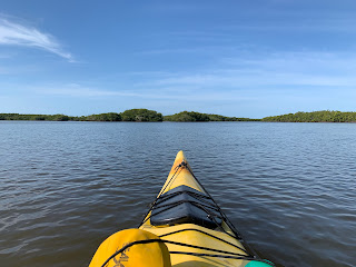
We start by paddling out into Chokoloskee Bay and then ducking under a small bridge, which S Copeland Ave passes over, and then down a long shoot that runs parallel to the road. Eventually it dumps us out back into the bay and we paddle alongside Chokoloskee Island, which is a small community built upon the largest midden (or oyster shell mound) in the park. These middens started as dumping grounds for the local Native Americans and over the centuries were built up into substantial land masses rising above these shallow waters.


Along the way, we encounter a rich and diverse view of aquatic fowl. I see duckbills, cormorants, egrets, herons, and ibis all feeding on the abundant sea life in these shallow waters. I say shallow and I really do mean it. While some areas are a few feet deep, I get my boat stuck in the mud more than once and nearly exhaust myself trying to get it free. At one point, I strongly considered getting out of the boat and pulling it to slightly less-shallow waters, but thought better of it when I considered how deep my feet would like sink into this mud. I was eventually able to brut force my way through it by literally paddling through mud. The others in my group had similar experiences, but I think I got stuck the worst of all of us.


As we leave the last civilization behind and enter the untamed wilds of the Everglades, I'm in awe of the environment. It's nothing like what I expected. We paddle east on the Lopez River surrounded by mangrove forests. From a distance, you would think this is all dry land where the trees or growing, but you would be wrong. This 'land' is nothing more than the exposed roots of the mangroves during low tide. There is no soil to speak of and the roots encroach on one another into an impassably tangled mess. This goes on in all directions as far as the eye can see and only the slightly deeper waters (maybe three feet at low tide) of the river prevent the forest from covering the channel in which we now paddle.

We'll be spending tonight on the Crooked Creek Chickee, which after paddling into a little cove, becomes clearly visible. A chickee is nothing more than a platform built above the shallow waters for visitors to pitch their tents on. This one is made up of two 12' X 12' platforms connected by a twenty foot walkway with an outhouse attached to it. Now at low tide, the platform is about four feet above the water level and getting out of the kayaks and unloading them is quite the ordeal. Our guide has done this countless times though and coaches and assists all of us until we and all of the required gear are safely out of the boats and on the platform.

As we erect our tents and our guide sets up the kitchen for the evening, we discuss our adventures for the day and wonder at how the water level will be when we wake in the morning. Before dinner, we are treated to cans of Sweetwater IPA and some cheese and crackers. We dangle our legs over the water and enjoy these treats while Dave makes our evening meal. Tonight, we'll be having fried grouper, beans, a salad, and garlic bread. It's all quite delicious.


Before long, the sun is down, but not before a dazzling sunset, and we all decide to turn in for the night. While I feel completely safe on this chickee, I do take note of what a short distance I would need to roll over in my sleep before sending myself and my tent into the murky waters (hint: it was about a foot). As the crazy calls of the wild fauna begin their evening calls, I drift off into a deep sleep. We paddled just about 9.5 miles this first day.

Day 2

I awake early and begin stirring. Soon, I crawl out of my tent and make my morning visit to the toilet. Though the sun isn't up yet, the others wake up soon after and Dave begins making breakfast. We eat a bite, enjoy some coffee, and begin breaking down our tents and packing. Loading our gear back into the boats is as challenging as taking it out was, but we manage it in a very systematic way under our guide's supervision. And then, loading ourselves into the boat is another interesting challenge, but with Dave's help, everyone manages to climb in without incident.

We paddle just a bit further on the Lopez River and then into the Wilderness Waterway across Sunday Bay against a strong headwind. The paddling is pretty exhausting, but I do my best to keep up. Along the way we see a number of dolphins swimming around us. Beautiful creatures and I wish we could get better views, but no doubt, they are in search of their morning meal in these shallow waters.

From Sunday Bay, we pass into Oyster Bay continually surrounded by mangrove forests, which go on as far as the eye can see. The water remains very shallow here. High tide was just about the time we were having breakfast, but even now the waters are no more than three feet deep in most places.

Dave guides us to a oyster bar with a few mangroves growing out of it, but with plenty of room for us to land our boats and hop out to relieve ourselves and to enjoy a quick lunch, which he had prepared while we ate breakfast. As I climb out of my boat, I'm very cautious of the incredibly sharp oyster shells that make up clusters every where we step. I feel a little bad stepping on them, but there really aren't any alternatives. Having finished our sandwiches and gotten a short rest, we're back on the water. 


More headwinds and dolphins as we paddle across the next bay, Huston Bay. Soon we pass by an old residence on stilts adjacent to one of the mangrove forest "islands". From what we are told, this is the last remaining residence within the park, but no one lives here full time. It seems to be well maintained though and the owners do occasionally come out to stay.


Leaving the Wilderness Waterway, we turn west and paddle a little ways down the Chatham River. By now, I'm completely drained. Any energy reserves I had held back during the half-marathon on Sunday morning are now depleted and I can't wait to get to our next campsite. Soon, the outhouse attached to Watson Place comes into view and I'm thankful to be able to pull my boat out of the water and lay my paddle down for the evening. 

Watson Place is a midden, like Chokoloskee Island, though much smaller. For all intents and purposes, it is dry ground and will be our campsite for the next two nights. After paddling right at 10 miles today, I'm ready for a break. There is a small dock attached to the mainland and I take advantage of this to sit in my folding chair and relax a little bit before putting up my tent. The others follow suit, while Dave tells us of the man this place is named for. Apparently, Watson had run a small sugar-cane plantation on this midden, but was often unwilling to pay those in his employee. He chose instead to murder some of them, or so the stories go. Eventually, justice caught up to him and he was arrested while purchasing supplies in town. When the Everglades was declared a national park, Watson Place was set up as one of the defined primitive campgrounds. 


I take some time to find a good spot for my tent and go ahead and get camp set up. Afterwards, I return to the dock just as our guide brings out gin & tonics for everyone, along with some chips and salsa. A nice snack before dinner. Speaking of dinner, Dave has the full kitchen set up tonight and after helping him pull a picnic table into the proper place has put up a bug net tent around the entire kitchen. At least the mosquitos and 'no-see-ums' won't bother us while we enjoy our dinner tonight, which consists of jambalaya, salad, and an apple pie.

Dinner was delicious and afterwards, we all spend a little more time out on the dock watching the sun go down. As soon as it does though, the hungry armies of insects invade and I make a run for the protection of my tent. I end a couple of mosquitos that got inside and then fall off into slumber.

Day 3

It was nice sleeping on dry ground last night without fear of rolling off into the water, but as soon as I leave my tent, the bloodsuckers are on me. I dose myself with a healthy shower of bug spray and they seem to leave me alone at least for a bit. This morning, we can be a bit more relaxed since we won't be breaking camp today. Dave makes pancakes and bacon on the stove and we all enjoy our fill over coffee.

He asks if I would want to be in the tandem kayak today, to which I gratefully agree. I'm still tired from battling those winds yesterday and being in the front seat of a tandem with a more experienced paddler in the back is just what my arms need to recover. We load the gear we'll need for the day into the boats and launch back into the Chatham River heading northeast this time. Paddling here in the Everglades seems to be a battle of tides and winds. Luckily, both are with us this morning and the paddling is pretty easy.

We make our way through more mangrove forest and eventually past the Sweetwater Bay Chickee. From there, we paddle into some very narrow passages and see our first alligators. These are big boys of anywhere between eight to eleven feet. We're forced to paddle within just a few feet of a couple of them that are sunning themselves on the mangrove roots. This is more of what I was expecting from the Everglades. That's not to say that what we've seen the last couple of day isn't gorgeous. It's just not the image I had in my head. In my imagination, I expected it to be much more of these narrow passage ways and alligators at every turn.


Going just about as far as we can, we maneuver to turn the boats around. As we pass back by the alligators, they spring into the water and disappear. Returning to the chickee we passed earlier, Dave says we'll take our lunch there. As we dock our boats and climb out (just as challenging as it was the first day), a large alligator from the nearby 'shoreline' swims out to greet us. We're told this is unusual behavior and that this animal has likely been fed by humans. We smack the water with a paddle from the safety of the chickee, but instead of fleeing as one would expect, the creature lifts its head out of the water. I'm honestly not really that concerned, but the other couple seem to be. Dave seems calm about this encounter as well. We keep note of his location and behavior while we finish our lunches.

Soon, it's time to load ourselves back into our boats. By this time, our 'friend' has disappeared. As we paddle back towards Watson Place, we continue to see amazing wildlife. Four alligators in total, hundreds of birds and at one point, an osprey launches into the air just ahead of me.


Back at our campsite, we relax on the dock and note some tiny little crabs poking their heads between the boards. They scatter as soon as we get close, but are very interested in what's going on it seems, or perhaps they are just looking for scraps. Dave brings out some grilled Cajun-spiced gator bites and a bottle of pinot grigio. We comment about how fitting it seems to be eating alligator after our encounter at the chickee. 

We paddled about 8.6 miles today, out and back and even with the appetizer, we're all hungry and ready for dinner. Tonight, we feast on fried chicken, stuffing, corn on the cob and individual key lime pie slices for desert. Scrumptious!

After dinner, we all turn in early to escape the bloodsuckers, but I struggle to fall asleep tonight. I always toss and turn when camping, but I can't seem to doze off for some reason today. Perhaps the alligator encounter is on my mind or perhaps, I'm missing my family. I'm not sure, but before I figure it out, I finally have fallen off to never-never land.

Day 4

Our fourth day begins much as our third, but with the added pressure of breaking camp this morning. After breakfast, we do just that and are soon paddling the Chatham once again. In the distance, I see something that I think is another alligator, but it doesn't seem to move and if it were an alligator, it would be a HUGE one. We paddle a bit closer and discover a black rain jacket floating on top of the water. The river channel here is a bit deeper and motorized craft can pass through (though carefully). I use my paddle to life the jacket out of the water and we tuck it under one of the bungies. Always good to pick up trash when you can.

Luckily, we're paddling with the current again this morning and I'm not wearing out my arms and core. Soon we reach the mouth of the Chatham River and enter the open waters of the Gulf of Mexico. That said, the continental shelf is some fifty miles long and we're still paddling over very shallow waters. The color has changed though. Where water in the interior was a murky brown, the waters of the gulf have a deeper green tint to them. We see a dozen or more dolphins as we to our destination for the day.

We stop at on one of the keys for lunch. This is another oyster bed, but this one has also been built up by sand and bleached-white dead trees that were blown up during the last hurricane. This one is much larger that most places we've stopped for our lunches, and we all take a short time to explore before loading back into the boats and continuing our paddle to Pavilion Key. 

Pavilion Key is a small island that forms a shape like a narrow letter 'C' with sandy beaches on most of its shoreline. We paddle around to the back (gulf) side of the island and land our boats into the white sands. This will be our campsite for the night. Among the giant conch shells we pull out boats well out of the water and decide where to pitch our tents. I decide on a spot north of the boats just above the high tide line, while the couple goes south of the boats. Dave walks a short distance into the islands interior and erects his tent and our kitchen there. The island is only a couple of hundred feet wide here and so, it's not like we have to walk very far. 


As Dave prepares a snack for us, I tell everyone that I'm going to find a place on the inland side of the island to bath. I've never gone skinny dipping in the ocean, but with three days of sweat, bug spray, and sun screen  on me and what I imagine to be a god-awful aroma emanating from me, I'm more than happy to rinse off in the salty waters of the gulf. It's actually pretty refreshing and I feel much better after cleaning up a bit. While the port-a-potties at our other two campsites were in dire need of service, I think the two on this island must have been serviced earlier this morning. They make for an easy place to store my clean clothes while I'm in the water.

The others decided to walk a ways down the beach while I cleaned up, but follow my lead upon their return. Dave cracks open a bottle of pinot noir. I had predicted that we would be getting red wine tonight, as it is really the only alcoholic beverage one can tolerably drink at room temperature and after three four days of the Florida heat, nothing was cold any longer.

For our dinner tonight, we are served a large helping of cheese tortellini with a pesto sauce, Italian sausage, something akin to a waldorf salad and a garlic knot. The meals throughout this trip have been top notch. After dinner, we all retire to the beach near our campsites and build a campfire. They weren't permitted at Watson Place, but here, there is no danger of anything burning other than the dried driftwood we gather for fuel.


We enjoy the campfire while watching the brilliantly red sun sink beneath the horizon. This is our last night and we had a good paddle of 8.2 miles today, but I'm going to be sad for this adventure to end. Soon, I wish my new friends goodnight and crawl into my tent. I'm separated from them by a couple hundred feet tonight, unlike the past couple where we were in close quarters. With my tents rainfly still in the bag, I'm able to see a myriad of stars through the top of the tent. 

I doze off pretty quickly on the combination of sleeping pad and soft sand, but before too long, I'm awakened by the loud squawk of some kind of bird just behind my tent. It startles me as it arouses me from slumber, but I quickly fall back asleep with the cool breeze passing through my tent and the sound of the waves rolling in just a few feet from me.

Day 5

Our last day and return to civilization. We get an early start after enjoying a quick breakfast. While Dave didn't plan for us to be on the water until nearly 9:00 AM, we're packed and paddling before 8:00 AM. I don't think any of us are anxious for this adventure to end, but knowing that a hot shower is in our future is some added motivation.

As we paddle through the Thousand Island section, we encounter many more dolphins and waterfowl. Apparently the alligators don't really come out into this much saltier water very often.


Paddling by Rabbit Key Pass, we find another small oyster bar to stop at for lunch. Today, we're having standard gas-station faire, including sausage sticks, cheese sticks, and granola. It's understandable given the difficulty in keeping food from spoiling out here. We also take note of the hundreds of little crabs on this oyster bar poking their heads out to see what's going on and then quickly hiding back in their holes. Most are about the size of a quarter and somehow cute.

After lunch, we continue north until Chokoloskee Island comes back into view. This time we'll be paddling on the western side of the island and in the distance we see the bridge we paddled under on Monday morning. Beyond, is the boat ramp at the park's visitors center. 

And just like that, our adventure is over. We help Dave unload the kayaks and then load them onto his trailer, and then say our goodbyes. It's been an amazing five days exploring this wild environment and I'm thrilled to have been able to enjoy this time with good people. In total, we paddled 47.4 miles, including 11.1 this final day.

I take advantage of the wash room to clean up a bit and put on some fresh clothes from my car. While my new friends are staying in nearby Everglades City, I have to drive about four hours to my hotel for the night in Ocola, FL. Like all great adventures this one has now come to an end, though I will likely stop at a couple of interesting sites on my drive home.

Sunday, February 25, 2024

Big Cypress Bend Boardwalk (Collier County, Florida)

My next stop on my way to the Everglades takes me to the Big Cypress Bend Boardwalk, near Carnestown, FL. The idea of a long boardwalk into the Everglades environment just seemed appealing to me and also gave me another chance to stretch my legs, which were very tight from having run a half-marathon early this morning in Tampa.

There really isn't much to this park other than the boardwalk itself, but it is about a quarter of a mile long and takes visitors through the palms and murky waters of this swamp-like environment. As I made the walk, I kept looking for alligators, but never saw one. As I reached the end of the boardwalk, it dumps out onto a gravel path along the side of a small lake, where I was able to see some interesting birds doing their thing. 

Returning to the car, I am glad I stopped if for nothing else just to get a little fresh air and perhaps, a preview of the kind of flora I will be seeing over the next five days on my trip deep into the Everglades.

Koreshan (Lee County, Florida)


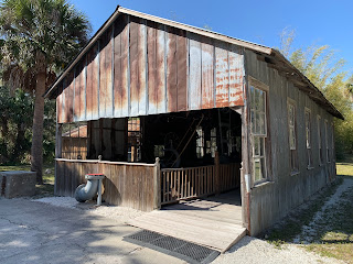
On my way between Tampa and the Everglades, I had planned a couple of additional stops at points of interest. The first was the state historic site and former home to the now defunct religious movement of the Koreshan Unity. This self-sustaining community was founded in 1894 by the two-hundred or so followers of Dr. Cyrus R. Teed, who adopted the name Koresh. Koresh was regarded by his followers as a new messiah. His teachings started in the 1870's and would very likely be called "cultish" in today's society. He preached celibacy, community, and equality to attain immortality. His group also believed in the hollow Earth theory, that described a system where we lived inside the crust of the planet and the sky was was also inside the planet. The group went to great lengths, even inventing some "scientific" equipment, to attempt to prove their beliefs. Koresh died in 1908 and membership declined steadily until the the final four remaining members deeded the land and community to the State of Florida in 1961.

As I walk around these old buildings and homes, I can't help but imagine what life must have been like here. The accommodations are nice, even by today's standards and it seems the community had everything it needed to sustain itself. I'm struck though by the concept of being tied to this man and believe system, without the ability to express one's own ideas. 

It seems the grounds are kept in a state of arrested decay for the most part and many of the homes and other structures have plexiglass walls built preventing visitors from entering into the furnished areas, while allowing visibility. There are actually quite a few visitors here, more than I would expect for such a place. It's an interesting reminder of how easily people can be influenced and the control that some of those influencers can maintain.

Gasparilla Half-Marathon (Hillsborough County, Florida)

Last year, I had traveled to Tampa, FL to run the Gasparilla Half-Marathon and then ended up getting sick the morning of the race and unable to run it. That's annoyed me for a year and so, I decided to make the drive once again and do the race no matter what this time. It was also part of a much longer road trip that will be detailed in my next few posts. Arriving in Tampa around noon on Saturday, I picked up my race packet and then checked into my hotel. I decided to go a little extravagant and stay at the Marriot down town, which is just across the street from the starting line. It made everything much more convenient. 

I was also able to spend Saturday afternoon and evening with one of my best friends, who had driven over from Orlando to hang out. We hit Cigar City Brewing for lunch and then visited the Salvador Dali museum in St. Petersburg, before enjoying a few drinks at a bar across the street from my hotel. With him needing to drive back home, I was able to call it an early night and get a pretty good night's sleep.

I awoke around 4:30 AM to my blaring alarm and started getting ready for the race. It was just a quick jaunt to the starting corrals, but I had forgotten to grab safety pins for my race bib. I checked at the front desk, but ended up having to walk to my car a couple of blocks away in a parking garage to get them. It all worked out though and I arrived to my place in the corral in plenty of time.

The race started just a couple of minutes after the scheduled start time of 6:00 AM. Though it was still dark, I was wearing my prescription sunglasses. For early starts like this, it's always a trade-off between everything looking dark or everything looking blurry. I normally opt for dark, as things will get bright pretty quickly as the sun rises.

As the corrals ahead of me began making their way under the starting banner, the successive groups moved forward until finally, I was running my first half-marathon in Florida. I was hoping for a time under three hours, but also had to remind myself that the next big part of this vacation is a 5-day kayak paddle through the Everglades. And so, I tried to not exhaust myself. 


With a couple of miles down and having found my pace, I was feeling pretty good. I was trying to hang near the three-hour pacer. At points she would get ahead of me and then I would catch up and pass her. The first few miles meandered through the streets of downtown Tampa before finally hitting Bayshore Blvd, which runs right along the shoreline of Tampa Bay. With the sun no up and heating things up nicely, it was a beautiful view for many miles of the race. 

Finally reaching the turn, I returned along Bayshore a similar distance. I did walk a few sections here and there, but I was trying to be mindful of my time. It was a difficult balance, know that I couldn't afford to spend all of my energy reserves during this race. With the finish line in sight, I made a break for it and did a near spring for the last tenth of a mile or so. I was pleased to see an official finish time of 2:56:18. Far from my best time, but better than any recent races that I've run. I grabbed a banana and a granola bar and headed back to my room to grab a quick shower before heading off on the next part of the trip. I really enjoyed this well-organized race. Though, I may not make the journey again, I would recommend this one to any of my runner friends.

Sunday, February 18, 2024

Arabia Mountain - Lake Alexander and Barn Trail (Rockdale County, Georgia)


Though I got in some really good trail miles yesterday, I was not content and decided to join another Meetup Event. This time we'll be exploring some new areas around Panola Mountain, which is part of the Arabia Mountain Heritage area. 

The drive to our meeting spot was less than an hour from my home, but I still wanted to make sure I arrived well before the start time. When I arrived, I was surprised to see a couple of friends that I haven't gotten to hike with in quite a while. As today's leader normally does, we did a quick round of introductions and an ice-breaker before we hit the trails. 


To start out, we headed around the reservoir along the paved bike trail, but soon entered the woods along the South River. I know there is an archer range here and I've heard that there used to be a golf course here. As we do a lot of bushwhacking, we eventually come to an obvious trail. Soon, we discover that it's actually a paved trail covered with years of pine needles and dead leaves. In fact, there are paved trails all throughout this wooded area. I suspect these were once golf cart paths and have long since been abandoned and reclaimed by the forest. The fact that none of the trees here appear to be more than twenty or so years old lends credence to my suspicion.,

We also note a number of numbered markers with trails leading a short distance back into the woods. These indicate what are called 3D archer targets, which are actually target dummies in various animal forms. There is a mountain goat, a moose, cougar, racoon, and many others. It's a little bizarre to see, but if that's what's been made of the abandoned golf course, it seems like a good use.

As usual, we circle back a few times on these trails and then end up down by the river in an area that seems to have been recently flooded. It's muddy, but the dead plants provide some relief from the mud. I spot a washed out bridge at one point. I'm not sure if that was part of the golf course or used for some other purpose. 

As we start wrapping up, we head back towards the cars. We only got about 6.4 miles in and much of that was backtracking along the same trails. It was an interesting adventure though. Seeing how the forest has reclaimed this formally developed area is really something to see. 

Saturday, February 17, 2024

Appalachian Trail - Springer Mountain to Long Creek Falls (Fannin County, Georgia)


While reviewing the hikes I have done since moving to Georgia about four years ago, I noticed that I've only hiked a couple of sections of the Georgia portion of the famous Appalachian Trail (AT). I then decided that I was going to try to knock out the remaining sections this year. I won't necessarily be going in order, but I did decide to start with the southernmost section. I had mentioned my plan to a few folks in one of the meetups and there seemed to be some interest. So, I posted it as a group hike with all of my standard "this is not for beginners" language.

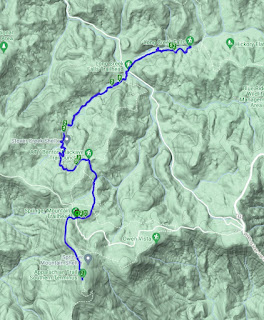
When the day of the hike arrived, I drove the two hours or so to the trailhead. The last portion of that drive was along some fairly rough forest service roads with just a gravel or dirt surface and in some cases only wide enough for a single car to pass by. This was along Winding Stair Gap road part of the way. I wondered how many of those that signed up for the hike would actually make it once they realized they would be driving up to twelve miles on these unpaved roadways. 

As usual when I lead hike, I arrived about thirty minutes early and scoped out the trailhead a bit. The southern terminus of the AT has always boggled my mind a little bit. The official start is at the summit of the very unremarkable Springer Mountain, which can be reached by either hiking eight or so miles along the AT Approach Trail from Amicalola Falls State Park, which I've done in the past, or by hiking about a mile south from the Springer Mountain trailhead. This means that a AT through-hiker has to either add an additional eight miles to their 2200ish mile trek or hike south from the parking lot south and then backtrack a mile. It makes no sense. Why not just make Amicalola Falls the official southern terminus?

Anyway not that I have my rant out, I waited in my car for a few minutes after scoping out the trails we would be hiking and waited for my participants to arrive. It's cold and windy up here. I'd estimate the temperature to be around the freezing point with the wind chill probably dipping into the mid-20's. As people start to arrive, I introduce myself and we gather up for a round of introductions and to go over the day's plan. I explain that this will be a double out-and-back due to the nature of the AT southern terminus. We'll first head up to the summit of Springer then backtrack to this parking lot. From there we'll head north to Long Creek Falls and then return once again to the parking lot. 


With that, the nine of us start heading across the road and making our way up the trail towards Springer Mountain. The trees are covered with a layer of frost and a cold fog fills the air. It's a very wintery feel this morning. The trail is well maintained and white trail blazes make it clear that we're on the correct path. Soon, we reach the anti-climactic southern terminus, marked by a bronze plaque imbedded in one of the rocks. I give folks a minute or two to take pictures before I gather us up and head back the way we came. 

I'm pushing a pretty good pace today. I really want to use these hikes to help me get back in shape and moving at a good clip is the best way I know to do that. Soon, we're back at the cars and heading the other direction out of the parking lot. 

It's still pretty cold, but I can feel myself warming up due to the quick and steady movement. Again, the trail is well marked here and we cross the Benton-MacKaye trail a couple of times. We also pass by one of the official AT shelters, which isn't much more than a three sided room built in the woods. I'm sure some through-hikers appreciate it though.

The rhododendron are plentiful here as we make our way down the shallow mountain and across a small creek. We don't encounter many other hikers on this part of the trail, but as we continue on towards Three Forks, we start to see a few more. At three forks, three creeks converge and the forest service has built a nice bridge across them and a gravel road that many people take advantage of as a parking area to hike to Long Creek Falls, which is just a mile further or so. Originally, I had planned to stop and turn back at the road, but as we are enjoying ourselves and everyone seems keen on seeing the waterfall, we decide to continue on.


A mile of so up the trail, we come to a crossroads in the trail system. Here the Benton-MacKaye and AT separate once again. There is also another spur trail to the waterfall. We stop at this clearing for a quick lunch and then travel another tenth of a mile or less to the impressive double-tiered waterfall. Though it's been dry the last few days, the waterfall still has a good flow, at least along half of the lower section. I imagine the entire thing is raging during or right after a good thunderstorm.

There are a couple of other folks here admiring the waterfall and one gentleman mentions the Native American petroglyphs on one of the nearby boulders. He explains that he's heard this as used for human sacrifices in the past. Of course I'm curious and since I've studied Native American rock art quite a lot, I have to climb up and check it out. 

What I find are some humanoid forms in outline with lots and lots of modern graffiti carved over them. The forms are unlike any true Native American style I have seen anywhere and I'm pretty confident in saying they weren't made by the First Nations. They probably are a hundred or so years old though and like the work of local pioneers that settled this area. I'm also even more certain that no human sacrifices took place here. It's a good story though.

After a few more minutes admiring the waterfall and trying to interpret the rock art, we start making our way back to our cars. I continue pushing a really solid pace even though we're now going slightly uphill. I know my legs are going to be a little sore tonight, but it's worth it for a good workout. 

We do encounter a lot more hikers heading north as we make our way south to the parking lot. Many of them have full backpacking rigs on and I ask how far they are going. Each in turn says "Maine". These folks are at the beginning of through-hiking the AT, all 2200 miles of it. I give each of them a fist bump and wish them luck. It seems to me they are starting very, very early in the season, but as we always say 'hike your own hike'. I am a bit jealous though. I hope one day I am able to complete all three of the big trails (AT, PCT & CDT) and become what is known as a 'triple crowner'. Someday.

For now, we'll return to our cars and wish everyone safe travels as they maneuver their way back down the mountain along the gravely rods. Everyone seems to have enjoyed both the hike and the pace. They all seem interested in doing future sections with me. Today, we got in about 11.1 miles and knocked out what I'm calling section 1 of the AT. Just a few more to go.

Saturday, February 10, 2024

Big Trees Forest Preserve (Fulton County, Georgia)


I just finished running the Tartan Trot 5k and decided that I wanted a little bit more of a workout for my out-of-shape old body. Nearby, is a small wooded park that I've been wanting to check out for a while and this seemed the perfect opportunity. Big Trees Forest Preserve sits in the middle of the Atlanta Suburb of Sandy Springs surrounded by the hustle and bustle of city life. Here, though, the creators of this little refuge found a way preserve a little bit of sanity in all the madness. 


Parking this time of day was easy and I quickly hit the trail in my running gear. The trail network is well marked and well maintained as it weaves its way through a small wooded area. There are some largish trees here, but having spent time with the Giant Sequoias and Coastal Redwoods of California and even more recently, with the Angle Oak in South Carolina, I struggle to think of these as truly 'big'. Nevertheless, it is a beautiful little park. A small stream runs through and several bridges have built across it throughout. 

I encounter a number of other hikers of all ages along the way. I can really see this being a place of quite contemplation during the busy day or an escape from the office during someone's lunch hour. It's a very nice park and while I'm only able to get in about 1.4 miles, I would recommend a visit to anyone in the area if you just want a little solitude and some fresh air.

Sunday, February 4, 2024

Colonial Dorchester (Dorchester County, South Carolina)


Continuing on my way home from Charleston, SC and a weekend on Bull Island, I stopped off to visit the Colonial Dorchester State Historic Site near Summerville. This now abandoned town was founded in 1696 by settlers from Massachusetts. The town thrived as a trading post due to it's location on the Ashley River. However, the town was devastated by the Revolutionary War and never seemed to recover.

Today, the state has preserved what remains of the town's structures. Though not much now, the old church bell tower was once the centerpiece of a thriving community. I stroll around the grounds and take note of the informational placards. A foundation here and there is all that remains of the many houses that once lined these streets. Closer to the river, the tabby walls of Fort Dorchester remain. This would have likely served as a protective fortification during the war. 

Walking down closer to the river, I can understand why this was such an important trade center. The river is wide enough and likely deep enough to navigate cargo vessels through. Some of the timber retainer walls remain from these earlier days (or more likely have been replaced). I take not of the alligator warning sign. I am in South Carolina after all. After finishing my walk around the area, I return to my car and head for home. It's a great little stop for anyone in the area.
Fort Moultrie (Charleston County, South Carolina)


While traveling home from a weekend exploring Bull Island, near Charleston, SC, I took time to visit Fort Moultrie, which is one of the four military installations that have guarded the waterway leading into the city for centuries. Construction was started just prior to the start of the Revolutionary War and the fort served as a defensive structure through that war, the American Civil War, WWI, and WWII. It has been updated several times over the centuries, but now serves as a tourist attraction managed by the National Park Service.

After check into the visitor's center, I walked across the street and entered the fort. It's irregular shape probably served well as a defensible position. The long hallways underneath the fort lead to ammo storage, offices, and other storage areas. All of which have been faithfully redecorated to the appropriate ear. The corridors snake along inside the walls and under the earthen barriers with several points of emergence. I can image this would have been a maze during battle, but probably a fairly safe maze to walk around in even under heavy fire.

On the walls, there area  number of gun batteries set up for the different ears in which the fort was in service. As I walk around these areas, it's interesting to see the contrast in cannons/guns from one war to the next. In the center, there is a double-walled building that served as gunpowder storage. The extra wall providing some level of additional protection from unexpected explosions.

Leaving the fort, I head out towards the shoreline. In the distance, Fort Sumter is visible. These two forts combined were designed to secure the main entrance way into Charleston via the estuary. I spend a little more time exploring around the outside of the fort before returning to my car. It's always interesting to visit these historical places and try to understand what it would have been like to be here in the earlier period.

Saturday, February 3, 2024

Angel Oak (Charleston County, South Carolina)


In my travels, I've seen ancient trees and I've seen giant trees, but the Angel Oak on Johns Island near Charleston, SC falls into both categories. This magnificent specimen is thought to be around five hundred years old and among the oldest trees east of the Mississippi. It's gigantic and shades an area over 17,000 square feet. The tree is enclosed in a large fenced off area and protected by the city. 

The massive tree's trunk is nearly 29 feet in circumference. While the tree only rises to about 67 feet in height, it's long branches stretch out and touch the ground. The longest of which is 187 feet long. Like most Southern Live oaks, the tree grows more horizontally than vertically and the gigantic branches sweep the ground. A couple have even touch down and grown back out of the soil. It truly is a magnificent tree and I'm glad to have been able to stop.

Friday, February 2, 2024

Boneyard Beach - Bull Island (Charleston County, South Carolina)

While spending some time on Bull Island, off the coast of Charleston, SC, the guided group I was with decided to explore Boneyard Beach on the northeastern side of the island. I visited this area a couple of years ago on my previous trip to this island and found it to be incredibly scenic and interesting.

As the cold waters of the Atlantic Ocean travel south, they have been eroding the small barrier island over the centuries. As sand is pulled away from the beach, the salt water intrudes further and further inland. The area that is now beach, was once a maritime forest, full of live oaks and a few other deciduous trees. Those trees don't do well with salt water though and slowly died from exposure to it. Their root systems became more and more exposed as the sand and dirt was pulled away. All the while, the bark was removed by the wind and the trunk underneath was bleached white by the pounding sunrays. Soon, gravity or wind robbed the dying or dead tree of it's vertical existence and it found itself laying on it's side in the sand with the ocean waves pounding on it's remains. 

Walking among these tree corpses, one is reminded of what a whale graveyard might look like. I think this is mostly due to the size and white color of the tree's remains, but I suspect his is partially where the name came from. Dozens, if not hundreds of these trees litter the beach along a section a mile or so long. It's a stunning visual.

Among the trees, we also stumble across the remnants of a old wooden ship. Just the keel and a few support beams remain buried in the sand. I examine the large nails imbedded in the rotting wood for some idea of age and speculate that they were blacksmith made, meaning it was likely pre-industrial era - eighteenth or nineteenth century, I would guess.

Traveling further up the beach, I finally reach a spot where water is flowing from the island back into the sea. The breach is deeper and wider than I'm comfortable crossing and so, I decide to turn back and return to the group. This is an amazing place though and worth a visit if you're on the island.

Bull Island - Dominick House Expedition (Charleston County, South Carolina)

 A couple of years ago, I visited Bull Island as part of a coastal kayaking trip. This barrier island is one of the many along the east coast and sits across the intercoastal waterway just north of Charleston, SC. I really enjoyed my time on the island. As with many of the other barrier islands I've visited since moving to the Atlanta area, I've found these islands to be the closest environment to my beloved Sierra Nevada mountains. That is not to say the ecosystems, landscape are anything like the mountains, but instead, the feeling of true remoteness is what I'm referring to. Many of these islands are uninhabited and protected as a nature preserves. When you walk around the island, you feel a since of being away from civilization - a feeling that I really savor. When an opportunity arose to spend a weekend on the island with Coastal Expeditions, I jumped on it.

The night before, I drove from Atlanta to Columbia, SC, which only left me a couple of hours of transit time to complete the trip the next morning. Once I arrived at Garrison Landing, where we would take the company's ferry to the island, I met up with my guides and group. We chatted while waiting for the remaining participants, but were quickly loaded onto the boat and on our way to the island. It takes about thirty minutes to navigate to the island through the salt marshes and rich oyster beds. Along the way, we saw a myriad of migratory birds and even a couple of dolphins. I always love seeing dolphins. There is just something hopeful about them.

Arriving on the island, we loaded our gear onto a truck and ourselves onto a flatbed trailer with cushioned seats for the short ride to the Dominick House, where we would be staying the next two nights. This is the only house on the island and was built by a former owner of the island in the 1920's. It's now maintained by U.S. Fish and Wildlife Service as part of the Cape Romain National Wildlife Refuge. We were shown our rooms and dropped our gear before coming down to a terrific lunch in the large dining room. We were treated to a great salad, grilled cheese sandwiches, and tomato soup. Not a bad way to start the day.


Once we finished lunch, we headed out for our first hike along part of the Turkey Walk Trail. This a curious name, as there are no turkeys on the island. There are, however, a huge number of other waterfowl who use the richly diverse ponds as a food source along their migratory paths. We see more species of birds than I can remember. Many members of the group are birding enthusiasts and carry large monoculars, some with tri-pods, to facilitate their bird viewing. The most surprising though was a lone flamingo, who is well north of his normal range. According to our guides, a pair of them were blown up this way during a recent storm and while one of the pair flew back to Florida, one has stayed for a few weeks and is often the highlight for the birders.


We also encounter a number of alligators along the way. While the marshes around the island are saltwater, the man that built the house also created a number of levees to trap fresh water into a number of large ponds. He used the island for hunting and the fresh water attracted large numbers of game fowl. At some point, the alligators gained knowledge of the freshwater and decided it would be a good hunting spot for them as well. A century later, there are hundreds of them on the island. Along this trail, we encounter a probably mother on the grassy bank and a number of her offspring of the last couple of years hiding in the reeds. They are interesting animals and one of the creatures I'm most interested to observe on this trip. The short hike is only about 2.3 miles, but it was great to stretch after all the traveling.

Returning to the house, we learn of a potential problem with the electricity and water (which is drawn via an electric pump). Our lead guide has been in communication with Fish and Wildlife and they are seeking a solution, but this may impact our trip. We relax for a short time and wander around the kept grounds around the house. Here the long limbs of large live oaks sprawl out across the yard. These trees are pretty unique and often found in the Southeastern United States. I find them quite beautiful.

After just a short rest, it's time to do some more exploring. While our lead guide remains at the house trying to sort out the facility issues, the rest of us load back onto the flatbed and are transported a ways north toward Boneyard Beach on the northeastern corner of the island. I'm going to write up a separate blog for this area, as it is just that amazing, but essentially, it is an area where erosion has allowed the salty ocean water to encroach into the interior of the island. The exposure to salt water has killed large trees and their bleached trunks and root systems now liter the beach like whale bones. 

We spend an hour or two walking along the beach before heading back to the house to learn of our expeditions fate. Once we arrive, we learn that they will not be able to repair the electricity tonight and will not permit us to stay at the house without electricity and fresh water. I personally wouldn't mind this at all, but Fish and Wildlife are firm in their stance. With sun having already sunk just below the southwestern horizon, we load back onto the ferry for a cold ride back to the mainland. Coastal Expeditions has made arrangements for all of us a nearby hotel and they will be cooking up a low country boil at their headquarters. It's an unfortunate circumstance, but I appreciate our guides and their management doing what they can to still make it an enjoyable weekend. 

I decide to drop my gear off at the hotel before heading to the feast. I admit that I'm a little disappointed, but I cannot fault our guide service. This is completely out of their control and we'll just have to make the best of it. After the short drive to their headquarters, I enjoy a glass of wine and some dinner of potatoes, sausage, corn, and shrimp (standard low country boil). Our lead guide informs us of the plan for the remainder of the weekend. We'll reconvene back at Garrets Landing in the morning and head back to the island for the afternoon. There is a chance the repairs may be completed tomorrow, but if not, we'll end the expedition in the afternoon and head back across dock. While they haven't determined how to properly compensate the participants yet, she indicates there will be some level of refund due to us. Returning to the hotel, I decide to crash and get up early for the next day's adventure. 

After enjoying a quick breakfast at the hotel, I check out and drive back to the dock where the group reconvenes and loads back onto the ferry. Unlike yesterday, we are approaching high tide for the ride over and the salt marshes look a bit different because of it. Once we arrive on the island, we spend some time along the northern part of the island enjoying the waterfowl from an observation deck. We see pelicans, osprey, eagles, and once again, more birds species than I can keep up with. 


Next we walk out to the beach once again, but this time to where that same storm that blew the flamingos in also destroyed two of the levees. This is allow massive amounts of saltwater to flood the freshwater ponds and is actively changing the ecosystem before our eyes. It seems there is some interest by Fish and Wildlife in restoring the levee, but there is still a lot of discussion to be had before a decision can be made.

After loading back onto the flatbed, we head east along the levees with brigades of large alligators sliding into the water as the truck approaches them. I'm not exaggerating when I say that we probably encountered over a hundred of the creatures along this little stretch. At a couple of points, we stop to observe the carnivores. Luckily, we're relatively safe from them as they will only attack if they feel threatened. They eat their prey whole and will not really go after anything too large for that feeding method, which includes adult humans. A small child might be in danger though.


Continuing the drive, we end up at the Old Fort and a historical marker indicating that the first settlers of Carolina first landed near the spot on their way to found colonial Charles Town (now Charleston). All the remains of the fort is a tabby (oyster shell and mortar) wall rising a couple of feet out of the grass and forming an octagonal shape. As I understand it, this was build by the British as a defensive hold. As we wander around, we also remain on alert for a particularly brave 10-11 foot alligator who has stubbornly decided not to move. We give him space, but he's still pretty close to the group. Eventually, he dives in the water as the we reload onto the truck and drive past him.

From here, we head back to the house and enjoy an terrific lunch prepared by our guides, which includes an "oyster roast". In this case, they are simply steaming locally caught oysters until they open and then we each take our shucking knives to reveal the morsel inside. I've only ever eaten oysters on the half-shell and this is a new experience, though, I think I prefer them raw. After our lunch, we load back onto the ferry and head back to our individual next destinations. Overall and even considering the unforeseen electrical problems, it was still a fantastic trip. Our guides were wonderful and I appreciate their efforts to make the very best of the circumstances dealt to us.