Sunday, September 27, 2020

Hard Labor Creek (Morgan County, Georgia)

 Wanting to get a few more miles in this weekend, I joined a different group to explore Hard Labor Creek State Park this morning. This park is roughly forty-five minutes south-east of my home and has a strange name. The story goes that either slaves or Native Americans found the namesake creek cutting through this park especially difficult to ford and named it accordingly.

Meeting with the group near the park's visitor center, we caravan to a somewhat remote forest road once everyone has arrived. Some people are concerned about getting stuck, but myself and another jeep owner with the group assure them that we can pull them out should the need arise.

Once we hit the trail, it's a series of interconnected winding mountain bike trails, though they are not very popular today and we only see a couple of riders. The fall colors are just beginning to take effect here as the summer greens begin to darken and brown. Soon, these leaves will fall from the deciduous trees here and all over the eastern part of the country. 

The hike is pretty uneventful, but pleasant. My tracking app logged 7.8 miles on this little trek and it was exceptionally easy. No real hills to speak of. I can't say this was a great hike, but the company and conversation was enjoyable, and I always appreciate a chance to get outdoors for some exercise.

Saturday, September 26, 2020

Dauset Trail to Indian Springs (Butts County, Georgia)


Today, I joined one of the local hiking Meetups to explore the Dauset Trail an hour or so south of Atlanta. The trail begins at a nature preserve and continues to Indian Springs State Park. As I make my drive down towards the trail head to meet the group, there is a light rain coming down and it continues once we begin congregating. At least it will keep today's miles on the cooler side. After a quick round of introductions, we head into the woods on some very well maintained trails.

There isn't much elevation gain as we follow the trail northwest towards the park, and it's pretty easy going. We are able to maintain a brisk and steady pace. After a couple of miles, the trail starts to run beside Long Branch Creek and then eventually, the shoreline of Chief MacIntosh Lake, which sits inside the park boundary.

Leaving the woods, we cross an old cobblestone bridge for a great view of the Big Sandy Creek, which feeds the lake. Taking advantage of the park's facilities, we take a short rest near the structure build around the spring itself. Apparently, this is one of the oldest parks in the state of Georgia and even before that the mineral waters coming from the spring were thought to have curative effects, inspiring many to visit and bath here. Even today, there are families bottling water from the spring to take home. A stone structure and spigot system within have been built to help facilitate the collection of this spring water. 

After resting a few minutes and enjoying an energizing snack (a fig bar and some artichoke hearts for me), we return nearly the way we came. The return trip is mostly uneventful, but as always the conversation is excellent. At one point, we cross the creek to see the largest crayfish I've ever encountered crawling through the clear flowing waters. This little guy looks to be nearly seven inches long. 

Finally returning to the parking lot, I see that I've logged about 10.1 miles on these easy trails today. Not a bad way to spend an early autumn Saturday. I say my farewells and head for home.

Sunday, September 20, 2020

Edge of the World Trail (Dawson County, Georgia)


Not willing to settle for only the 5-miles hiking out from the Len Foote Hike Inn this morning, I decided to explore another short trail that has been on my radar for a little while. Though there is some naming confusion over this trail, I prefer to call it the Edge of the World Trail, named for the river rapids and small tumbling falls popular for kayaking and tubing that the trail hikes beside part of the way. It's also known as the Amicolola River Trail and the Amicolola Creek Trail. Regardless, Edge of the World certainly sounds the coolest.

The trail starts from a gravel parking lot and after descending a few steps, follows a boardwalk along the river for quite a ways. A number of shoals or rapids are visible out in the river and I suspect they would be quite fun to traverse in an tube or small kayak. Further on, however, the rapids get even more "seat of your pants" as they tumble over a series of small falls. A number of people are in the water in the section passing through the complex in tubes. I must admit, it does look like fun.

From here, the trail heads uphill and enters the woods. It's steep in a couple of short sections, but as I'm already warmed up this morning, I actually run up the steep sections. Reaching the top of the area, the trail follows what I suspect was an old logging road for a short distance before passing beyond a locked gate and onto an overgrown road. Judging by the tall pine trees, lack of deciduous trees, and the tall grasses and shrubs up here, I'm pretty sure this area was logged in decades past and is only starting to return to it's wild nature. Honestly, the pine trees remind me of hiking in Reno and I have fond thoughts of my former home.

After a long section on this overgrown road, with some gorgeous grasses and wildflowers blooming, the trail descends back to the boardwalk and returns to the parking lot where I started. It was only about 2.8 miles, but I was able to enjoy some nice scenery.

Saturday, September 19, 2020

AT Approach Trail to Springer Mountain via Len Foote Hike Inn (Dawson County, Georgia)

Upon moving to Georgia nearly a year ago, I started thinking about hiking sections of the Appalachian Trail (AT). While I hope to be able to thru-hike the entire 2,200 miles, it's not a realistic option at this point in my life, but hopefully, after retirement I will be able to. That said, I certainly do have free time to be able to hike sections of the trail and the logical starting place was the AT Approach Trail departing from Amicolola Falls State Park. 

In addition to the trail itself and the amazing waterfall, the Len Foote Hike Inn was something of a curiosity to me. Several hikers I have met on the trails while living here have told me of this legendary place and I wanted to check it out for myself. Early in the spring, I made a reservation to stay at the Inn tonight and so, now all that remains to do is to get there. Unlike most guests though, I'm going to hike the Approach Trail first and then come back to the Inn, which should be about 12 miles. Most guests of the Inn, hike a simple 5 mile trail to the facility.

After admiring Amicolola Falls for a few minutes, I get my trek underway. I do question whether or not I should have climbed those 425 steps down to and then back up from the base of the waterfall. I guess we'll see how wise of a decision that was in a few hours.

The trail starts out easy enough and obviously well traveled and maintained. Not long after departing the parking lot, the trail splits, with blue blazes indicating the AT Approach Trail going to the left and green blazes representing the trail to the Inn going to the right. While I intend to come out tomorrow on the green blazed trail, my planned destination for today has me following the blue blazes. 

I got here early and the time of day in combination with the cloudy skies seems to have frightened away most hikers. I do encounter a few backpackers on my way, though most of them look like first-timers. They're a friendly and eager bunch though, and I answer questions as best as I can when they ask.

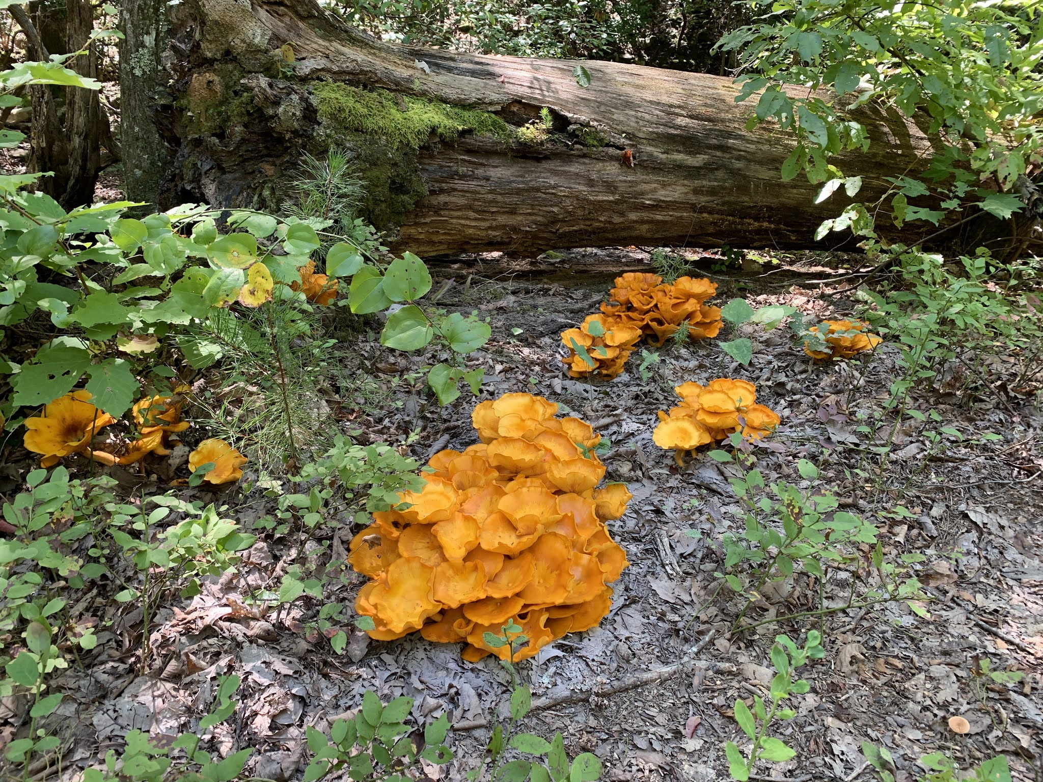
The first several miles of the trail undulate with the rolling hills of the southern Appalachian Mountain range. Many warnings indicated the strenuous nature of this trail, but it's really not bad at all. Along they way, I encounter a number of previously used campsites, complete with logs fashioned into benches surrounding piled-rock fire pits. I'm sure lots of people come out here to get away from it all, though no one is out here this morning.

Finally reaching another fork in the trail, the sign indicates that Springer Mountain is another 3.5 miles ahead of me, while a trail going the other direction is 1 mile to the Inn. I'll be returning to this fork in a little while and traveling that 1 mile. For now though, I continue to push ahead to Springer. Almost immediately after this fork, the trail starts a steep downhill section about half-a-mile long. On my return, I will have to remember to take this section slowly. 

Once at the bottom of the section, I pop out on a forest road and gravel parking area labeled as Nimblewell Gap. There are a few cars here and I pass several hikers making their way up the trail on the other side of the parking lot. I assume they are also headed to Springer Mountain, though on a much shorter route. As I approach the summit, I encounter even more well laid out campsites and even a hiker's shelter. Again though, no one is here at this time of day.

Finally reaching the summit of Springer Mountain, I take a moment to admire the bronze sign inlaid on a large stone indicating this location as the southern terminus of the Appalachian Trail. I'll return here someday. In the meantime, I take a few minutes to get a snack and water. There are a number of people here. From what I'm told, there is parking lot just 0.9 miles away in the opposite direction I came up and people often come to visit from that lot. Springer Mountain, at 3,782 feet, is not all that impressive and the views are somewhat obstructed by trees, but it's a popular destination nonetheless and now I can check it off of my list.

Returning the way I came, I make my way slowly up the steep section I mentioned earlier and upon reaching the fork, head down the trail to my left following the green blazes. I'm looking forward to a shower and a comfortable place to relax. That mile, while fairly easy, does seem to take a long time to complete, but eventually, the Len Foote Hike Inn comes into view.

This lodge is somewhat unique in that the only way to reach it is on foot using the trails I have been and will be walking. It has twenty guest rooms, a dining hall, game room, and the most coveted area, the bath house with hot showers available. All around the facility there is ample outdoor seating and guests are encouraged to unplug from technology during their visit. 

As I enter the lobby, I'm greeted by a young man who walks me through their procedures (put in place to help safeguard against the COVID-19 pandemic) and provides me with my linens and room key. I make my way to my room which is just outside the lobby and open the door to find very Spartan-like arrangements. A large bunk-bed is the main feature and occupies the majority of the room, but there is also a small closet area and stool. Some might think this was crude, but for me and many other hikers this looks perfect after a long hike.

After doing some basic unpacking of my small pack, I decide to take advantage of the hot showers in the bath house. After hiking 12.25 miles this morning, nothing feels quite as good as a hot shower. Not to mention, I'm planning to take the tour of the facility that is offered at 4:45 and followed by dinner in the dining hall at 5:30. 

During the tour, our guide, who is the assistant manager of the Inn, explains a number of things about the Inn, including it's history and efforts to be completely sustainable. Through composting, gardening, solar power, and other efforts, the Inn has earned platinum status from the Leadership in Energy and Environmental Design organization. While they are proud of their accomplishments they don't preach, but simply try to be an example to others. The thought being that if it can be done way up here on the top of a mountain in the woods, it can be done anywhere. I tend to agree.

Guests are pre-assigned tables and dinner is served in two shifts to help maintain social distancing. My vegetarian option meal consists of an incredibly fresh garden salad, corn, baby carrots, and a black-eyed pea main course. I believe the others are having some kind of ginger-glazed ham. It's quite delicious and I eat every bite, as I'm sure many hikers do. For desert, we are served some kind of blackberry compote with an angel-food cake topping. Again, very tasty. 

After dinner, I take a walk around the facility, but as the night air at this elevation has a cold bite to it, quickly decide to head back to my room as the night settles in. I suspect the air temperature is in the low forties, but my room is supplied with several blankets and a hot-air vent. While it does take a few minutes for my body-heat to warm up the sheets, I'm quickly very comfortable in my bed and doze off to dreamland.

I awake shortly before sunrise, and it's a good thing. Today is the autumnal equinox and the inn has constructed a large stone equinox observatory, which we educated on during the tour yesterday evening. I take care of my morning personal matters and then head out to see the sunrise over the green hills to the east. For just a moment as the sun crests the distant hill, a beam of light enters the carved hole of the granite block and illuminates the man-made cave wit the first rays of autumn. The effect lasts only a minute or two before the sun rises to high to enter the hole, but I'm thrilled to have been here on this day to witness it. I hadn't even considered that astronomical significance of this date when I made my reservation.

Much like dinner, our breakfast is basic, but scrumptious. Mine consists of eggs, grits, and biscuits with milk gravy (they made some without sausage just for me). After breakfast, I head back to my room to pack and after dropping off my dirty sheets and returning my key, I'm once again on the trail following the green blazes back to my jeep.

These final five miles are very easy and pass through a number of small valleys and watersheds. As I walk over supported board walks in some sections, I'm guessing this can section can be quite wet at some times of the year, but it's not bad at all today. Arriving back at my jeep, I take a moment to get some water and reflect back on the last twenty-four hours.  A total of 17.2 miles hiked (12.2 yesterday and 5 today) and a stay at a hiker's paradise. It has been glorious!

Amicolola Falls (Dawson County, Georgia)

At 729 feet, Amicolola Falls is the tallest waterfall in the state of Georgia and has been on my "to visit" list almost since moving here nearly a year ago. That said, I learned early on during my time in Georgia, of the famous Len Foote Hike Inn and made a reservation several months ago. Since the state park dedicated to the falls is the trail head for the Inn, it made sense to combine the trips. And now on this last day of summer, here I am.

From the parking lot used by guests of the Inn, the walk to the waterfall is all paved and on a wooden bridge and staircase. From here, you can walk across the water as it prepares to take it's mighty spill over the precipice of the falls and tumbles into the valley below. Unsatisfied with this view, I decide to climb down the 425 steps to a better vantage point. Knowing that I'm going to be hiking about 12-miles immediately after leaving the falls, I'm not sure that was such a good idea, but you only live once. 

From the bottom of the staircase, the view is much, much better. I can look directly up the towering waterfall in all its glory. The water is roaring today, but this must be an absolute monster in the spring when the rains come frequently. After spending a few short minutes admiring this natural wonder, I climb back up the stairs to the trail head and prepare for my next adventure.

Saturday, September 12, 2020

Pickett's Mill (Paulding County, Georgia)


Joining one of the local hiking groups, I plan to hike around Pickett's Mill this morning. On May 27th, 1864, this was the site of a bloody battle during the American Civil War. A battle that cost approximately three thousand soldiers their lives, this place saw a minor victory for the Confederacy as they delayed General Sherman's advance.

Meeting with the group at the scheduled time, we find the organizer strangely absent. One of the members that knows him gives him a call and it turns out he got the times mixed up. After arriving twenty or so minutes late, he immediately hits the trail and enters the woods behind the battlefield's museum. The trail is easy, but we do go through a few overgrown sections. Much like many of the trails in Georgia, small creeks run through the park. In one section, there is a marker indicating the location of the former location Pickett's Mill, but nothing of that structure remains.

As we make our way around a couple of loops in the park, we here the unmistakable sound of cannon-fire in the distance. As we were arriving at he visitor center, we saw a number of individuals in period dress. Apparently, there is a re-enactment going on today and they pull out one of the replica cannons for a bit of excitement. It does give some small sense of what this place must have been like during that hellish time one hundred and fifty years ago.

As we return to the parking lot, we say our good buys. This was a nice group of people and I enjoyed our conversations along the way. We put in just over 6 miles this morning, which is not a bad way to start the weekend.

Wednesday, September 9, 2020

Daisy Days at Arabia Mountain (DeKalb County, Georgia)


I always enjoy getting out for a nice hike before work and today I'm bringing a special guest. My elderly mother has recently moved in with my wife and I. I've been trying to get her out for some exercise, but each time she has made excuses. Finally, the appeal of seeing bright yellow daisies alive on the mountain inspired her enough to get up and active at an early enough hour for us to get a short hike in and me make it back to my home office to start work.

We arrive at the trailhead on the southern end of Arabia Mountain just in time to snatch up the last available parking spot. The conservancy that oversees Arabia and Panola Mountains is running an event this entire month to get people out for Daisy Days. The event entails hiking up each of the three monadnocks southeast of Atlanta during the month of September when the mountains spring to live with bright yellow daisies. Judging by the number of cars here so early, it seems to be drawing a crowd, even on a Wednesday morning.

My mother is not much of a hiker, but she's interested, and so, we make slow and steady process towards the granite incline. All along the way, we are greeted by an assortment of gorgeous fall wildflowers. The bright yellow daisies are the most prevalent, but there are also purple flowers on various bushes as we follow the well-worn trail to the closest ridge. Mom seems to be enjoying the hike. I warn her to be exceptionally careful as the ground beneath our feet is anything but even, but she seems to do fine on it.

When we finally reach the top of the ridge, she spends a few minutes looking in all directions and taking in the view. Mom has never really explored very much and this is probably one of the longest views she's ever had, though we are barely at 900 feet above sea level. Still, it's nice seeing her enjoying herself. Afterwards, we make our way back the way we came and she says how much she enjoyed the short hike. I don't know the distance that we covered for sure, but it was probably about a mile in total. It was nice to spend some time with her and I look forward to doing it again.

Sunday, September 6, 2020

Olde Rope Mill (Cherokee County, Georgia)

My second hike of the day departs the same trailhead as my earlier hike. Meeting with the hiking group, we do a quick round of introductions and then cross the bridge again and start exploring the mountain bike trails of Olde Rope Mill. The trails here are pretty well maintained and obviously get a lot of use, but much like many of the local parks, simply curl around on themselves to provide more distance for bikers than exploring anything truly interesting. 

Today though, our group leader has some other ideas in mind and before to long, we have left the trail and are bushwhacking our way through the woods. It seems that some of the older trails have overgrown and are now much harder to find. I actually enjoy path-finding and bushwhacking tough and so this is right up my alley. That said though, the occasional site of poison ivy gives me pause. Hopefully, that won't become a problem.

For part of the trail, we follow along the river and then under a seldom (if ever) used railroad trestle bridge. Eventually, we pop out of the woods and onto a crossroads, where make use of the paved bridge to cross the river and then re-enter the woods on the far side. A short time later, we return to the train trestle and after some discussion the majority of the group decides to explore the other side of the park. 

As it's approaching our scheduled end time and I have other plans this evening, I decide to head back towards the trail head. I wish the group well and then walk across the trestle. I didn't think this would be a big deal for me as I don't have a particular fear of heights, but as I make my way across this railroad bridge, which sits approximately a hundred feet above the river, I find myself being a little anxious. The ties which I'm walking on are spaced about six inches apart and while there is really no way I could fall between them, it's still a little bit unnerving. Eventually, I reach the far side and take a minute to compose myself and figure out the best path back to the parking lot. 

I'm forced to cut across several loops of the mountain bike trail, descending lower and lower towards the river with each cut, before ending up right alongside the river. I soon come to the ruins of what must have been the Old Rope Mill. A long canal has been constructed and is now an interesting path for kayakers. I would imagine this is the channel where the paddle-wheel sat to power the operation.

After only a short distance further, I end up back at the trail head and then walk back up to the parking lot where I left my jeep. It's been an interesting hike and while I'm sorry I didn't get to explore the rest of the park with the group, the railroad trestle was kind of fun, even if a little scary. To add to my earlier miles, my tracking app shows an additional 5.8 miles, which makes for a pretty good day.

Cherokee Falls (Cherokee County, Georgia)


I'm meeting up with one of the hiking groups that I frequently explore with in a little while, but since there is a second trail departing from the same trailhead that I'm interested in checking out, I arrive a couple of hours early to visit Cherokee Falls. In my research, this waterfall is also known by the names of Allatoona Falls and Hause Shoal Falls. Whatever the name you know it by though, it seems to be a very popular destination for local kayakers. 

The trail departs Olde Rope Mill Park, a popular put in spot for kayaks and starting point for mountain bikers, and immediately crosses a modern bridge over the Little River. It follows a section of mountain bike trail before cutting through the woods and then popping back out onto a gravel road. The road passes under interstate 575 and then enters an area being used to dredge the river. It looks as though this is an active site, but on this holiday weekend, no one is working. It's exactly a pretty place, but I make my way through this area quickly and re-enter the woods, where the trail now follows right alongside the river. I imagine this trail can be problematic when the water is higher or after hard rains.

After leaving the river bank and crossing over a hill, the trail turns back the other direction and descends towards a small finger of Lake Allatoona where one of the feeding creeks cascades twenty or thirty feet over a series of eroded granite steps to form the waterfall. It's actually more impressive than I was expecting and has drawn quite a crowd of kayakers to admire it.

I take a few pictures and turn back the way I came to meet up with the group and explore another trail in the park. This little side adventure took me about 3.6 miles from where I parked the jeep.

Saturday, September 5, 2020

Choccolocco Creek Archaeological Complex (Calhoun County, Alabama)


 While in this part of Alabama, I wanted to take the opportunity to visit another nearby mound site. The Choccolocco Creek Archaeological Complex was once home to a thriving Native American village, and was reoccupied a number of times over the centuries. The site is now home to a well-maintained community park, complete with a small lake and paved walking trail, which I must follow to reach the far side where the remaining earthen mound sits.

After reading the educational placards placed here by the park, I realize that the original site included three mounds and a serpent-shaped rock structure, all of which having been mostly destroyed by local farmers in past decades. The earth mound and the loose stone mound that now sit here are attempts to recreate the history that was lost. It's a shame to have lost such treasures to the ravages of time and the inconsiderate nature of mankind, but I appreciate the attempts to correct those mistakes and pay respect to the peoples that once made this their home.

Cheaha Mountain via Lake Trail (Cleburne County, Alabama)


Labor day weekend is upon us and I decided to continue my quest to summit the highest point in each of the fifty states, setting the neighboring state of Alabama's Cheaha Mountain as my target for today. There are several trails leading to this summit on the southern end of the Blue Ridge Mountains, but after reviewing them, I opted to hike the Lake Trail.

Starting out from the parking lot near Cheaha Lake, I head into the woods alongside a small creek that feeds the lake. The trail is relatively easy at this point and with a nice breeze blowing, it's pretty comfortable temperature-wise as well. Some interesting groups of orange mushrooms, which I believe to be the poisonous jack-o-lantern species, add some nice color contrast to the path.

The trail starts to ascend ever so slightly and then suddenly, much more abruptly. I briefly loose the trail as it climbs a dirt embankment, but making use of some deeply embedded tree roots, I quickly find my way back and continue forward. This section of the trail is marked by several tree falls that have yet to be cleared from the foot path. I do my best to navigate around or in most cases, under them, but I grab a stick to clear the spiderwebs and keep critters out of my face. 

From here and for the next three-quarters of a mile or so, the hike turns much more into a rock scramble. Though the distance is pretty short on this trail, the constant class 2.3-2.5 terrain makes for a really good workout. I'm starting to think this will be the first of my recent high-point summits that I will actually earn. What I mean by that is the last several (Tennessee, Georgia, and North Carolina) were very "touristy and included paved walking paths and observation towers. At least I'm having to work for this one a bit.

After taking a short break on a rock outcropping that offers a magnificent view of the surrounding hills, I continue on towards the summit. Along the way, I pass a couple of young men on their return trip. We chat for a minute and they inform me that the summit itself requires walking through a camp ground and that this trough trail comes to an end just a short distance further.

Just as they described, the trail meets the road and winding my way around the mountain top and through the campground, I reach the tall radio tower that sits atop the mountain. An observation tower allows visitors to climb up and see the distant horizons over the trees, but the view is spoiled by all of the development and by the steel cables supporting the radio tower. 

After spending a short time taking in the views, I make my way back down the mountain. Since I am now a bit more familiar with the path, I'm able to move a bit more quickly, but still carefully as I navigate the steep trail. Ending up back at my jeep, I check my tracking app and see that I've only hiked about 4.1 miles, but that one long scramble section made it quite a workout.