Saturday, August 20, 2016

Mount Whitney - Take Two (Inyo County, California)


I've never been one that deals overly well with personal failure and my inability to reach the summit of Mount Whitney two years ago has bothered me since that day two years ago. I don't regret my decision to turn back. I was suffering from altitude sickness after reaching about 12,500 feet and would have been risking my health to push on further. I made the right decision on that trip, but that doesn't mean I wasn't going to give it another go at some point in the future . . . and the future is now!

I along with several friends entered the Whitney lottery this year, but I was the only one to secure permits. This time though, I had put in for two nights in the Whitney Zone instead of just one, which would give me a bit more time to acclimate to the thin air and low pressure of the highest elevations of the formidable Sierra Nevada range.

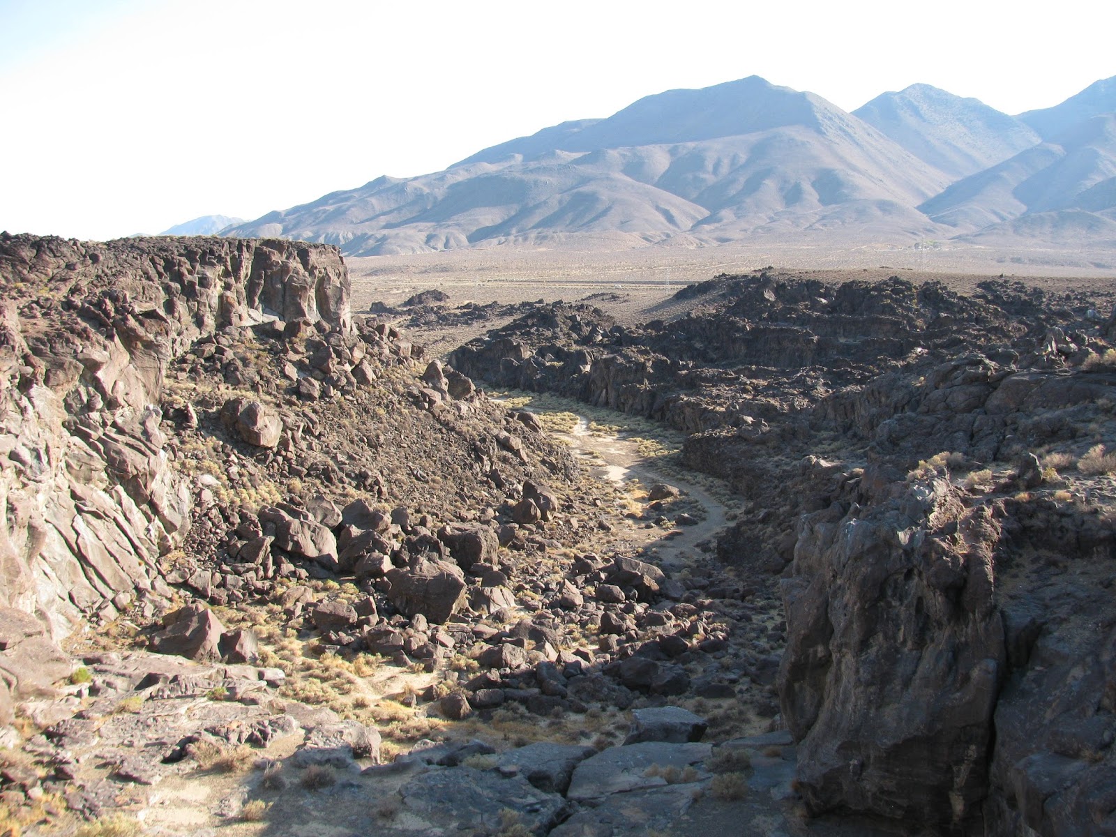
After driving down US 395 from Reno to Whitney Portal, we had set up camp at a site we had reserved in the campground and spent a short night at 8,000 feet only to rise at 4:00 AM for my trip to the top. All along, my plan had been to simply hike from Whitney Portal to Trail Camp (where I spent most of my last trip suffering from 'hot-air balloon head') on the first day and camp there at 12,000 feet in preparation for my ascent on Sunday to Whitney's Summit. 


As my friends, Van and Bill, and I made our way up the dark trail, illuminated only by a nearly full moon, we observed a number of other hikers hitting the trail at a similarly early hour. After only a quarter of a mile or so, Van realized he had left his hiking pole (necessary for him to hold his tent up) at the jeep, and so had to turn back to get it. Bill and I found a rock and enjoyed the early morning air while we waited. In truth, I was feeling great. The cool morning air and though of the adventure at hand had me invigorated. Once Van returned, we took off again and I had a lot of spring in my step. I bounded over a couple of the creek crossings, hopping from one granite step stone to the next avoiding the water.


As the sun started to rise, I had gained several minutes on my companions and found myself some new friends amongst some deer, including two fawns, grazing in the early morning light. They were timid, but not truly afraid of me. I always love seeing wild life in their home, but I do my best to 'Leave No Trace' and not disturb them any more than absolutely necessary.


Continuing on towards the lower of the two camps along the trail, Outpost Camp, I take a few shots of Whitney and the setting moon over the meadow just before the campground. Great shots here of the high mountains above - which I would be on top of in the near future. Pushing on through Outpost Camp, I felt great and continued my quick pace another two or so miles up to Trial Camp, where we had planned to spend the night.


Arriving 15 minutes before Van and about 45 minutes ahead of Bill, I spent a few minutes talking to a Forest Ranger about the weather forecast, suitable camp sites, and just the great outdoors in general. The ranger did actually ask to see my permit, which I consider a good thing since I had one. If I have to go through the lottery process to secure one, its nice to know that others can't just ignore the rules. Once Van arrived, we looked over a couple of sites I had pre-scouted and selected some that would be suitable for our three tents.


Still feeling great, we started putting up our tents and as Bill finally arrived, we fixed a quick dinner. The ranger had mentioned to me that there was a very slight possibility of thunderstorm later this afternoon, with increasing chances over the next two days. I suggested to Van and Bill, that I wanted to try to summit today and even if we had to turn back, we would still have tomorrow to make another attempt. They agreed, but Bill decided to remain at camp and relax. 


Van and I packed our day-packs (essentially, the top section of our backpacks converted into much lighter fanny-packs) and started up the legendary 99 switchbacks leading to Trail Crest. The switchbacks are relentless and seem unending. Luckily, I was doing okay with the elevation at this point and we made pretty good time up to the crest. 

The view at the crest is spectacular - another of those to add to my list of the greatest on Earth. Looking West, one can see into Sequoia National Park with Hitchcock and Guitar Lakes below, and then on into forever. Looking East, the trail up, Trail Camp, and the great valley below are clearly visible. With only the slightest hint of gray clouds to the distant southwest, Van and I agree that now is the time to go for it.


We wave our way around the back side of the ridge and quickly reach the junction of the John Muir Trail. The going is slower and more treacherous beyond this point. The roughly carved trail, loose granite, and deathly steep drop-offs make for an adventure. Over the past little while, I have once again started to feel the effects of altitude sickness. I was having some difficulty catching my breath in this thin air and I was occasionally getting slightly dizzy and off-balance, but at 13,500' with only another thousand feet of elevation and a mile and half of trail to go, I was not going to stop this time. I pushed through the symptoms, but I did have to slow my pace considerably. Dizziness over such treacherous terrain was very dangerous and while summiting was very important to me, it wasn't worth dying for. Van understood my determination and cautiousness and stayed close by. Luckily, Van seems immune to the altitude here.

Slowly making our way past the 'fingers', which is my own name for the steep granite obelisks on the southern side of Whitney's summit, I had to put on my windbreaker. The wind gushing between these remarkable formations was cold and swift. The gusts of air added to the danger, but we pushed on.

Finally, reaching the last turn before the summit, I felt myself kick into another gear. And while I was dizzy, a bit nauseous, still struggling to catch my breath, being only a few hundred horizontal feet and a few dozen vertical feet from the top triggered something inside of me. Noticing my struggles, Van asked if I wanted to stop and rest for a minute. I responded "I'll rest at the top!". 


The next time I looked up, I saw the landmark I had been searching my horizon for, the Smithsonian Shelter, a stone hut constructed over a hundred years ago at the summit. I was here. I made it. As I explore around the summit a bit, I found multiple Geologic Survey caps marking the altitude and met a Korean family that had accompanied their 79 year old patriarch to this achievement. I want to be that man. He is an inspiration to us all and you can see the pride in his smile as he looks at his young grandsons.

I find what looks to be the single highest point and stand atop it. I pull out my phone to snap a picture of the world beyond, and notice I have a signal (I would have never expected that). I use it to do a Facebook check-in at the Mount Whitney Summit. I'm standing on the highest point the contiguous 48 states, the top of Mount Whitney, 14,508 feet above sea level. While I body is still struggling, my soul is screaming in triumph. I've conquered this mountain. It wasn't easy and I still have the trip down to consider, but for this moment, I'm on top of the world (at least this small part of it).


I sign the register at the top, adding some flair to my mark, and start the trek back to Trail Camp. The way down is not really any easier, as I'm still suffering from dizziness and unsure of my balance at times, but as we continue to descend, I begin feeling better and better. Eventually reaching our camp site, I raise my hands in victory as Bill smiles and congratulates me. With only another hour or two of daylight, we fix some dinner and I pour myself into my sleeping bag. While my head is feeling better, my knees are letting me know how hard they worked on all of those granite steps and scrambles. 

The night is cool, but pleasant. Though, I don't get a lot of sleep due to fellow summit-seekers rising early to reach the top. Unfortunately, they have as little consideration for the volume of their voices as many others have for caring for this pristine site and carrying their garbage out with them. It's a long night and though I stayed in my tent until after 7 AM, I didn't get a lot of good sleep.

When I finally get out to make some breakfast, I'm greeted by Van and Bill who have been up for a short time already. We discuss or plans for the day and while we have another night reserved if we want to use it, I suggest hiking out and heading home today. The extra day was only my insurance plan, but having accomplished what I came to accomplish, I was ready to go home. They agree. As I look back up to Whitney in the distance, I point my finger and defiance.

The hike out is uneventful, but through beautiful country. We stop at Outpost Camp to refill our water before making the final push to Whitney Portal and the jeep. All the while, we know that we have some cold beer waiting for us in the cooler. That thought is always a little bit of inspiration for those final steps. Popping the cooler open and finding it still has ice surrounding our beer brings a smile to all of our faces. With a trip of 22 miles round trip and about 6,500 feet of elevation gain on the way up and loss on the way down, it feels like good trip. I have redeemed my previous failure, and while I may never l climb this particular mountain again, I can know that I did it.

Friday, August 19, 2016

Fossil Falls (Inyo County, California)


I always keep a list of sites that I have discovered while reading other hiker blogs, researching trips, or just talking to fellow outdoorsy folk. Among the more interesting ones I have recently read about was a place called Fossil Falls about 40 miles south of Lone Pine. With my weekend dedicated to reaching the summit of Mount Whitney, I was going to be in the area anyway. I ran the idea past my trip companions, Van and Bill, and arriving in Lone Pine with plenty of day light left and only the quick chore of setting up our night's camp at the Whitney Portal campground, we agreed to check it out.

The sign would be easy to miss if you were not looking for it, but the feature itself is probably less than a quarter of a mile off of US 395. A gravel road leads past some exposed campsites to a small trail head. The trail from the parking lot leads just a couple of hundred yards to the top of the ancient falls.


From here, the landscape below is filled with some of the most contrasting and interesting geology I have seen. After reading the sign, I have a better understanding. Volcanic basalt flows from ancient volcanoes in the area covered the area prior to the last ice age and then as the ice age was coming to a close, a river of melting snow and ice created a river flowing through this canyon over the basalt.


The water carved and polished the semi-soft basalt into some amazing features. As I walk around, I'm amazed to see such an interesting place so near the highway and so little known. I can't help but visualize the water flowing from the creek beds and river bed below and tumbling over a series of connecting waterfalls to finally create what must have been a raging river of cold snow melt below flowing for the horizon.


After exploring for a short time, we head back to my jeep and start the drive back towards Whitney Portal, but this side trip was well worth it and I would recommend it to anyone traveling the already rich drive along US 395. You won't regret this extremely short detour.

Friday, August 12, 2016

Perseids on the Playa 2016 - Black Rock Desert (Pershing County, Nevada)

*Photo courtesy of Google

For a couple of years, I have wanted to camp out on the near-lifeless playa of the Black Rock Desert. Fortuitously, the Friends of Black Rock organization announced that they were organizing a campout to view the annual Persied Meteor Shower this year. The meteor shower itself was predicted to be the best show of the year by astronomers. After letting the organizer know that I was planning to join the festivities, it was simply a matter of packing the jeep and heading out towards Gerlach, NV, which is a couple of hours northeast of Reno.


I had researched the directions a bit, but relying mostly on the GPS coordinates given ended up taking me on a adventure in and of itself. After driving 20ish miles down a rough gravel road, I finally found an entrance to the playa. The Black Rock Desert Playa is a dusty, dry soil that that contains no visible vegetation or life of any kind. It forms a nearly white expanse for many miles in every direction and driving on it can be a lot of fun. On occasion, the land speed record is challenged in this desert. With only a vague idea of where I was headed, I drove around on the playa for bit until I finally saw what appeared to be cars in the distance. I headed straight for them, and as luck would have it, it was the group I was looking for.

After a short discussion with one of the members of the organizing committee, I found a suitable campsite the end of the horseshoe formed by the other campers. In truth, the playa is perfectly flat with absolutely zero features or flora, and so, pretty much any spot one picks is as suitable as any other. I quickly set up my tent and chair and struck up a conversation with my new neighbors, Dave from Reno and Amber from Susanville. They offered to share their dinner and a glass of wine, which was very generous, but I had popped open a beer and started preparing my own dinner. We enjoyed a some nice conversation while we awaited the setting moon and approaching darkness. 


Eventually, Dave and Amber joined some other campers on a visit to a nearby hot spring on the edge of the desert. This area is full of the and I was invited, but instead chose to crash for a couple of hours. My plan was to hit the bed (or bag, as the case may be) at about 9 or 10 pm and then wake around 2 am in order to see the meteor shower without the distracting light pollution provided by the moon.

When I awoke to my alarm clock, the sky was dark and from the sounds (or lack thereof) from my 60-ish fellow campers, I suspected I had chose the perfect time to view the stellar show. I grabbed my folding chair, a cold beer, and walked several yards beyond camp out into to the desert. Kicking back and enjoying the hoppy character of a Great Basin Ichthyosaur, I looked to the dark sky to see watch the wonders reveal themselves. The milky way is clearly visible out there so far away from city lights, and as I gazed on it and pondered the mysteries of both the universe and my own personal place in it, I was delighted to see a number of meteors streak through the sky. 

I focused my attention to the northeast, where the majority of the meteors were supposed to radiate from. They came in flurries - five or six in a row within seconds of each other, and then nothing for 4 or 5 minutes. They left short streaks of light across the sky, but lasted no more than a second, if that. Over the course of the hour or so I sat enjoying my beer, I saw upwards of 50 meteors, and considering I could only watch a small section of the sky, it seems like the astronomers were correct, and this meteor shower was one for the books.


Finally crashing a bit after 3 am, I slept soundly, only awaking to the rising sun. I quickly, broke camp and headed back towards Reno. I had plans in the afternoon and still a long drive ahead of me. The outing was very worth it though, and I will look for future opportunities to visit this stark, but beautiful landscape.