Friday, July 30, 2021

Mulberry Creek from Hyde Farm (Cobb County, Georgia)


This morning is really my first time moving since running the marathon last weekend up near Seattle, but it's time to get my legs active again. There are more trails to hike and more races to run. I decided to join an early morning hike hosted by the Atlanta Outdoor Club. This morning, we are going to hike a section of the Chattahoochee River National Recreation Area along Mulberry Creek and through the historic Hyde Farm.

Meeting the small group a little before 7:00 AM, we do a quick round of introductions and then make our way across a dew-laden field to admire Hyde Farm. I didn't know much about the historic site at the time, but upon my return home did a little research. The farm was settled in the 1830's inside territory owned by the Cherokee Nation. The original log cabin still exists within the farmhouse. James Cooper Power and his family borrowed indigenous farming traditions to make a life here growing sweet potatoes, pumpkins, squash, and beans. The farm was productive up into the 1990's, when the land was given to the National Park Service in payment of some inheritance taxes. Several buildings remain, but don't approach too closely and quickly turn around and head along the creek.

Mulberry Creek provides an important watershed for the Chattahoochee and water for many local residents. As we hike at a good pace and do some rock-hopping in a few places to cross the small stream, I recognize much of the area. As it turns out, I have hiked much of his area before but starting at the other end in the Johnson Ferry unit of the park. 

While the humidity is still miserable, I appreciate getting out early like this to avoid the heat. Returning to the parking area, I see that we've hiked about 4.5 miles this morning. It was nice to get the blood flowing a little before starting my workday. I hope the club will organize more early morning hikes like this in the future.

Sunday, July 25, 2021

Jack and Jill's Downhill Marathon (King County, Washington)


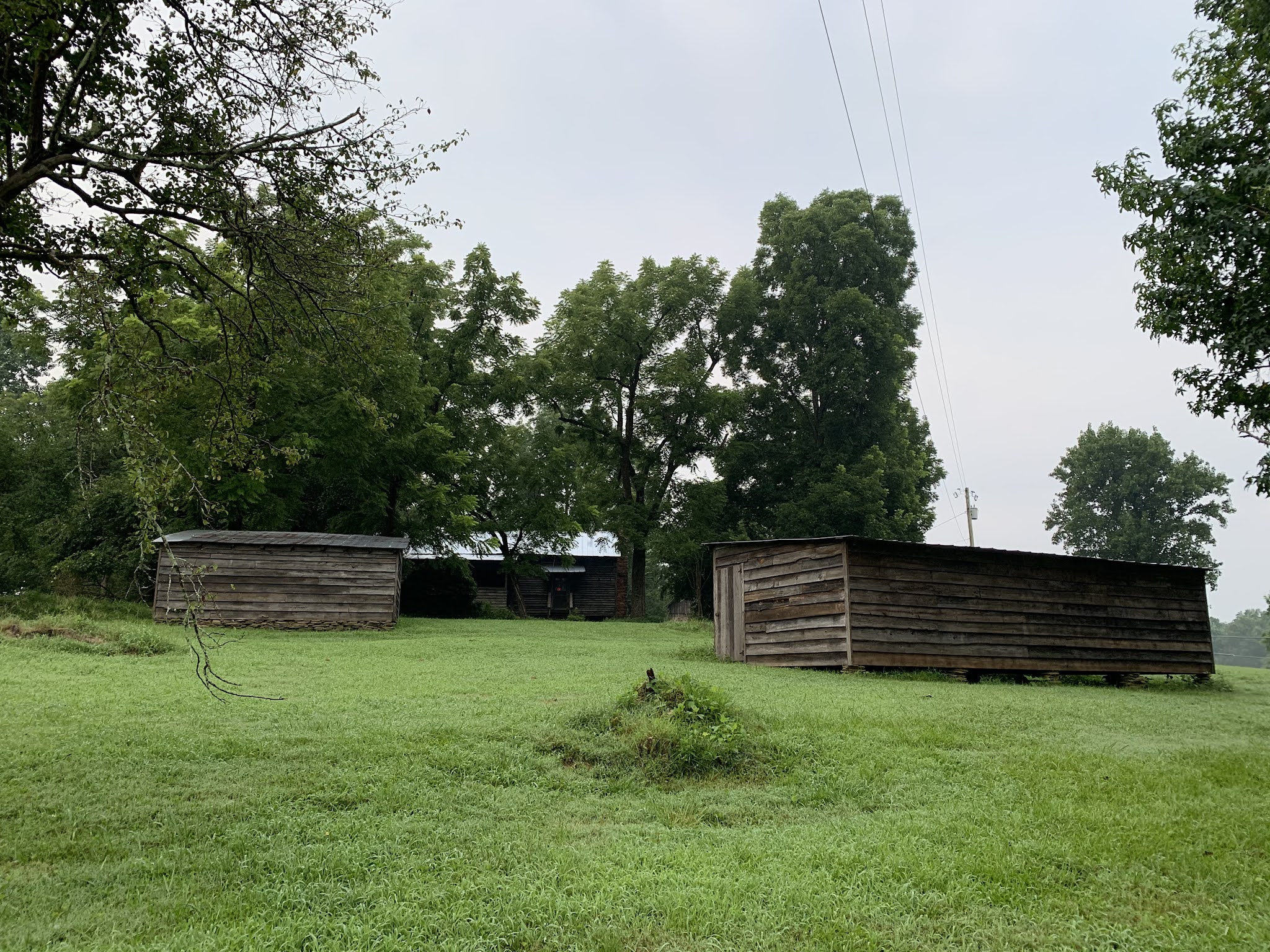
Once again fans, it's race day . . . and once I again, I feel ill-prepared for the task before me. Today, I will run my second full marathon or perhaps, die trying. I had originally signed up for this race last year, but accepted a deferment when the pandemic hit. After discussing with a few running friends, we decided to meet in Seattle and make a weekend out of it, which we have definitely been doing. That said though, I'm really don't think my body is ready to run the 26.2 miles required of me this day, even if it is almost entirely downhill.

My friends and I rise at the bright and early hour of 4:00 AM to begin our preparation. Knee braces, running socks, body-glide, etc. is equipped and applied before we head out to meet our other friends in the parking lot and head for the starting line on this brisk Washington morning. Luckily, our friend that is driving ran the half-marathon yesterday (and set a personal record in doing so) is rested enough to hall the rest of us to the marathon start this morning. Four of us will be attempting to run this long distance along an old railroad line.

When we arrive at the starting line, myself and one other friend decide to wait in the truck where it is warmer (we are the slower runners of the group), while the other two decide to go out and do a little warm up run (these two are regionally competitive runners and will likely finish in half the time I do). As the sun rises, the ambient temperature starts to climb to a more reasonable level outside and I decide to get out and start stretching a bit. 

As the race start time approaches, we all head toward the starting line and await the gun. The organizers ask that faster runners (like my two friends) line up a the front and go with the first gun, while others hang back and start with a later wave and respective starting gun. I'm fine with that, but as the third wave prepares to launch through the starting inflatable arch, I feel the urge to hit the bathroom again. I thought I had taken care of that just a few minutes ago, but perhaps all of the water I have consumed this morning in trying to hydrate for the race is just running through me. Too late though, I can't make it to the port-o-potties before the gun for the last wave. And so, after the gun and my wave takes off, I make a quick detour to take care of business before rejoining the group. 


My slower friend has gone on ahead, but I manage to catch up to her in the tunnel, and then go a little past her. The tunnel? Yes, about a half-mile into the race course, we enter a long, straight, and pitch black railroad tunnel carved into the mountain. There are no lights, though the organizers did mandate that everyone should have either a handheld flashlight or headlamp with them for this section. And I find that it's very necessary, as it is incredibly dark in here. The fact that I'm wearing my prescription sunglasses probably worsens that effect. I decide to remove them and try to run by the light of my handheld. Unfortunately, my vision is poor enough that I can't see a couple of puddles in this low light and manage to splash down right into them. I finally decide to find a runner that is near my pace and just follow her exact same track through the darkness. When she swerves to avoid something, I swerve as well. It works out pretty well for me. Far off in the distance, I see a light, which I assume is man-made, but as I approach it, I realize that is actually the exit from the tunnel. It speaks volumes to the straight nature of the tunnel that I could see this exit from nearly two-and-a-half miles away. Finally, I reach the light at the end of the tunnel and take a quick water break.

I'm feeling pretty good so far, but my friend hasn't caught up with me yet. Eventually, I'm sure she will and so, I push forward. The trail from here is a tightly packed gravel road. It's dusty, but a great surface for running on. I'm making pretty good time and doing better so far than I thought I would. I have been training as much as possible, but between work, rain, and the unbearable heat and humidity of Georgia, I've only been managing to run a couple of times a week, with my longest recent run being only around nine miles. I'm sure I'll pay for that soon.

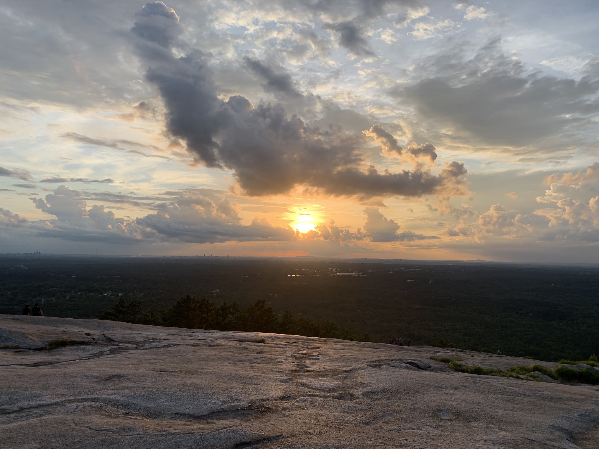
The views are fantastic from up here. The course starts 2,000 feet above the finish line and ever-so-slowly gives away that elevation as we run down the mountain. It's only about a 1% grade, but even that small downward slope is appreciated by my body, as I don't really have to work to much.

Along the course, I encounter a number of smushed frogs and slow-moving ground slugs making their way across the path. The slugs are thicker, but just as long as the banana slugs of northern California. These have a dull gray color though, as opposed to the bright yellow of their cousins to the south.


As I near the half-way point, my friend texts me that she sees me in the distance and is catching up. I slow down a bit and wait for her. That might have been a mistake though, as she quickly catches up and continues to build a lead on me. I'm starting to struggle a bit. The views remain fantastic, but my get-up-and-go seems to have got-up-and-went. While my knees, which are often a source of pain during races, seem to be behaving themselves, I just feel a lack of energy. A couple of gels and I'm back at it though.

Around mile seventeen, I catch back up to my friend, but soon she once again leaves me in the dust. I'm hurting at this point. Nothing specific, other than my feet, but they are hurting badly enough to require me to alternate between running and walking. I do calculations in my head to ensure I can finish before the cut-off and then cycle through stages of inspiration and disappointment as I continue my relentless push towards the finish line. 

Running below Rattlesnake Ledge, I remember that I hiked up there on my last trip to Seattle about four years ago. I hadn't really paid attention to the location of the race enough to realize that I have been here before, but it was a nice surprise. With the finish line only three or four miles away, I try to strengthen my resolve and push for the finish line.


Eventually, I reach the final turn and see the row of state flags leading me to the finish line. My friends have walked part of the way up the course to greet me on my way and I feel obligated to put on as much of a show as I can muster. I summon the last of my strength and push hard for the finish line. Crossing it provides a sense of elation and accomplishment. I'm quickly met with a volunteer placing a finisher's medal around my neck and an EMT offering me water and a wet towel to help me cool off. I find my 'slower' friend sitting just beyond the finish line. She had crossed it a few minutes before me and so, I guess I'm the 'slower' one this day. I rest for a few minutes, but in that time think back on the beauty of the course, the pain my body now radiating, and the fact that I just ran 26.2 miles in 5:53:19. That's not a great time, but before you judge, ask yourself about the last time you ran a full marathon. At one point, I thought I might be able to beat the time of my previous marathon, but I'll settle for just finishing. That's two full marathons for me and I'm registered for yet another one in November. Perhaps, I'm crazy, but as long as my body holds together, I'm going to keep pushing myself. For now, I'm going to go crash and then eat . . . . or maybe the other way around . . . I'm not sure.

Friday, July 23, 2021

Diablo Lake Overlook (North Cascades National Park, Washington)


Driving out of North Cascades National Park and on the way to the airport to pick up friends, I was told I simply must stop at the Diablo Lake Overlook for one of the best views in the area. The folks I hiked with yesterday and this morning did not oversell it. The view from up here is magnificent. The glacier-fed waters of the Skagit River are dammed in three places forming three separate lakes. Diablo Lake is the middle in size, but much smaller than Ross Lake to the north. Still, the view offered from this overlook is out of this world, The almost phosphorescent turquoise of the frigid waters below me are in stark contrast to both the lush mountain side sloping into the lake, the ivory snow caps atop some of the taller peaks, and even the eternal blue of the sky above.

I spend a few minutes walking around the area taking in different vantage points, all of which are equally as amazing. As I get back in rental car and drive away, I'm thankful for my ability to get out and experience places such as this. 

Thursday, July 22, 2021

Ross Lake East Bank Trail (North Cascades National Park, Washington)


My next adventure in the Seattle area takes me to North Cascades National Park and the associated National Recreation Areas. This is going to be a short overnight backpack with the local REI team. When I saw the even on their calendar I thought it would be a great way to explore parts of a new park and relieve me from having to pack and fly with all of my gear. Meeting up with the crew in Darrington, WA, we choose our gear, our meals, and make plans to reconvene at the trailhead about an hour away.

While the gear they provided isn't as lightweight as my personal backpacking setup, it will do fine for a short hike into the woods and a quick overnight. Once we reconvene, we quickly do some last minute checks and then enter the woods. After a short descent, we cross over a small suspension bridge spanning the confluence of Ruby and Panther Creeks, which further down flow into the Ruby Arm of Ross Lake, which we'll hike alongside for most of our trip. The waters of this creek are a gorgeous transparent turquoise color and generated mostly by the melting snows of the tall jagged mountains of the Northern Cascade Range, which surround us.


We make our way to the Hidden Hand Campground, which will be our accommodations for the night. Along the way, I chat with and get to know my guides and fellow hikers. For a couple of the participants, this is their first backpacking experience, but for others, they are simply wanting to enjoy a new location, like myself.

Though we aren't moving at a crazy pace by any stretch of the imagination, we do make pretty good time. We discuss the damming of the Skagit River and the formation of Ross Lake, which runs some 23 miles and cross the border into Canada. We also chat about some of the local flora and fauna, which is of particular interest to me, as I have not spent much time in this area previously.

When we reach our campsite, we find another family has squatted on the site we had reserved. They are very friendly about the situation and offer to move, but we decide to scout out the other campsites before asking them to uproot. Unfortunately, the remaining single sites are just not big enough to accommodate our group of eight and so, we give the family a some time to move their tents. 

While we wait, we begin playing some lateral thinking puzzles, which is something that I had done with my nephew a couple of weeks ago. As there are some highly educated individuals with this group, including an attorney and a bio-chemist, it turns out to be great fun. For those unfamiliar with these types of puzzles, let me explain. One person, who knows the answer, describes a specific situation and then poses a related question to the group to solve. The group takes turns asking the storyteller a series of 'yes or no' questions until they have figured out the puzzle. Some are quite complex and require several rounds of questions before the mystery is revealed. That said though, the entire group seems to enjoy these puzzles and between myself and one of the guides, we keep the group entertained with these brainteasers through the evening.

Once the family has moved on, we take a break from our puzzles to set up our individual tents and bedding arrangements. I'm able to get my tent up fairly quickly and decide to leave the rain-fly off for the evening. It's only suppose to be in the low fifties and there is almost no chance of rain tonight. The open air will do me good. While I wait for the others to finish their setup, I stroll down to an overlook that offers a magnificent view of Ross Lake.

When I return, there is still a little time before dinner and I decide to check out the area around our campsite including the pit toilet, which is true to its name. A winding path leads from the hilltop on which I've erected by tent down into the gully and to a large rock. On the other side of the rock, a pit has been dug and crude toilet has been constructed out of wood. No walls and just an open view of the forest is what greets the camper taking care of their business. It's perfect.


After I get back to the group, it's time to begin fixing some dinner. We enjoy a round of bourbon, which the attorney packed in while we boil water for our individual dinners and continue playing the puzzle games we had started earlier. Though one of the gentlemen decides to crash early, several of stay up well after sunset trying to solve the riddles. Eventually though, we all head to our respective tents and call it a night. As I crawl into my sleeping bag and look up, I see the tall douglas firs blowing in wind above me. The amount they sway is a bit unnerving as I realize that any one of them that came crashing down would likely end me, but the wind feels nice and if I've got to go, this seems like a nice place for it to happen. Soon I drift off into dreamland.

Several hours later, just before sunrise, I awaken to the long complicated song of the Pacific Wren. There are few ways I would rather greet a new day than in the open air and to the melodies of nature. I lay in my tent for a few minutes just enjoying the moment. Eventually though, I decide to get up and start making some tea. I seem to be the first one awake and so, I try o be as quiet as possible, but soon two other members of our little expedition join me. Before you know it, we are deep in a conversation about the pandemic. I appreciate good conversation and other points of view and these gentlemen offer both. It's very pleasant and a great way to get the gears turning. Soon others join us and we begin to make some breakfast before breaking down our camps.

After we have completed packing up our backpacks and doing our last minute checks around the area to ensure we aren't leaving any trash, we begin the short hike out and back to our cars. In total, we hike about 7.7 miles and it was great to enjoy a new area with new friends. I was especially nice to not have to worry about packing and unpacking all of my personal gear. I will definitely need to visit this area again. There are many more trails to explore.

Camano Island - Holly and Bluff Trail (Island County, Washington)

I'm in Seattle for the weekend and while I've got lots of plans, I figured I would take a detour and enjoy a short, quiet, solo hike. After looking at several different options and considering my schedule, I decided to do the Holly and Bluff Trail on Camano Island, which is only a slight detour from my next destination. I flew into town late last night and while I didn't get to the hotel and to bed until nearly 2:00 AM, I did get some sleep on the plan, which makes rising at such an early hour at least tolerable. After packing my gear, I check out of my hotel in Everett, load the rental car, and head to Camano Island on the west coast of Washington.

Arriving at the trailhead, I park the car and head down what appears to be the correct trail. This park seems to have an entire network of trails, but they are well marked. The trails are nicely groomed and appear to get a lot of use as I encounter a number of other hikers along my path.

As I approach a section above Port Susan, I decide to take a side trail down to the shoreline. It's low tide currently and the shoreline is a mix of white driftwood with a carpet of biologically rich mud leading out to the salt waters of the estuary, which have receded several dozen meters out. The view here is spectacular and as I made my way down this side trail, I encountered a trail runner on her daily jaunt. She took that hill like it was nothing. As I'm running a race in a few days, I hope I feel as good as she seemed to making her way up the steep embankment.

Continuing on my path, the trail circles around above the bluffs overlooking Port Susan. In the distance, I can see a coastal community, complete with a fleet of fishing boats. It's interesting to think of the lifestyle in this part of the country; so dependent upon the bounty of the sea and so different from any place I have ever lived. It's got a "Stephen King" character to it, which is to say that it has a sort of haunting charm. I could see myself retiring in a place like this someday.


Time to finish out the loop and head back towards the parking lot. On my way though, I encounter a huge number of blackberry bushes.and holly grapes (which I mistake for blueberries). This place is loaded with them, especially the blackberries. I will later discover that these bushes are quite destructive and an invasive species to the area. That said though, they are a nice treat for a weary hiker. The key is to find ripe berries that separate cleanly from their stem. Those are the sweet ones that you want to eat. The rest are quite tart.

I soon find myself back at the parking lot and ready to head toward my next destination. This was a nice little diversion hike though and I really enjoyed the 2.0 miles I was able to get in on the island. 

Sunday, July 18, 2021

Martin Luther King Jr. National Historic Site (Fulton County, Georgia)


 Having lived in Atlanta for a while now and especially during these turbulent times, I've been meaning to visit the Martin Luther King Jr. National Historic Park near downtown, but until today, just hadn't gotten around to it. Dr. King is a personal hero of mine as the park contains both the house he was born in and his final resting place, I feel an obligation to pay my respects. 

There is ample parking on this rainy summer day, but even so, I encounter a lot of people, especially families, visiting the site. From the parking lot, I stroll down a promenade with plates naming individuals crucial to the civil rights movement embedded in the walkway. Many of the names are familiar to me. At the end of the walkway, a statue of Mohandas K. Gandhi, who was a great inspiration to Dr. King, stands welcoming visitors. The Mahatma is also a great hero of mine and seeing his image here is quite an honor, though not exactly a surprise. I'm very aware that much of Dr. King's strategy for gaining equal rights for African-Americans was built upon Gandhi's non-violent struggle to free India from British rule.

From here, I turn down Auburn avenue and walk a short distance to visit the home in which Dr. King was born. It's a large two-story house, but packed into a small urban neighborhood. Other visitors stand in line to have their photo taken on the steps of the home, which is normally open to tours lead by park rangers, but during the pandemic, many of the park's programs are on hiatus. 

My final stop sees me strolling down the reflection pool of the King Center and to Dr. and Mrs. Kings final resting place. Their tombs rest on a pedestal at the end of the reflection pool overlooking the "eternal flame" of hope. I remove my hat and think about the great man, his affect my own life, and his impact on correcting a terrible mistake in our society. I can only hope to do a fraction of the good that Dr. King accomplished during his time. Rest with the angels, dear soul. You have earned it.

Sunday, July 11, 2021

Upper Whitewater Falls (Jackson County, North Carolina)


 With the rain starting and stopping, but threatening to worsen, we decided to make one last stop to see the mighty Upper Whitewater Falls. This waterfall in combination with the lower falls a short distance downstream, is thought to be the tallest waterfall east of the Mississippi. The upper falls, at 411 feet tall, is a spectacular site. My nephew and I walk the short, paved trail to the observation deck, which includes descending a number of steps to a terrific overlook. I have to admit that this is one of the more impressive waterfalls I've seen since moving east. My young nephew seems to be equally in awe. After taking in the view for a few minutes, we climb back up the steps and head back to the jeep just as the rain begins to fall.

Oconee Station (Oconee County, South Carolina)

Just a short distance from Station Cove Falls is Oconee Station, which was a frontier trading post where the early European settlers traded with the local Cherokee nation. To help protect their interests, a military presence was housed in the Stone Block House. The original building, constructed in 1792, remains in near pristine condition. As my nephew and I walk around the grounds and examine the dwelling, he seems impressed with the construction and materials used back then. I think he thought something so old would be much more primitive, but I explain that the European settlers brought many technologies with them.

Nearby, a home constructed by Irish immigrant William Richards in 1805, also remains. It's construction is a bit more complex than the Stone Block House and includes a second story and and a cellar. The cellar is accessed by climbing down a set of stone steps exposed once two doors that form the surface of the front porch are folded back on hinges. My nephew is amazed.

We begin heading back to the jeep, but I think an interest in history has been sparked in my young ward. If I do nothing else of note in my life, inspiring young people to learn about the history around them is still a life well spent.

Station Cove Falls (Oconee County, South Carolina)


I'm returning my nephew home to the Asheville, NC area today, but as we make the three or so hour drive from the Atlanta area to his parent's house, I thought it might be nice to get in a couple of short hikes along the way. The weather is a little wild today and so, our plans may have to be adjusted on the fly, but we'll get in what we can. The first stop is a short hike to Station Cove falls in northwestern South Carolina.

After parking at the trailhead, we quickly hit the popular trail. It's well maintained and mostly flat, but the humidity is thick. As we make our way through the woods, we cross bridges over several small streams. We note a young couple pointing out a forest snail climbing a tree to their young daughter. My nephew has never seen them either and we take a minute to examine the little guy.

When we reach the waterfall, there are a few people already there, but they generously give move out of the way and give us an unobstructed view. The tiered waterfall drops about sixty feet over moss-covered naturally-hewn steps. The flow is minimal at the moment, but it's still quite a striking view. My nephew seems to be pretty impressed. After taking in the view for a few minutes, we head back to jeep and continue our journey. We managed to hike about 1.9 miles on this little jaunt and it was well worth it.

Saturday, July 10, 2021

Sunset Hike of Stone Mountain (DeKalb County, Georgia)


I've hiked up Stone Mountain several times since moving to Atlanta, but with my 11-year old nephew staying with us for a few days, I thought it might be another opportunity to expose him to the trail. One of my friends was leading a group to view the sunset as part of a Meetup event. It seemed the perfect opportunity. 

We arrived at the parking lot around 7:45 PM and after gathering the group, began making our way up the steep monadnock. The group was a bit slower than my normal pace and my nephew and I quickly put some distance between ourselves and most of the group, arriving at the top before the largest part of the group. Even though he's only eleven, he seemed to be doing pretty well.

After arriving at the top, we found a good viewing spot and as the rest of the group reached the summit, we began socializing a bit. Some folks even brought some cheese and crackers with them, which was a nice touch. The sunset, partially hidden by incoming storm clouds was pretty spectacular and we sat and watched in awe as the life-giving orb slowly dropped below the horizon with the silhouette of the Atlanta skyline between us and the brilliant star. As the storm clouds began to move in and we saw lightning strikes in the distance, I advised the group that we needed to make haste down the mountain. Being on top of the tallest peak in a thunderstorm, is not a good idea. Everyone arrived safely back at the parking lot and we departed for home.


Monday, July 5, 2021

Stoneplace Trail - Tallulah Gorge (Rabun County, Georgia)


For the extended Fourth-of-July weekend, I decided to take my eleven year old nephew camping at Tallulah Gorge State Park in northern Georgia. Over the past couple of years he has expressed an interest in my hiking and backpacking adventures and so, it seemed time to get him out there a bit and see if he really does enjoy it. He is spending the week with us and came down on Saturday evening. Early Sunday afternoon after I ran the Peachtree Road Race in downtown Atlanta, he and I packed the jeep and headed north.

We did a little hiking around the rim trail on Sunday evening, but for the most part stuck to our campsite, as I showed him how to put his tent up, arrange his bedding, and start a fire (though, that is a whole other story to itself). We spend the evening playing some lateral thinking puzzles before finally drifting off to sleep under the stars in our respective tents. 


Once we awoke Monday morning, we started breaking our camp down and then drove over to the trailhead, which is near the interpretive center. The Stoneplace Trail initially follows part of the path we took on the north rim of the gorge yesterday evening, but quickly heads into the woods. There are still a couple of great overlooks though and the view from up here is spectacular. Additionally, we came across a fallen and rusty tower that according to a sign was used to string a high-wire across the gorge back in 1970. A daredevil high-wire artist crossed the gorge on it, performing a couple of handstands along the way. I imagine that would have been pretty spectacular to see.

Diverging from the gorge itself, the well-maintained trail heads deeper into the woods. My nephew seems to be pretty excited to be out here, but already I can tell that he's feeling it in his calves. He asks several times how far we've gone and how much further we have to go. I explain that we can go as far as he feels ready to do, but that he needs to consider that however far we go, we have to walk that far back to the jeep. 


As we pass a couple of backcountry camping sites, which include wooden shelters (not much backcountry in my opinion), we are continually fighting off some very pesky gnats. Also and true to Georgia summers, the humidity is outrageous. Luckily, the trail is mostly shaded. Eventually, we get to a point where he feels he's gone far enough and asks if we can turn back. While we still have another mile or two before we would get to the Stoneplace Boat Ramp on Lake Tugalo, which marks the end of the trail, I agree to make our turn and head back the way we came. I know that pushing him too hard, or any young person, can be the difference between an enjoyable experience and turning them off from hiking for all time. 

We make our way back towards the jeep. The trail, especially towards the gorge, is a bit busier now, but we make good time. Once we arrive at the interpretive center, we make a quick bathroom break before heading home. Checking our GPS track, I see that we hiked about 5.2 miles this morning (along with approximately 2 miles yesterday evening). It's not a bad start into the hiking lifestyle for a young man. I really hope he enjoyed it and I look forward to taking him on future adventures if he is so inclined.