My final stop for the day is at High Falls State Park, which is centered around . . . you guessed it . . . a high waterfall. By Yosemite standards, the waterfall itself is quite tiny, but it is reminiscent of the plethora of falls along the Grand Canyon of the Tuolumne in the high country of the park. The main differences are an obvious lack of twenty feet of snow and the water here is much more muddy than the clear mountain streams of that park, oh so far away. Still, this is a beautiful place.
Parking the jeep near a dam, which forms a man-made waterfall itself, I walk down the entrance road and across a bridge over the Towaliga River, before hitting the actual trail. A series of wooden steps sees me down to the base of the cascading waterfalls. It's actually quite beautiful and I'm blessed to be able to enjoy my day in such a place.
The Native American Mississippian culture and the nations of people that pre-dated it ranged far and wide east of the great river. Growing up near St. Louis, I'm very familiar with Cahokia, which is though to have been a regional capital, but there are a number of other smaller sites scattered around the eastern United States. One of these is Ocmulgee.
Traveling the ninety or so miles from home to visit the site, I arrived at the visitors center of what has been made into a National Historic Monument just a little after 10:00. After chatting briefly with the park ranger, I head out to explore the site. As with may earthen mound sites, much has been lost to development, but the park service, since purchasing the land, has made an admirable attempt to preserve what remains and educate the public on the generations of communities that inhabited this place in eons past.
Leaving the visitors center, I first encounter the diminutive Cornfield Mound and Earthlodge, which is restored ceremonial center that is hollowed out and allows visitors to walk inside. Continuing up the trail, I next encounter Great Temple and Lesser Temple Mounds, which were obviously central to the community. The larger of the two towers some sixty of seventy feet above the surrounding landscape and with the addition of a set of wooden stairs, I take the time to climb to the top to survey my surroundings.
Heading back down to the base, I continue on to the Southeast Mound before following the Bartram Trail back to the visitors center. Along the way though, I pass beside a swift moving creek and under one of the few brick railroad bridges every constructed. Luckily, a I hear a train in the distance and decide to wait it out for a decent shot. It's unfortunate that modern progress has destroyed so much of this remarkable site, but I'm thankful that what remains will be protected.
While researching trails in and around at Atlanta, I stumbled across one that had an unusual name. Doll's Head Trail is a few miles south of downtown Atlanta in something of a less than desirable area. It wanders along the Constitution Lakes, which were dug out decades ago for clay to be used in bricks. Over the years, the pits filled in and a partially-paved trail and boardwalk system has been built to create an urban park. Some years ago, a local carpenter started a movement that has since been fueled by local volunteers to turn a small section of that trail into an art project. Using trash items found at and around the site, these folks have created an eerie, almost post-apocalyptic urban landscape.
Since my company graciously decided to add a few holidays to our schedule, including New Year's Eve, I decided to not waste my day off and hit a few trails. Doll's Head seemed like a great place to start. Luckily, it seems most of the city has taken the day off, as the highways are not jammed packed as they would be this early hour on a normal Tuesday. I arrive at the trailhead parking lot just before eight. A couple of other cars are here, with people hanging out in them and the smell of a particular herb fills the air. Nonetheless, I'm here for other reasons.

I make my way down the paved trail a short distance until the boardwalk and deck built out over the lake. It seems I'm alone. With the ability to see my breath on this chilly winter morning, I'm not surprised. After leaving the boardwalk, the trail changes to earth and enters a wooded area. A sign greets the visitor and informs me that the Doll's Head Trail is free to the public, but asks that visitors do not bring in outside trash or vandalize the area in any way. It also suggests a clockwise route around the small loop, which is advice I decide to follow.

At pretty regular intervals on either side of the trail, piles of old bottles, broken toys, doll's heads, and other discarded items have been built into lego-like contraptions. Most of the sculptures have a famous quote or other words of wisdom written on some flat piece. The feel of the whole thing is really a bit disturbing. I say "disturbing" and while it is, I don't necessarily mean that with the negative connotation that normally comes with it. There is also something strangely beautiful about these works of urban art. It's a bit difficult to describe and I think this is just the type of place that one must visit for themselves to fully understand.
I make my way around the short loop trying to take it all in, before finally returning to the jeep. Overall, it was a short hike, but really unique. I got in about 1.5 miles, but this is not a trail I will soon forget.
My final hike of the day is also along one of the tributaries to the Chattahoochee River. This one is called Vickery Creek. Getting to the trailhead just before noon, I luckily snag the final open parking spot. Apparently, this is a popular area. The trail departs the parking lot and follows the large creek for a ways. A side trail heads up to the steep hill to a parallel trail at the top of the ridge. I opt to hang by the river for now.
The trail passes through some thick brush, which has been conveniently carved to allow passage, before arriving at a short cliff above the creek. I'm assured by my map that the trail passes this way, but bouldering around the cliff a little ways, I'm not convinced that the map is marked correctly. It might be passable beyond, but I can't see around the next bend and I with the cold creek flowing a couple of dozen feet below me, I decide to turn back and head up the side trail I had passed a short time before.
Once I reach the top of the ridge, the trail is about as easy as could be for the next little while. I pass a number of trail intersections, but I have a pretty good line on the route I want to take. After a short switchback, I am once again above the creek and in the distance I can hear either rapids or a waterfall.
It turns out, there is a covered bridge crossing the creek here and staircase has been constructed down to it and to the creek below. I decide to check out this little detour. Finding myself at the water's edge, the natural stone of this area provides a short waterfall and the accompanying rapids just below the bridge. It's actually quite pretty.
After returning to the top of the ridge, I continue on the trail and circle around the park. Now finding myself at above another larger waterfall, I scramble my way down the muddy embankment to get a good view. It turns out this waterfall is actually man-made, as attested to by the stone wall behind the spray of water. Apparently, this was constructed as a dam at some point in the past. While it is visually pleasant, I really hate seeing so much development here. I would love to see more of nature left alone.
Moving on around the top of this plateau, I encounter a number of other side trails, but eventually make my way back to the jeep. This little hike added on about 4.1 miles to my total for the day. Not a bad way to spend a Saturday and if the rains continue to hold, I may even get some more hiking in tomorrow; we'll see.
Since joining the local hiker community in and around Atlanta, I've been told that I must visit Sope Creek, which is a large tributary to the Chattahoochee River. All those telling me of the hike, spoke of some amazing ruins along the trail. Since the rain seems to be holding off for now, I figured today is the day.
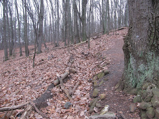
I arrive at the trailhead parking lot around 9:30 AM and quickly hit the trail. As this is only going to be a short hike, I only bring my camera this time. I quickly learn that here is a network of trails here in the park, but find my intended path without much trouble. It travels through the deciduous wood, which is littered with fallen leaves this time of year. A gate bars bikes from certain sections is noted as such.
After dropping down a steep and somewhat muddy hillside, I find myself at the ruins of the Marietta Paper Mill, which was in service for nearly a half-century until 1902, which production stopped. During its active period, the structured served to make paper, twine, and other materials. It was also a prominent target during the Civil War and was burned twice. Today, all that remains are the rotting husk of a large building, sitting alongside Sope Creek, whose waters powered the manufacturing.
Heading back up to the main trail, I continue exploring. At one juncture, a pair of deer run out in front of me. There area lot of deer in and around Georgia. The national park lands here around the Chattahoochee provide a safe zone for them to breed in. In addition to the deer, I encounter a number of mountain bikers. I'm not sure why this area is so popular, but for whatever reason they are out in droves today.
The ruins were definitely very cool to visit, but beyond that and the creek, this trail doesn't offer a great deal of uniqueness. Still, it's great to be outside taking in the fresh-ish air once again. Returning to the jeep, I see I logged about 3.5 miles on this one. I'm sure one could get in more miles with the criss-cross of trails going on here, but I have another destination to hit today and I'll add up more miles there.
Georgia is very rich in history, especially the history of the American Civil War. Towards the end of that year, Union Major General William Tecumseh Sherman lead a campaign to seize one of the richest cites of the Confederacy and my new home, Atlanta. Several skirmishes took place during the campaign, but one of the bloodiest and one of the few victories for the south took place at Kennesaw Mountain just north of the city proper. On June 27, 1864, Union forces made a direct assault on the heavily fortified mountain and after approximately three hours of horrific combat, the fighting ceased and the Union Army dug in across from the Confederates. Nearly three thousand northerners fell in the assault, while only about one thousand of the defenders lost their lives. While the Union's advance had been temporarily halted, a number of flanking maneuvers in the following weeks saw Atlanta captured.
Kennesaw Mountain and the surrounding area has been preserved as Kennesaw Mountain National Battlefield and is the site of my first hike of the day. Arriving at a bit before 9:00 AM, I make my way up the foggy trail. A hundred and fifty years ago though, this fog may have been smoke from canon and rifle fire, but luckily there are no bullets shooting past me today. The trail is very well maintained, though a bit steep. Along the way, a number of trenches can be easily identified. These were likely dug by soldiers as an attempt to shield themselves from enemy fire.
As I approach the top of the mountain, a number of civil war-era canons have been staged, much as they might have been placed during the actual battle. Between the armaments and fog, this place has an eerie feel to it. Perhaps those that lost their lives here over a century and a half ago haunt this place.
Continuing up to the summit, a doe and her two fawns run across the trail in front of me. Just past they point where they crossed, a rock outcropping marks the summit of the mountain, which Sherman's forces never saw that day so long ago. In the rocks, someone has carved "Prepare to meet thy god". Perhaps a overzealous Confederate soldiers warning to the advancing forces or maybe just graffiti carved long after the Civil War. After a little research, it seems that here is no answer to that question.
Returning the way I came, a light drizzle begins to fall. Weather reports suggested the rain would hold until this evening, but they were obviously incorrect. I double-time it down the hill and return to my jeep after having hiked about 2.3 miles. Of course, the rain has now stopped and my indecision about heading to my next destination is quickly resolved.
Since moving to Georgia, I've made a concerted effort to get out, do things, and meet people. Meetup has been a great tool towards those goals. Today is my third hike with one of the local groups and we will be hiking the trails of the Sweetwater Creek State Park, which is a few miles west of downtown and OTP (outside the perimeter).
I arrived a bit early and had the opportunity to walk through the park's museum, which contains a number of Colonial, Civil War, and even Native American artifacts. As I wrapped up my time in the museum, a few hikers began to gather outside. Today's event is co-hosted by two-different meetups and after everyone arrives and we exchange names, it seems we have about twenty people in the group.
We quickly head out on the white trail, which departs directly behind the museum and makes a large loop before connecting to the orange and black trails, which we are also planning to hike today. The weather is pleasant and the pace is quick, just like I enjoy it. As we make our way through the bare deciduous trees, having shed their autumn colors on the forest floor, I'm surprised at how well the trail is visible even in this sea of fallen leaves.
After a short time, the trail hits Sweetwater Creek, which by all accounts, should more appropriately be called a river. At this particular point, it is approximately eighty yard across. It contains a large number of ancient boulders in the water and several small spillage type waterfalls, forming a fairly intense set of rapids. It's quite awesome to behold. The trail alongside the river requires some minor rock scrambling, but nothing too hazardous.
As we walk and talk, my new friends enlighten me on a number of other areas to explore within the region. We take a short detour to find a small waterfall, no more than eight or ten feet tall, but still worth a minor distraction. The group seems to be keeping up pretty well, but as we start up a long, steady incline, the group fans out a bit. I remain at the front, but even I'm getting a little winded. I really shouldn't be, but I haven't been nearly as active as I was back in Reno. I need to change that.
Eventually, we reach another highlight of the trail, the ruins of the New Manchester Manufacturing Plant. The factory was built in the middle of the nineteenth century and seems to have only operated until the end of the Civil War. Though I'm unsure of the history, all that remains is the skeleton of a once large building, with an obvious mill creating power from the churning river rapids alongside the husk. It's an interesting reminder of the impermanence of all things.
Returning to the parking lot, we say our goodbyes and head our separate ways. It was a pretty nice hike with some interesting scenery totaling about 7.7 miles. Not a bad day, but I really need to get my butt back in shape.
A couple of months ago and prior to moving to Atlanta, I began searching the internet for groups and events that I thought I might want to be part of after the move. Among the events I had found was a REI-hosted bikepacking trip to a large island just off the Georgia Coast called Cumberland Island. While I've done a pretty fair amount of backpacking over the last several years, I have never been bikepacking. To go with an experienced group, who would also provide the necessary gear (and bike) seemed an ideal way to both try out a new activity and to explore a new area. Besides, as I get older, my knees my appreciate a lower impact activity, lol.
Day 1
Meeting up with the two REI guides and nine adventurers near the National Park Service's visitor center for the island, we began our preparations. I brought a lot of my personal backpacking gear with me, expecting to leave some of it behind in the jeep. The guides were terrific about telling us what to expect and demonstrating how to properly load the bikes and specially-designed bikepacking bags they provided. From all indications, it was going to be a fabulous weekend with terrific weather.
With our bikes loaded, we peddled down to the ferry that would carry us and our gear the 45-minute ride down the St. Mary's River and over to Sea Camp, the primary ranger station on the island. The ferry ride was uneventful, but pretty and gave us a chance to get to know each other. In addition to my group of bikepackers, REI was also hosing a basic camp-out on the island this weekend, which would be attended by thirty-five or so more people. Though the park service does provide a daily ferry to and from the island, this boat was hired by REI to carry all of us over to the island.

After we disembarked from the ferry, we filled our water bottles and then headed to the larger group's campsite to share in some of the REI provided food. Barbeque pork was on the menu tonight, but as I had notified the guides of my vegetarian diet, they had provided some additional dehydrated meals for me and another young lady that share my dietary preference. From what others in my group said, the barbeque was quiet tasty though.
Once we had our food and water situation set, we made a last check of gear and equipment and then began peddling down the sandy dirt Main Road north toward Stafford Beach, which would be our home for the evening. Approximately a four-mile ride, we arrived well before sunset. The guides suggested setting up our tents and then exploring the beach a bit before we built a campfire and settled in for dinner and the evening. The campsite itself was set back into the sub-tropical woods and surrounded by dense fauna. As one of the guides and I made an initial inspection of the area, we encountered the first of many armadillos. Apparently, the little armored rats are quite prolific on this island.

Doing as suggested, I quickly set up my tent and then walked the quarter-mile or so from camp to the beach. I'm not a "beach-person" per say. Generally most beaches are far to crowded for my taste, but this particular stretch of the Atlantic coast we had all to ourselves this evening. Cumberland island was once almost entirely owned by the wealthy Carnegie family. With a number of bequethals and other purchases over the decades, the Park Service has managed to obtain most of the island. The few residents that remain are often descendants of descendants of the Carnegie's and maintain their own secluded small pockets of the island.
After returning to camp, I helped get a campfire going and then began heating some water to cook my dinner, a dehydrated rice and bean dish this evening. We shared stories around the fire and as the temperature dropped with the setting sun, noted that while it was very dark outside, it was only 6 PM. Still, we had all had a busy and active day and most of turned in around 8:30 or so.
Day 2
I slept really well. The temperatures got down into the mid-forties overnight and some complained about being cold, but with my cold gear on and under my backpacking quilt, I was just right. Not in any huge hurry this morning, I wandered out to the beach once again to see a gorgeous sunrise. Most of the others started stirring and made breakfast before we all broke down our camps and reloaded our bikes for today's journey.

Setting out on the trail around 9 AM, we ran into a number of wild horses, which I'm told are also very prevalent on the island. While not aggressive, they do tend to do and go wherever they want, and pay little attention to us. I'm very used to wild horses, having just moved east from Nevada, home to the largest wild-horse population in the country, but the horses here appearing somewhat unhealthy have a different battle to fight than the ones I'm used to. In Nevada, there is very little nutrition available in the high desert, while the horses here suffer from very limited sources of fresh-water. Somehow though, they make do.
I notice how sore my tail-bone is. I haven't ridden a bike since Burning Man last year, and that was the first time I had ridden one in probably more than a decade. I'm told you get used to it, but damn, this kind of hurts.
Our first stop today is at Plum Orchard, which is a large mansion build as a wedding present for one of the Carnegie heirs and his bride. It's about a five-mile ride from our campsite and we arrive pretty quickly after our departure. Here, the forest opens up to well groomed and gigantic yard, complete with the occasional live oak for character. The magnificent house sits perpendicular to the shoreline. After resting for a bit, we take advantage of a tour of the mansion offered by the park service.
As we make our way through the original house and the expansion, two things become clear. First, our tour guide is quite knowledgeable and second, the Carnegies were fabulously wealthy and fabulously snooty. The later comment becomes quite obvious when the guide describes the additional hallways and accommodations built for servants just to prevent them from being seen by house guests. The home itself though is a thing of wonder. Built in 1898, it included a number of early iterations of modern conveniences.
After the 45-minute tour, we broke to explore the grounds and eat some lunch. A few of us wandered over towards the shoreline and enjoyed our lunch at a perfectly placed picnic table under the shade of a live oak. These oaks are all over the island and are somewhat unique in the way their large branches hang so low to the ground, often touching it.
Once we finish up lunch, we head back to our bikes and depart for tonight's campground at Brickhill Bluff, another eight or so miles to the north. We end up taking a wrong turn and adding on a couple of miles, but it's of no matter. We are in no big hurry. Along the way, we see more armadillo and wild horses. I'm told there are lots of wild boar on the island as well, but never manage to see any of those critters. Just as well, their tusks can be dangerous.
We arrive at the campground around 3:30 PM and while some members of the group want to head up to see the first African Baptist Church and some other ruins further north, my backside is screaming at me to get off of this bike. I opt to set up my tent and then take a little hike, before returning to camp to enjoy the sunset from my camp chair. It's paradise with the exception of swarms of biting gnats that refuse to leave me alone.

No fire tonight, as the Park Service has directed, but we manage to create a camp-fire like environment with the use of a couple of solar lamps. As the night settles in, we prepare dinner and enjoy each other's company. Re-hydrated pasta primavera for me this evening. It's actually quite tasty and the cheese sauce is icing on the cake. While I chow down, I hear something rooting around near my tent, a few yards from our dinner spot. I pull out my headlamp and wander over to find an armadillo digging through leaves. I gently kick a stick at him to encourage him to move on away from my stuff, but he takes very little notice and continues his search for food. A moment later, one of our guides makes note of the little spider eyes peering back at us from the leaves. Several large spiders have come up to see what's going on. Perhaps these guys are what the turtle-rat is looking for.
After cleaning up from dinner, I and the others return to our tents and enjoy another wonderful night's rest. As I set my tent up on a ridge just above the shoreline, I'm treated to the sounds of tiny waves crashing all evening. It's very relaxing.
Day 3
Rising before dawn today, we quickly pack up, eat a very light breakfast, and hit the trail. A few of our group need to leave the island early by catching the public ferry which departs two hours before the one REI set up for us. As I climb back onto my bike, I'm reminded of just how painful this is. My tailbone is killing me now and as we ride, each little bump in the road causes pain. I try to keep up with the main group that is now traveling pretty fast in order to cover the eleven or so miles before the early ferry departs, but after a little while I fall back to the slower group. As I'm really in no hurry, it doesn't make much difference. I was just hoping to get back earlier and enjoy some breakfast at the larger REI camp-out site.
Going at a pretty slow pace, we still arrive back at our starting point just prior to the early ferry's departure. We wish those leaving early (which is the majority of our group) safe travels and then head over to enjoy some breakfast hash made by some of the REI camp-out guides.
After second-breakfast, one of my new friends and I hike a couple of miles (not getting on a bike again for a while) to the southern end of the island to see the ruins of Dungeoness, which was the home to Lucy Carnegie for many years, before falling into disrepair and eventually burning down in the 1950's. Judging from what remains, this must have been akin to a medieval castle in its day. It was huge.
Returning to the dock, we await the ferry and the depart for the mainland. It was a really enjoyable weekend and while I have gnat bites and an incredibly sore backside, it was well worth it to explore such a remote area and make some new friends. In total, we covered almost 30.6 miles over the course of the weekend, and while I certainly need some time to recuperate, bikepacking is something I will do again.
This weekend, I will exploring parts of the Georgia coast and after looking at some of the hiking options, a place called Driftwood Beach, which is located on Jekyll Island seemed a great place to start. The name seems a little obvious. I'm sure every beach has driftwood, but as I would soon learn, this is a very special place.
Driving the 4-ish hours to the coast last night, I slept at a hotel in nearby Brunswick, GA. Knowing that I wanted to hit this beach before meeting up with the group for big adventure weekend, I got up early and made my way out onto the island. Much of the Georgia coast is made up of what are essentially barrier island and Jekyll is just one of many that is large enough for a small community to call home. Driftwood Beach is toward the northern end of the island and easy to find.

Leaving my jeep behind, I hiked a few dozen yards through the coastal woods before reaching the sandy beaches. I fully expected to see driftwood here, given the name of the locale, but this is more like drift trees and drift forest. The beach for hundreds of yards in either direction is littered with the unmistakable sun-bleached white wood. Not just pieces of trees, but in many, many cases the entire tree. They have washed up here to form a sort of morbid, but strangely beautiful cemetery. Additionally, there are a number of trees that seem to have grown here in the sand at some point and since died and taken on an appearance very much like that of driftwood; thanks to the tides no doubt.

As it is shortly after sunrise, the sun has risen slightly over the Atlantic Ocean's horizon and now casts long shadows from the branches of these fallen trees. I don't claim to be a skilled photographer, but this place must be a photographers dream. After exploring perhaps half-a-mile up the beach and taking a myriad of amazing shots, I head back to the jeep and set off for my next adventure. If you're ever in the area of this place though, it is certainly worth your time to stop.


