Sunday, November 6, 2022

Fire Fest Trail Half-Marathon - Valley of Fire (Clark County, Nevada)


I'm in Las Vegas this weekend to run my first trail half-marathon near Valley of Fire State Park. While I generally avoid trail runs (though I have run a few here and there), Valley of Fire is one of my favorite places and I couldn't resist the urge to do my first trail half in this otherworldly landscape. In fact, I had registered to run this race last year, but a series of mishaps both for me and a friend that was planning to run with me, prevented me from make the trip. I'm here now though and I'm looking forward to the run, though I'm not in the best shape and haven't been running regularly for a while.

The Fire Fest Ultra is a series of weekend races of varying distances, which kicked off early Saturday morning with a 100-mile Ultra. There is a race for pretty much every conventional distance between that 100-mile and the ever-popular 5k. My race (the half-marathon) doesn't start until Sunday morning. That should give me time to get acclimated and even enjoy some of what Las Vegas has to offer. 

After landing early Saturday afternoon, I grabbed my rental car and started heading out towards Red Rock Canyon on the western side of town. My intention was to try and find a route out to Brownstone Canyon, where I've learned of a magnificent pictograph panel. Unfortunately, it seems new construction has blocked every path I had wanted to explore. I think the only way to get to the site now is via a long hike out of Red Rock Canyon. That will have to wait for my next trip out this way, which is disappointing. 

I drive to the other side of town and drop my gear off at my hotel before heading out to the starting area of tomorrow's race at the Logandale Trail System. There I meet up with a friend who has driven down to support me and another of her friends for our respective races. After taking in some of the magnificent views, we head into town to enjoy a nice pasta dinner at Wolfgang Puck's Lupo. I like to load the carbs before a long race. The food is terrific and the company even better, but as I want to get a good night's sleep, we head back to our respective sleeping arrangements and call it a night. 

Arising early Sunday morning, I start gearing up for the race. Races in the desert are always tricky because of the huge swing in temperatures. Right now, it's around 38 degrees, but by the time I finish the race, it will likely be around 80 degrees. How do you dress for that? Layers! By the time I reach the starting area again, it's already in the mid-forties and I shed my down vest. I pull up next to my friend's van and she comes out to meet me. It's about twenty minutes before the scheduled start time of my race and I use the time to hydrate. 


With a simple countdown, we depart the starting area promptly at 7:30 AM. The sun has only recently come up and the colors of the red and orange rocks that spread out before me are just amazing. From the start line, the race descends down a narrow sandstone chute before dumping out into a sandy wash. From the high point, you can look down several miles into the fiery valley, though the race route will takes us on the other side of the valley sprawled out before us. 

It seems there are only a couple of dozen half-marathoners running today, but I know there are other longer races still in progress. This entire area, which is on the northern end of Valley of Fire State Park is unknown to me. I've explore the park itself extensively over the years, but I didn't even know this area existed. Much of this part of the park is used for OHV recreation and there are a lot of them out here. They are all pretty thoughtful though and do their best not to stir the dust for us runners.

There are abundant aid stations, which is always a necessity in desert races. Hard to stay hydrated when the sun and arid environment pull the moisture right out of you. I take a couple of gel packs for calories and drink a couple small cups of water at the 1.8 mile station. The trail surface is mostly loose gravel and broken sandstone, with some sand and solid stone sections mixed in for good measure. I'm feeling okay so far, but the surface is a bit challenging and I find myself walking a bit here and there . . . mostly because I haven't been training appropriately. 


Around mile three, I get a little confused on the route I'm supposed to take, but eventually figure out that I'm to head up a steep ridge and follow that south for most of the rest of the race. It has some undulating sections which are quite steep. At mile 4, I nearly faceplant on an incredibly steep downhill. From the top, I knew it was going to be sketchy, but I decided to go for it anyway. After only a few steps, I found myself running at full steam and doing my very best to stay on my feet. I've never been so close to loosing it without actually wiping out, but somehow, I magically managed to stay on my feet. With my heart pounding from the stress of the anticipated injuries I would have sustained on these rocks, I look back on this monstrosities and thank my lucky starts I made it down without falling.

From there, the race bounces back and forth between this high ridge and a lower gravel road, which eventually turns east towards the half-marathon turn-around point. Halfway done and I'm exhausted. That hill took a lot out of me. I really wanted to run this race for the scenery and I'm not all that concerned with my finishing time. The scenery doesn't disappoint.


The return is the same path I took to get here, though I manage to get of course at one point and end up adding a couple tenths of a mile to my overall distance. No matter. As the sun is getting higher in the sky, the air temperature is warming and more and more of OHV enthusiasts can be seen heading out into to the red hills. For me, I'm just ready to be done.

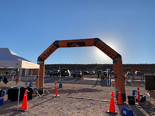
After seeing the turn back into the long valley I saw at the beginning, I start climbing my way back up the chute towards the finish line. My friends are at the top cheering for me as I run through the arch. They're quick to get me a Gatorade and some food, which is most welcome. I find a chair and relax in the glory of my accomplishment. A time of 3:41:41 isn't exactly a good for a half-marathon, even a trail half-marathon, but I'll take it. It was my first and I'm just glad to have completed it. I'm going to rest for a while and then head back to the hotel to clean-up. Dinner at Morimoto's awaits me as a celebration.

Saturday, October 29, 2022

Jacks Gap to Wolfpen Ridge and Brasstown Bald (Towns County, Georgia)

It's been a while since I've led any hikes for the meetup and I've been trying to get back to organizing a few. For today's hike, I'll be leading the group up to Brasstown Bald (4,784'), the tallest point in Georgia, from Jacks Gap. We'll also pass over Wolfpen Ridge (4,561') along the way, which is actually the fifth highest point in the state. I had set up this hike a few months ago, but due to a very wet weather forecast ended up cancelling it. I'm glad we'll get the chance to do it today.

I arrived at the Jacks Gap parking area about twenty minutes before the scheduled start time and after getting my day pack on, I headed over to the trailhead sign. After standing there a minute, a couple of people call out my name (which they knew from the event posting) to confirm that I was today's organizer. I acknowledge them and they introduced themselves. I explained that we would wait until the scheduled start time of noon and then do a quick round of introductions before heading up the mountain.

By the start time, there were seven of us, including myself. We circled up and I asked each hiker to tell us their name and their favorite trail within the US. It's always fun hearing the diversity of hikers we have in this large group. Some have traveled and hiked all around the world, while others have not even left Georgia. Hopefully, the discussion and this hike will inspire some of them to further adventures. I provided a little information on the organization of our meetup and then began to remind them of what to expect from today's hike, which I had already laid out in quite a bit of detail in the event description. 

This is the shortest and least challenging of the three trails to the summit of Brasstown Bald. I have hiked the other two in the past, the Arkaquah and Wagon Trail Trails. That said though, I still wouldn't consider it easy. We will be gaining a lot of elevation over a short distance. Everyone acknowledge what they were getting themselves into and soon we were on our way. 

The first two miles are pretty steep, as we make our way up to Wolfpen Ridge. I'm just getting myself back in shape after a pretty light summer, but even I was out of breath climbing this section. The trail is obvious though, even covered with the fallen yellow, orange, and red leaves of mid-autumn. As we continue up, I'm forced to stop for a minute due to some lower back pain. I tell the group to use this opportunity to strip a layer off if they are so inclined. We're working pretty hard coming up this steep section and by now, I'm sure all of us are sweating pretty good. 

After a couple of minutes, we continue on toward the first high point along our way. The fall colors in this yellow wood are outstanding. I don't think we could have chosen a better weekend to do this hike. Originally, I had planned to do this hike and then continue up into Tennessee to do some kayaking tomorrow, but some incoming weather forced the organizer to cancel tomorrow's activities and so, I'll have to make the most out of today. As we reach Wolfpen Ridge, there is really no doubt, as the trail obviously reaches a high point and then begins to descend again toward the Brasstown Bald parking area. 

As we pop out of the woods into the large parking area, a couple of the hikers take a minute to absorb the view ahead of us. The parking lot opens up to the towering Brasstown Bald above us with it's observation tower setting on the very top and over the crowning trees. We quickly walk across the parking area and then begin making our way up the paved trail towards the top. This section is heavily trafficked, but quite steep.

Once we reach the top, I tell everyone to take about fifteen minutes to take in the views and eat a snack before meeting back a the point I designate. Myself, I eat a granola bar and then head up to the ring around the observation tower to get a few pictures of the surrounding landscape. I think this is probably my fourth trip up here, but it's still a pretty spectacular view. The rolling green hills so lush in spring and summer are now blanketed with a palate of autumn colors, providing a spectacular visual.

At the agreed up on time, we reconvene and begin our trek back down the mountain. Down should be much, much easier. We will need to be cautious on the leaves though. They are not wet, but still will make it easy to slip, as one of our hikers finds out. On our way down, we keep a pace of nearly 4 mph, which means we make quick work of the return trail and are soon back at our cars after hiking a total of just about 6.4 miles. Everyone thanks each other for a great hike and we each go on our respective ways. I always get some personal satisfaction from leading hikes like this and exposing interested people to new trails. I hope to see them again on future events.

Tuesday, October 25, 2022

Kings Pinnacle (Gaston County, North Carolina)


I took the day off from work so that I can drive up to Greensboro, NC for a concert. Along the way though, I thought I would try to get at least one hike in (possibly two if I get going early enough). Not far off my route, there is a state park called Crowder Mountain and within it, several hikes that might be worth while. I decided to hike one of the more challenging options called Kings Pinnacle.

When I first arrived at the visitor's center parking lot, I started down the wrong trail. I only saw one, but after asking around, I finally got pointed in the correct direction. The wide trail is well maintained and the surface is a combination of earth and gravel. The fall colors provide a gorgeous backdrop to my wanderings. 

As the trail climbs towards the Kings Pinnacle, the highest point within the park, it follows a moderate incline. It's pretty easy, but at least it's getting my heart going a little bit. There are a few folks out here, but it's pretty low-activity as you would probably expect for a Tuesday afternoon. I try to maintain a really good pace to get something of a work out from this little adventure. For most of the trail, I'm hovering around 3.5 mph and it feels pretty good.

The pinnacle itself sits atop a rock mesa at the top of the hike. The trail cuts around below the mesa and then forces me to do a little rock scrambling to reach the top. There are a few others up there enjoying the view, which is far-reaching from this elevation. The terrain is mostly flat in all directions and the nearby towns can easily be seen from up here. 

After a few minutes taking in the view, I decide to head back. On my way down, I find a young  rattlesnake stretched out on the rocks I had climbed up earlier. He's about 30 inches long with only about three or four bands on his rattle and a distinct black section near the end of his tail and rattle. This markings are not like that of a eastern diamond back and I'm left wondering which species he actually belongs to, but with the diamond shaped head and rattle, there's no doubt of his venomous nature and I do my best to avoid him. After doing some research online once I got home, I at first thought he was a black-tailed rattlesnake, but that would put him far out of his range. Some online experts that I shared the photo with identified him as a timber rattler. The black tail, must just be an anomaly.

On my way down the mountain, I warn several groups and individuals that are approaching the top so they can be watchful for where they step. Finally reaching the parking lot, I check my GPS app and see that I've covered about 4.2 miles. Not bad for a quick trek. I had hoped to get a second hike in, but I think that would rush me a bit too much and so, I'll have to settle for just this one, but it was actually a pretty nice hike and I would recommend it to anyone in the general area. 

Sunday, October 23, 2022

Sweetwater Creek (Douglas County, Georgia)


Sweetwater Creek State Park has to be one of the best parks in the Atlanta metro-area. I've visited here several times before, but I really enjoy it each time. This morning, I'll be getting in a few more miles with the Atlanta Outdoor Club. The meetup, which I normally hike with will also be hiking here today, but as I had promised to take my mother to a move this afternoon, I wanted to get the hike in early and the AOC just happened to give me that option.

When we arrive at the visitor's center parking area, we find that today's leader is running late. She had texted one of the other attendees, but arrives at about 9:05 AM and starts the hike almost immediately. I'm impressed with the pace she keeps. I haven't been hiking that much in the past couple of months and I'm really looking forward to getting myself back into shape. This 3.5mph pace should do a lot to help with that. 

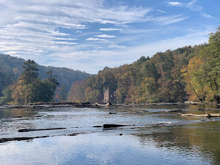
The fall colors in the park are in full display and it makes for a wonderful experience as we make our way up and down the undulating hills of the park. The very large creek known as Sweetwater carves it's way through the landscape here. Wide, but shallow, numerous rocks jut out from the water's surface to make for some fantastic pictures. 


In the distance, we can see the ruins of the New Manchester Textile Mill, which we'll walk past later, but for now, several of us wander out onto a long stretch of rock extending into the creek to get some pictures. As our quota of fun has been reached, our hike leader mushes us onward. I'm actually thankful for it. Standing too long in one place is detrimental to workout I'm hoping to get from today's hike.

From here, we follow the color-coded trails along the creek. This requires a fair amount of rock-scrambling as the shoreline is pretty jagged. At one point, we reach a wooden staircase where the bottom three steps or so have been washed away. We each, in turn, climb up the embankment to reach the first available step and then make our way up the steep steps. It adds a bit of adventure to the day, which I'm always up for. 

I mentioned earlier that the fall colors were showing well, but seeing them over creek with the waters and sky contrasting against them is truly magnificent. I'm often weary of hiking the same trails over and over again, but the scenery here on this mid-autumn day makes it all worthwhile. I'm really glad I decided to join this hike today.

At one point, I notice that we are hiking in a circle and will be forced to retrace an area that we had hiked earlier. I point this out to the leader who agrees, but seems to have been confused by the route we were on. We decide to head back the way we came. I get the feeling that the leader is not entirely sure of the trail system here and I begin to go my own way. I let her know that I'm heading back to the visitors center and she and most of the rest of the group follow me. I'm hiking at a really fast pace (~4.2mph) right now because we're already 30 minutes over our planned completion time and I have other things to do this afternoon. It's not my intention to be rude, but I just need to go. Eventually, I reach the parking area and others arrive moments afterwards. We got in 9.8 miles of good hiking today - lots of hills. I'm feeling pretty good and it's been a great weekend on the trails.

Saturday, October 22, 2022

Mason Mill and Lullwater Preserve (DeKalb County, Georgia)


This morning, I'm getting out to a new hike inside the I-285 perimeter with the Atlanta Outdoor Club. We'll be hiking several trails that connect Mason Mill Park to the Lullwater Preserve. I join the group at the Mason Mill parking area and after a quick round of introductions, we're off. It's brisk this morning, but knowing that I'll heat up pretty fast once we get moving, I decide to go ahead and loose a layer here at the start.

We keep a pretty quick pace as we make our way through the woods on well-maintained trails. I chat with a couple of the other attendees as we hike alongside a small creek. The fall colors are nearing their peak and it makes for a pleasant visual experience.

Soon, we enter Lullwater Preserve, which is essentially the grounds to Lullwater House, a mansion build in the Tudor style in 1926 from stone quarried on-site. The house and grounds were much later donated to the nearby Emery University and now serve as a recreational area for the public. The mansion itself is quite beautiful and appears to be cared for very well, though I fail to get any pictures of it due to maintenance workers in my frame.

Nearby, we pass by the creek again and what was once the power-generator house for the mansion. A small dam creates a man-made waterfall in the creek and once provided the power source to light the grounds. It's got a very rustic look and is quite interesting.


A bit further, we re-enter the woods and find the concrete ruins of some kind of structure, which has now become the canvas for numerous graffiti artists. It actually adds a lot of character to this hike, which isn't far from the metropolis that is downtown Atlanta. The art work is pretty standard, with cryptic words and letter combinations painted in bright and vivid color schemes. One panel, seems to illustrate a fight between three individuals. I'm sure there is a story behind it, but much like the petroglyphs I enjoy searching for in the deserts out west, perhaps only the artist knows what he or she was trying to say.

Rounding out the hike, we return to Mason Mill Park. Unfortunately, the group splintered and it takes us a couple of minutes to determine the correct path, but we soon find it amongst the tennis courts and parked cars. We managed to hike about 6.6 miles today and I must say that is was surprisingly interesting. I often find that hikes in and around the metro-area are simply trails cut for the sake of cutting trails, with no real scenery or points of interest to be found, but that was not the case with today's hike. I'm thankful to the organizer for introducing me to this area.

Friday, October 21, 2022

Voices of the Past - Jarrell Plantation Lantern Light Tour (Jones County, Georgia)


This evening, I'm joining the rangers at the Jarrell Plantation State Historic Site for a lantern tour of the retired property. It's a nearly two hour-drive from my house and so, I leave around 6:30PM to ensure I arrive by the 9:00PM start time. There was an earlier tour, but I wasn't sure I could get out of work early enough to make it down for that one. When I arrive to this very rural area south of Atlanta, it's not well lit and there aren't really any instructions telling me and the other attendees where to do or what to do. Soon though, a ranger comes out to the fenced off parking area and informs us that the earlier tour is still finishing up and that as soon as they depart, he will open the gate and let us into the parking area. In the meantime, he asks us to pull over along the side of the gravel entrance road, which we do.

After waiting a few minutes, the gate opens and we proceed into the parking area. We are instructed to head inside the visitor's center while everyone gathers. Inside, there is a wide area of artifacts from the Jarrell family's century of habitation at this formerly working plantation and homestead. Once everyone has arrived and checked in, we head back outside into what is a very dark evening and begin our tour, lead by the ranger carrying a rather bright lantern.

Our first stop takes us past a small field of sugar cane to the barn, where a few pigs are bedding down for the evening. The ranger tells us stories of the children who lived on this cotton plantation in the mid-nineteenth century. It seems he has also taken great care to collect audio recordings of many of the family members and plays one here for us. These are the grandchildren of those children relaying the stories told to them by their grandparents. It's an interesting way to add a voice to the family.

From here, we move onto Dick Jarrell's home, built in 1895. Dick was the eldest son of John Fitz Jarrell, who build the first permanent structure on the site. Seeing all of this by lantern-light really adds character to the tour and I'm enjoying the stories. Inside the home, we stand by the fireplace while we are told tales of Dick's children, two of which contracted typhoid fever during their time here. One perished to the disease. 

Continuing on toward the original home of John Fitz (constructed in 1847), we pass a syrup mill where sugar can was boiled down into syrup. The plantation cat joins us at this junction and several of the children on our tour loose interest in the history in lieu of the feline's antics. When we enter John Fitz's home, I'm surprised by how large the entry room is. It's almost modern in it's accommodation. From the dining area, an elderly gentlemen dressed in period clothing steps into the main room and seats himself in a rocking chair beside the fireplace. 

Keeping himself in the character of a civil-war era old-timer, he begins to tell us more tales of the goings-on of this historically rich place. I have to give him credit; he does a fantastic job and lives up to the expectation of what anyone would have an old man living hard on the land back in those times. With his "he-he's" and jokes about his friend 'Arthur Rightus', he really makes it an enjoyable experience.

Our last two stops bring us to he Gin House, where the cotton gin used to turn out cotton in mass and the blacksmith shop. The evening ends with a walk back to the parking lot and our cars. It was a short hike, only about a mile, but I must give credit to the organizers and guides on an extremely interesting and well put-together experience.

Saturday, October 15, 2022

Chattahoochee Bend Hike & Paddle (Coweta County, Georgia)


I've been meaning to get down to hike at Chattahoochee Bend for quite a while. It's about 70 miles from my house, but as I enjoy seeing new places and hiking new trails, this seemed like a place worth exploring. Earlier this year, I had signed up for an event called the Hike & Paddle hosted by the volunteer group, Friends of Chattahoochee Bend State Park. We had some family visit during the originally planned weekend and so, I was forced to reschedule. The organizers were very gracious in letting me move my reservation. 

Driving down in the brisk morning hours of this fall Saturday was uneventful, but it gave me a chance to catch up on some podcasts. I arrived at the visitor center and was able to quickly check-in with the organizers. I then drove another couple of miles to the boat ramp, where we would begin and end our adventure. Shortly thereafter, others began arriving until finally, the whole group and all of the guides were present. They did a quick round of introductions and went over the agenda for the day. Our plan was to hike northeast through the park and mostly along the river to another put-in for the kayaks. From there, we would enjoy a leisurely paddle down the Chattahoochee River to where this very spot.

We soon hit the trail. The lead guide discussed several topics along the way including invasive species, flooding, and construction projects within the large state park. Everyone was quite friendly and we were able to keep a pretty good pace, though we did stop a few times at interesting spots. One of those spots was a large wooden observation tower constructed by the park system. While much of the brush and overgrowth has been cleared out, it still doesn't really offer much of a view than can be achieved on the ground. I'm not exactly sure why someone would decide to build it here, but it was a nice stop nonetheless. 


Continuing on, we departed from the track along the river and headed uphill a bit. From here, the trail zigzags a bit as it makes it's way through a few small ravines and finally ends up at a cleared area with picnic tables. When we arrived, the kayaks were waiting for us. Being lunchtime, we sat at some picnic tables and enjoyed whatever lunch we had carried with us - a peanut butter sandwich for me. 


Soon, we were donning our life-jackets and carrying the boats down a set of stairs to the river below. With the sun shining overhead and a cool headwind blowing in our faces, I really just felt like taking a nap while the current carried me downriver. We paddled very leisurely, letting the river do most of the work. For a couple of participants, it was their first time in a kayak, but they seemed to pick it up pretty quickly. 

After about an hour-and-a-half or so, we were back a the starting point. Each paddler propelled their boat onto the boat ramp with as much speed as they could muster and the guides helped most people bring it the rest of the way in. We took a quick group picture and headed our separate ways. The hike was approximately 5.7 miles and the paddle just over 3.5 miles. It's interesting how much more direct the river is than a trail through the woods. Overall, it was a great experience and I'm thankful to the organizers for putting it together.

Thursday, October 6, 2022

Great American Beer Festival (Denver County, Colorado)


While a beer festival isn't the normal type of adventure I post about, I think the largest craft beef festival in the country is worth a few paragraphs here in my blog and it was certainly a fun experience. This is actually my second time attending the Great American Beer Festival (GABF), which is the Brewers Association's flagship event and again this year (like every year)  is being held in Denver. My wife and I attended about four years ago and had a fantastic time. With my love of craft beer, it's always on my radar. The event is held over three days and at the end of Denver's Craft Beer Week as a crowning event.

I flew from Atlanta to Denver on Thursday morning and arrived at my hotel just afternoon. I've learned from past experience that this type of event warrants getting a room as close to the event as possible. And I made my reservation nearly a year ago for a hotel that is just across the street from the Colorado Convention Center, where the event is held. Each year, the festival is separated into four or five sessions, each requiring a separate ticket. The sessions are generally four hours long with one being held in the day and one in the evening on both Friday and Saturday. Thursday is the opening ceremony and generally only has an evening session. I bought tickets to the Thursday night and Saturday day (members-only) sessions.

After getting checked into my room, I took a short nap. I had intended to sleep on the plane, but ended up talking craft beer with the couple I was seated with it. As it turns out, they and twenty or so other people on our flight were attending GABF as part of Taco Mac's Brewniversity Club. Taco Mac is a chain of restaurants in the greater Atlanta area known for buffalo wings and great tap lists. Their Brewniversity Club (which I'm a member of) is a promotional program that awards members with points for drinking craft beers they haven't had before. At certain point levels, members are awarded with things like ball caps, sweatshirts, kegerators, or even a trip to GABF. I've only been a member for a little over a year and so, I have a ways to go before getting the free trip to Denver. It was great talking to this knowledgeable craft beer enthusiasts though and to see their excitement at attending their first GABF.

Shortly before starting time of the Thursday night session, I walked across the street to the entrance to the festival. The line wasn't bad at all and after getting through a security check, I was corralled into a waiting area along with a few thousand other attendees. Just before the we were allowed into the festival, a marching pipe and drum corp. paraded through the walkways of the festival. Nothing says it's going to be a great beer festival quite like Scottish bagpipes. And with that bit of ceremony, we were off to the races . . . err . . . taps. 

I quickly made my way to some of my favorite breweries and began tasting their wares. They were all quite delicious. After a few samples, I began looking for the signs for the related Paired event. Not seeing any, I had to ask around. Eventually, I was directed through an exit and into a an area below the main floor. Paired is an add-on event that grants access to more beer samples and food pairings. Around twenty-five breweries had been paired with chefs from all around the country to create inspired pairings. There things like duck bourbon sausage and chicken salted popcorn, each expertly paired with my favorite malty beverage. I tried several pairings, but eventually started to get full and head to surrender. They were all quite delicious.

After about an hour downstairs, I headed back up to the main floor for more samples. Just as I got back to the entrance, a loud "booooooo" rolled over the crowd and I was reminded that this is the traditional reaction to someone dropping their glass on the concrete floor. It's all meant in good fun. The timing was just about right too. I had wanted to get a sample of the 2021 Utopias by the Boston Beer Company (Sam Adams), which would only start being poured at 8:13pm. I'm not sure the significance of that time, but when I arrived (well before 8:13), there was already a huge line. I decided to wait anyway even though I've previously had the 2017 Utopias. This very special 'beer' is only released every other year by the brewery and is a labor of love. It is aged in a number of different barrels and crafted to taste very much like a tawny Port. It retails for around $200 for a 750ml bottle, which is designed to look like a whiskey still. I bought a bottle of the 2017 as a treat and it was an amazing experience. That said, the 2021 seemed a bit hotter to me and I didn't enjoy it quite as much. 


I had a few more samples from various breweries, including some standouts, but finally, felt I had consumed enough for the night and headed back to my hotel room. Sleep came pretty easily even though I tossed and turned quite a bit throughout the night.

I awoke to a lazy feeling and relaxed in my bed for a while watching TV. Eventually, I went downstairs for some breakfast and then came back to my room. I didn't have anywhere in particular to be today, since I didn't buy tickets for either of the Friday sessions. I decided to walk to some of the nearby breweries. The exercise and fresh air would do me good. I ended up visiting three breweries (Epic, 10 Barrel, and Great Divide) all within a mile-and-a-half or so of the hotel. Some of the beers here were incredible, especially an espresso stout at Great Divide. Many of the breweries around town release special selections for Denver Craft Beer Week.

Returning to the hotel in the early evening, I resigned myself to resting and watching some TV, before preparing myself for another day at the festival and calling it a night. Tomorrow, I would be attending the member's only session, which is restricted to members of either the Brewers Association or the relate American Homebrewers Association. I'm told this is the session to be at.

The member's session kicked off at noon and I was there when it opened. Much like Thursday night, the bagpipes played while we were admitted from the corrals and began exploring the wares. I had a plan of the breweries I wanted to visit, but the first one had a line of fifty or more people when I got there. I waited anyway - Bottle Logic is probably worth it . . . and it was. I continued around to other stands and tried a variety of samples. 

As I approached the Brooklyn Beer Company's stand, I couldn't help but notice Celebrity Brewer, Garrett Oliver behind with a pitch in his hand pouring samples. I had to enjoy the pilsner, which he had formulated and was now pouring. As he poured a small sample into my glass, I thanked him for the beer and for all he has done for the industry. He raised his hands in a grateful gesture thanked me.

I noticed a small section of the back corner of the gigantic convention floor that was walled off with a stage and several rows of chairs. After looking around a bit, I discovered that there were to be two lectures/tastings being held here starting in just a few minutes. I decided to sit in. The first was a lecture on beer and food pairings. It included a couple of really delicious food samples paired with beer made by students at the Culinary Institute of America. The second was a beer and cheese pairing, lead by a renowned cheese author. Everything was delicious and it gave me a chance to sit. When I had walked into the area, I was curious how the audio would be, but I was pleasantly surprised to be handed a set of sanitized head phones. The entire audience was listening into the speakers through a closed sound system. It worked great.

With just a couple more samples, I decided to end my session and headed back to the hotel. I fly out early tomorrow morning and wanted to get some rest. The Great American Beer Festival as again a fantastic event and I'm really glad I came to Denver for it.


Sunday, October 2, 2022

Conyer's Horse Park (Rockdale County, Georgia)


 Originally, I had planned to be in Asheville, NC this weekend to run a half-marathon and do some kayaking on the French Broad River, but Hurricane Ian had other ideas. The events were cancelled due to expected flooding from the rains of the weakening hurricane. That said, I'll settle for getting some miles in with friends closer to home. I decided to join my friends for a hike through the Georgia International Horse Park (also known as Conyer's Horse Park). This facility was built for the 1996 Olympics' equestrian events and has been maintained as an event complex for the related sports. That said the trails are also open to hikers.

I met up with my group right at noon. I generally like to be early, but some unexpected road construction delayed me a little bit. After our traditional round of introductions, we headed off into the woods. The trail was pretty standard for this part of the country in this time of the year. Dirt trails circling back on themselves through a yellow woods preparing for the winter slumber. It was great to catch up with my friends, but the hike itself was pretty uneventful. We put in almost exactly 8 miles in total along the meandering paths of this trail system.

Sunday, September 18, 2022

Red River Gorge Underground Kayak Tour (Powell County, Kentucky)


After a good night's sleep at Hemlock Lodge, I awake and head off to my final adventure of this trip to the Red River Gorge area of Eastern Kentucky. For this one, I'll be doing something completely different - kayak underground. Gorge Underground runs a guide service that offers a short paddling trip through a flooded limestone mine just a mile or south from the lodge where I stayed last night. How could I resist something like that?

I arrive early and have to wait a short time for the other participants to show up, but we start pretty much on time. The guides go through a quick safety briefing and then we're off to climb into our boats. While I have my own kayak and have paddled a fair amount over the years, this will be my very first time using a "sit on" kayak instead of the traditional "sit in" type. Additionally, this guide company has a loading shoot, which makes it easier for the inexperienced to get into their boat without capsizing it - neat!

Soon, the twelve or so of us are on the water and admiring the gigantic rainbow trout that have been stocked in these waters (presumably to make it a little more interesting). A few lights have been placed underwater and give the dark cavern a sort of eerie feel. The fish seem to like the light and swarm near their placements. 

As we slowly paddle through the cavern, our guide tells us about the history of the mine, how it flooded when they accidentally hit a natural spring, and some of the interesting fossils discovered within, including the petrified roots of a gigantic tree in the ceiling of the cavern.

It's an interesting paddle though brief. I think we only paddled about a half-mile through the cavern before ending back where we started. The guides were very good and the overall experience was unique, but given the brevity, I wouldn't recommend going out of your way for it.

Saturday, September 17, 2022

Original Natural Bridge Trail (Powell County, Kentucky)


My final hike for the day will take me to along the Original Natural Bridge Trail to the Natural Bridge for which Natural Bridge State Park is named. Yes, I said it that way on purpose to emphasize the Natural Bridge. Unlike most of my hikes though, the trail for this one starts just outside my the door to my room at the lodge - convenient. Knowing this is a short one, I drop my pack off in my room before heading out.

The humidity is pretty high and as I begin to ascend up the steep trail, I'm sweating pretty profusely. It's not all that challenging, but physical exertion in these conditions results in the need for a shower pretty quickly. The trail continues up a well traveled path and I pass quite a few hikers on my way up. Apparently, this is a pretty popular trail.

After only about a half-mile, I reach my destination. The trail approaches from almost directly below the natural bridge, which gives it a very majestic appearance. This another very large one and quite impressive, spanning roughly a hundred and twenty feet and rising perhaps eighty feet above its base. I walk around to get views from all sides, but soon my hunger gets the better of me and I decide to head back and grab a quick shower before heading to dinner at the lodge's restaurant. Tack on another 1.2 miles for the day - not bad.

Double Arch Trail (Powell County, Kentucky)


My plan for my next hike in the Red River Gorge area of Eastern Kentucky was to visit Star Gap Arch, which seems a really cool name. My plans changed a bit though and I ended up on the trail to Double Arch to the north of Star Gap Arch. After arriving in the parking area, I headed out on the well maintained gravel road. There are quite a few other hikers on this trail, but nothing overwhelming.

As I wander along the path, I take note of the carpet of poison ivy on either side of the road. I've had my battles with this treacherous plant since moving to this part of the country and have no desire to fight today. I do my best to avoid it. The road continues on around a curve and eventually, I begin to question my location. A quick check of the map indicates that I'm off of my planned route. No sooner do I notice this than I see a couple of hikers pop out from behind the tree line on a side trail. I ask where they are coming from and they inform me that they are returning from Double Arch. I thank them. Apparently, I missed a side trail further back that would have led me to my original destination, but since I'm here now, I decide to continue on to see Double Arch.

This will end up being the longest trail on my trip, but it's still pretty tame in terms of total miles. At one point, I'm presented with a sturdy wooden staircase to traverse down through a series of sandstone boulders while descending roughly thirty feet. It's easy enough, but it's always interesting to me to see these constructions so far out in the back country.

Soon, the trail begins to parallel a large sandstone cliff and I hear voices above me. I look up to see an arch through the tops of the trees. I don't really have a good view and the trail continues forward, leading me to believe it may take me to a better location for pictures. The trail quickly curls around to the other side of the cliff, which is actually more of a rock finger now that I have a better sense of it. It also leads up a series of switchbacks to deposit me right under the Double Arch. 

The arch itself is not as impressive as the previous one I visited, Gray's Arch, but it is unique in the fact that it has two crossbeams instead of the standard single, thus giving it the name Double Arch. What is impressive though is the view through the arch. Apparently, this sandstone finger was once a section of the cliff wall of the gorge and from here, I can see the opposing wall. It reminds me of Cloudland Canyon in Northern Georgia.

It's a great view, but late afternoon is settling in now and I still have another hike to get in before I call it a day. This one put another 4.7 miles on my trip odometer for the day, but it was definitely worth it for the view.

Gray's Arch (Powell County, Kentucky)


Hike number two of this weekend in the Red River Gorge area of Eastern Kentucky takes me to a much larger sandstone arch hidden in the thick foliage of the area. Gray's Arch is one of the larger natural arches I have ever encountered (and during the time I lived out west, I've encountered a lot of them). 

The trail to get to Grays' Arch is pretty straightforward and similar to most trails in this part of the country. After dropping down into a gigantic sandstone bowl, the massive arch becomes visible through the trees above me. It is apparently the opposite side of the bowl, where the center has eroded away over the eons to leave a this huge stone structure. It requires a little rock scrambling to get to the base of the arch, but nothing too crazy. The arch itself spans roughly a hundred feet and rises about this same height from it's base. It's pretty impressive as far as natural arches go.

After climbing around a bit on the rocks below the arch trying to get some good shots, I make my way back down the scramble and head back towards the parking area. This trail added about 3.1 miles to my total for the day, but there is still more to come.

Rock Bridge & Creation Falls (Powell County, Kentucky)


A couple of years ago while driving through eastern Kentucky, I came across Red River Gorge Geological Area. I didn't have the time to explore it during that trip, but made a note to come back at some point in the future. This weekend is that point. I drove the six or so hours after work on Friday night and stayed at a lodge at the nearby Natural Bridge State Park. 

Though I ended up sleeping in a little later than I had planned, I still got out pretty early to start exploring some of the nearby trails and natural wonders located within the area. The first couple of trailheads I drove to were either completely full or required some pretty serious off-roading to get to (I do miss my Jeep at times like this). Eventually though, I found my way to the parking area for Rock Bridge and Creation Falls. It was pretty busy here as well, but I managed to find a spot to park my Subi.

The trail is a small loop and as it was my first in the region, I really didn't know what to expect. It was easy going though; a pretty standard single track through the woods in Appalachia. At about the midway point, I reached Swift Camp Creek, which is little more than a shallow stream. Much of the surface here is made up of the same sand that formed the sandstone arches and natural bridges, which give the area it's notoriety. And there out of nowhere, the first one of my visit appeared before me just as I rounded a turn. 

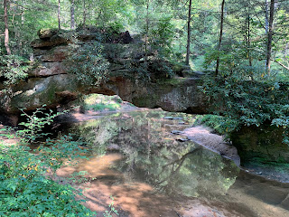
I didn't recognize it at first due to the angle of my approach, but soon it became obvious that the Rock Bridge was right in front of me. This sandstone structure spans the creek about fifteen feet above the surface of the shimmery water. It connects the opposing banks; a distance of maybe fifty feet. Presumably the waters of the creek have eaten away at the soft sandstone over the centuries and eventually bored a hole through it, which has now become known as the Rock Bridge. It's a pretty cool feature.

Just a short distance further, I encountered the other highlight of this trail, Creation Falls. This two-tier water fall allows the creek water to plummet twenty or so feet into a large shallow pool before it continues downstream to the Rock Bridge. It's far from the most magnificent waterfall I've ever seen, but it is charming in its own way. A large family group is here taking in the scene and wading in the cooling waters. They ask me to take a picture of them in front of the falls. 

The return to the parking area is a little steep, but nothing crazy and I find myself back at the parking area a short time later. This trail was only about 1.8 miles, but is hopefully a good preview of what I should expect on other hikes in the area over the next couple of days.

Sunday, August 28, 2022

Rottenwood Creek & West Palisades (Cobb County, Georgia)


I've been in a funk lately and haven't really gotten outdoors much in the past couple of months. A number of factors have been contributing to this, but regardless of the causes, it needs to stop. Today, I'm joining the Meetup group for the first time in a few weeks to further explore an area that I've only had a taste of. The Rottenwood Creek Trail is a mostly paved route departing the the Paces Mill and West Palisades units of the Chattahoochee River National Recreation Area in the heart of Atlanta. I'm looking forward to reconnecting with some of my hiking friends.

As I arrive at the parking lot a few minutes before the scheduled start time, I see the group leader at his car and walk up to say hello. I always feel very welcomed with this group. The thirty or so of us group up in the shade and do a quick round of introductions. Soon, we're on the trail alongside the Chattahoochee. The surface is a fine gravel in this section and it's almost perfectly flat. We make good time along this section and then hit the first fork to head off into the woods. 

There is a pretty extensive trail system here and it's easy to get turned around, but most of us on the trek have a good sense of direction and getting lost is not really a possibility. That said, we make an attempt to connect to trails that parallel the river further up, but steep drop-offs provide no where to walk and we're forced to turn back. On the way, we encounter a young couple carrying a pair of stand-up paddle boards through the woods and struggling pretty mightily. It seems they got separated from their group and decided to come ashore at an opportune spot. Unfortunately for them, the nearest parking lot where they might get picked up is nearly a half-mile away, uphill, and along a single-track dirt trail through the thick woods. As we can see how badly they are struggling, a few of us offer to help and take some of the weight of boards. The couple thanks us over and over again, as we finally lower the paddle boards onto the grass at the parking lot.

After getting a little bit of an upper-body workout carrying the paddleboards, we decide to stop at a group of picnic tables near the parking lot for a quick snack break. I enjoy a Clif Bar and two of the Nature's Bakery Fig Bars to recharge a bit. After just ten minutes or so, we hit the trail again. From here, we'll be mostly on pavement. 

As we review the map on our phones, we realize we need to go through a gated community to get back to our intended route. As an Amazon Prime van enters, we hold the gate and head through. I comment that the residents will be horrified by this rabid hiking group terrorizing their community. The folks around me chuckle. Soon, we leave the neighborhood and are back on our intended route. 


This puts us on the roads near Truist Park, where the Atlanta Braves play. I have to say that I'm not all that fond of all of the road walking today, but it can't be helped given the area we are in. Eventually, we reach Rottenwood Creek, which has a well maintained paved trail running parallel to it. This is probably the most scenic part of the trail. The muddy creek water flows over a series of small waterfalls and large boulders, which provides some very picturesque scenes.

Soon, we are back at the junction with the trail we started on and then back at the parking lot. We covered almost exactly 10-miles today. It was kind of a mixed bag, but overall, there was definitely too much pavement involved. Some of the scenery is nice though and it's always great to hang with these folks. Now, we'll head to a nearby restaurant and allow the other patrons the pleasure of enjoying the aroma caused by hiking in ninety degrees and ninety percent humidity for a few hours, while we enjoy some food and drinks. Slante!