Friday, March 29, 2019

Cottonwood-Marble Canyon Loop (Death Valley National Park, California)


This will be my third attempt at doing this short backpacking trip in Death Valley. I tried two years ago and was foiled by poor weather, and then again last month, only to face similar conditions. Originally, I had planned to be in Buckskin Gulch in southern Utah this weekend, but after talking with the BLM, it sounds as though the gulch is currently flooded with deep water. So as an alternative, I decided to take one more attempt at the Cottonwood-Marble Canyon Loop just north of Stovepipe Wells. My friends Gen and Emily joined me. 

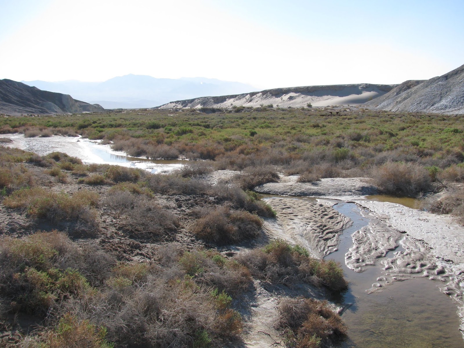
We met last night and camped in Sunset Campground near Furnace Creek. Arriving late, I decided to cowboy camp under the stars and it was a great experience. Temperatures and winds were just perfect. After packing up, we did a short hike down the Salt Creek board walk, before driving the out some fairly rough roads to the fork of Cottonwood and Marble Canyons, which would be our starting point for this trip.

From the area where we left the vehicles, the canyons open up widely and as we head up Marble Canyon, we get into a discussion about clockwise versus counter-clockwise. Some comedy ensued, but eventually, we agreed that we would do the hike in a counter-clockwise direction, which leads us into Marble Canyon first.


For the first few miles the trail is pretty easy. The dry wash is surrounded on either side by slopping cliff walls that will close in tighter and tighter as we make our way up the canyon. After about four miles, we reach our first obstacle, the boulder-jam. Sometime in the distant past, a large car-sized boulder has rolled down the dry creek bed and blocked off the upper canyon. While we know there is a way around the jam from our trail research, we decide to take this opportunity and the shade of the large boulder for a short snack break. Hundreds of butterflies are in this part of the canyon and Gen, takes the opportunity to play among them. It is actually a pretty cool scene to see so many of the small orange beauties flapping their wings. 


After we make our way up the canyon wall and around the boulder jam, we push onward. The canyon narrows into much more of a slot canyon and we begin to find signs of past visitors. Some historic scratches on the wall tell of pioneers making their way up this dry canyon over a century ago and being helpful, they mark that a water source is a further five miles up the canyon.

Just beyond the pioneer markings, we begin to see more ancient markings in the form of Native American petroglyphs. This is one of the things that attracted me to this trail and I'm glad to have found them. We take a few minutes to observe and try to interpret their meaning. I've been interested in rock art for some time, but Emily is actually an archaeologist who searches for and studies these ancient markings as part of her job. It's nice to hear her educated perspective on the symbols.


Further up the canyon, we reach the next big obstacle in our path - the dry falls. Today though, it's not quite dry. A green, mossy flow of water trickles over the white alabaster to form a tiny stream of water flowing further down the canyon. We knew this was coming, but pause for a moment to determine the best way to overcome the 8-12 foot climb in our path. Emily checks out the holds on the right of the canyon and I explore the left. I'm not much of a climber, but I clumsily manage to pull myself over the edge and reach the top. I had left my pack at the bottom and Gen rigs a para-cord on it before I pull it up over the edge. My companions are much better climbers than I am and manage to make it up part of the way with their packs on before handing them off to me and pulling themselves over. Gen slides a bit and scraps up her leg, but we take care of it at the top. 


The dry falls will be our last big obstacle for the day, but before moving on, we decide to take advantage of a pool at the top of the fall to refill our water. While we have reports from the rangers and other hikers we have encountered to this point, it's always best in a place like Death Valley to take advantage of every water source you can find.

Moving into the junction of Marble and Deadhorse Canyons, we begin searching for a spot to put down our tents for the night. We finally settle on a previously used site under a large cottonwood tree. We all take a short time to relax before pitching our tents and preparing some dinner. At this higher elevation, the temperatures are a bit cooler and we take major notice of this as soon as the sun dips down behind the mountain to the southwest. Originally, I had not planned to put the rain fly on my tent, but my companions convince me that it might get colder than expected overnight and that the rain fly will provide one more layer of warmth while sleep. I agree and attach the thin fabric over the top. As the evening darkens and the stars begin to appear, we decide to turn in, each heading to our respective tent set up in a triangle pattern around a dinner circle.

Day 2

It seems whenever I camp in the backcountry, I wake with the sun, and today is no different. Waking up to birds chirping in the nearby cottonwood, I change clothes in my tent before unzipping and heading out to relieve myself. It seems I'm the first to wake and I decide to get some breakfast going before waking my hiking partners. Granola with wild blueberries and milk will be the featured dish this morning. I've had this selection previously and it's quite tasty. I also prepare my normal earl gray tea for that little caffeine boost.

My companions begin to stir and make their way out of their tents and over to the dining area to prepare their own breakfasts. We talk about the best way out of this canyon. We know the direction we need to go, but we also know that the path over the two ridges separating us from the wide section of Cottonwood Canyon is steep and somewhat elusive. From reports I have read, past visitors talk about not really have a trail and just finding the most doable path over the two ridges.

We break camp and start up the sagebrush covered hills toward the high point of the trail. It's steep and pretty slow going with full packs on our backs, but we eventually make it to the top. My altimeter shows our elevation to be nearly 4,800' on the top of the ridge, which is quite high considering we started yesterday near sea level. From here there is no particular trail down, but we make our way into the wide canyon, more of a valley really, and eventually the wash a the center. Along the way, we encounter a couple of other groups going in the opposite direction. It seems that clockwise is the most popular route, but from our experience so far, we have made the correct choice by going in reverse.


We find a few more worn petroglyphs in this wide valley and a number of interesting plant specimen before finally reaching the mouth of Cottonwood Canyon, our next and last major obstacle. As the spring feeding Cottonwood Creek is much more generous than it's companion in Marble Canyon, the vegetation has grown to be a thick tangled mesh of living and dead cottonwood trees, bushes, and other assorted flora.


We spend the next few minutes finding a passable route through the mesh, before stopping at clear pool in the stream to refill our water and take a snack break. From here and for the next hour or so, we fight our way through the net of brush, the muddy stream, and the steep cliff sides of the canyon choke-points, eventually dropping out down canyon in one piece.


As the canyon opens up, we take note of some wild mustangs starring at us from a distance. They are cautious, but don't run off as we approach. We leave the trail and make our way around them at a distance of about fifty yards, trying to stress them as little as possible while make our way down the canyon.

Reaching another wooded area of cottonwoods and then another, we finally reach the second spring, which is also flowing, but this time as only a trickle of water. Luckily, these lower two wooded areas are much smaller and tamer than what we encountered up canyon and we are able to quickly push through them. As we arrive at the end of Cottonwood Road, which is our planned campsite for the evening, we discuss the possibility of pushing on and finish the trail today. The campsites here are not as outstanding as what we had last night or even further up the canyon, and since it is only a little after 2 PM, we are pretty confident we can make it out before dark. 

Discussing it a bit more while we rest and get some calories in our bodies, we finally decide to make the push. We know that a passable road leads all the way back to our vehicles and that the hike will be easy. We've covered about ten miles to this point today, which means we will have another nine or so to push through before sun down.

As we thought, the hike is very easy from here on out with no true obstacles. We do find a few pieces of liter, including a grill grate, which we pack out with us. The canyon here is very beautiful, but nothing like what we have been through over the last two days. 


About three miles from the end, we find a large cave in the cliff wall and decide to explore it a bit. The covered space is probably about fifteen hundred square feet and their are signs that this is often used as a camping spot. It probably was for the ancient peoples in this area as well as modern adventurers. 

Finally reaching our parked cars, we remove our packs and consider that we've hiked 18.6 miles just today with full packs on our backs. The trail in total was 27.8 miles over two days. Quite and adventure and I'm thankful to my companions for joining me on it. We've had a terrific time and seen some beautiful scenery along the way. To reward ourselves, we head back into the saloon at Stovepipe Wells for some cold beers and warm food.

Salt Creek Trail (Death Valley National Park, California)


I'm in Death Valley for a backpacking trip this weekend, but knowing that we only have about 9 miles ahead of us this first day, my friends, Gen and Emily, and I decide to do a short hike on the boardwalk trail that parallels Salt Creek. It's just a short warm up, but it has been on my radar for a while.

The trail is only about 0.8 miles long, but offers some nice views of the wash and running stream. In the shallow water, tiny pupfish fight against the current. I've seen various sub-species of these little guys before in the region, but they are very interesting. In past ages, this entire area was covered with water, but as the climate changed and the waters dried up, the small fish were separated by impossibly dry areas. Over the eons, they have evolved into a number of slightly different species, almost all of whom are in danger of extinction. Hopefully, they will beat the odds and the dryness and survive into the future.

Sunday, March 24, 2019

Linda Falls (Napa County, California)


I meant to do this short hike a couple of weeks ago while in Napa for the half-marathon, but time got the better of me. As I'm in the region again and it's not terribly far out of the way, I decided to knock this one out before heading home. There isn't much of a trail head, but there is lots of parking on the side of the road. A few other cars are here already, but I'm not sure if they are hiking to the falls or doing something at the adjoining baseball fields. Either way, I head into the wooded area on the other side of the road.

The trail is very easy and crosses a shallow creek before diving down a deep hill and circling back around to the waterfall. When I arrive, I find a couple sitting on a rock overlooking the flowing water and enjoying the day. It seems like a romantic spot and so I do my best to not disturb them. 

The waterfall itself is actually quite impressive, much more so than I expected. It's a split double fall that drops about twenty feet onto grey stone. The water is flowing very well, which isn't surprising given the amount of rain the area has received. I turn and return to my jeep. It was about 1.6 miles round trip and definitely worth a visit if you happen to be in the area.

Valley of the Moon (Sonoma County, California)


Waking early in my room at the Jack London Lodge in Glen Ellen, CA, I wanted to get in a few more miles. Before that though, I was obligated to try a croissant from an authentic French bakery just across the street from my hotel. Topped with apple and cherries, it was delicious and just the calorie boost I needed before a short hike.

Just a mile or so down the road another regional park offered the opportunity to do just that. Sonoma Valley Regional Park is a lush hill just south of the village and a particular trail, the Valley of the Moon Trail, seemed to be just what I was looking for. A cold, moist breeze blows through this small valley this morning, but it won't deter me. I make my way down the two-lane highway toward the park. 

Finally, turning onto the trail, I see that this first part is paved. I generally prefer walking on soil, but given the wet nature of the area this morning, pavement may not be a terrible thing. The trial follows along Sonoma Creek as it meanders through a sparsely wooded shallow valley. It's peaceful here and hearing the local birds sing their morning tune is inspiring.


The trail curves around and then eventually turns back on itself and climbs up to the southern ridge. The pavement ends and we are now on moist earth, more to my liking. In the distance, I see a small pond and two deer cautiously approaching through the trees for a morning drink. I love scenes like this and wish I could capture them on film, but they are too far away for any video to turn out well with my equipment. I'll just have to commit it to memory.

The trial climbs to the top of the ridge and then quickly descends back to the starting point. It's only 2.5 miles, but it was a great way to wake up and begin the day.

Saturday, March 23, 2019

Sonoma Ridge (Sonoma County, California)


Lodging for the night just down the road from Jack London State Historic Park, I wanted take the opportunity to fully explore the park and surrounding area. I have visited before, but my time was short. Today, I'm going to get some miles in. After visiting the Wolf House, I decided to hike up to the Sonoma Ridge, which overlooks much of the gorgeous vineyards in this famous valley.


The trail starts from a paved parking lot and wanders through what remains of London's Ranch. Rows of vines, owned by a private vineyard, paint the hillside leading into the forest. The trail in this section is double-track and easy hiking. It leads up to London Lake, which resulted from the construction of a stone dam across a small creek. London's family used the pond as a swimming hole and even built a small bath house nearby. Today, the lake is full of debris and covered in vegetation, though a couple of ducks swimming around in the muck don't seem to mind.


Beyond the lake, the trail enters deeper into a lush forest. Small streams cross the trail periodically. This area has had tremendous amounts of rain this year and the landscape is rich with life. As I make my way further down the trail, I'm startled by a trail runner coming up behind me. I guess I was just lost in the moment, thinking about Jack London following this same path a century ago. 


As I reach higher up the hillside, the terrain begins to open up in sections to richly grassed meadows. While there are a few gray clouds overhead, only a soft breeze blows through right now. It's actually quite pleasant.


Finally reaching a fork in the trail just below the ridge, I start a steep uphill climb towards a grassy noel at the top. A few oak trees are scattered among the light green grasses and the hills roll for some distance in all directions. The climb is a bit challenging and gets me breathing harder, but the view from the top is definitely worth it. From this vantage point, I can see many miles in all directions. Vineyards blanket the landscape in the distance and I'm reminded of how much I love this area.

The return hike is uneventful and as I get closer to the trailhead, I encounter a number of other adventurers out on day hikes. We greet each other and then continue on to whatever our intended destination. Reaching the jeep, I see I've covered about 7.7 miles - not bad. I told the lady at the fee station that I would probably hike ten or so miles in the park today. Between this trail and my walk to Wolf House, I'm pretty close to that.

Wolf House (Sonoma County, California)


Near the little village of Glen Ellen in Sonoma Valley, the famous author, Jack London spent the final years of his adventurous life trying to build and manage a sustainable farm. This was quite a revolutionary idea in the early twentieth century, and it, unfortunately, was not very successful in financial terms. On the property, he worked with an architect  to design and build his dream home, the Wolf House. So named for London's classic works featuring wolves, The Call of the Wild, White Fang, and others.

Construction began in 1911 on a four-story, 15,000 square foot mansion that overlooked Sonoma Valley. It was to be London's castle, but fate intervened. Just one month before he and his wife were scheduled to move in, the home was destroyed by fire, leaving only the husk made from local volcanic stone. London intended to rebuild, but pass away before the work was finished.

Today, California has designated the ranch and surrounding area as a state historic park in London's honor. As I'm staying in the area, I wanted to check it out. The hike to the ruins of the Wolf House is about 1.8 miles round trip and a short side trail leads to the cornerstone placed over London's remains. Walking this trail, I can't help but think of the inner longing experienced by the lupine characters in his great novels. I read them as a young teenager and they lit a spark of adventure in my soul that still burns brightly thirty years later. 

It's also quite tragic to see this husk of a dream standing through the ages. A fantasy almost realized, but then taken away by a cruel twist of fate. It's a reminder to all of us of the fleeting nature of life and the need to treasure each second. Rest well, Jack. May you answer the call.

Saturday, March 16, 2019

Fort Bragg Coastal Trail (Mendocino County, California)


I've often reflected on how much I love living in the high mountains of Sierra Nevada. Something in the high elevations among the pine forests and crystal clear lakes speaks to my soul. The only other feature I have encountered that even comes close to inspiring me to a similar level is the great oceans. Since I was going to be in Fort Bragg, along the northern California coast, for a wine festival, it seemed only fitting to get some hiking in along the ocean and as luck would have it, this is the time of year when humpback whales often visit these coastal waters. Perhaps, I'll catch a glimpse of some of the majestic behemoths.


Departing directly from Glass Beach, I made my way north up the well-worn Fort Bragg Coastal Trail, which follows right along the shoreline. The ocean fogs are minimal today, but they offer some great ambiance to the views. Temperatures are pleasant and the cool ocean breeze rolling in is a nice touch.


As I follow the trail around the tiny coves and inlets, it traverses along the top of earthen cliff some distance above the crashing waves. In the distance, I see the occasional whale spout, similar to those I was taught to watch for in Lahaina Harbor in Maui a couple of months ago. Unfortunately, I only see spouts on the way north - no breaches or dives.

It's early and there are a few other people out exploring this crisscross of trails, but I suspect they masses will descend in the hours to come looking for whale sign. The trail continues far beyond where I will turn around, but having only a limited amount of time before the wine begins pouring, I finally decide to turn around and head back. Just as I start thinking about where to turn, I note a large land snail crawling across the trail directly in my path. It's interesting how similar they appear to the banana slugs I saw last weekend. I wish the little guy good travels and turn to head back the way I came, though, I end up taking a slightly different route for part of it. 


On my return to the hotel, I finally see, in the distance, a single humpback leaping out of the water and breaching. It's a magnificent site and I'm thrilled to have been looking at the right place at the right time. As I get close to Glass Beach, I notice a much larger of spectators crowding the shoreline cliffs, just as I suspected. I hope they catch some wonderful views. Upon returning to the beach, I find that I've hiked about 4.9 miles. A pretty good day overall.

Glass Beach (Mendocino County, California)


For many years, I've heard of a beach in northern California with broken glass polished by the pounding ocean into a rainbow of colorful beads over the decades. Since I was going to be in the area for an event, I decided to get a couple of hikes in early this morning. Glass Beach, near Fort Bragg, was the first on the list. Luckily, my hotel is only half a mile or so away.

After arriving at the beach, I take some time to explore the area. As I understand it, the locals used this as a dump site for sixty years or so starting around the turn of the twentieth century. The lumber eventually rotted away, the rusted metallic scrap was later cleaned up, but the broken glass remained. The never-ending waves pounding on the shoreline and over years, rounded the sharp multi-colored pieces of glass into beads. Pictures I've seen in the past show a rainbow of colors, but as visitors by the thousands have collected and taken samples of the beads, the rich color spectrum has all but vanished. While many glass beads remain, most that remain are clear glass and less interesting. Still an interesting place to visit, but perhaps, I should have come here many years ago.

Friday, March 8, 2019

Skyline to the Sea (Santa Cruz County, California)


Late last fall, a friend planned a trip to an area in the Santa Cruz Mountains called the Skyline to the Sea. The trip ended up cancelled due to some health issues he was having, but the trail intrigued me and I looked into it further. A couple of months ago, I put a plan together and got the necessary permits to backpack the trail. My friend, Gen, joined me for the adventure.

Leaving Reno after work on Thursday, we drove separately across Donner Pass and all the way down to Santa Cruz, California. Driving two different cars was necessary as this is a shuttle style or point-to-point hike. Rising the next morning, we drove to Waddle Beach along Highway 1 on the Pacific Coast and left my jeep there. We then loaded all the gear into the Subaru and head back up into the Santa Cruz Mountains to the starting trail head at Castle Rock State Park. 

It was raining lightly when we arrived, but having driven all this way, we were not to be deterred. After checking in with the park ranger, we strapped on our packs and headed into the forest for what would become a three day and two night excursion from the Redwoods Skyline of Castle Rock all the back to Waddle Beach on the Pacific Ocean. The trail is appropriately named for such a trek.

The trail itself was well marked and well groomed, but the near constant rains over the last few days have made it quite muddy, especially in areas near trail heads that see more foot traffic. The weather forecast suggested a small chance of rain over the next couple of days, but having made all of the arrangements previously, we were willing to risk it. As we would find out over the next three days, the forecast was not very accurate.


The first stop of note was to Castle Rock Falls, which required a hike along a short side trail to a wooden observation deck. While not offering a great view due to the topography of the canyon, the waterfall itself is quite magnificent. It's difficult to see the exact height, but I would guess it to be at least eighty or a hundred feet, and with the wet weather, it's flowing with fury.

Pushing on, the trail follows along a mountainside and offers a few open views of the lush coastal forest. In a few areas, we are forced to climb over challenging rock formations. As we soon learn, this entire area is a favorite place for rock climbers. A specific rock face called Goat Rock shows promise for a great climbing destination and a number of signs asking climbers to care for the site and not climb when its wet. 


We take the rangers advice and take a slightly different path called the Travertine Springs Trail to avoid some wash outs along the main trail. The namesake of this alternative route is difficult to see. The spring is covered in thick vegetation including some green cane. We never quite see the water, but given the water-loving flora growing in the area, it's obviously there. 

As we return to the planned route, the trail begins to run parallel the road, which twists and turns some distance above us on the hillside. As we take note of a couple of abandoned wrecks in the forest below us, it's obvious that some drivers do not take the curves slowly enough. The apparently slid off the road and rolled down this hillside. It's hard to know how long ago these accidents happened, but the vehicles, while vandalized, appear to be less than ten years old judging by the models.


Finally arriving at Watermans Gap, we take advantage of a break in the rain to put up our tents and fix some dinner. It's cold and muddy, and with the temperature hovering in the mid to high thirties, I suspect we are going to be in for a cold night. As dark approaches, we decide to turn in and head towards our respective tents. No sooner do I crawl in my sleeping bag than the rain cuts loose. My tent provides me adequate protection, but the rains intensifies and sits in for the night. I awaken a few times to toss and turn in my bag. The air temperature is even colder now, but I'm warm enough in these accommodations.


Day 2

Waking shortly after sunrise, the rain has let up a bit, but continues to fall. We rise and quickly break camp, doing our best to keep our gear as dry as possible. I had been looking forward to a nice warm breakfast and a cup of hot tea, but given the wet conditions, I settle for a cliff bar and a chug of water.


While the first day of the trip was a bit wet, the second day, will prove to be even more so. Given the conditions, we push our pace pretty hard with few breaks as we make our way into Big Bend State Park and the bulk of the coastal redwoods in this area. Early on, the trees are relatively young and lack the girth of some of the other specimen I have seen, but as the day progresses and the miles are put behind us, some of the trees become true giants. 

In addition to the amazing flora, we also encounter a few fauna in the wet muck. Banana Slugs and California Newts seem to be coming out of all over the place. Gen was hoping to see some slugs on the trip and they didn't disappoint.


Many sections, most in fact, are a slippery muddy mess. Man-made steps constructed of timbers seem to only act to hold the water in standing pools. While I'm loving being out here in the wilderness, the trail conditions and we weather make the day very unpleasant. 

Finally arriving at the park headquarters, we take advantage of a break in the weather to get some food and decide a course of action for the night. Given how soaked we are and the likelihood of temperatures again dipping down to near freezing overnight, I'm reluctant to camp, as planned, at Jay Campground. We discuss bailing on the trip and catching an Uber or cab back to the cars. Eventually, we decide to rent a tent cabin for the night, complete with a wood-burning stove. 

The accommodations are not luxurious, but given the alternative, a thin mattress, a dry room, and a fire are extremely welcome. We quickly get a fire going and do our best to spread out our drenched gear. Unfortunately, wood is a bit damp and we spend far too much time and effort trying to keep the fire going, eventually surrendering and settling to just be happy for a dry room.

The rain again continues throughout the night and while it's not exactly warm inside the tent cabin, it's far more comfortable than the inside of my tent would have been. I'm able to get a decent nights sleep.

Day 3

The clock change to daylight savings time happened overnight and we wake at about 7:15 AM. As the rain is still pounding down on the tent roof above us, we don't hurry ourselves to pack, but do start getting stuff together. I take a few minutes to cook some mango sticky rice, a gift from my wife, for breakfast - quite tasty. I'll have to get that one again.

We toss on our packs, do our best to waterproof ourselves (for what little its' worth), and head out into the downpour. It's a mile-and-a-half back to the trail from where we spent the night and it's mostly along paved road, but at least the rain hasn't puddled up on the blacktop. 

Arriving back at the trail, we start a significant uphill along Hinh Hammond Road, a muddy dirt pathway carved through the forest. The road eventually reaches an overlook and clouds part just long enough for us to get a clear view of the ocean, some ten miles in the distance. It's actually a marvelous view and in a way, summarizes the trail. With mighty redwoods in the foreground and the sea in the distance, it's truly a Skyline to the Sea view.


As yesterday, we encounter a number of forest floor dwellers scurrying about at our feet. In total, we will see fifteen California newts and eleven banana slugs along our path, most of them on this our final day.

Our decent, takes us down a slippery sandstone wash that follows the ridge of the mountainside. It's touch and go for a while, but we make it without injury. The small streams of run off build merge to form larger and larger streams, until finally, we are walking alongside Waddle Creek, which is nearly as large as a small river like the Truckee, back home. The waters rush towards the ocean just a few more miles beyond.

Eventually, the trail widens and becomes more traveled by visitors to the park from the downstream entrance. We speak with a few mountain bikers and trail runners as we continue our push towards the sea. The rains seem to come and go during these last few miles, but are never falling very hard, which is a nice change of pace.


We finally reach my jeep and do a high-five in celebration of our feat. It's been a wet and muddy mess of a backpacking trip, but I'm still glad to have done the trail and to have had such great company with me. Our total distance is right about 35.6 miles, with a pretty even split each day. While I don't know that I will ever do this trail again (simply because there are so many others I want to explore), it is worthy of a visit for anyone interested, but do it later in the year when its not so damn wet.

Shark Fin Cove (Santa Cruz County, California)


Just a very short stop on the way to a much bigger adventure, Shark Fin Cove is just north of Santa Cruz on the famous Highway 1. My friend, Gen, mentioned it on our way. I really didn't know what to expect as we parked the cars at a wide shoulder and began walking back towards the site. After crossing an abandoned railroad track and maneuvering under a drainage pipe, the reason for naming this place as such became quite clear.

A lone tall spear of rock juts out from the angry ocean. There is no mistaking the shape, as it looks precisely like the dorsal fin of a shark. It's unmistakable. We make our way down a slippery trail to the sand below and explore the small area a bit. A drainage has been cut into the rock and forms a small waterfall that runs into the ocean. To the left, the battering ocean waves have carved a tunnel into the solid rock. As we make our way back around the other side of the tunnel, we climb up onto a slippery piece of rock that has a number of tide pools, though apparently devoid of life. I wonder if they are truly tide pools or simply puddles formed by the splashing waves crashing against this place. Either way, we head back up to the cars without an answer, but this was a very cool little diversion on the way.

Sunday, March 3, 2019

Napa Valley Half-Marathon (Napa County, California)

Note: Photo courtesy of Napa Valley Marathon

Two years ago, I ran my first, and to date, my only full marathon in Napa Valley. I've been much more focused on half-marathons since then due to the lesser training commitment necessary. The training isn't the problem, but the time to do it can be. Though I ran a half-marathon in Las Vegas last weekend, it wasn't going to deter me from an attempt at a personal goal, which is to run a half in less than two hours.

My friend, Chris, joined me for the weekend as we were at the Capitol City Beer Festival in Sacramento yesterday. Originally, Chris was going to the half, but he aggravated an old injury and was unable to compete. He was still very supportive of my run.

I stayed at a hotel just a tenth of a mile or so from the bus pickup, which made it an easy walk at 5:00 AM. The bus was scheduled to leave for the starting line at 5:10 AM and I made use of the time to chat with some fellow runners. Runners packed the bus and we took off promptly for the starting line. 

Arriving at Conn Creek Winery, the start of the half, we shuffled off the bus and began stretching in the pre-dawn darkness. A slight mist fell from the sky, but with the air temperature at a mild 50 or so degrees, I started to think the weather was just about perfect for a long run. I've been working hard to improve my times over the past few months and today might be my best chance for a while to meet that goal. The Napa Valley Half-Marathon course is slightly downhill and with the temperature as it is, I might have a shot today.


At 7:00 AM sharp, the countdown sounds and we're off. I love wine country, but seeing it in the morning light with a light fog as I push my body to its limits brings a new appreciation to this beautiful valley. I start out of the gate strong. My pace in the mid-8's for the first several miles. Unfortunately, my bladder decides I need a quick pit stop and my shoes decide to untie themselves twice in the first three or so miles. Up until these delays, I was keeping up with the 1:55 pacer, but I loose some ground and fall back to the 2:00 pacers.

I'm able to stay with these pacers for the majority of the race. I occasionally build up a lead on them, but I never again catch up to the 1:55 team. As we hit the 10-mile mark, I can feel myself struggling to keep up. My knee begins to hurt a bit and I loose some ground on the 2:00 pacer team. Mentally, I remind myself that this is going to be my best chance for a sub-two for a while and I force myself on.

As we approach the last mile though, I've fallen behind again. An Asian woman comes up behind me and offers me a couple of words of inspiration and I push through the pain. Just two-tenths of a mile from the finish, I see her struggling and I return the favor and tell her that we're going to finish this together. With the pacer out of site, I don't expect I'm going to meet my goal, but I'm still going to finish strong. She and I sprint for the finish and as I pass through, hurting as I am, I see the official clock is still under the two-hour mark. Did I actually get it?

I high-five my new friend and reach in to check my own timekeeping, which indicates that I'm about a minute under the two-hour mark. I quickly (as quickly as my aching legs can carry me) make my way over to the time-keepers table and discover that I have, in fact, finished the 13.1 mile half-marathon in 1:58:54 at an average pace of 9:05 per mile. I grab a banana and a fig bar, before find a wall to sit against. As I enjoy a few post-race calories, I consider what I've just done. Me, a 45-year old, has just run a half-marathon in less than 2-hours. For many, that may not be a big deal, but for me, on this day, it's glorious!