Canyonlands National Park and the area surrounding it is a view into millions of years of geological forces in conflict. Seeing the layers different types and densities of sandstone eroded away by the forces of nature over the eons makes the visitor ponder the infinities. A number of vistas and overlooks can be found in the area to look down on the confluence of the Green and Colorado Rivers, and many are similar, but of the ones my friends Van, Bill, and I visited, none were as impressive as Dead Horse Point.
Legend has it that a century or more ago, cowboys would drive wild mustangs out onto the point, which is access by a passage only about 30 feet wide. They would then gate the entrance with brush to prevent the horses from escaping. Then they would bring the favored animals out to be domesticated, while leaving the unwanted individuals trapped on the cliff to die of thirst, in view of the Colorado River 2,000 feet below. It's really an evil thought and one can only hope that it is more legend than reality, but we will probably never know the truth.
Even with such a dark stain on the location, the view is amazing. Seeing the river snake through and carve the canyons below is truly an amazing experience.
After a night of backcountry camping in Horse Canyon, my friends, Van, Bill, and I decided to visit some of the noteworthy sites in and around Canyonlands National Park. The first stop was a state historic monument known as Newspaper Rock, which is just off of state highway 211 outside of the Needles District of the park.
The parking lot offers ample parking for the curious and a very short walk to the right of the to visit a sandstone cliff face covered in desert varnish. The single largest petroglyph panel I have encountered greets visitors. For two thousand years, the ancient Native Americans of this region carved their marks and/or stories into this large rock. The panel is about 50 feet across and 30 feet tall. It is covered with hundreds of glyphs of many different styles. It is truly an impressive site and demonstrates the extremely rich cultural history of this region.
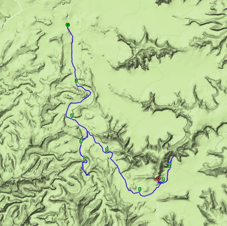
Of all of the preservation areas in Southern Utah, one of the few that I have not had the opportunity to visit in past years is Canyonlands National Park. Earlier in the year when I was planning my trips for the year, the extended memorial day weekend seemed like a perfect time to remedy this situation. With my friends Van and Bill, we planned a three-day two night backpacking trip into the Needles region of the large park. Months in advance, I reserved the necessary backcountry permits. We were all looking forward to the trip, as it was the first visit to the park for all three of us, and to Southern Utah at all for Bill. Finally, the day came and after meeting up and loading the Toyota Camry we rented to save some fuel costs, we were on the road by about noon Friday.
The drive from Reno to Canyonlands is nearly 800 miles and our plan was to take turns napping and driving to arrive at the park's backcountry office when they opened the next morning. Everything went to plan and we arrived in Moab, UT by about 2:30 AM. After some discussion, we found a parking lot to rest in for a couple of hours and then drove into the nearby Arches National Park to catch the sunrise at Window Arch. Coincidentally, I hiked to Delicate Arch (also in Arches National Park) almost exactly a year ago to see the sunrise. We pulled into the parking area and joined 20-30 other adventurers in the cool morning air, under the giant sandstone arch. The Sunrise was magnificent, but I failed to bring my camera with me to capture it. After a few short minutes, we got in the car and drove the remaining distance to the Needles Visitor Center in Canyonlands.
Discussing our backcountry permits with the rangers, it seems I had made a terrible mistake. The permit I got for the first night was for the section north of where we wanted to be and it would add an additional 20-miles to our trek - 20 miles we don't have the time or resources for. In my defense, the reservation system is based on zones, but these zones are not clearly defined on the website. If only the park service would post the map we were looking at in the backcountry office on the website, this confusion could have been eliminated. As this is a holiday weekend, the rangers were unable to issue the correct permit and we were left figuring out an alternative plan. Luckily, the original loop we were planning to backpack, the Salt Creek-Lavender Loop, was actually significantly shorter than we thought. We decided to hike and camp in Salt Creek-Horse Canyon the first night and visit some sites that Van was interested in, and then do our original loop plan tomorrow and Monday.
Arriving at the Salt Creek-Horse Canyon trailhead, we put on our packs and headed down the dry wash. Almost immediately, we were attacked by swarms of hungry mosquitoes. We put on some repellent and continued down the canyon. A short ways up the canyon, we encountered a friendly off-duty ranger out for a day hike. He offered somewhat confusing directions to our first planned destination. Hitting the fork of the two creek-carved canyons, we went to the right, but after passing the point where we thought we should have seen what we were looking for, we decided to regroup and take a look at the map. It turns out we had traveled about a mile and a half up the wrong canyon. We cursed our bad luck and returned to the fork.
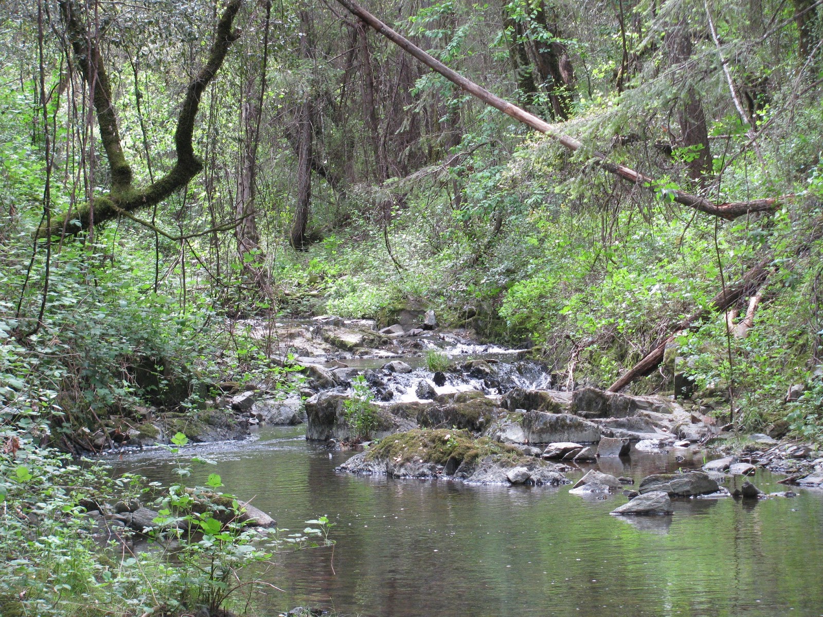
The entire wash alternates between patches of completely dry sand and wet areas filled with schools of tadpoles. Timid of the unknown, the infant frogs scatter at any approach to the area they are swimming in. The walls of the canyon are made of steep layered sandstone. They alternate in bands of red, orange, and yellow, just as one would expect in this section of the great staircase that is Southern Utah and Northern Arizona.
After making our way up the canyon we intended to be in, we stopped for lunch on a small side trail to admire a small natural bridge. As the afternoon is wearing on, it gets noticeably warmer and there are only small patches of shade available on the edges of the canyon.
Still searching for our point of interest, we round the corner and find what we are looking for. About midway up the canyon wall, the sandstone has been carved out below and a large hole has been eroded into the capstone to form what can only be known as Paul Bunyan's Potty. The wall is approximately 150 tall and the potty and 'tank' below it occupy more than half of that height. It's quite a site to see and easy to imagine a giant 'taking care of business' while sitting on this giant seat.
The trail wash snakes around back and forth with loose sand for footing, which makes it a bit more challenging to walk in. Luckily, someone has cut trail across the 'peninsulae' to form a much more straight path on slightly more solid soil. As we reach a sign for our next destination, we leave the main trail and head into a side canyon. Along the way, we note stand of trees and some large loose boulders along the side of the canyon. We think it might be a good place to camp for the night and head over to take a look. Deciding it looks ideal, we drop our packs and continue down the side trail.
The canyon floor is covered with sagebrush and as we make our way through it, we see a sandstone tower in the distance with some caves in the wall behind and above it. This turns out to be what we are looking for. In the cave, ancient Native Americans have build small cliff-dwellings. This particular dwelling is now known as Tower Ruin, presumably due to the tower which it overlooks. We search the wall for a place to climb up and eventually find a steep approach up the sandstone cliff and reach the area just below the dwelling. We consciously choose not to proceed any further, as we don't want to risk damaging the amazing architecture of this cultural treasure. This would have been an ideal home, with an amazing view of the wide canyon below and the sunrise. It's doubtful if any enemy could have approached without being spotted by the inhabitants.


Making our way back to the area we dropped our packs, we bust open a small bottle of spiced rum we packed with us and begin celebrating life. The recess where we decide to cook is almost a cave and is ideal for a dwelling. The fire ring in the center of the floor make is clear that we are not the first to think so. Perhaps the ancient peoples of this area once camped here.
As we get a little buzz on, we decide to do more rock scrambling in the cliffs above our camp. Reaching a sandstone pillar separated from its parent cliff by a sliver of space, we look down on how far we have climbed. We are about 75-feet above our camp and the combination of accomplishment and alcohol gives us all a sense of pride and grandeur. We yell at the world to take notice, before carefully making our way down the cliff.

As I finish off the rest of the rum (too much on an empty stomach), I loose my sense of balance and roll over before finishing my dinner. Van and Bill set up my tent and help their drunk friend into his sleeping bag. Actually, I don't remember a great deal of that part of the night, but I do remember waking up in my tent not knowing exactly where it was, where my glasses were, or where my flashlight was. I fall in and out of sleep until the sun finally begins to rise and I leave the tent to relieve myself. Luckily, the effects of the night before are minimal and I quickly get my bearings and begin packing my gear.
After a quick bite of breakfast, we make our way out of the canyon. Without detours, we make great time coming out of the canyon. Arriving back at the car, I check the GPS for distance. We covered about 8.1 miles on Saturday, including detours, and about 4.1 miles this morning for a total of 12.2 miles over the single-night backpacking trip.

Now for the second part of our plan, the original loop. Driving south to the trailhead at Cathedral Butte, we quickly run into another obstacle. The road to our trailhead is covered by a creek. I get out and toss a rock into the water to get some idea of the depth. I guessed that the water is approximately three to four feet deep in the deepest section. Well, that was unexpected. All three of us are jeep owners and wouldn't have hesitated to drive our rigs through this rushing water, but the Toyota Camry we are currently driving is a completely different story. We search the map for other options and explore a couple, but none work out and we are forced to abandon our plan. Instead we decide to visit some of the noteworthy sites in the park.
A few weeks ago, I drove down to El Dorado County for the annual Passport Event, which is essentially a tour of many of the area's wineries. Just south of South Lake Tahoe on US-50, the road curves around a big bend and offers a view of a tall waterfall coming over the ridge. This is Horsetail Falls, which forms as Pyramid Creek runs out of Lake Aloha and a couple of smaller lakes before coming over the tall ridge. With the massive amounts of snowfall this winter, the water was raging and I felt like I needed to visit this mighty waterfall this year more so than any before.
Driving down to the area early, I arrived at the trailhead parking lot, which was still closed for the winter when I was here a few weeks ago, but luckily was now opened. There were a few other cars in the area, but not many. I threw my small day pack on my back and started up the trail, which initially follows along Pyramid Creek. Large sections of the trail at this southern terminus have large puddles of melted snow that must be detoured.
Passing through the forest and up the steep grade, the trail leads into a wide valley cut by the creek. All along the way, huge amounts of loose wood and other natural debris have pooled along the creek acting like leaky damns and pooling the crystal clear snow melt into large pools.
As I enter an large open area covered with a massive granite floor, the view of the top of the valley opens up and offers my first view of Horsetail Falls in the distance. It is mighty. Trails on granite always become a little difficult navigate and I quickly loose the route. Not that it is a terrible issue, as the creek and waterfall in the distance offer obvious markers. Nearby, the creek bounces over some overlapping sheets of granite to form small cascading waterfall, much like a rippling sheet.

As I see a couple of other hikers in the distance, I decide to try and re-find the trail in the area I spot them. To find any semblance of a trail, I'm forced to do some scrambling up steep granite boulders and sheets. I always enjoy this type of scrambling, which is so common in the Sierra Nevadas. I'm thankful for my Merrell hiking shoes during this activity, as I've found the tread of this particular model does extremely well on granite. Not finding the trail here, I eventually give up and return to the creek.
I'm soon joined by a couple that are having similar difficulties, but eventually, the three of us find a route. As we pass through a lightly forested area, we are forced to do a number crossings of the small streams running off the mountainside and into the creek below. Normally, these are probably no more than a trickle, but with all of the water, most are fast-flowing, broad and deep. Luckily, we are able to find a way to cross in all cases, be it a fallen log, a series of granite rocks, or some combination of the two. That's not to say the crossings are easy, quite the contrary, but we make our way precariously across.
Leaving the forested area, we enter another open granite covered area. A small group resting here indicates that they have searched a bit for another path up to the base, but gave up and have decided to turn back. I'm not so easily turned and while the couple I was traveling with head to the north looking for a path, I decide to head up a snowfield to the south. Unfortunately, my 'route' ends in thick brambles with no clear path. I turn back and just as I arrive back at the resting group, a couple of guys who claim to know the path offer to lead the way.

Their path goes behind a large boulder and requires navigating some granite steps to avoid getting completely soaked. As we make our way up, I realize that the trail is actually a flowing stream now, which is why it has been so difficult to find all along. Water always the path of least resistance and the trail has made a easy track for it. Just a short distance further, we arrive at the base of the falls. Probably a dozen or so hikers have parked themselves here on a large piece of granite overlooking the falls. I know the path continues on up to the top, but given the flooding conditions and the fact that there is still a fair amount of snow up here, I decide to stop here. I take balance on a rock and take a few photos of the raging waterfall. It is truly magnificent to see such a natural wonder.
The way back turns out to be just about as difficult to follow and I loose the trail a number of times as I make my way down the valley. As I mentioned before though, it's not really possible to get lost here, as the creek and the valley itself funnel everything towards the trail head. I finally arrive back a the jeep. I covered nearly 4.4 miles, but with all of the rock scrambling, stream crossings, and path finding, it was quite an adventure.
My first trip to Seattle, WA was a fun filled weekend of breweries, meaderies, and some great food, but the highlight (and reason for the trip) was to see U2's 30th Anniversary Joshua Tree Tour. However, I couldn't visit a totally new area without trying to get in a little hiking . . . if the weather was willing to cooperate, that is. I did a fair amount of research on the best hikes and settled on a few to explore. The weather wasn't kind though and I was only able to fit one trail in during my visit. At least it was a good one.
Rattlesnake Ledge is a tall cliff below the summit of Rattlesnake Mountain that overlooks a turquoise blue lake called . . . of all things . . . Rattlesnake Lake. Oddly, on my short adventure in this area, I didn't encounter any of the vipers, for which everything here seems to be named. Lucky for me, I guess. From the parking lot, a gated gravel road leads just a short distance to the trailhead. There, beside the lake a mother goose leads here young geese-lings around a smorgasbord of grass. This appears to be a popular trail, though the skies are questionable. I encounter a number of fellow hikers as I start up the steep, damp trail.

The forest here is so lush. With the near-daily rain that the Pacific Northwest is so well known for, ferns and moss grow in, on, and out of everything. Looking in every direction while on the trail, yields a feast of varying shades of green. A very light mist falls in conjunction with a blanket of humidity, making for the dampest environment I have ever hiked in. It reminds me of New Orleans, but without the heat and stickiness.
The trail snakes its way up the mountain via a great many switchbacks, some of which pass near tall chutes down the mountain, but the thick foliage is selfish with any views of the accompanying waterfalls.
I continue up the steep trail and I take note of the large number of hikers traveling up to the ledge with their dogs. Breeds of all shapes and sizes, but all seem to be enjoying the trip. The people (and the dogs) are incredibly friendly here. That's always the case with hikes, but these locals seem to be exceptionally courteous, each of them wishing me a good morning as we pass.
Finally, reaching the top, I find a rocky outcrop with a sunken depression in the stone. The mist has made the footing a little treacherous on this slick rock. I'm careful not to get too close to the ledge, as recall reading of a number of hikers falling to their death from this area in the last few years. Far below, the blue lake sits in a green sea of trees. In the distance, the mighty Cascade Mountains are only partially visible from behind the wispy clouds here and there.
After drinking in the amazing view from up here, even through the clouds, I begin the trek back down to the parking lot. It travels the exact same path, but going downhill always provides a slightly better view. As I reach the rental car, I see that I've hiked about 4.6 miles. I truly wish I had more time to explore some of the other trails, but I've seen enough to know that I want to come back someday.
The weather in my little part of the world has been very volatile this year, which has been making hiking and camping plans pretty fluid. Originally, I was supposed to go snow-camping this weekend, but an incoming snow-storm put a stop to trip. No matter; the meetup group had been planning to explore another trail in the Auburn State Recreation Area just over Donner Pass. It seemed like a good opportunity to get some miles in and the company is always good with the group.
Meeting on the western outskirts of Reno, we carpooled to the trail head of the Olmstead Loop Trail, just a couple of miles outside of Cool, CA. Driving to the trailhead, I remembered my last trip to hike in this area, which was a couple of years ago and a truly unforgettable experience. We met up with a couple of our other members at the trail head and soon we were off.
Coming out of the parking lot, the trail initially parallels the road as it makes its way along a fence line. White bell-like flowers decorate either side of the trail, along with a fair amount of poison oak. Having just recovered from a nasty case, I keep my distance. After just a couple of hundred yards, the trail turns and veers away from the highway, making its way into the grassy fields and wooded area of the park. The trail all along this section is well maintained and pretty flat. Apparently, there was a race this morning as we see a couple of runners and find chalked areas all along the trail point them in the right direction.
Soon we come upon a small creek flowing through ancient rock formations to feed a pond in the distance. Surprisingly, there isn't a great deal of water flowing. Given all of the precipitation this year, one would have thought otherwise. Though the trail is well maintained, we do encounter a few small patches of mud, but most are easily navigable.
Shortly thereafter, we come upon the first of about three steep uphill sections. Nothing too terrible, but they do get the heart going a little bit. All along the way, we have great conversations across a range of topics, including the wild flowers, the ski resorts, other hikes, craft beer, politics, etc. It's always fun being around such great people with so many similar interests.
Eventually, we loop back around and are forced to cross a small creek. This one is slightly wider than the last one that we hiked by and we must each stop across a series of somewhat unstable stones to keep ourselves dry. We all make it without incident.
As we enter the last section of the trail, I'm in awe of the openness of these rolling hills and the greenness of the grass that carpet them as far as the eye can see in many cases. An occasional flowering tree or patch of wild flowers provides some contrast to the green. Though the day started out very cloudy, some patches of blue sky start to peak through now, making these pictures a symphony of spring colors.
Finally, returning to the trailhead we rest at a picnic table and discuss visiting the nearby Moonraker Brewery, which I had suggested. Moonraker is producing some of the best beer in California right now and everyone seems excited to try it. We head over and enjoy some brews, food, and good company before driving back over the hill and saying our goodbyes. We put in about 8.8 easy miles today, but the company always makes it an even better trip.