I haven't been able to hike as much these past couple of weeks just due to family obligations, but this morning, I'm going to get a chance to put in a few miles. I decided to revisit the East Palisades section of the Chattahoochee River National Recreation Area. It's a great section of the river and has a couple of especially interesting points, specifically the bamboo forest. More on that later.
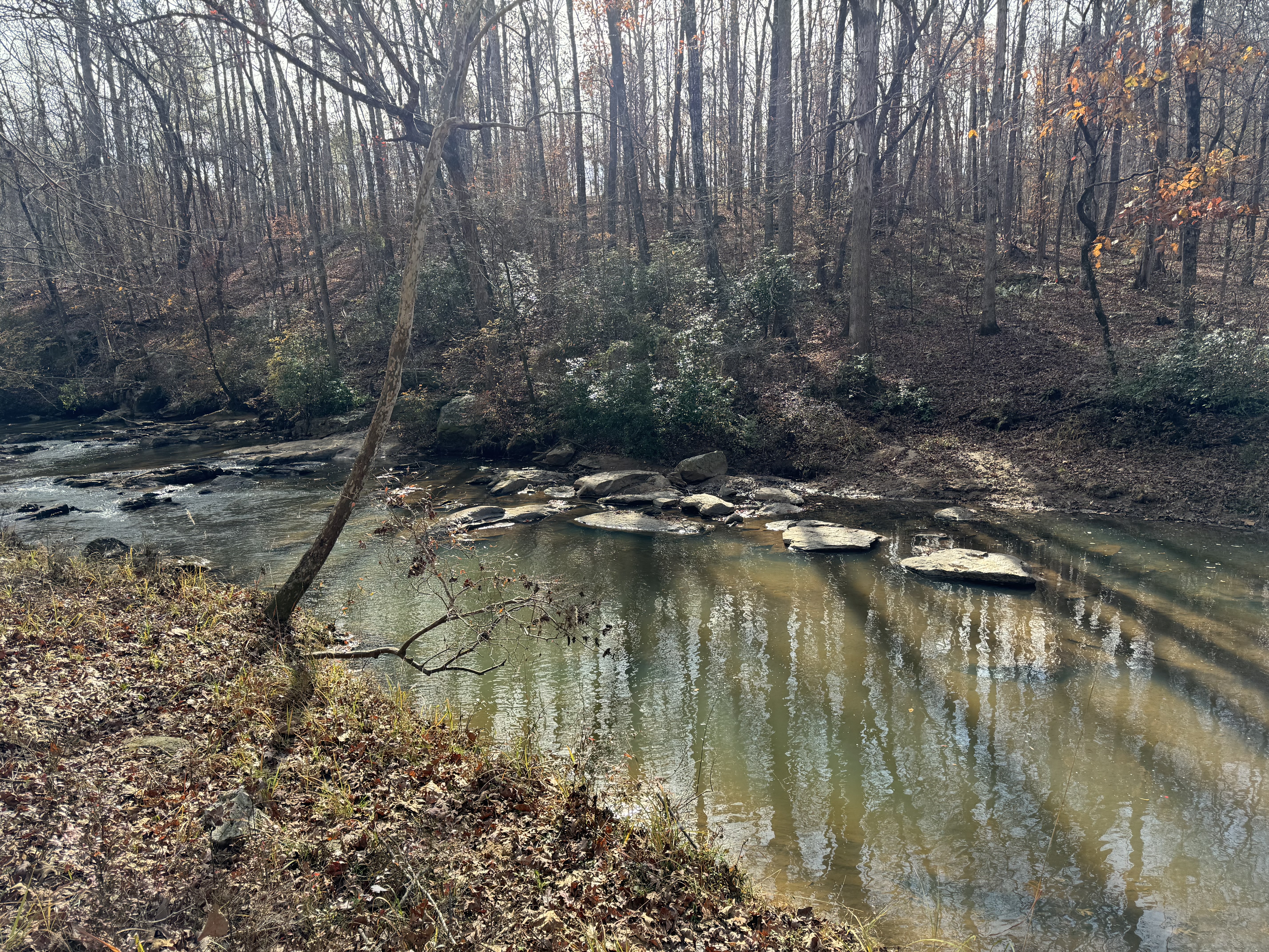
It's a brisk morning as I leave the car, but in true hiker fashion, I proceed with the "be bold, start cold" motto and leave my coat in the car. The trail crosses a bridge over Long Island Creek and then almost immediately splits. I take the left branch and will be returning on the other side at the end of this hike. Almost immediately, I'm hiking alongside the Chattahoochee River. The rock-laden shoals provide places to stand for a number of Canadian Geese, who are out sunning themselves. The trail network here is well-marked and nearly every junction has a map placard.

Reaching the summit of the hill, the trail follows the ridge for a while and then starts back down towards an observation deck, high above the river. There are a few teenagers here, but they politely move aside when I ask if might get in for a picture. From here, one can see the river far below and some high-rise buildings in the distance and on the opposite side of the river. After all, we're basically in Atlanta-proper.

Continuing on, I hit the northern end of the loop and then continue north toward the bamboo forest. I'll be returning to this point on the way back. This section takes me right beside the river once again and another hiker has decided to rock hop the across the shoals to get out into the middle of the shallow river. Must be cold out there. In the summer, I might consider doing the same, but for now, I'm more interested in the bamboo forest.
Another three-quarters of a mile, and I see the first bamboo stalks rising up for the shore. Most of these rise forty or more feet towards the blue skies and have a diameter of 6-10 inches. Truly monster bamboo. They are packed in densely and this 'forest' continues north for a maybe a hundred yards. I take some time to walk around and take a few pictures. I especially like shooting straight up and allowing the leafy stalks to converge towards the center of the picture.

Crossing another couple of bridges, I get back to the car and check my distance. I was able to hike about 4.2 miles this morning. Given that I have other plans this afternoon, I think this was a pretty ideal situation and it's always great to visit this little section of wilderness in the city. I would say this is probably one of my favorite hikes close to the city.