Looking east from pretty much anywhere in Reno, the 6k peak that we commonly refer to as Road to Nowhere Mountain is visible, as the tallest peak on eastern mountain-scape surrounding the valley. So named due for what appears to be a road on its western slopes that abruptly ends. While I have climbed this small mountain before, today seemed like a good day to revisit it and try to remember the route to the summit.
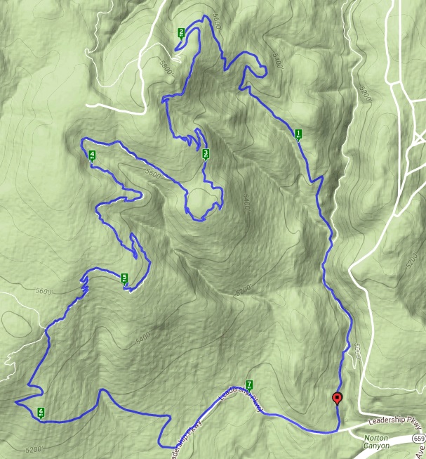
The trail starts at Hidden Valley Regional Park, at which I arrive a little before 9:00. As this peak is very near my home, I didn't feel the need to get started too early. Squeezing through a cattle gate, I hit the trail and immediately greeted by one of the many wild mustangs that survive on the fringes of town. How great it is to find such a magnificent symbol of the west at the start of a good hike.
I soon find the the trail leading steeply upwards into the surrounding hills. It is a combination of hiking trail and horse path. This area is home to many wild mustangs who roam these hills year round. I'm not sure this the same trail I have taken in the past, as it seems more steep, but it provides a good leg workout nonetheless.
Wriggling through these hills can pose a challenge and it is essential to keep a bearing on one's destination, as the peak I'm headed for is hidden from sight time and time again. The trail is nice and dry, which makes for an easy hike, other than the elevation gain of course. Finally reaching a saddle, which I remember from my previous trip up this mountain, I start a scramble up the sharp rocks to the top of the mountain, all the while try my best to follow the hidden horse trails.

Reaching the summit, I find the pyre of rocks that I was expecting. In addition, there is a military ammunition box on the side of the pile. I open it to investigate and find that it is a geocache. I sign the log book and offer the phrase "be excellent to each other" to any that may read the book in the future. I linger for a short time on this mountain top overlooking the city of Reno. My mind clears in places like this and my mind is often a mess these days. Finding some sense of peace at a place like this is a necessary activity for me. Up here my trouble soul sings. Up here I can breath. Up here all worldly cares seem insignificant and I can be one with the world around me. I fear the day that I will be physically unable to visit places like this. When my times comes, may be it swift.

Retreading a path down the hill, I decide to find a less steep trail that I might use on future visits. These hills are full of criss-crossing trails and I soon come upon a familiar site. A collection of used couches and recliners set up a round a fire pit fashioned from local stones. Judging by the shotgun shells, this is obviously a place for teenage drunken festivities, not unlike those I grew up with, but with more mountains. The high desert has a singular beauty, perhaps not appreciated by some, but I truly enjoy the landscapes here.
Arriving back at the trail head, head for home. A short hike of just under six miles, but I have been wanting to revisit this summit for a while. I shall return.
Continuing my long weekend in the Bay Area, I had signed up to do something called Hike and Hops with REI in the Marin Highlands. I've been to nearby Muir Woods before, but I know there is an amazing network of trails above the coast in this area and this seemed like a great opportunity to get some exposure to it.
I'm glad the group met fairly early as parking was not an issue. Arriving at the Muir Beach trail head at about 8:45, I quickly find the rest of the group and we get through all of the introductions and formalities before hitting the trail. The group is about 18 strong with hikers of all experience and ability. Knowing this would be the case, I had decided to add some weight to my pack just to up the ante a little bit. My laptop and a number of books from my weekend events raise my day pack weight to probably around 30 pounds - not exactly heavy, but still better than nothing.
As expected the pace is a little slower than I like, but good conversation with both the guides and other hikers keeps my attention. We make our way up the well-worn trails to a nice vista point overlooking the rocky California Coast below and the endless Pacific Ocean beyond. The views are sweeping. I get a shot of a red-headed turkey vulture perched just a few feet from the trail, rather oblivious to our large group.
We continue down the path towards Pirates Cove and there decide to take a small break. Through our conversation, David, one of the guides learned that I had just recently become a certified Leave No Trace trainer and mentioned that while he normally offers a few comments on the philosophy, he would welcome me to give a short talk about it. While I only received the training about two weeks ago, it seems like a wonderful opportunity to put my it to use and I agree.

David gives me a quick introduction and the stage, overlooking the rolling breakers below, is mine. I try to keep my comments brief, but touch on the seven principles of Leave No Trace, focusing primarily on 'Travel on Durable Surfaces', as it seems most applicable to our current location. I explain how repeated compacting of the ground prevents vegetation from growing and over time can expand a once small trail into a ugly, lifeless multi-track road. I finish with a comment about just trying to get humans to consider the consequences of their actions when they are in the outdoors. I think my little talk was well received as I am thanked and asked related questions throughout the rest of the day. It felt good to have the opportunity to inspire people, even with a spur-of-the-moment little three-minute spiel.

We break and hit the tail again, heading back up the rolling hillsides and back in the general direction of the Pelican Inn. From here, we are offered a great shot of the San Francisco skyline through the green hills, including the iconic Transamerica Pyramid. Continuing on, the trail takes us through the Green Gulch Farm Zen Center, which is a small retreat near Muir Beach that focuses on farming and Buddhist practice.
Finally, arriving at our destination, the Pelican Inn, we take up residence on the lawn and continue our conversations while our guides order some pitchers of beer and appetizer plates for us. While it takes a while to get our food and beverage due to the crowd, when we finally do get it, it is most welcomed. Lagunitas Pelican Pale Ale is quite refreshing and makes for a great reward for such a hike. I think everyone had a great deal of fun and was able to see some good sites on our little 5.5 mile trek.
I have a couple of wine events in the Bay Area this weekend and thought it would be a good opportunity to do a little hiking in some new areas. As I will be staying the last couple of nights in Fairfield, I decided to start there and see what hikes the local area had to offer. Searching the web, I discovered Rockville Hill Regional Park and it looked like a good fit for my somewhat tight schedule.
Rising early Saturday morning, I arrived at the trail head, which is only a few minutes West of my hotel in Fairfield, just before 7:00 AM. Its beautifully lush here with a nice cool morning fog. All of the El Nino inspired precipitation that California has gotten so far this winter has reinvigorated the landscape, and it shows a rich green color in all directions.
I hit the trail with only a vague idea of where I'm going and a basic map of the park in my phone, but as it is near large urban areas, I'm not too worried about getting lost. The trails are well maintained and as I reach a small pond, I start trying to determine which of the branches of the trail to take. This park has a spider web network of interconnected trails and as I learn throughout my visit, they are not all marked very well. I head in a generally western direction and take a side trail up a steep hill. Above my head, I can here the sizzle of power lines . . . not very nature-like.
The twisted trees on these hilltops are really spectacular and while without their leaves, I can't really determine the species, a little research indicates that most of them are probably blue oaks.
Moving on, I again try to figure out the trail and head for what I believe is Fern Falls. The trail to the bottom of the falls is fairly rugged, but doable. Unfortunately, the falls is dry at present, though lush with ferns and other vegetation. It's getting close to my time to head back to the jeep and I continue to struggle to find my way on these confusingly marked trails, which differ quite a bit from the published map. On the way, I see a sign for Sunrise Cave and look up a steep hill to see a small hole in the rocks above. Time or not, I can't pass up a cave and so, I make my way up the steep rocky hillside to discover a pair of small openings, both of which are just large enough for a person to curl up inside of, but not much more to them than that.

Back on the trail, I make my way through a really cool little gulch that has bare rock with colorful trees growing out of it and a lush grassy hillside above. Really, really beautiful. I arrive back at the jeep in plenty of time to make grab a shower and make it to my event, but this was definitely a great way to start the morning with just shy of 4 miles covered.
In all of the years I have lived in Reno, I have only been on one hike on Peavine Peak, which is the third tallest peak on the horizon.Today, would be my second. As I have been pushing myself hard for many runs and hiking trips this season, I'm trying to take advantage of every outing I can to get myself in shape. When I saw a hike posted on the Reno Hiking Meetup group to do some trails at Peavine, I had to take advantage of it.
Getting a start 9:30 at the East Keystone trail head, I met up with Nick and Jim, my hiking companions for the trek. Nick, the organizer, is a believer on starting on time, which I appreciate. And so, we hit the trail promptly. We expected it to be something of a muddy mess and the trail did not disappoint. Luckily, Nick is very familiar with the trail system and guided us through the myriad of junctions.
As this was advertised as a training hike, we didn't plan on taking any substantial breaks, which was just fine by me. In truth, this is simply sagebrush/high desert terrain with very little in the way of uniqueness. Its all about the exercise. As we sway too and fro, following the muddy, but well-defined trail as it hugs the contours of the canyons, we talk about careers, other hikes, and general attitudes towards the outdoors. My new friends seem like good chaps.
Approaching what Nick refers to as the 'Serenity Tree', he asks if anyone needs a break, as I'm pretty good shape at present and Jim is a fit 24 years old, we agree to keep moving. The tree itself though warrants a picture, as it appears to be the only tree on this entire side of the mountain.
Moving on a bit further, we arrive at a spot that Nick describes as one of the best vistas on the this trail and I take a moment to get a picture of Reno, in the valley below us. We push on and find ourselves hitting patches of snow that we sink into up to our knees and a sea of mud (not as bad as Hunter Creek a couple of weeks back, but still muddy).
Finally, hitting the high point of the Halo Trail, which falls far short of the summit, we start the downhill sections. A stream of running water from the snow melt follows the trail closely and while it would seem to be something to avoid, it is actually running over far more solid ground than the slippery mud on the rest of the trail. Everyone is good spirits though; we all knew what we were getting ourselves into before hitting this trail.
The final section follows a blacktop road between the Western and Eastern Keystone trail heads, before arriving back at our starting point. Total distance was just shy of 7.5 miles over just under three hours. Given the terrain and trail conditions, that's not bad time. I bid my new friends farewell and head for home.