I have always been interested in history; all the way back to high school. I took three years of Latin there and as part of the curriculum studied the Roman Empire. Unfortunately, I've not had the opportunity to visit any ruins of that great dynasty so far. A couple of years ago, a hiking friend that I met once moving to Georgia told me of a long hiking trail in northern England that runs parallel to and celebrates the great wall the Roman Emperor Hadrian had built to keep the Picts and other barbarians from what is now Scotland out of the Roman province of Britannia in what is now England. While much of the wall was carried away over the centuries for other construction, a great deal of it remains in ruins. For about a year now, my friend has been organizing a trip to hike this trail, known as Hadrian's Wall Path. I wasn't going to miss this.
The day finally arrived and I flew overnight from Atlanta to London on Tuesday. With a five hour difference in time zones, 'overnight' may be a bit of an exaggeration, but nonetheless, I arrived in London early Wednesday morning and after meeting up with the rest of the group (13 of us in total) at the train station, we took a three hour ride north to Carlisle. From there, we were shuttled by Mac's Adventure, who helped arrange our trip accommodations, to the inns we would be staying in tonight in Bowness-on-Solway. Bowness is a quaint little coastal town and represents the starting point of Hadrian's Wall Path. After getting settled, we met for dinner and drinks at the local pub and explored the tiny little hamlet a bit before heading back to our respective accommodations and getting a good night's sleep in preparation for long miles on our first day.
Unlike many of my other multi-day trips, this is not actually going to be backpacking. We will be hiking from inn to inn, while Mac's transports our luggage each day to our next stop. I say inn to inn, but most of these inns include a pub and so, it will more likely be pub to pub.
Day 1
Arising early, we head down for a hearty full English breakfast as prepared by our hosts at the Wallsend Old Rectory Bed and Breakfast. It's been a little while since I've enjoyed this style of breakfast, but with many miles to cover today, the eggs, baked beans, sausage, bacon (which in England is more like what American's would call), mushrooms, black pudding, and toast are a welcome addition to my stomach. Oh, and I can't forget the breakfast tea, without which no English breakfast would be complete.
With my morning hunger now satiated, my fellow travelers and I make our way the short distance to the beginning of the trail. A small structure and sign marks the spot overlooking the Solway Firth. When we were exploring the town last night, the tide was out and this was nothing more than a mud flat, but this morning, that has all changed and now a wide body of water separates us from the opposing shore, which is actually Scotland.
It's overcast this morning and there is a chance for rain. It is northern England after all. I read in some of the materials about the path that if you don't have at least one day of rain on this trip, it's as if you haven't really experienced it. It's no matter. Nothing will dampen my spirits this morning. I'm in gorgeous country with friends and on the first day of a mighty adventure. The rain and weather can do what they will, but I'm in a great mood and ready for miles.
The trail today will mostly follow the River Eden with a hefty amount of road-walking as we make our way back to Carlisle, by foot this time. As we depart Bowness, it does begin to rain a bit as we make our way through sheep and cow pastures, but nothing too heavy and it doesn't last very long. I put may rain coat on, but don't bother with my rain pants as it is light enough that the quick-dry pants I'm wearing will suffice nicely.
I've been told that the path is well marked and while some parts that actually follow the remains of wall are obvious, others are marked with the symbol of a white acorn. This will be our guide. While some of the group chooses to continue on the pavement, a few of us, know that the dirt is easier on our knees, head up to a parallel trail above the road on an earthen levee. I'm not sure if this levee was made by the Romans are later peoples, but for now, it's making the hike pretty easy and overall the group is making great time.
A few miles in and we find our first true pub, the Greyhound. It wouldn't feel right if we didn't stop for a pint or two. After all, this adventure is nearly as much about enjoying English pubs as it is about the hike and the history. Over the miles leading up to the pub, the group has stretched out about bit based on our natural hiking paces. As one of the faster hikers, I arrive at the pub pretty quickly and choose a nice cask ale, which the English refer to as 'real' ale. It's actually a big movement here, promoting secondary fermentation and the natural carbonation that comes with it over artificial carbonation. Outside the pub, a statue of King Edward I, also known as Edward 'Longshanks', stands commemorating the 700th anniversary of his death. While we have been using Facebook Messenger to communicate as a group, we failed to post that we had stopped at the pub in time for the person at the back of the group to know to stop. We apologized and asked her to wait for us at a good spot.

After a couple of beers and finishing our packed lunches, we continue on the road to Carlisle. As we make our way through the small villages, we note several old churches and cemeteries. It's amazing to think that many of these structures are several time solder than the US as a nation. We also pass through several pastures and in a couple of cases, note signs indicating the presence of a bull in the field that put us on hyper alert. We never see the big guys though and make our way across without incident.
In a couple of places, the map provided by Mac's Adventures suggests a different direction than the white acorns would indicate. In the end, the white acorn was correct. There are some areas of the trail that are undergoing maintenance and the map hasn't been updated. I jokingly suggest to my comrades that we are now a cult and should call ourselves the "Followers of the White Acorn" in acknowledgement of it's all knowing nature with regard to the way we should travel. They laugh.
Finally arriving in Carlisle, we spit into three groups and head to our respective bed and breakfasts. It seems we couldn't get accommodations for such a large group at a single location, but all three are close enough together so as not to be a problem. Our total trail mileage for the day was 16.6 miles, but the day is not over yet. Carlisle is the second largest city we will visit during this epic trek and there are areas to explore.
After getting settled in my room along with my bunkmate, I put on some flip-flops and head out to see Carlisle Cathedral, which is a nearby massive and ancient structure. I'll write a separate post about it. I also walk past Carlisle Castle, which appears to be little more than a fortified area at the center of the city. It's not much to speak of. After that, I meet my crew at the King's Head for more beer and then we walk as a group to the Woodrow Wilson for dinner. The name seems a little out of place in England, but the food and beer are pretty good. I enjoy a nice chicken korma and another pint before heading back to my room to crash. Day one has been outstanding and we haven't even seen any of the wall just yet.
Day 2
Day two starts with a nice warm shower followed by another hearty English Breakfast. Our hosts at the Langleigh are an eccentric older little couple, but they are great fun and wonderful cooks. As we depart, we take a picture at the exit of the large house and then we are on our way. We have to retrace a short distance of yesterday's path to return to the trail, but we arrive in no time and are back at it.
Today, we will be heading toward Irthington. The hike once again takes us through rolling green pastures, mostly for sheep today. And with this being the lambing season, we see literally thousands of mothers and their offspring in the fields. The green sea seems to roll on forever in all directions, with stone walls (not Hadrian's, but possibly made from stones taking from Hadrian's) separate different sections. With the overcast sky above, there is no doubt we are in England.
As we walk in a single file through one particularly green field, I can't help but hear the Howard Shore's Lord of the Rings theme playing in my head. Tolkien must have based much of his description of the 'shire' upon this fertile green landscape. There's no denying the similarities between where we stand and the visual extravaganza from Peter Jackson's film interpretation of the novel.
I'm interested to learn that national pathways like the one we are hiking are granted what are essentially easements over private property. The stone walls that presumably separate ownership are crossed by a variety of methods, including what are called "kissing gates", steps up and over, ordinary gates, and then upside-down v-shaped ladders. We become accustomed to crossing these various obstacles frequently. That said though, there is no hardship about it. This path has been well laid out and well maintained. Walking it is easy. I know there will be some undulating hills as we get into the crags later this week, but for now, this has been very easy hiking.
With all of the sheep, it is necessary to do a little hopscotch to avoid the piles of poo along the path and if one can't appreciate the finer aromas of nature, this section may not be ideal for everyone. I don't mind it though. It's much better than breathing in the exhaust and smog of the big cities. These are country people and life moves at a slower pace here. It's a refreshing change from the hustle and bustle.
A sign indicates another pub around lunch time and we divert a half-mile or so off of the trail to enjoy it. While we arrive a few minutes before they open, they are gracious and allow us to relax outside while they make final preparations. The Sally is a fine pub. Our server/bartender is definitely overwhelmed by our large group, but he maintains a pleasant manner and works his butt off to provide everything we require. I enjoy a couple of pints of new cask ales, which of course gets me feeling even better. Once our food arrives, I'm in awe of the unctuousness of these morsels. I ordered the steak pie, which is essentially a steak pot pie with a savory gravy and some vegetables on the side. I also tried the sticky toffee pudding, which is to die for. While I'm consuming a lot of calories, I will be hiking between 10 and 15 miles each day for the next week. I'm not worried. The food is absolutely delicious and some of the best we will enjoy the entire trip. We thank our server for his excellent service and begin the next part of the day.
After we return to the trail, we're in for more of the same. More sheep, more pastures, more stone walls - it's all wonderful. As we arrive in Irthington, we are again forced to separate into multiple groups as no single inn in this small community could host our large group, which has now diminished by one. The young lady that fell behind yesterday had decided to go her own way and leave the trip. I'm sorry to hear about that, but I understand, these big mile days are not for everyone.
The twelve of us arrive at the Orchard House, which is just off of the path. Three of our members of our group will be staying here, while the owners of the Belted Will Inn, just a couple of miles down the road, will host the rest of us, as well as pick us up here and return us tomorrow morning. While we sort things out, we take a seat around a picnic table at the Orchard House. A couple of minutes later a small irate man comes out yelling at us for being in his yard. This is actually the host and owner of this bed and breakfast, and we explain that some of our group are to be his guests. At first, we think he is joking, but apparently, he is actually upset with us for 'making ourselves at home'. This seems a bit odd for any hospitality establishment such as this, but maybe customs are different here. We apologize and he acquiesces. I'm kind of glad I will be staying at the other inn tonight.
A short time later our ride arrives and we head down to the Belted Will Inn. Our hosts here are much, much nicer. We settle in our rooms and then head down for dinner a short time later, which is delicious. My stomach is a little unsettled and so, I eat only a light dinner and avoid the alcohol tonight. Hopefully, it will feel better tomorrow. We completed another 13.4 miles today, bringing our total to 29 miles.
Day 3
It has been a terrific hike so far. The rolling green countryside has been breathtaking, but after a couple of days of walking through pastures and along paved roads, I'm ready for some history. Day three on the trail won't disappoint.
Shortly after getting started for the day, we take an off-trail detour to visit Lanercost Priory. It only takes us a minor distance off of the path and my friend that organized the trip assures us that it will be worth it. Besides, it's late morning and we're all a little peckish and the grounds of the priory includes a tea shop and cafe.
Most of us purchased a multi-day English Heritage Pass before the trip and this the first place we're able to actually collect and use our pass, as the grounds are managed by the English Heritage Foundation. The pass gives us access to explore the site and somewhat strangely, to a mead and wine tasting inside the gift shop. With my stomach feeling better today, I partake. The priory itself is deserving of it's own write-up, which I will get to soon, but after exploring the ancient structures, we take a much-deserved break in the tea shop.
The tea shop offers a variety of English sweet pastries as well as light lunch menu. I enjoy a diet coke for a caffeine boost, an amazing squishy lemon cake, and a dish of hummus with some toasties for dipping. The food is absolutely spectacular and just what I needed to keep me going today, on what will likely be our biggest mileage day.
Just a couple of miles after returning to the trail, we see our first section of the actual wall at Hare Hill. It's hard to believe that Roman legionnaires built this structure 1,900 years ago and I'm now touch it. While the wall rose much higher in it's prime and when it served as a defensive barrier, there is still a fair amount of the construction remaining. Though this section is only a few dozen feet long, it will only be the first of many that we will see.

For the next several miles and as we pass through even more sheep pastures, we see Roman ruin after Roman ruin. Sections of the wall, remains of turrets and guard towers litter this landscape in a dramatic historical sense. So much history remains here and I'm walking along and within it. My mind goes to scenes of eons past when centurions would have been standing guard high up in these guard towers looking over the lands to the north, ever vigilant and ready to defend the citizens of Britannia from any threat that may attempt a hostile crossing. I admit it - I'm awestruck at what I'm seeing.

A few miles further and we arrive at the Birdoswald Fort, known as Banna in Roman times. This is one of the best preserved of the sixteen forts that were built along the wall to garrison the legions defending the empire. This is another of the English Heritage sites and our pass once again gives us access to the grounds, museum, and yet another mead and wine tasting. I shrug off the unusual placement of these tasting and enjoy the offering before exploring the ruins, which are vast.
Judging by the remains of the outer wall, this fortified area must have enclosed a couple of acres of ground. Within it, the ruins of a number of structures have been excavated. A barracks, guarded gates and more towers are visible, or at least their foundations are. The stones that made up the rest of the facility were probably carted off long ago for other local constructions. Roman soldiers lived and worked here nearly two millennia ago and now I'm walking in their very footsteps. Truly amazing . . .

Tonight, we will be staying near Greenhead. Most of my companions are eager to get to the hotel, but As we cross a road on the outskirts of town and then pass through a concrete tunnel, I see a sign pointing the opposite direction as we need to go indicating another Roman fort just a few hundred feet away. I'm the only one curious enough to take the extra steps, but I'm glad I did. This is the Poltross Burn Milecastle, only one of dozens that sat at every Roman mile along the wall, but this one is built into a hillside above a creek and much of the walls have been preserved by being buried. It's definitely worth the short detour, but I soon return to my companions and enjoy a couple of cask ales at the Samson, where some of our group will be staying.

The remaining four of us will be bunking at the Blenkinsopp Castle Inn, which is literally the remains of a small castle. It's a couple miles further down the road, but I'm feeling good and after having a ale-powered recharge, I'm ready for those extra miles. The guest rooms have been built on the outside of the castle and the interior that remains structurally sound has been turned into a lounge and dining area. After getting settled, we head down for dinner and enjoy a delicious meal. There was slight mix-up on the rooms, but it was worked out and the manager comped us a bottle of wine as an apology. It's time for bed and my feet could use a break. We hiked 18.1 miles today, or at least I did. I know I took a few detours to see various things of interest, but it brings my personal grand total to 47.1 miles for the three days so far. I'm tired, but overall, I'm feeling great and my head is still buzzing from the historical aspects of this adventure.
Day 4
After enjoying a wonderful breakfast (full English, of course) at the castle, we meet our companions at the designated spot and continue our walk. This section goes through some residential areas and could get a little confusing, but following our lord and master, the white acorn, we navigate without difficulty.
Leaving the residential areas, we approach the Walltown Crag, which is something of a community park and today, is hosting a fun run and other events. As we pass through the family groups with our day packs and rain gear on, we must seem a bit out of place, but then again perhaps not. I've been surprised by the number of other hikers we've seen on this journey. While the wall has existed for nearly two thousand years, the official Hardian's Wall Path was only officially designated in 2003. I guess that has been long enough for it to become quite popular.One of our group has been suffering from blisters and a light groin pull and is falling a bit behind, but to her credit, she is courageously pushing forward. Quite the trooper. She would have made the legions proud. That said though, we have the hardest part of the trail just ahead of us. The reason this areas is called Walltown (beyond the obvious relation to Hadrian's Wall) is because it is the start of the crags, which are a series of uplifted cliffs in central Great Britain. While none of the cliffs are especially tall, the steep climbs and just undulating nature of the trail for the next couple of days will prove a challenge.
As we approach the top of the first crag, we rejoin the ruins of Hadrian's Wall, which we can now see stretch for miles and miles to the east. It's truly epic! My companions take their time as we go up and down over and over across several of these crags.
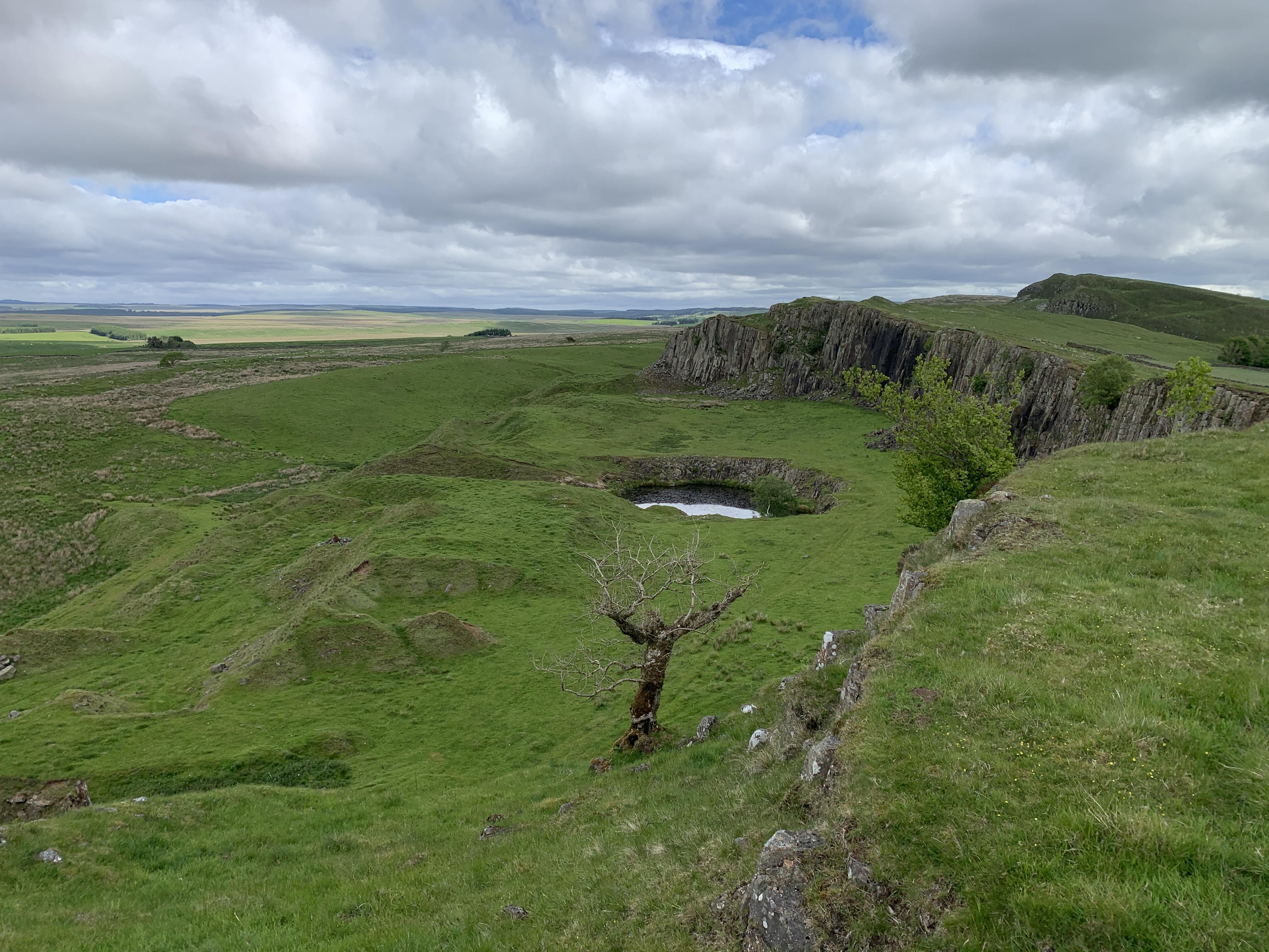
It's a little late in the day, but we're all hungry and decide to stop at the Cawfield Quarry for lunch. This area provided some of the stones for the wall and has been turned into a small park in modern times. It's a great location to take our lunch and enjoy something of a picnic. Many others appear to have the same idea.
As I sit at a picnic table near the flooded quarry and look across the water at the small crag rising behind it, I pull out my brie and cranberry sandwich and get some much needed calories. Though this is going to be our shortest day in terms of mileage, it's also the one with the second most elevation gain and loss thanks to the many crags we will traverse. My companions spread out in various areas on the grass and on the provided picnic tables and enjoy their meals as well. The sun is overhead and we're enjoying a rare picnic-worthy day here in northern England.
Soon, we're back on the move and climbing over more crags. The crags form a tall ridge overlooking the landscape on either side. To the north, a steep cliff would lead to quick death, but to the south, it's mildly steep downhill to the pastures. In the distance, we can see our stop for the night - Twice Brewed Brewery, which is a popular spot for all the locals, not just crazy hikers.
We're not ready to drop down just yet. Before we do, we pass a marker indicating the high point of the entire path. I check my elevation app and find that we have climbed to the height of 1,105 feet above sea level. It seems nothing, since I live at about this elevation near Atlanta, GA, but given that we're on an island, I didn't expect we would get too very high. After stopping for a minute to admire the views from this high point, we head down the hill towards Twice Brewed. The ales are calling my name.I enjoy three pints in the pub before our entire group sits down to dinner in the restaurant. The cask ales were truly excellent - the best so far. The entire facility houses everything from the pub to the restaurant to the hotel. It's nice to be able to wear flip flops or socks for some of my friends as we make our way around the facility. Unfortunately, the restaurant seems to be woefully understaffed and dinner orders are just one mistake after another. Some of the group leaves the table in frustration, but I'm hungry though and ready to eat. The food is okay, but nothing fantastic. I enjoy another couple of pints with dinner as my remaining companions and I contemplate the British concept of a 'pudding'. How in the world are black pudding and Yorkshire pudding even considered the same type of thing? After dinner, we retreat to our respective rooms and rest our tired bodies in preparation for even more crags and miles tomorrow. Today's mileage was only about 8.2, with the grand total now at 55.3 for me.
Day 5
Day five will turn out to be the most scenic of the entire trip. After yet another full English breakfast at Twice Brewed, our group quickly organized and headed out. Based on the cloud cover, it looks like we're going to be in for some real rain today, but I'm hoping to get to the first spot of note before the downpour begins.
I remember watching the 1991 film Robin Hood: Prince of Thieves in theaters and enjoying it. There is a scene early in the movie, where Robin (not yet Robin Hood) saves a young boy from some of the Sheriff of Nottingham's soldiers, who have forced him to climb a tall sycamore tree growing next to a magnificent wall at the bottom of a rolling hillside. The location of that scene is only about a mile from Twice Brewed and is called Sycamore Gap. The tree has come to be known as the Robin Hood Tree.
Climbing back up to the top of the ridge ahead of most of my companions, I continue pushing a fast pace to reach the gap before the rain starts. It's a fairly brutal section of the trail with some very steep climbs and descents that just repeat over and over, but the views of the countryside all round us are stunning. The wall lines the top of the ridge and from the high points, can be seen to continue on for as far as the eye can see to the east. In places, stone stepping stones have been placed along the path to help with the heavy traffic this place must sometimes get, but with rain, those stones are going to be slick and in places where they lead down to the next gap, potentially dangerous.

After just first or second (I can't remember) high point, I look down on the beautiful Robin Hood tree. There is a large group of teenagers ahead of us on the path. It seems to be some sort of school field trip. The students are being especially careful on the steep descent down to Sycamore Gap, but their teachers instruct them to let us pass the group. By the time I reach the bottom, most of the teenagers have already cleared out leaving the perfect photo opportunity for my group. I take a number of pictures from different angles. It's really a stunning scene. The tree rises probably 100ft of so above the Hadrian's Wall, which has been built amid the wave-like form of this gap. After snapping several pictures ahead of the rest of my group arriving, the other fast hiker of my group and I head back to the stone steps to ensure the next couple of members of our group makes it down safely, which they do.

Just as we get past Sycamore Gap, the rains begin. While not a true downpour, this is the heaviest rain we've seen so far on the trip. Luckily, we stopped to put our rain gear on just as it started. My jacket and rain pants should keep me nice and dry while we continue to pump out the miles. The dark clouds hovering over the lush green landscape with the ridge and wall cutting through it like a dagger makes some fine pictures. We continue making our way across the crags for several more miles before the trail finally descends and the rough section comes to an end. Here, we cross through more cow pastures heading towards the Temple of Mithras.
This small Roman ruin was a temple to the god Mithras and allowed the stationed soldiers to worship in this foreign land. The practice of Mithraism is something of a mystery to historians today. We know that it was popular among the Roman military, but even there seemed to be more of a cult, complete with special handshakes and the like. Only the ruin of the temple remains, but the tiny enclosure couldn't have been comfortable for more than a dozen or so patrons at any given time. I suppose that it could provide some needed spiritual comfort to soldiers serving in this far northern province back in their time. It's certainly an interesting site and worthy of further research into this mystery religion.
Just beyond the temple, we enter a large parking area, where a coffee and tea truck has set up shop to serve warry hikers such as ourselves. A hot cup of tea and/or coffee is welcomed by just about everyone at the front of our group. The rain and lack of sunlight has made today's hike a bit cool compared to days past and a hot beverage is just the thing to warm us up.
As we reach the end of today's hike, we enter the another Roman Fort, this one at Chester. Even more extensive that the previous one, the foundations of numerous buildings have been recovered to show just how large this area was. It went on for hundreds of yards and included upwards of thirty buildings. I take some time to walk around and enjoy the site and museum. I'm even able to walk through the remains of a Roman bath house. The Roman nobles were famous for their luxurious life style and stepping through the various chambers, I can only imagine the deeds and conversations that once took place here among these walls. After a pretty thorough tour of the ruins, we continue on to our end point for the day.

Tonight, we'll be staying near Hexham in two different establishments, which are a couple of miles apart. Graciously though, the owners of the bed and breakfast where I and some others are staying have offered to give us a ride to and from their inn. Before heading to the bed and breakfast though, we have a nice dinner with the family of one of our hikers. Her mother is from England and they've traveled with other relatives to meet up with their daughter. Fine people they seem to be and we all enjoy some lively conversation over a great meal.After dinner, we call our ride and three of us are off to Simonburn a short distance away. These are amazingly warm and friendly people and I'm happy to enjoy a pint with them and their neighbors in the bar area of their establishment. It's just a little farming village, but I feel so very welcomed by these people. Good beer and great discussion wears me out after hiking about 14 miles today and I soon head up to my room and crash for the night. Total mileage for the trip is now up to 69.3.
Day 6
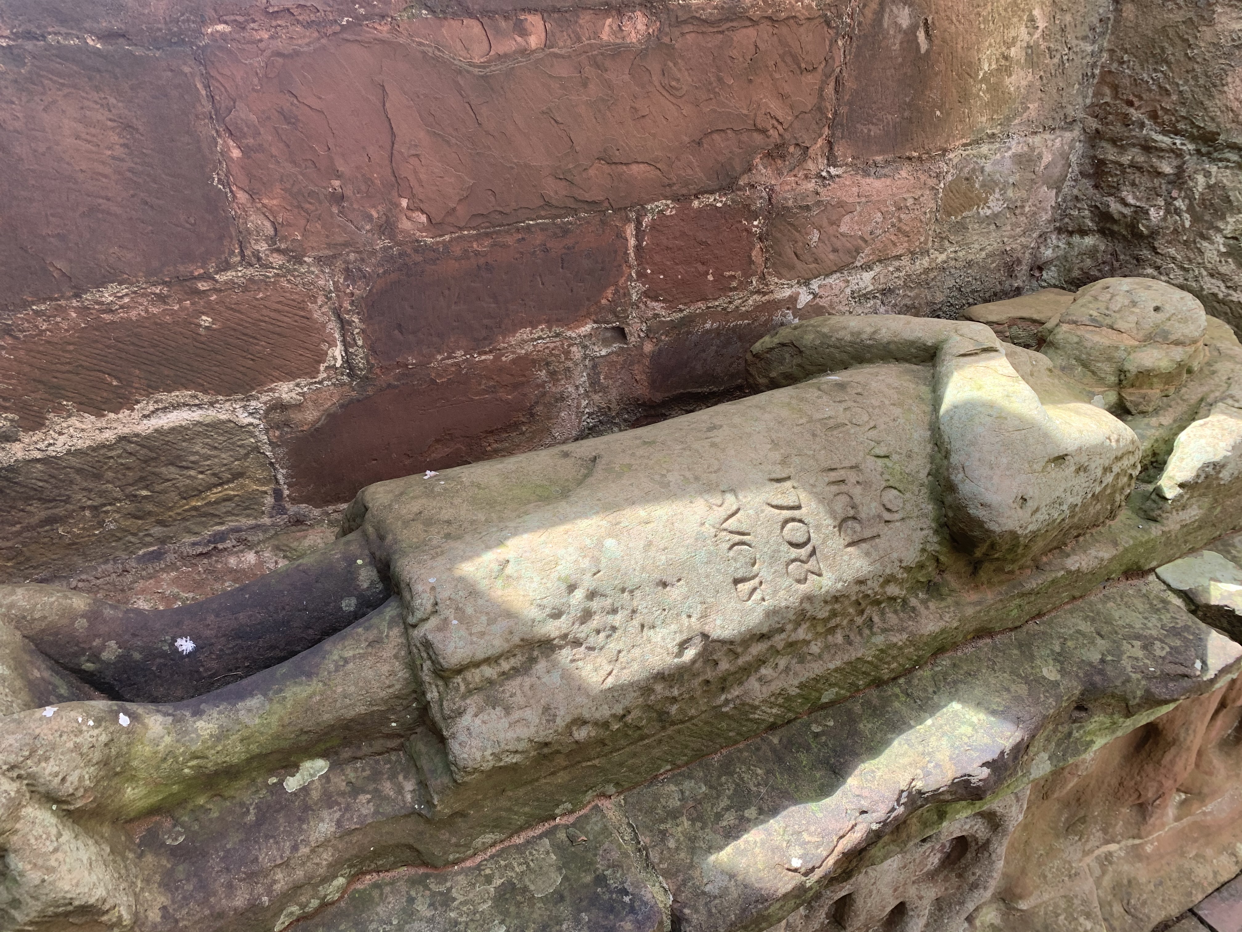
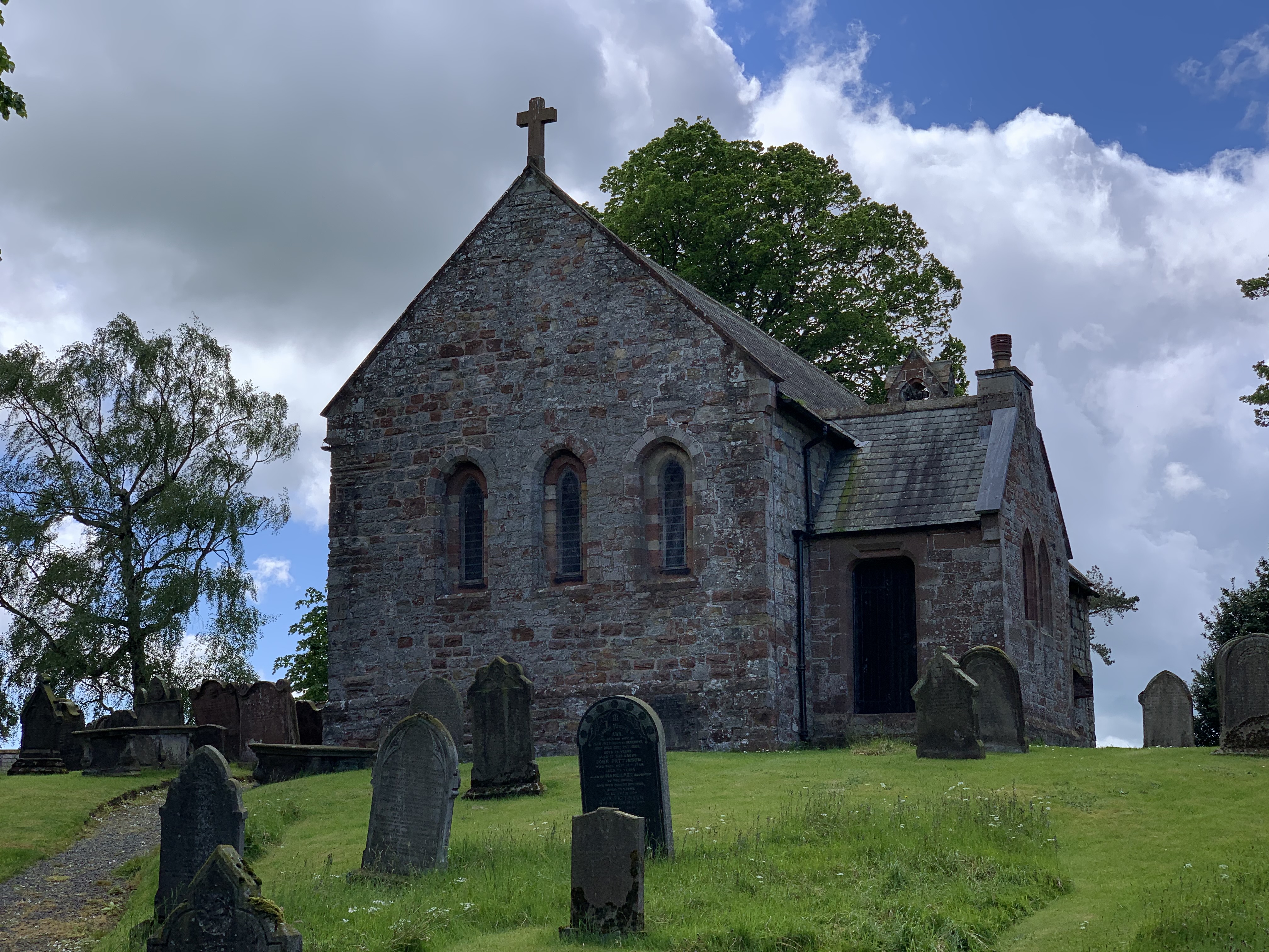
Awakening early and at the recommendation of our host, I walk a short distance over to the local place of worship, Saint Mungo's Church of Simonburn. The structure is surrounded by a cemetery of ancient looking headstones and itself, appears to be a hod-podge of different architectural styles and materials. I'll probably do another short post about this historical church.
Breakfast is absolutely delicious and our hosts couldn't be better. After we pack and fill our bellies, we're given a ride to rejoin the main group and start our hike for the day. It's a little rainy again, but not bad at all.
Today, we're headed to Corbridge, which is a very ancient settlement dating back to even before the Romans. Continuing the pattern, we pass through endless sheep and cow pastures and climb over numerous stone walls. Parts of the trail are once again alongside Hadrian's Wall with the customary turrets and guard towers every so often. One might think that after a couple of days of this it starts to get old and become a routine site, but I'm still finding myself fascinated by these ancient stone structures and the history surrounding them. I stop and read each placard as we pass them.

For lunch, we stop at the Errington Coffee House. I enjoy a pint and something called a "cheese savory sandwich". It's delicious and consists of two slices of bread with a mixture in between that resembles coleslaw with a heavy dose of shredded cheddar cheese mixed in. Everyone in the group seems to enjoy their meal. From here, we have to leave the official path and walk about a mile and a half to our accommodations for the night at the Angel of Corbridge, which is a small hotel.Along the way though, we pass through the ancient Roman city of Corbridge, which is quite extensive. The ruins of many buildings remain for us to examine and walk through and the museum houses some amazing everyday items that have been recovered from the site by archaeologists over the years. While most of the sites we have visited were military in nature, this is just a normal town where Roman citizens went about their daily life in the north of the empire.

Arriving at the hotel, we make our way to our respective rooms. I decide to shower before dinner and it feels so very good. After I dry the hot water off and dress, I head down to the bar where several members of my group are already getting a head start on pints. I join the fun, but before long we're told our table is ready and we shuffle into a large dining room, which is set up much like a board of directors meeting room, with a gigantic oval table surrounded by twenty or so chairs. As I enter, I note a sign at the entrance wishing me a happy birthday. I failed to mentioned that today is my birthday and it seems my hiking companions remembered. It's a nice gesture and I appreciate it.

For dinner, I start with a lamb-sausage Scotch egg, which most of my comrades chose to order after they heard me order the first one. It's delicious and served with a tomato-harissa sauce, which goes perfectly with it. For my entree, I enjoy a pan-seared halibut along with a plethora of vegetables and a potato gratin. It's a fine meal and I'm pretty full. That's not the end of it though.
As everyone finishes their meal, the servers carry in a pair of birthday cakes (one yellow and one chocolate) complete with candles and place them before me as the group sings Happy Birthday to me. I feel a little embarrassed, but it's amazing that they thought of this and went through so much trouble for me. It feels good and I can't thank them enough for organizing this little surprise. We enjoy cake and great conversation as the evening winds down. After hiking 14.2 miles today, this fabulous meal and the surprise birthday cake, I'm very ready for bed. It's been a wonderful day. With only two days of hiking remaining, our total is up to 83.5 miles.
Day 7
The next to last day of our trek begins early, as this is going to be a big mileage day. Instead of a full English breakfast today, I opt for an eggs benedict with smoked salmon instead of the customary ham. It's delicious as most of the food has been along our trip. Once we finish breakfast, we catch a ride back up to the Errington Coffee House where we left the trail yesterday to pick up near where we left off.
While there are a few sections of wall to see today, most of our path actually runs parallel to a modern road built atop the remains of Hadrian's Wall. Today is mostly flat with just a single hill to climb. We end up walking through yet more pastures and dodging even more sheep piles, but I'm still really enjoying myself. Especially after last night's surprise, I feel great. Even with the better part of a hundred miles over the last few days weighing on my knees and feet, my body is ready for more.We agree to stop at a famous pub along the route known as the Robin Hood Inn. I pop in first and enjoy a pint of cask ale. There's just something about being able to hike a few miles and then having a nice beer before continuing the hike that really appeals to me. My companions join me soon after, but my feet seem to want to move today and after finishing my drink, I tell them I'm going to continue on and will see them at the next stop.
As I leave the front of the pub, I scan for where to pick up the trail. I see a well worn path alongside the road, but I'm unsure if that's right or not. I go ahead and begin that way, but soon after realize that the actual path is on the northern side of the vallum (the deep ditch that was dug beside Hadrian's Wall and that I have to cut through a row of bushes and a mass of stinging nettles to get to it. I find a spot where someone has obviously done the same thing and choose this spot to return to the trail.

From here, it's smooth sailing as we pass over rolling hills and beautiful poppy fields on our way to Three Tuns Pub, where I stop for yet another pint and to await my peers to catch up. It's lunch time and decide to stop for an extended period and enjoy a meal. I do finish before most of the others though and anxious to get rolling continue the hike. Originally, we were going to stop here for the evening, but decided to go a little further. We're getting a ride to our hotel from our stopping point and it was a simple matter of calling to make the change.Now, we are going to end the hike at the Big Lamp Brewery, which has a fabulous outdoor seating area. One of my companions and I arrive first and after grabbing a pint, secure a couple of picnic tables for our group to sit once they arrive. As we enjoy our ale and relax our legs and feet, we observe a number of young children playing in the courtyard while their parents look on and enjoy their own beverages. It's really pleasant scene.
We have some time to burn and as others from our group begin to arrive, we talk about tomorrow this being our last day on the trail and all of the miles we've traveled by foot. Unfortunately, another member of our group had to drop out this afternoon as she was experience some swelling in her knee. She took a cab into Newcastle and will meet us for dinner and drinks. She's just done with the actual hiking portion it seems.
The final four of our group arrive just in time for our shuttles to drive us a few miles into Newcastle to the Hotel Indigo, which will be our home for the next two evenings. We'll get a ride back to this spot tomorrow morning. Once at the hotel, we shower and then explore the city a bit before dinner. It's been along day and I'm ready for bed. Mileage for today as about 18.8 bringing my total to 102.3 miles for the trip so far with a single day remaining.
Day 8
The final day of our epic trek across the island of Great Britain begins with a hearty breakfast followed by a return ride to the Big Lamp Brewery, where we pick up where we left off. Today, will be once again almost entirely road walking, as we enter the outskirts of the large city of Newcastle.
As we enter the city proper, the path takes along the River Tyne and follows a beautiful constructed river walk area, where families enjoy some outdoor time. The tide is out once again and so the river area is mostly a mud flat with one deeper channel out in the center where boats can continue to traverse. We pass a few other hikers with packs on and ask if they are finishing today, to which they give an enthusiastic "yes". I must say that as much as I have enjoyed this trip, I am starting to get a little homesick. That's nothing a good ale can't help with though.
Luckily, there are a number of pubs along the river walk and we stop at one called the Quayside with a large outdoor seating area. I order a couple of pints and have an American style burger for lunch. It's the best burger I've had in England, but it's also the only burger I've had in England. It's adequate, but as my comrades start to take off, I try to finish up and head on myself.
As we depart, we see a conspicuous gentleman wearing centurion armor, complete with a shield and pilum. We stop to chat with him for a moment. He's an Aussie and has walked the entire path (just as we have) in full Roman regalia. It's a unique twist on the hike. I'm not sure I would want to do it, but I have the utmost respect for his choice.
There are a dizzying number of bridges across the Tyne here in Newcastle and we pass by at least a dozen as we continue through the city on our way to Wallsend. Due to my delay finishing my burger, the group has gotten a little ahead of me and I bump up my pace to catch back up. According to my GPS app, I'm walking about 4.2 mph right now. I never do see the group, but a little while later get a message that they decided to stop at another pub. I'm a bit jealous, but as I'm only a couple of miles from the end now, I decide to push on and finish this epic quest. The last part of the path continues to follow the river, but through an old industrial section that is somewhat run down. In the mud below me, I see the spine and ribs of an old wooden ship that must have sunk here many years ago and rotted away. Graffiti paints the concrete walls of the walkway and I find myself head down continuing at this quick pace ready for the hike to be over with.

Nearing the end, I stop to visit the fragmented remains of another Roman bath house along the river. This one has very little remaining though, unlike the previous one I was able to walk through. There is also a section of the wall jutting out from a hillside overlooking the path. Eventually, I see the sign indicating the end of Hadrian's Wall Path. It's placed just before the entrance into another museum based on the Roman fort called Segundum. The museum his home to a number of recovered artifacts, but seems to serve as more of a gift shop than a museum. I do purchase a few items for my family back home and then take a combination of the lift and the stairs to an observation tower overlooking what remains of Segundum.

There are no structures at all still standing and only the ground-level foundations can be seen from up here. The major difference between this area and the others we've seen is the fact that this ruin is in the middle of a major metropolitan area, Newcastle, whereas the others were in very rural areas. More people generally equates to less preservation. It's still an interesting site to see though.
I head off to a local pub, where some of my comrades join me and we enjoy a pint before taking the metro back to the hotel. Today, I hiked about 13.2 miles. My total for the entire Hadrian's Wall Path is showing as 115.5 miles. Though the official path is listed as 84 miles, I did take a lot of detours to visit various sites along the way. I'm not sure my GPS is completely correct, but I'll just go with it.Overall, this has been a once in a lifetime adventure that I would recommend to anyone. The idea of hiking pub to pub and stopping for a pint every few miles sounds great in theory and is even better in practice. The rich history of this land and the warmth of the people that live here now has made this a great experience. Not to mention the terrific comradery among my own group. I can't imagine a better vacation than this. I'll take a train back to London tomorrow and then fly back to Atlanta the day after that, but that should give me some time to explore the United Kingdom's capital city and that it is the Queen's Platinum Jubilee celebration should just make it all the better. Cheerio!