Saturday, December 12, 2015

Donner Snow Park with REI (Nevada County, California)

Over the past couple of years, I have made an attempt to get something of a formal education in outdoor skills. REI's Outdoor School, among other organizations, has been very helpful in this regard. Today, I am attending a Winter Survival course hosted by REI a the Donner Snow Park, along the Pacific Crest Trail and just East of Boreal Ski Resort. 

Arriving a few minutes early, I suit up with my snow-shoes and plenty of layers. The day is beautiful and we have about two feet of powder on the local hills. Not enough to brag about, but it is still early in the season. The class today will consist of just one other student and the instructor, both of which are pleasant fellows.


We head south on, what during the normal season, would be the PCT in our snow-shoes, setting a pretty good pace. To the north, Castle Peak overlooks our training with interest. During the day, we cover essentials like gear, navigation, water acquisition and shelter building. I had never considered using the snow itself as such an integral part of a shelter, but it makes perfect sense. Overall, the time passed pretty quickly. I didn't track it, but would estimate we traveled about 2.5 miles via snow-shoe. It was a good day.

Sunday, November 22, 2015

Huffaker Hills (Washoe Valley, Nevada)


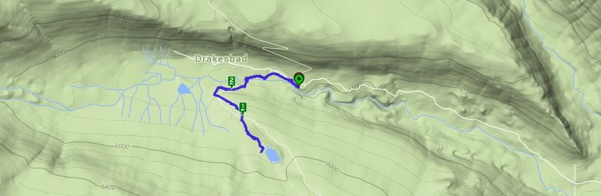
Because of its close proximity to my home, I frequently spend a few hours hiking the familiar trails of Huffaker Hills on the eastern side of Reno. The drive from my home is only about 5 minutes and while I really enjoy seeing new landscapes, sometimes you just need a quick place to put some miles in. Huffaker Hills offers just that, along with some nice views and decent inclines. Rattlesnake Mountain in particular is a nice steep climb, though short, to a peak overlooking Reno-proper. 

Hitting the trail head early this chilly Sunday morning, I head out NW route through the park, which drops down to the lowest point and then climbs back up towards the Twin Peaks. The climb to twin peaks can be a little challenging for those out of shape, but the rewards is worth it. Reaching the top of Southern Peak, which is where the commonly traveled trail leads, one finds the stone fort built for unknown reasons by unknown hands. It does make a nice windbreak on a windy day though.


While I won't make my way across the saddle and up the next-most peak to the south, I have visited it many times before and upon my first visit, was amazed to see a large rock piling in the shape of a stylized big-horn ram. The construct is large, with dimensions approximately 40' by 50', and only visible from the mountaintop or above. Pretty cool. In fact, among my friends we have names this particular peak Big Horn Mountain.

Returning to the parking lot, I decide to summit Rattlesnake Mountain, which sets on across and above the other side of Alexander Lake Road. The climb is always steep, but is forgiving at only about a mile long. Upon reaching the top, one is rewarded with a fantastic view of the Reno/Tahoe airport and all of Reno laid out before me. 


This was intended to just be a quick training hike and it succeeded in that. At a little over 3.5 miles for the morning, I will consider it a mile work out and get on with the rest of my day. I'm sure I will return many more times in the future.


Oh, I must not forget the wild mustangs. Though they rarely wander directly into the park itself, they frequent the nearby hills to the east and this day is no different. On my way out, I encounter a few of the gentle beasts. I understand that many people dislike these horses running wild and ruining their lawns, but it's difficult for me to imagine doing harm to these beautiful creatures.

Sunday, November 1, 2015

Petrified Forest (Sonoma County, California)


Petrified trees have always interested me. Seeing these living things transformed into stone to last through the ages is a pretty awesome thought. When I recently learned of a magnificent example of a petrified forest in Sonoma County, I had to make the trip and traveling through wine country to get there was just a little bonus.

Passing through a small gift shop attached to the privately held lands starts the tour. A nice trail leads through the woods and signage offers details on the history of the area and the specimens, which Iearn are the largest petrified trees ever discovered. The vast majority of the numerous examples here are an extent subspecies of the giant sequoia, and the stone-rendered trunks of these gargantuan trees give testament to the relationship.


Strolling the entire maintained path, I am able to see about a dozen examples. Some are nearly intact tree trunks that have been excavated, while others have broken into sections over the ages. While I've seen petrified trees before, these specimens are substantially better preserved, larger, and more densely packed. It's a bit of a drive to get over here, but the mile-ish trail through this ancient petrified forest was definitely worth the trip.

Sunday, October 25, 2015

Chimney Beach (Washoe County, Nevada)


I've spent a lot of time over the weekend studying for some upcoming certification tests. With all of that staring at the computer screen and at reference books, I figured some fresh air would do me some good. As the clouds have cleared and a nice breeze is blowing in from the west, I thought I would take the opportunity to visit Chimney Beach on the eastern shore of Lake Tahoe. It's only thirty-ish minute drive up the mountain.

The trail head is marked by a doughnut shaped parking lot a few miles south of Sand Harbor. The trail leads steadily down towards the lake, with only a single switchback to break up the elevation. While the trail is relatively easy to follow, there are a couple of forks leading to other nearby destinations.


Chimney Beach itself is named for a stone hearth and chimney that mark what was most likely a wealthy residence in years past. Many Californians built homes on the eastern side of the lake as secluded get-aways. Yet, all that remains of those times are mostly ruins. Even without the abode though, this quiet beach is peaceful. As the sun moves low in the sky and the cool wind blows in endless waves of the blue alpine waters, I feel relaxed here. The hike itself is just over a mile round trip; not much of a hike, but still a nice way to spend an hour or so.

Friday, October 23, 2015

Maggie's Peaks (El Dorado County, California)


While in the area of Emerald Bay, I thought I would take the opportunity to get a few miles in. Though the season is getting a little late, the snows have yet to take hold of the peaks around Lake Tahoe and so, a hiking I shall go.

Maggie's Peak rises above Emerald Bay and Cascade Lake, offering spectacular of views of both, as well as into Desolation Wilderness. The trail starts at the Bayview Campground and traverses the southeastern slope of the mountain. The going is a little steep at first, as it bobs and weaves around a number of the large granite boulders that define the landscape of the Sierra Nevada. 


Following a tiny sliver of a creek into the forest, the trail eventually reaches Granite Lake, a small alpine lake sunken in a small valley above and between Emerald Bay and Cascade Lake. I take a few minutes to wander out onto some rocks and logs to take in the whole experience of the lake. I love these little secluded spectacles; so peaceful, so tranquil.


Hitting the trail again, I make my way towards the saddle between Maggie's Peaks. The trail is even steeper here, but it feels good to stretch my legs a bit. Switchbacks make the grade a bit more manageable, but it's still slow going. I finally reach the saddle and have to decide where to go first. The northern peak of the two is more interesting to me, as it should afford me great views of Emerald Bay and Fanette Island Below.

There is no trail, but that won't deter me. I start bouldering over the large slabs of granite that are between me and the peak, about a third of a mile ahead. The way is treacherous and the going is slow, but I keep trying to see my next steps. Eventually though, I loose site of any safe path to the peak and decide to turn back. I make my way back the way I came, climbing and pulling myself of the granite.


Reaching the saddle again, I decide to attempt to climb up the southern of the two peaks. The trail wraps around the peak and eventually, I go off-trail and head straight up the slope towards the summit. The going is steep, but less littered with boulders. Finally reaching the top, I am forced to do a little more boulder, but it's not nearly as dangerous as the path to the other peak. I take a few minutes to take in the majestic vista from the top. To the south, I can see the sun beams shimmering off of Azure Lake. 


The view of Lake Tahoe and the city of South Lake Tahoe, CA is spectacular from up here. It's also obvious that Lake Tahoe is low, as the sandy beaches extend much further than normal. After a little stay, I begin making my way back down the mountain. As expected the way down is much faster than the way up, though my knee does start bothering me slightly. Luckily, the trail is short. In total, I put in about 5.3 miles on this trail, including all of the bouldering and bushwhacking, but the views make it well worth the effort.


Taylor Creek (El Dorado County, California)


Each year in the early fall, the kokanee salmon start their spawning run from the cold waters of Lake Tahoe and make their way up Taylor Creek. Normally, this happens around the first week of October, but for some reason the salmon have been delayed this year. Over the past few weeks, I have made a couple of stops to see the run, but found either no or very few fish. Today, their numbers were a little better, but still not in the vast quantities I have seen in some previous years. Taylor Creek is a bastion for wildlife, even with the salmon being so late. 


From the visitor center, the Rainbow Trail weaves in and around the creek and offers some spectacular views of the creek, the wooded marsh surrounding the area, and of course, the wildlife that makes their home here. From the salmon, to a plethora of water fowl, to bears, to beavers, this area has a rich population.


On my stroll down the short trail, I see a few salmon schools in the clear water of the creek. There are also a number of ducks and other birds swimming and soaring on and around the cool flowing waters. While I don't see any bears this trip (probably due to the low salmon numbers at present), I do see sign of beaver constructions. The busy creatures have constructed a dam at some point, but the waters have broken through, possibly with intervention of the rangers. There area also a number of trees that have obviously been gnawed down by the mammalian engineers.

It's a little disappointing to see so few fish, but a nice stroll through the woods and the opportunity to see so much wild life makes the trip a success.

Sunday, October 11, 2015

Pyramid Peak (El Dorado County, California)


High above lake Aloha in the Desolation Wilderness area, rises Pyramid Peak. My backpacking trip through the wilderness area earlier this summer offered some amazing views from below, but when my friend Van inquired about hiking to the summit today, I had to take advantage of seeing the vistas from the top. 

Pyramid Peak sits at 9,985 feet above sea level and the approach from Rocky Canyon is brutal with 4100 feet of elevation gain over a short 3.3 miles. A guide that Van sends me indicates 'The Rocky Canyon route to the summit of Pyramid Peak is probably the greatest vertical climb in the Tahoe Sierra.' Not being ones to shy away from a challenge, this is the route we decided to take of course. We met at a small pull off on highway 50 right about 7:00 AM. It was Van, myself and Van's friend Mark, whom I was meeting for the first time. Not finding a clear trail head, we bushwhacked up a steep hill through manzanitas for the first half-mile or so before finally stumbling across the actual trail.

The trail is fairly well maintained, but obviously does not see a lot of traffic. However, the steepness of the trail is harsh and it doesn't ever seem to let up. We make our up the trail, occasionally loosing it, only to re-find it a short time later. As the trail passes through a number of rock out-croppings and in some cases, through dense growth it continues it's drive up the mountainside.


Finally, reaching an area with much less vegetation, we begin what was probably the steepest part of the journey, and with the sun now well overhead, it made for a pretty warm day. We push on though, until finally reaching the base of what has to be one of the largest piles of granite boulders I have ever seen. This essentially what makes up the highest part of the mountain and to get to the top, we must scramble up 500 feet or so of these large stones. 


Van and I carefully make our way up, while Mark lags a bit behind. He says he's a little out of his element and so, we try to give him plenty of time and guidance to make it up at his own pace. The climb itself is fun, but a bit tiring. Finally though, we reach the summit and discover what may be some of the best views in all of Tahoe. From up here we can see so many of the lakes in or near Desolation Wilderness. Lake Aloha is directly below us, but in the distance we can see Gilmore Lake, Lake of the Woods, Upper Echo Lake, Tamarack Lake, Heather Lake, Susie Lake and that's just looking North. 


In addition to the amazing views, we discover an ammunition box chained to a large boulder with a collection of journal entries from those that have climbed the mountain before us. Van and I each leave a word of wisdom and sign the book. My own thought was that 'Whatever your problem, this is the solution!', which I believe to be true for myself and many others. Being out here among the mountains gives me a since of clarity that I struggle to find most other places. This is my sanctuary; this is my church.


The climb down is equally challenging and as I hop from boulder to boulder, my bad knee starts feeling each and every impact. We make it down and start our way down the mountain, taking in some amazing views along the way, including Lover's Leap in the distance. Eventually, we reach a fork in the trail and learn where we went wrong on the way in. The trail does actually go all the way to highway and literally drops one out only about 50 yards from where we started bushwhacking. That said though, it is unmarked and probably impossible to see from below. All in all, it was a great hike of roughly 7.4 miles, but that elevation gain on the way up and the impact of that same elevation loss on the way down made it an extremely challenging adventure. 


Sunday, September 27, 2015

Clouds Rest (Yosemite National Park, California)


For most of the summer, I have been trying to find another weekend to get down to Yosemite and hike to the lofty Clouds Rest, which overlooks Yosemite Valley from the East. I've read the hike is challenging, but not in the same league as Half Dome. I've also read that the final approach is a narrow strip of crumbly granite with 1000 foot drop offs on either side. All of this proved to be true. In addition to the challenge of another hike, I needed to consider some professional opportunities that have become available to me. What better place to consider job offers than 1500 feet above the most scenic valley on Earth.

Getting an early start, I made the drive to the park. I love living only a couple of ours from Yosemite. It means that I can do day trips without to much of a hardship. This time of year, its a little brisk in the high country of the park in the early morning hours, but it wasn't too bad today. I would guess it was about 60 when I hit the trail at the Sunrise trail head.

The first section is well traveled and quite easy, as it passes through the evergreen forest. I note that in my research of the trail, two early water crossings were mentioned. In this, the 6th(?) year of the drought, there was no water to be found to pose any difficulties. 

The trail then takes a turn and begins climbing over a granite spine running parallel to highway 120. The path is steep and filled with granite steps that kill the knees, but luckily, my bad one feels strong this morning. I push my pace pretty hard during these early miles, as I'm hoping to complete the 14.1 mile trail in about five hours.


After crossing over the spine and dropping back down, the trail becomes tame for another mile or two, before starting the final push up towards the destination, Clouds Rest. As I get near the top, I notice a couple standing at the beginning of the narrow path and inquire as to their condition. The nice lady explains that she is a little scared of continuing on any further. I can't say I blame her as I gaze ahead at the climb I'm about to make. Several overlapping slabs of granite make for a rag-tag stair case leading to the top. On either side, I can see the tree-painted valleys far below with a sheer wall of steep granite between me an them. I push forward.


From the top, the view is amazing as so often reported. I can see Half Dome, Tenaya Lake, the corner of El Capitan. In all directions, I can see for miles and miles. It offers me a little time and a great venue to think about my future job prospects and the fact that it may be the time to make a change. After taking a few snapshots and chatting with some of my fellow hikers, I make a hasty retreat, still trying to complete the trail in my planned time frame.


The way down is pretty uneventful, but I do manage to take a wrong turn and only notice it when I see the first of the Sunrise Lakes, which I didn't remember seeing on the way up. All in all, it only added about a mile to my overall hike, which was still less than the described distance. In total, I hiked just over 13 miles. I think the final markers are a bit off, but it was a still a fantastic high nonetheless.

Sunday, September 20, 2015

Mount Judah Loop (Nevada County, California)


It's a lazy kind of Sunday, but even so, I wanted to get some trail miles in. Originally, I had considered driving down to Yosemite today and hiking up to Clouds Rest, but drive time + hike time would have resulted in a 12-14 hour day, and I just wasn't feeling like that today. Instead, I decided to hike up to a small peak overlooking Donner Lake just across the Nevada/California border. 


As I reached the trail head, a group of 20-ish teenagers and a adult guide were starting up the trail, but the guide graciously allowed me to skip past them. It's probably a good thing. While I probably have 25-ish years on those kids, I hike enough and am currently in good enough shape to maintain a pretty quick pace on the trail. The trail itself is pretty easy as a number of switchbacks make their way over a crumble of granite. Eventually, the trail enters the forest and diverges from the PCT, which it had been following to this point.

This is a popular trail and I encounter a number of other very friendly hikers out today. All of them, offer to allow me to pass as they recognize my pace is significantly faster than theirs. Eventually, I reach a point where the trail splits with one branch going out to Donner Peak and the other continuing to Mount Judah. I head out part of the way to Donner Peak and take a couple of snapshots, but as I don't see a clear path to Donner Peak and don't want to take the time to search for it, I head back and shoot for Mount Judah.


A short time later, I arrive at the top of the barren Mount Judah, which has a terrific vista of Donner Lake and most of this particular part of the Sierra Nevada. I take a couple of minutes to take in the view, including a great view of Donner Lake, and then start back toward the trail head. However, I encounter a couple of gentlemen I had passed earlier and after a little discussion with them, I decide to try to continue the loop around back to the PCT, instead of coming back exactly the way I had come. 


After a about a mile, the loop trail is clear and I see that I will rejoin the PCT and dump out at the trail head I came in on. It has been a quick hike, but I never miss a chance to get out here and take in the fresh air. It helps me clear my head and get back to reality. In total, the trail was only about 5 3/4 miles, but my pace was fast and it was enough to get the blood flowing a little bit. It would have been a great hike to have some company on, but I survive on my own.


Sunday, September 13, 2015

Angels Landing (Zion National Park, Utah)


Several months ago, I was lucky enough to get camping reservations for Watchman Campground in Zion National Park. While I visited the park a few years ago with my friend Nick, I was unable to knock out the premier hike of the park, Angels Landing. That was my goal on this trip. Angels Landing is a precarious perch of a wedge sticking out into Zion Canyon with 1200 foot drop offs on either side of the narrow trail. Seems like great adventure to me. 

As the day of the trip approached, a few plans changed, but I decided to go forward with the quick trip. With some of things going on in my life at present, I was desperately in need of some time to get my head clear and a death-defying climb seemed a great place to do just that. Waking early on Saturday morning, I started the long trek from Reno to Zion National Park in Southwestern Utah. It's a nine hour drive, but I like driving. It gives me time to think. The trip is perhaps the greatest expression of the beautiful desolation that is the great state of Nevada. From Fallon to Tonopah, down the Extraterrestrial Highway, and finally entering into the states of Arizona and Utah, before arriving at the park. 

Parking the jeep at my reserved campsite, I quickly set up my tent and begin thinking about what I want to do next. As it is mid-afternoon, I'm not really considering any hikes, but food is at the forefront of my thoughts. The tourist town of Springdale serves as the entrance to the park and provides a number of dining and drinking options. A foot bridge crosses the Virgin River from the park into town. The last time I visited the park, I found a great place called Zion Pizza and Noodle. I finally decide to give it a second try, but to my dismay, they don't reopen for dinner for another 45 minutes. No worries - a saloon across the street seems like a perfect place to spend that short duration. Oddly, the bartender tells me that Utah law prevents the purchase of alcohol without the purchase of food. I order some french fries, which meet the requirement and then enjoy a sampler of some of the local craft brews. A short time later, I wonder back across the street and have a magnificent Mediterranean vegetarian pizza for dinner. The remainder of the evening involves me finishing off a growler that I brought with me and falling asleep under a cool, calming breeze. 


I wake early and decide that it's going to be a hot day. Hitting the exposed trail early to avoid the heat seems like a wise plan, and so, I make my way to the shuttle stop by 7:30. Beyond the Zion Lodge, only shuttles and park-authorized vehicles are allowed. This is the NPS's attempt to help preserve the pristine nature of the valley. Arriving at the Grotto shuttle stop, I depart the bus, eat a snack, and start up the path. The first part of the trail is easy and I'm greeted by a flock of wild turkeys looking for food along well-traveled walkway.

The trail soon starts up a series of switchbacks as it climbs the side of the canyon and enters a the crag between the canyon wall and the wedge that is Angels Landing. It's pretty steep, but I feel that I'm in very good shape right now and so, it wasn't terribly challenging. However, reaching the top of the canyon, the true test of the hike is about to begin - the chains! 


The remaining third of a mile or so to the final destination is challenging to say the least and very far from horizontal. The 'trail' such as it is winds and weaves its way around and up the sandstone formations. Heavy chains are placed nearly the entire distance and for inexperienced climbers, such as myself, are a near necessity to keep from falling. Worse, there is only one narrow 'path' through the obstacles, and so, passing hikers going in the opposite direction poses significant logistical challenges in places. At some points the trial is only about two feet wide with steep 1200 foot drop-offs on either side. As I make my way up this deadly course, my mind wanders to my personal issues and thoughts of falling. If I figure out nothing else on this trip, I did reaffirm that no problems in life are so bad that one should ever want to end it. I grip the chains tightly and finish the climb to the top.


Viewing Zion Canyon from this point is magnificent. I think this must be one of the great view points on the face of the Earth. I can see miles and miles down the Virgin River, which with the slow march of time and erosion is responsible for carving this place. I think of all of the other divine views of other parks and natural places that I have been fortunate enough to be able to absorb over the last several years. I am truly blessed.

I don't linger long, as I'm concerned that making my way down the chains will be more difficult than coming up. I was correct. Finding gaps in the uphill traffic is difficult and the polished tree-roots and dusty sandstone make for poor foot holds. The going is slow, but I eventually reach the end of the chains and then start down the foot trail. My knee is bum knee is starting to act up a bit and I feel it with each impact going down the switchbacks. 


Eventually, I reach the bottom. Total mileage is a meager 6.5 miles, but the danger level of the trail definitely puts it high on my list of accomplishments. Compared to the cables of Half Dome, I this is far more dangerous. At least with Half Dome, you can see where you are going. Not so here, as the trail bends and flexes around that the sandstone on that final section. I can't say that I have had any great revelations, but perhaps a renewed lust for life is a good foundation to build other things on. Not being able to see the future is a cruel reality and we never what tomorrow brings. Perhaps, the greatest lesson is to always push forward, to reach for those things that bring you happiness, and to be true to yourself.

Sunday, August 16, 2015

Dardanelles Half-Loop . . . and then Some (Tuolumne County, California)


My intention was to hike to Clouds Rest in Yosemite today, but as of about eleven o'clock last night, Tioga Pass (CA 120) was closed due to an encroaching wildfire. With no easy way to get into the park, I had to change my plans. My friend Bill was along for the ride and we met about five in the morning to decide where to put some miles in. We decided on the Dardanelles Loop hike near Sonora Pass. Our intention was for a seven or so mile hike, but it turned out to be much, much more.

The Dardanelles, from my research, are the remains of an ancient volcanic rock formation, which has eroded away and left only some high buttes or mesas. From the pictures I have seen, they are striking as they tower over the surrounding landscape. It's a hike that has been on my list for a year or so. I was happy for a chance to give it a go.

Making our way up the long rough gravel forest service road, we arrive at the County Line Trail Head. As we park and begin getting our day packs set up, we are approached by a group of guys backpackers with desperate looks on their faces. They have been backpacking through the area, but now need to get water to another band of their large group that has been stranded on the other side of a river, which will require them to swim across. They politely and understanding ask for our help, which would involve driving one member around from Sonora Pass, where we currently are, to Ebbets Pass to the North. Bill and I talk it over and agree to assist, but explain that we had driven three hours to get here and want to get our hike in first. Completely sympathetic they are more than happy to let us get our seven miles in before giving them the ride they need. 

We hit the trail and are almost immediately crossing paths with several other backpackers, including several groups of young teenagers with their adult guides. I haven't checked, but I think this part of the trial may be shared with the PCT, which would explain the volume of foot traffic. 


Making our way down some dusty steps, we begin to catch our first site of the Dardenelles West towering over us. It's quite a site, but with the sun in our eyes, the pictures aren't the best. As we make our way on around the butte, we find better and better views, including some neat little grassy marshes.


By this point, I had fully expected to see our turn to cross over the saddle between the West and North Buttes, but even watching for the turn keenly doesn't supply a path. We continue on and arrive at the nearly dry Spicer Meadow Reservoir. From the looks of things, this was at one time a very large body of water, but all we see before us is a dry lake bed with a small puddle at one end. This drought has been so tough on the land.


Keeping Dardenelle West in our sites as best as we can, begin circling around Dardnelle North, which gives me some cause for concern, as I believed our trail should have taken a right turn by now. We agree to continue forward on the trail we see, in the hopes that it will circle around eventually. Crossing over a couple of small streams and a foot bridge, we eventually reach a point where we decide that we have missed the turn. We are now almost nine miles in. 


After some discussion, we agree to turn back the way we came, as we have no idea how much further this trail goes before turning back. It's beautiful country, but we have limited food and water, and our seven mile hike will now be at least seventeen miles. Bill and I are both pretty hearty hikers and so, we don't worry, but we do begin making our way back the way we came.

Pushing our pace pretty hard for the first couple of miles on the return trip, my knee begins feeling the impact of a number of granite steps along the trail. Our water supply is also beginning to run dangerously low. The last several miles of the trail are torture as my knee aches with every step and Bill and I both begin to experience dehydration in the hot August sun. A mile or so from the trail head, I get a burst of energy and start pushing my pace. I know I have extra water in the jeep and while it may be hot, its still wet. We finally arrive back at the jeep and chat with the guys we had talked to earlier.

While we had expected to be gone no more than three hours, it turned into more like eight, and in that time, the guys had found other arrangements. They were understanding of our predicament and thank us for our willingness to help them. All in all, we ended up hiking 17.7 miles along this trail. With a little post-hike research, I found that the turn we were supposed to make is unmaintained and by all reports very difficult to find. Ah well, we got our exercise for the day.


Sunday, August 2, 2015

Boiling Springs Lake (Lassen Volcanic National Park, California)


My second and final stop for the day will be Boiling Springs Lake back inside Lassen Volcanic National Park. I first heard of this lake from a documentary film about the Pacific Crest Trail. When I researched it and learned that I had hiked very near the lake a few years ago, I was disappointed that I had not visited it. Since that time, I have intended on a couple of occasions to revisit the area, but until today, had not been able to follow through with those plans. 

Arriving at the PCT trail head near the Drakesbed Ranch, I start the short mile or so trail to the lake. The trail follows the nearby Hot Springs Creek, and seems to have received some nice upgrades since my last visit to the area about five years ago. The boardwalks over the marshes have been rebuilt and a new bridge offers an easy passage over the creek to the south side. As I make my way up hill towards the lake, I'm anxious to see the deadly natural wonder. 

As I see the trees clear, I realize I have arrived. The lake itself looks like something Sauron from Tolkien lore would emerge from to spout evil upon the Earth. It's mint green waters emit a constant steam as they simmer at about 125 degrees. Ample signage warns visitors to stay on the trail and avoid getting near the water, as many people have sustained serious injuries when the brittle ground gave way beneath their feet and exposed them to the hot waters and steam vents below. The lake itself is a bit smaller than I had expected and on the far side, I can see steam vents on the shore. I spend a few minutes looking around before heading back to the parking lot and making my way home. This a very cool site, but echoing the signage, be very careful if you visit - death is only a misstep away.

Subway Cave (Shasta County, California)


After the Carson City Wine Walk on Saturday, I drove up to Lassen Volcanic National Park to camp at the Butte Lake area for the weekend, hoping to get a couple of trails in on Sunday. The camping was uneventful, except for a nice light show generously provided by an encroaching thunderstorm. I awoke early Sunday morning, broke camp and made my way toward my first stop - Subway Cave. 

While I had made a brief stop here a few years ago with my friend Nick, I didn't have the opportunity or equipment to take many pictures. I decided to fix that this time. The cave itself is technically just outside the park's borders and just a hundred or so yards east of the junction of highways 44 and 89. I parked and made my way into the blackness. The cave has always fascinated me with it's size and relatively smooth walls, but as I understand it, this is fairly typical of a lava tube cave, which this is. The darkness, however, is complete. As the entrances to the cave get lost around corners, the light fades into non-existence and the visitor is left with nothing but true blackness. Thankfully, this time I brought a head-lamp. The cave tour itself is only a few hundred yards, but towards the end, I am taken by an area of cave in, where it seems part of the ceiling collapsed into a pile of rubble on the cave floor. I snap a few shots and make my way back to the jeep.