Sunday, February 25, 2018

Red Rocks Canyon - Petroglyph Wall (Clark County, Nevada)


Just a few miles outside of the lights and ceremony of the Las Vegas Strip, shades of red, orange, and white paint the walls of a giant canyon. Red Rocks Canyon National Conservation Area is a local favorite, due to it's beauty and close proximity to the city. I've visited and hiked in the area before, but I only recently learned of a petroglyph panel that decorates a canyon on the western side. 

Taking a little break from the casinos, I drive out through the park and take the very short hike to the petroglyph wall. Tucked behind a tree growing in the shade of the cliff wall, a single panel is visible. With foresight, the park service has put a barrier between the trail and the rock art. Thankfully, it seems to remain unmolested even with the number of daily visitors it must see. It's a fairly basic panel, but it's still nice to finally see it.

Las Vegas Strip (Clark County, Nevada)


Over the years, I've been to Las Vegas numerous times. My work is closely connected with the casinos on the strip (and elsewhere) and often required me to visit Las Vegas. In my travels, I have often walked up and down the strip, usually in a drunken stupor, but I've always thought about walking it as more of an urban hike. Well, today is the day.

As I walk out the main entrance to the Luxor, I'm surprised to feel a cold breeze in my face. This is Las Vegas after all, and even though it's February, I can't help but remember summer visits when the mercury entered the triple digits for multi-week stretches. It's actually refreshing and since I'm hoping to maintain a pretty brisk pace on this "hike", the cool air will keep it bearable. 


I walk a block south in order to get Mandalay Bay in my camera's view, before turning north and heading up the famous Las Vegas Blvd. The strip is a different place during the sunlight hours than it is at night, but the grandeur of the largest resort casinos in the world maintains its majesty in the presence of the bright desert sun above. 

In many ways, this is very much the opposite of the places I most enjoy being. I frequently depart the urban landscape for the peace and tranquility of the forest, the open desert, or some remote mountaintop. I don't mean to imply that walking the strip is not a pleasant contrast, but only that it truly makes me appreciate the great outdoors . . . even more than I usually do.


Between crosswalks and over-street bridges, elevators and escalators, I make my way down the concrete jungle. I pass all of the largest of the resorts, Excalibur, New York New York, MGM Grand, Bellagio, Caesars Palace, Venetian, Planet Hollywood, Treasure Island, and on and on. They glitz and glam seems to never end. 

Finally, getting a view of the Stratosphere, marking the northern end of the strip, I notice the time and decide it's time to head back. In theory, I could stop anywhere and get an uber or cab back to the hotel, but doing so before seeing the end, would seem like cheating. Still, the time is short and I need a shower before leaving the hotel. I was able to get in just over 3.6 miles. It would have been nice to complete the whole 8 miles out and back, but time is short and I have to check out.

Saturday, February 24, 2018

Liberty Bell Arch (Mohave County, Arizona)


I love hiking and backpacking. I cherish the opportunity to be outside, to visit natural and cultural treasures, and to find peace in the great church of the backcountry. With that said, I rarely find myself traveling to new areas, for whatever reason, without getting at least a couple of hikes in. This weekend, a trip to Las Vegas was in order. While the trip was mostly to enjoy the shows and dining experiences of Sin City, I found time to get some miles in while in the area.

This morning, I left my hotel room at the Luxor and drove out past Hoover Dam and into Lake Mead Recreational Area. The target for this hike was Liberty Bell Arch. The trailhead leaves a parking lot just off of the highway. A bridge allows the trail to pass under the highway as it follows a long wash into the red and white hills of the Colorado River basin.


It's very desolate out here, but a few small cacti and yucca poke up from the soil.  As I leave a smoothly carved section of the wash, I note a couple of small tents tucked away in a crevasse. Seems like a decent place to camp . . . unless a quick rainstorm comes through. The trail generally follows the wash, but eventually leaves it to cross over some of the sandstone hills.

As I climb up out of the wash, I note a antique mining cart abandoned on the hillside. Apparently, someone thought there were minerals of value here at some point in the distant past. As I climb over the next ridge, I get my first view of the arch. From this angle, it's impossible to see the negative space, but the shadow it casts, leaves little doubt of the formation's identity.


I continue on around through the desert searching for the best angle and finally find a spot that offers a great view of the natural arch. This arch would seem to be more of a hoodoo formation with a cap still present, but the shape left between the hoodoos is very clearly the liberty bell. It's no wonder how the arch got its name.

After snapping some shots, I head back the way I came. It seems I beat the crowds as the parking lot is starting to fill up. I was able to get about 4.3 miles in on this trail and to see such a cool arch was definitely worth the time and effort.

Sunday, February 18, 2018

Griffith Canyon Petroglyphs (Washoe County, Nevada)


Far out in northern Sparks, another small canyon holds a few petroglyph panels. I recently read about this area and decided to make the quick trip out to explore the area. The pavement yields to gravel and then to washboard dirt, before arriving crossing over the top of the canyon. A second dirt road splits off here and runs parallel to the one I was on and the junction of the two offers a reasonable place to park the jeep.

A few yards ahead of where I parked, a suburban appears to have gotten stuck and abandoned in the area between the two roads. Broken windows and shotgun holes in most of the body panels attests to the remoteness of the area.


I begin to make my way down the canyon. A trail has been worn by past visitors and offers as good as path as any to follow. This top part of the canyon doesn't have any rocks with enough surface area to have been blessed with rock art, but the canyon is still quite beautiful. The light golden grasses cover the hillsides with the occasional section of small stones adding a touch of crimson.

Further into the canyon, it begins to twist and turn before finally coming up on sections with boulders large enough to have panels. I begin scanning the surfaces carefully, but fail to find anything. Then finally, I see the first panel. It only has a couple of figures, but it's a good place to start.


Continuing, I have to do a little scrambling in and around the mostly dry creek bed at the base of the canyon. At one point, I find what I believe are the primary panels of the canyon. The figures include wavy lines, spirals, inter-crossed lines, and other patterns. It's actually a very nice panel and I take time to get several pictures. of it.

Not knowing if there are more petroglyphs beyond, I walk just a bit further until the canyon narrows and moves over a number of dry waterfalls. The pools below the falls though do contain some frozen water. It's not all that cold, but in the shadows of these hills, it must drop below freezing over night. 


Failing to find any more rock art, I turn and make my way back to the jeep following the same path I took into the canyon. Another group of adventurers pull up in a another jeep just as I am taking off my windbreaker. They ask about the trail conditions and the wind in the canyon. I answer their questions and wish them a good hike. Out and back the trail was only about 1.3 miles, but it's always nice to find more rock art near home.

Saturday, February 17, 2018

Kings Canyon Waterfall (Ormsby County, Nevada)


I have lived in Reno for more than fifteen years and only recently did I learn of another waterfall in the Carson City area, just thirty miles to the south. I find this a little funny, as I spend a fair amount of time scouring various sources for interesting places to visit and hike. That said and now that I know about the waterfall, I had to add it to my list to be visited.

As I have some time this morning, I thought I would take the short drive to the western outskirts of the state capitol and check out Kings Canyon Waterfall. As I arrived at the trailhead, I surprised to find a dozen or so cars already there. I guess it shouldn't be that surprising given the falls proximity to a small metropolitan area like Carson City. As I walk up to the trail, I note a sign providing a map of a number of interconnected trails starting from this trailhead. I may have to hike more of them in the future.

The short hike to the falls follows a couple of switchbacks up the hillside and eventually turns a sharp left to enter the narrow rocky canyon. After the turn, waterfall is so close the mist is pretty much spraying the visitor in the face. Flowing over a 30-ish foot moss-covered cliff, the water splits into three flows. The top of each has a small amount of ice, which is a little surprising. It's been pretty warm, but this is February after all.

I carefully step out into the shallow water to get a couple of pictures. The constraints of the canyon prevent me from back up to get a wide shot, but I think they turned out okay. As I'm getting ready to depart, a young family arrives to enjoy a day at the falls. I wish a good day and head back the 0.3 miles or so to the trailhead.

Monday, February 12, 2018

Tule Springs Fossil Beds (Clark County, Nevada)


For my second and final distraction on my way home from Phoenix, I decided to give the recently declared Tule Springs Fossil Beds National Monument a quick exploration. Declared in 2014, but President Obama, the park protects a long, deep desert wash where numerous iceage and pre-iceage fossils were found.

I hike out into the desert and find a "tunnel" through one of the canyon walls. It seems that the area is actually a number of interconnected washes. The white desert earth has likely seen its share of teenage parties, as the abandoned campfires and broken bottles give testament to. While there are no park facilities at this time, hopefully, the standard park regulations will be put in place in the near future and this protected land will be be protected.

Waterfall Trail & Petroglyph Plaza (Maricopa County, Arizona)


After four days and three nights in the backcountry of Saguaro National Park, one would think I would be done with adventure for a bit, but needing to drive from Phoenix to Reno today, I had to have a couple of stops to break up the trip bit.

The first stop was a state park just outside of Phoenix called White Tanks. I had researched this park a bit and chosen a trail that included a dry waterfall and some petroglyphs. I hit the road early and arrived at the park just as it was opening. I'm really surprised at how many facilities this park has for picnickers. I suspect this pace is really popular on warm spring days.

The Waterfall Trail starts at a paved parking lot complete with a restroom and a number of awnings. The trail is paved for much of it's mile-ish distance. As I walk along the trail, I'm impressed by the beauty of this place. It encapsulates all of the various desert terrains I have experienced in the last few days. There are saguaro, joshua trees, desert oaks, prickly pear, and a number of other desert plants.


As I approach the area known as Petroglyph Plaza, I'm amazed at the number of rock art panels here. I knew there were a few, but I didn't expect this quantity. 

Continuing up the trail, I reach the dry waterfall, which must be incredibly impressive during a rain storm. A 100-ish foot shoot comes down the stone cliff and empties into a shallow pool at the end of a slot canyon. The pool still holds some water.


While a short stop, I was still able to get in a nearly 2-mile hike and see a wonderful state park that I was completely unaware of until researching this trip.

Wednesday, February 7, 2018

Leave No Trace Master Educator Course - Douglas Spring to Turkey Creek (Saguaro National Park, Arizona)


About two years ago, I took an overnight course/camping trip to become a Leave No Trace (LNT) Trainer. It was fascinating and though I haven't had the opportunity to put it to a great deal of use, I've always wanted to take my training to the next level and become a LNT Master Educator. I have watched the organization's website for some time waiting for for a good opportunity to take the 5-day course. I finally found a offering of the course that was to take place in Saguaro National Park, near Tucson in the extremely southern side of Arizona. As I haven't been to this park before, it seemed an excellent chance to knock out two birds with one stone.

My road trip was designed to deliver me in Tucson the evening before the start of the course, and while I was able to include several additional adventures during the trip, the focus was always the course and associated backpacking trip in Saguaro.

While I did experience a few delays on the road due to closures, I arrived in Tucson around 8 PM. I took the opportunity to hit a couple of new breweries and relax. I knew the next several days would be quite challenging, both physically and mentally.


Waking early and meeting my fellow students in the lobby of my hotel for a quick breakfast, we quickly loaded our gear into a trailer and ourselves into a van pulling the trailer, which were provided by the host of our class, NOLS. I have taken a couple of classes from NOLS in the past and been very impressed with their organization and mission. I expected these next few days would be no different.

Arriving at NOLS Southwest, we quickly unloaded our gear and jumped into our classes and trip preparation. Gear was issued, food was packed, and backpacks were loaded and checked, all the while our crew of future Master Educators got to know each other. It was a great cross-section of outdoor enthusiasts, including a teacher, a search and rescue captain, a couple of college students, a first-time visitor from Singapore, and a couple of others. In total, twelve students and two instructors would head off the next morning into the backcountry of Saguaro. 

After a full day of learning and preparation, we set up our tents in NOLS back yard (a nice swatch of desert) and wound down, before turning in. We had divide ourselves up into tent/kitchen groups, which we would maintain throughout the trip. I ended up with Matt and Ian, a great couple of guys. The coyotes were howling all night and it got everyone excited for our upcoming adventure.


Day 2

We awoke, made final preparations and finally set off in the van for our trailhead. The morning air was pretty cold, but we knew it would heat up very quickly. The diurnal in a true desert like this can commonly swing fifty to seventy degrees within the same day, and so, I stripped off a layer before our feet started moving.

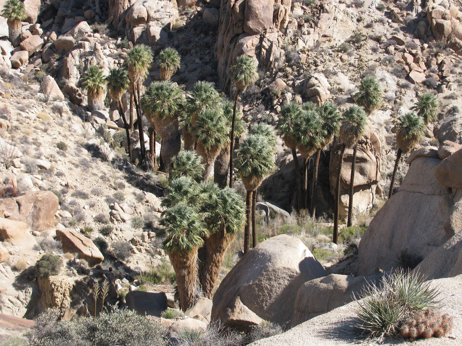
The mighty saguaro cactus dominates the landscape here at these lower elevations. Standing from ground-level to as tall as seventy feet. Very tree-like in it's appearance, the saguaro grows very slowly in this arid environment. From what I'm told, the first branches don't begin go grow off of the main trunk until the plant is at least sixty years old, and branches don't grow from other branches until well over a hundred years old. They really are something to see.

As we make our way up the trail, I note that our friend from Singapore, Tammy, is wearing snow pants and is struggling on this incline. From my earlier conversations with her, I know she is an ultra-runner and so, I know she can handle the physical nature of the trail, but I suspect she was overheating. I suggest she take off the snow pants and switch to something a little cooler. She finds a relatively private place and takes the advice. It seems to make quite a difference and she seems much happier.


Turning onto a short side-trail toward Douglas Springs Waterfall (dry at this time of year). As part of our certification, we must each prepare and present a lesson on an assigned LNT principle or topic. I have already been warned by our instructors, Ashley and Jeff, that I am up first to teach my short course. I have prepared a 20-ish minute lesson concerning the LNT principle of Traveling and Camping on Durable Surfaces. 

I place my fellow students around the base of the dry waterfall and begin my exposition. I tried to incorporate a lot of group discussion and examples into my lesson, but mostly I focused on the idea that the definition of a durable surface is more than a binary decision and many factors must be considered. From the feedback I got both from my fellow students and from my instructors, I think the class went pretty well. Throughout the day, a couple other students would give their presentations. Each was excellent and packed full of information.


Continuing down the trail, we arrive at our campsite for the night, Douglas Springs Campground. There really isn't much to the campground. A total of three primitive sites comprise the entire facility. We decide to use one of the three for our group kitchen and then divide use the other two sites for two tents each. While we prepared our dinner of Mexican rice, vegetables and re-fried beans in a tortilla, we discussed the possibility of skipping the tent and sleeping out, cowboy style. Though it was expected to be cold, we opted to take the freedom road and enjoy the desert sky overhead while we slept instead of the blue and white canvas of our tent. It was well worth it.


Day 3

Rising early and getting some breakfast in, we break camp and start on the trail. Today's hike will gain a few thousand feet of elevation, as we march towards our trail-high point at Manning Camp (7,900'). It will prove to be our most challenging day. As we push through different ecosystems at the different elevations, the vegetation changes dramatically. We have left the saguaro far below and now the terrain starts to look a bit more like my home in the eastern Sierra Nevada with pine needles carpeting the forest floor and ponderosa pines offering shade from the desert sun.

Along the way, more students give their presentations. Again, they are well thought out and professionally delivered. Each discussion offers a chance for points and counter points, and provokes a great deal of head-scratching and pondering. It's very exhilarating to discuss the principles of conservation with such an intelligent and environmentally-concerned group of people.

Arriving at our campsite near dusk, we quickly erected our tents. Manning Campground is much larger than our accommodations last night and allowed us to spread up a great deal more freely. Being at a higher elevation, we expected the night to be colder and hoped the tent would contain some small measure of warmth. 

After putting the tent up, we arranged our small kitchen areas and began cooking dinner. Pasta with red sauce was on the menu this evening. In my personal backpacking trips, I normally use a canister stove and dehydrated meals, but NOLS prefers to use white gas, which allows a much more controllable flame and preparation of fresh food. Our menus were built around this idea and allowed some element of gourmet flare from each of us.


After dinner, we turned in for a much needed rest. Between the long hike, the stimulating discussions, and the standard chores necessary for a campsite, we were all ready for some shut-eye.

Day 4

This day was planned as a down day with no actual further travel. As we awoke, we were glad to be relieved of the duty of breaking camp once again. While the task is not overly burdensome, the idea of untying knots and packing packs in the frigid morning air is always somewhat unpleasant.

We immediately set ourselves to the task of preparing breakfast. As we had additional time due to staying put today, we decided to cooking the often tricky dried hash browns. My tent-mate, Ian, has concerns and comments that he has never been able to turn them to anything but mush. After chatting with our instructor, Ashley, I put her advice to use and start preparing them. The first step is to slightly brown the dried hashbrowns with nothing more than a bit of oil. Next, a small amount of water is added. Just enough to mostly cover the "ha bros", which allows them to rehydrate. Cover the skillet and wait a couple of minutes while the water is absorbed. Finally, add a generous amount of butter to the center of the skillet and allow the now toasted and rehydrated hash browns to saute. After taking our individual portions from the skillet, we added some nice cheddar cheese. Ian comments on how life-changing this meal is for him, lol.

After breakfast, we have a couple of more presentations before heading off for a short day hike. This time, we gladly leave our heavy packs at camp and simply carry the essentials. We hike a mile or so up the trail to Spud Rock, which is an exposed piece of granite atop a small peak. It's incredibly windy up here and in the distance we can see a recently started forest fire in a valley near the Mexican border. We get in position and take a few group photos.


While out without our packs, we have a couple of more discussions and take a few minutes to privately reflect on why each of us loves being out here so much. For me, the great outdoors is my church. It is the place in my life where I feel most connected to the world around me and to something much larger than myself. Though, it's easy to get wrapped up in our daily tasks, be it in town or in the backcountry, we must always remember why we do these things. We must remember the things that make life worth living.

We head back to camp off-trail, purposefully. As this is always part of the outdoor experience, our goal is to do it while leaving as little impact to our surroundings as possible, and to make it even more interesting, the fourteen of us do it in complete silence. We use only gestures and hand signals to communicate.

Back at camp, we begin to prepare dinner. Tonight's special will consist of a curried quinoa. I use some of my chef's flare to add some freshly cut vegetables, peanut butter, and raisins to the dish. Someone comments on my knowledge of Indian cuisine as we enjoy our dinner. I must admit, it is quite delicious. 


As the sun settles in the west, I make my way the hill to bath in the day's final rays of warmth. The winds have only strengthened during dinner and we decide to tie our tent down even closer to the ground in preparation for our coldest night yet. 

Day 5

The gusts must have died down sometime in the early morning and while it probably approached the freezing mark, it is actually quite nice this morning. Today, we hike out of the back country along a steep course. As we have many miles to cover and much to do once we arrive back at NOLS, we hit the trail before first light.

After only an hour or so, we are able to eliminate our headlamps. The trail includes a number of carved steps. It is easily the most challenging terrain we have covered to this point. The Turkey Creek Trail heads southwest out of the park and enters National Forest Lands. 

Higher up, we passed by a small grove of white trunks belonging to a group of quaking aspens. They stand out against the high desert landscape. When we arrive further down the trail, we are able to see the patch of white on the hillside far above us.


As we approach our exit trailhead, we are greeted by some NOLS staff directing us to the van. I love backpacking, but it will be nice to return to civilization and showers!!! In total we have traversed about 23 miles and gained and then lost about 4,000 feet of elevation. In conjunction with all of the learning and teaching done, it made for a packed trip. 

After about an hour-and-a-half drive, we arrive back at headquarters for debrief and graduation. I'm very proud to have completed this trip and course, and to be recognized with my fellow students as Leave No Trace Master Educators. With this certification, we are now empowered to certify other trainers and preach the good word. Congratulations to all of my peers and my gratitude to our wonderful instructors.

Tuesday, February 6, 2018

Blythe Intaglios (Riverside County, California)


It is believed the the giant geoglyphs or intaglios near Blythe, California were created by indigenous peoples between 900 and 1200 C.E. Traveling between Joshua Tree and Saguaro National Parks, it seemed only right to pay these giant rock art forms a visit.

Just a few hundred yards off of US 95, some of the better examples have been fenced off to protect them. These giant forms were scratched into the desert surface for reasons unknown. Human and animal forms, along with a spiral decorate the landscape. To the unsuspecting desert traveler, they might go unnoticed as they are gigantic and must been seen from above to truly appreciate they\re scale.

The first one I examine stretches more than 100 feet to represent a human holding a bow and arrow. It is truly magnificent to see such works survive through the centuries. I do have to wonder though, what was they're purpose. While the forms can be discerned from ground level, it does take some attention. Like the more famous Nazca Lines though, these designs could be far better appreciated from above. This, of course, begs the question of how could the ancient people have appreciated them from above. There are not nearby hillsides or natural features provide such a view. Aliens perhaps? lol, We will likely never know, but we can certainly appreciate these works of art for what they are.

*Image courtesy of Google Images

Lost Palms Oasis (Joshua Tree National Park, California)


For my second hike within Joshua Tree, I had intended to do the Willow Hole Trail, but I looked at the map incorrectly and missed the turn for it. As I don't really have the time to go back, I decided to hike to the Lost Palms Oasis instead. 

This trail is near the southwestern entrance of the park and according to a ranger I briefly spoke with, leads to a seemingly out of place group of palm trees deep down in a desert wash. It seemed interesting and the distance was just about right of the time I had available. 


The trail departs the parking lot and heads straight into the heart of some of the most arid country I have ever seen. Near the trail head, a couple of boulders have had grinding holes worn into them. Presumably, this was used as a mortar in centuries past for the grinding of the tiny desert acorns into a viable food source by and for the local indigenous peoples.


Further along the trail, I encounter a gorgeous garden of cholla cactus. They cover the ground like tailgaters at a Raiders Game, but are much better looking. The gold and brown needles look almost treasure like.

The trail flows up and down through washes and over hills as it pushes me onward toward the distant oasis. For the most part, the it is easy to follow, but in a few places it becomes a bit tricky. I encounter a few other hikers and as always has been my experience, they offer a friendly greeting and encouragement.


Finally reaching a sharp drop off, I see a number of hikers sitting on the rocks and eating their lunches. Far below a number of tall palm trees rise from the desert floor to greet the sun. The trees have propagated up into the far hillside. Though smaller and presumable younger, the palms in this higher area are no less impressive and seemingly out of place.


I take a few minutes to get some pictures, but the whipping wind makes it a bit difficult. Finally turning around, I had back the way I came. Just as I reach the trailhead, I encounter an older couple that catch my attention. He is wearing a t-shirt from Southern Illinois University at Edwardsville (where I went to school) and she has a St. Louis Cardinals cap on her head. These are my people and I have to take a minute to say hello and chat with my countrymen (and countrywomen).

Returning to the jeep, I see that I covered nearly 7 miles on this trail. It seems to have been a good cross-section of the park and I'm glad to have had the opportunity to hike it.

Skull Rock (Joshua Tree National Park, California)


My next stop on this long journey takes me through Joshua Tree National Park. As I have never been to this park before, I wanted to take at least a little time to get some hiking in and experience the Mojave Desert.

Entering the park around 8:00 AM, I pull off the road at an area known as Skull Rock and decide to hike the short trail. The desert here is similar, but yet slightly different than other deserts I'm used to. The vegetation is different. Instead of the sage brush of my home, the landscape is dotted with desert oaks and joshua trees. 


The namesake of the trail comes into site immediately upon hitting the trail. A large cone shaped rock with three holes juts from the landscape. It is reminiscent of one of the crystal skulls from that terrible, but long-awaited Indiana Jones sequel. The holes resemble the eye sockets and nasal cavity. It is quite striking.


After admiring this rock formation for a short time, I continue down the trail, as it passes to and fro in and among the desert hillsides. In some parts, the trail passes between large sandstone walls before opening back up a the far end. Eventually, the trail crosses the road and takes me through a campground before returning me to the jeep. This short trail covers just shy of 2-miles, but it was a good introduction to the park.

Monday, February 5, 2018

Chumash Painted Cave (Santa Barbara County, California)


High above the fog-covered coastal flats where the city of Santa Barbara meets the sea, ancient Native Americans, the Chumash people, found a sandstone cave and created beautiful works of art on it's walls. These pictographs have survived for hundreds of years and seemed worth a visit as I passed through the area.

The narrow winding road passes numerous driveways as it makes it's way up the mountain. These must be incredibly expensive homes, but they must enjoy a magnificent view of the ocean from here. The road is one lane and so I must find a wide spot to pull off. I set the jeep's hazard lights before walking up some fashioned steps to the focus of this state historic park, the Chumash Painted Cave.

A large grate protects the artwork from would-be vandals, but also makes it difficult to get a good shot of the pictographs within. I angle the camera, set the flash, and hope for the best. I take a few more pictures for good measure before returning to the jeep and getting back on the road for my long journey.

McWay Falls (Monterey County, California)


I've always been curious about the area along California's Highway 1 known as Big Sur. As I have to travel from the town of Chico to Joshua Tree National Park today, I decided to take advantage of this opportunity to see the coast. My specific destination is one of only two waterfalls in California that empties directly into the Pacific Ocean, McWay Falls.

Leaving the hotel early, I head south and make my way along the central valley and on through to Monterey. From there, highway 1 becomes the sole road snaking its way along the rock, steep slopes of the California coast on it's way to Santa Barbara. As the miles pass, signs warn that the highway is closed many miles beyond the falls and that no detour is available. It's understandable as the mountains above me are steep and without mercy. As I'm with a few miles, I decide to continue on and then just back track to get to my next destination.

Finally arriving at the falls, my breath is taken away by the site before me. It looks like a post card from some tropical paradise. The thin stream of water run out of a finger of lushly covered terrain to drop 75 or so feet into the sapphire blue waters of the ocean below. I take a few minutes to hike around the defined trail for the best view before returning to my jeep and head back the way I came.

Sunday, February 4, 2018

Zim Zam Falls (Napa County, California)


For some time, I have been aware of a remote waterfall in northern Napa County. For my second hike of this extended road trip, I decided to seek Zim Zam Falls out and explore the area. The drive to the trailhead follows some winding backcountry roads in and around Lake Berryessa. The countryside is gorgeous. Rolling hills covered with a carpet of golden grasses flow to the horizon in every direction. 


I'm forced to cross a number of causeways along this old road. Some have creek water flowing across them, but nothing of consequence. I search carefully for an area matching the description of the trailhead, but eventually decide to turn back, assuming I had missed it. Finally, I find the unmarked pull-off. At the same time, a friendly couple with thick British accents pull into the area and ask me if this is the proper place. I tell them that I think it is and we decide to find out.

Crossing the road and walking around a small meadow, I see something unexpected along the trail. A hedge-apple lay right in the middle of the walkway. The neon-green wrinkled surface of the fruit are unmistakable and the tree nearby with several smaller fruit confirms my finding. I haven't seen one of these trees since my childhood visits to see my grandparents in Western Kentucky. I never expected to find such a thing here, nor did I even know they grew in this area.

Continuing on, the trail is well defined, but requires several creek crossings as it passes through this beautifully wide valley. Most are shallow enough to simply walk through, but others require a bit of rock-hopping. Game trails lead off the main trail in all directions and recurring signs notify the hiker of fiber-optic lines passing below the surface.

The trail continues up the valley for several miles, with a total of ten water-crossings, before finally turning up hill on a large switchback. Just as I start up the hill, I catch my first glimpse of the falls in the far distance.


The water pours out of the mountainside and drops what appears to be 200+ feet to the creek below. It's difficult to judge the exact distance, but regardless, it is a pretty tall waterfall. I continue up the hill looking for the best view. I'm never able to approach the base or top of the falls, but this vantage point allows for some good shots. 


Turning back towards the trailhead, I re-encounter the British couple and describe where I found the best view. I make my way back to the jeep. Just before reaching the meadow with the hedge-apple, I am greeted by a hawk flying out of the creek-bed with a snake in it's clutches and flying just a few feet above my head. 

As I return to the jeep, I take note of my distance. I was able to get in just over 7-miles on this trail. It was pretty easy except for the very last section, but it was still a good hike. As many of the reviews of this trail mention an abundance of ticks, I decide to give myself a good once-over before head out. Luckily, none of the bloodsuckers found they're way onto me.

Saturday, February 3, 2018

Cataract Falls (Marin County, California)


For the next few days, I will be on a multi-segment road trip, which will take me from the Bay Area, down the California Coast, across into Southern Arizona, and then finally back home to Reno. My first stop on the trip was in Santa Rosa to get my first taste of the famous Pliny the Younger triple IPA, which the Russian River Brewing Company only releases for two weeks per year. I decided to wait in line this year and give it a try. It was extremely good . . . probably not worth the wait, but still extremely good.

After quenching my curiosity and my thirst, I needed to get some trail miles in and so drove around to Southwestern corner of Alpine Lake to hike up the Cataract Falls trail. The drive to the trailhead winds in and around the coastal mountains of the Marin Highlands before crossing a spillway and then leading up a steeply inclined hill above the trailhead. As the trail appears to be pretty popular, I'm forced to park quite a ways up the hill and walk back.


As is always the case in this part of the world, the foliage is incredibly lush. Green ferns and moss cover every angle of every hillside, with the canopy above granting us ground-dwellers a shady and humid trip up the steep trail.

As I make my way up the canyon, I pass beside waterfall after waterfall. Most are 10-20 feet tall, but there are a few others that drop further. To be honest, I'm not sure which is Cataract Falls, but I suspect it is one of the larger ones.


I continue on up the trail hoping to find the obvious namesake, but after speaking with a group of hikers going the opposite direction, it seems I have passed the best of the falls already. I thank them and decide to turn and hike back to the jeep. I was able to get in about 2.6 miles total and with sunset quickly approaching, it's probably time to get on the road to my next destination.