
Labor day weekend is upon us and I decided to continue my quest to summit the highest point in each of the fifty states, setting the neighboring state of Alabama's Cheaha Mountain as my target for today. There are several trails leading to this summit on the southern end of the Blue Ridge Mountains, but after reviewing them, I opted to hike the Lake Trail.
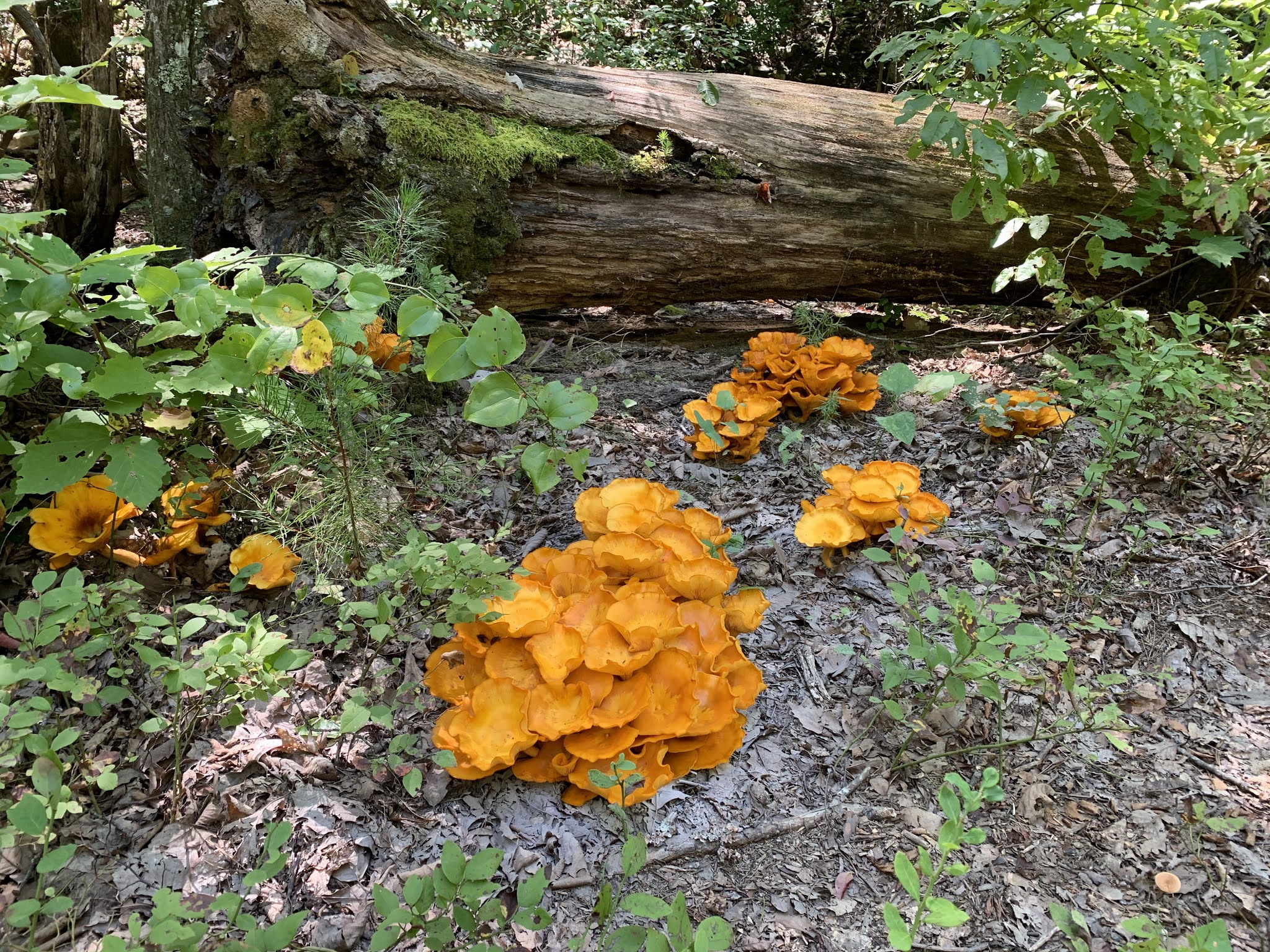
Starting out from the parking lot near Cheaha Lake, I head into the woods alongside a small creek that feeds the lake. The trail is relatively easy at this point and with a nice breeze blowing, it's pretty comfortable temperature-wise as well. Some interesting groups of orange mushrooms, which I believe to be the poisonous jack-o-lantern species, add some nice color contrast to the path.
The trail starts to ascend ever so slightly and then suddenly, much more abruptly. I briefly loose the trail as it climbs a dirt embankment, but making use of some deeply embedded tree roots, I quickly find my way back and continue forward. This section of the trail is marked by several tree falls that have yet to be cleared from the foot path. I do my best to navigate around or in most cases, under them, but I grab a stick to clear the spiderwebs and keep critters out of my face.
From here and for the next three-quarters of a mile or so, the hike turns much more into a rock scramble. Though the distance is pretty short on this trail, the constant class 2.3-2.5 terrain makes for a really good workout. I'm starting to think this will be the first of my recent high-point summits that I will actually earn. What I mean by that is the last several (Tennessee, Georgia, and North Carolina) were very "touristy and included paved walking paths and observation towers. At least I'm having to work for this one a bit.

After taking a short break on a rock outcropping that offers a magnificent view of the surrounding hills, I continue on towards the summit. Along the way, I pass a couple of young men on their return trip. We chat for a minute and they inform me that the summit itself requires walking through a camp ground and that this trough trail comes to an end just a short distance further.

Just as they described, the trail meets the road and winding my way around the mountain top and through the campground, I reach the tall radio tower that sits atop the mountain. An observation tower allows visitors to climb up and see the distant horizons over the trees, but the view is spoiled by all of the development and by the steel cables supporting the radio tower.
After spending a short time taking in the views, I make my way back down the mountain. Since I am now a bit more familiar with the path, I'm able to move a bit more quickly, but still carefully as I navigate the steep trail. Ending up back at my jeep, I check my tracking app and see that I've only hiked about 4.1 miles, but that one long scramble section made it quite a workout.

No comments:
Post a Comment