Saturday, August 31, 2024

Moray (Urabamba Province, Peru)

 Our next stop on the way to the Sacred Valley of the Inca takes us to the Incan ruin of Moray. This site consists of several concentric circles terraced into the landscape. My guide explains that current research suggests that this site was used as a agricultural laboratory by the the great Incan Empire. They understood the differences that temperature and air pressure made on a crop's ability to thrive. By planting different crops at different elevations within the circle, these genius peoples could determine which crops grew best at which conditions. While this theory is not universally accepted by archaeologists, it makes a lot of sense to me. The Inca were meticulous with their study of the environment and through their research and knowledge came to master all aspects of it.


Maras Salt Flats (Urabamba Province, Peru)

 
My guide and I are on our way from Cusco to the Sacred Valley of the Inca. Along the way, we will make a couple of stops. The first is the Maras Salt Flats. This very impressive site sites at an elevation of 10,500 feet above sea level. While a fresh water creek passes beside and below the salt flats, a salt water spring feeds the saline rich liquid through a complex canal system and allows the indigenous peoples to mine thousands of tons of salt each year. 

Researchers have discovered relics dating back as far as 700 B.C.E. in this area, indicating that these pools have been a source of salt for thousands of years. And, they are used until this very day. The saline waters flow through an ingeniously engineered system of canals and pools. The pools are flooded and then over the course of a couple of weeks, the high Andean sun evaporates all of the water, leaving a thick layer of crystalized salt to be harvested. There are a few thousand pools in the system and it is quite site to behold.

Friday, August 30, 2024

Cathedral de Cusco (Cusco Province, Peru)


Our second stop for the day, sees us to the Cathedral de Cusco or Cathedral Basilica of the Virgin of the Assumption, which serves as the primary headquarters for the Catholic Church in this region. It is built atop the Incan Temple of Kiswarkancha, but with many things that occurred during the Spanish conquest of the Inca, the temple was largely destroyed and the modern cathedral built in its place.

The temple sits at the head of a square that serves as the main gathering area for the city of Cusco. At the center of the square and at the top of a fountain, a golden statue of Pachacuti raises his arms to the heavens. He was the great force that created the Incan Empire and his descendants revere him to this day. It also just so happens that today is the celebration of Santa Rosa de Lima and the later of Santa Rosa is being hoisted through the square, while adoring worshipers follow along in a parade and music fills the air. It's a pretty amazing site to behold.


As my guide and I walk into the cathedral, he warns that no pictures are allowed within, as there is concern that flash photography may damage the priceless paintings and other religious artifacts. We spend some time walking around visiting the many alters within the cathedral, each dedicated to a different saint or prophet. My guide is educated and very knowledgeable of the entire history of this place and it's great to learn so much about the clash of cultures. 

Below the church are several tombs of late bishops and cardinals that once served the church. The artwork of the alters is amazing. Woodcarvings, silversmithing, and all other manors of craftsmanship give glory to the church. I try to be as respectful as possible as I take it all in, but it is truly overwhelming. After touring the grounds extensively, we depart and head to lunch. After which, I will return to my hotel and rest in advance of the next several days, which will focus on the grueling trek to Machu Picchu.

Qorikancha (Cusco Province, Peru)

I'm in Cusco, Peru for a couple of days in advance of a trek up to Machu Picchu along the Inca Trail. As part of the trip, the guide service offers a tour of some of the historical sites of the city. In addition to sharing the rich history of the area, these couple of days give visitors a chance to acclimate to the elevation, which is over 11,000 feet. For our first stop of the day, my guide takes me to Qorikancha, an important temple for the Inca and later converted to a religious center by the conquering Spanish.

From the exterior, everything about the structure looks Spanish, but once inside, it is obvious that the conquistadors build their structures on top of the magnificent Inca stonework that predated their arrival. The heavy wooden doors open up into a large courtyard, which is a hodge-podge of the two cultures. What's interesting though is that the Spanish construction has collapsed several times during earthquakes, while the interlocking, tightly-fitted Inca masonry work just laughs when the ground rumbles. 

After leaving the courtyard, we had out for a view of the terraces to the Southeast of the main structure. From here, there is no doubt that the origins of this place are with the Inca. This site is often used for community events. It's a great start to what I hope will be an amazing trip.

Sunday, August 25, 2024

Whites Mill Trail (Barrow County, Georgia)


For my last hike of the weekend, I drove east of my house and headed to Whites Mill Park. I had attempted to hike here earlier in the week after work one evening, but traffic was atrocious as it always seems to be in Atlanta (Google suggested it was going take me about an hour and twenty minutes to drive the twenty miles to the park from my house). Anyway, I'll get it done today.


The trail begins from a gravel parking lot and seems to be pretty popular as there are several cars here. It starts out simple enough as a wide path through the woods with brown pine needles creating a soft carpet. As I approach Cedar Creek at the northernmost point of the trail, I see a large rock outcropping that offers a nice view of the stone slicks below that the creek is flowing over. It seems this area was home to a grist mill a century or more ago, but nothing of it remains. After taking a couple of photos, I continue along the loop trail.

The entire trail system here is well maintained and I had no issues whatsoever. I encountered a few other hikers, some with their leashed pups. Soon, I arrived back a the parking area, ready to head home. This trail added about 1.9 miles to my weekend total. It is a really nice trail and pretty close to home. If it wasn't for the traffic, I might hike here regularly.  

Burnt Mountain - Champion Creek Trail (Pickens County, Georgia)

 On my way home from Cloudland Canyon, I wanted to do a couple more hikes. I got in some good trail miles yesterday, but I've got some big hikes coming up in the next few weeks and I really want to give myself some conditioning hikes. I chose to drive to the Burnt Mountain Preserve near Jasper, GA, which has been on my radar for a while, but until now, I've never visited. 

The trailhead is nothing more than a dirt clearing and there was one other car there when I pulled in. Knowing that even the more challenging of the two available trails was only about two miles, I decided to leave my pack and my water in the car. The trail starts out simple enough, but I ran into a lot of spider webs and saw quite a bit of poison ivy on the shoulders of the path. I grabbed small stick and began waving it in front of me to clear the spider webs. It helped a bit. 

Where the trails diverge, I decided to do the more challenging one that lead down to Champion Creek far below. The descent was actually pretty steep and it seems the trail has eroded quite a bit. Eventually though, I made it to the creek and found pretty cool shelf-like water feature, which is probably a neat waterfall when there is more water flowing. This really was the highlight of the hike.

From there, I began the steep ascent along the other half of the loop. With the temperatures rising and me working pretty hard to climb out of this valley, I think I may have suffered some minor heat exhaustion. At least, I was exhibiting the symptoms of it. I slowed my pace and took my time on the last half-mile or so, but I was very glad to reach my car, my water, and my air conditioning. The loop trail was only about 2.1 miles, but it was a good workout.

Saturday, August 24, 2024

River to Clouds Route: Cloudland Canyon to Five Points (Dade and Walker Counties, Georgia)

 After enjoying a tasty breakfast burrito served up by the Georgia Conservancy, who organized this weekends trip to Cloudland Canyon, I wanted to get an early start on the trail and get some good miles in today. I've hiked nearly all of the trails at the state park and decided today to hike the longest one, which I haven't been on up to this point. I've always known it as the Cloudland Connector Trail, but along the route, I saw signs calling it the River to Clouds Route. After doing some research, I discovered that this trail system goes all the way to the Tennessee River near Chattanooga, TN, thus giving it the name.


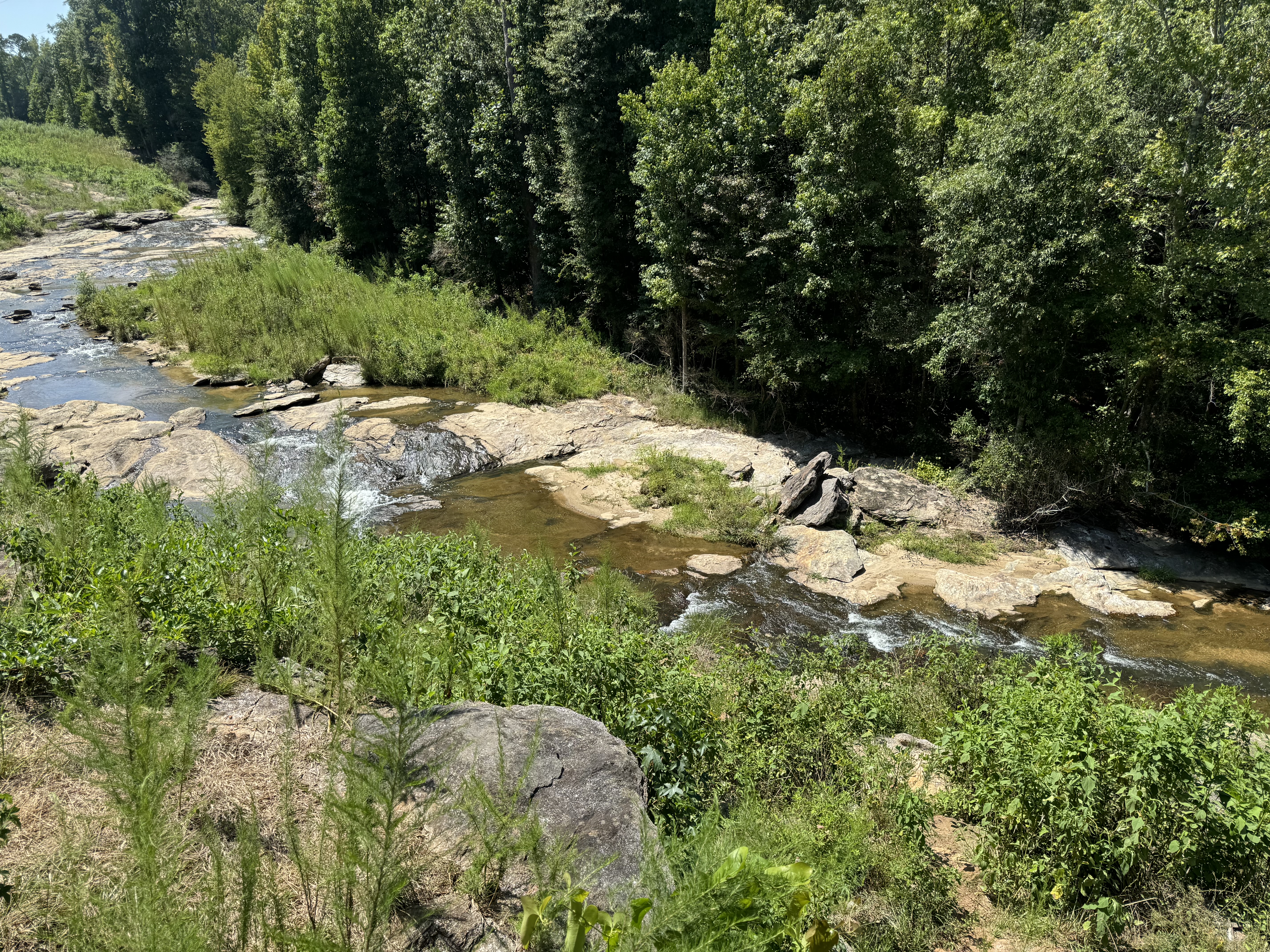
The trail is well maintained and relatively flat. When I mentioned my planned distance to the other folks that are here with the Conservancy, I think I scared them off. Most of them were looking to do 5-6 miles and I'm planning for more like 14-15 on this hike. That said, I didn't see a single other hiker along this route today, but there were plenty of mountain bikers and even three horses and riders.

Overall, the trail is actually kind of boring. There aren't any dramatic vistas or really interesting stops. The most exciting thing along the entire route is a steel-framed bridge crossing Bear Creek. I wasn't exactly sure how far I was going to go to get in my desired mileage. I thought about turning around at the Ascalon trailhead, but I still had plenty of energy and turning back at his point would have only gotten me about ten miles round trip.

Instead, I decided to hike further north to Five Points. This area is named because it is the intersection of several mountain bike trails, but really nothing all that special. It did put me at about 7.3 miles one way though, which was good for my desired mileage. I used the privy at this trailhead, which was nothing more than a wooden platform with a fence around it and a hole in the bottom where human waste simply dumps out on the hillside. 

From there, I head south back towards the park. I did have to stop to care for a hot spot on my left pinky toe. I'm trying to break in some new hiking shoes and they actually did really well, but I don't to get a blister now. After I tended to that, I continued on. Around the 12 mile mark, I could sense myself getting a little tired and about that time, two of my best friends started a political discussion via text messages, which kept me occupied and distracted for the last couple of miles. 

Finally, I got back to my car at the trailhead and slurped down a big gulp of water from my Nalgene. I was tired, but nothing was sore and the shoes seemed to have done okay on my feet. Round trip, I was able to get in 14.5 miles, which is right about where I wanted to be. I wish there was more to see along this trail. It is really nothing more than doing a walk in the woods, but it was still nice to get a good stretch on my legs. For now, I'll head back to the lodge and relax.

Friday, August 23, 2024

Cloudland Canyon Adventure Weekend (Dade County, Georgia)

I've done a few trips with the Georgia Conservancy during my time living in Atlanta and this weekend, I'm heading out to Cloudland Canyon with the organization for one of their "Adventure Weekends". Unlick many of the others though, this is fairly unstructured and allows a lot of time to explore the park's various trails.

I drove up after work on Friday and as always, getting through Atlanta traffic was a nightmare, but I finally arrived at the park's Group Lodge around 6:30 pm. It seems I was one of the first to arrive, but after checking in, I brought my gear into the lodge and picked a bunk. Unlike past trips, I decided to stay in the bunk house this time instead of camping. Over the next hour or so, several others arrived and we enjoyed a great dinner of loaded spuds (complete with pulled pork) and some beer over a campfire. Around 10:30 pm, I called it a night, knowing that I was planning to get in some pretty good miles the next day.

I shared a bunk room with another group of really great guys (an elderly father, his son, who is around my age, and the father's friend). We all awoke around 6:30 after a good night's sleep and headed to the kitchen for coffee and breakfast. This morning, the crew made up some fantastic breakfast burritos for us, which was the perfect fuel to power me through my trail miles today. Around 9:00 am, I headed out to hike the Cloudland Connector Trail, or as I would learn to call it, the River to Clouds Route. I'll do a separate write-up for that trail.

I got back to camp around 2:30 pm, took a quick shower, and relaxed the rest of the afternoon. After 14.5 miles, I think I earned it. For dinner, we had tacos with all the fixins. They always take great care of us on these trips. After the meal, I grabbed a beer and headed out to the raging campfire, where the trip organizer and I traded backpacking stories. It was great fun and I stayed up until about 10:30 pm again. 

Sleeping in a bit, I finally rose a little after 7:00 am. The organizers had made a breakfast of bacon and pancakes for us, which hit the spot. I did a short hike to Bear Creek Canyon and then said my goodbyes and headed over to the main overlook to snap a picture or two before I departed. I really enjoy the events Georgia Conservancy puts together and I'm glad to be able to take part in them and support the organization.

Sunday, August 4, 2024

Watson Mill Bridge (Madison County, Georgia)


It's been very hot and humid the last few days and with my wife traveling for work, I needed to stay with my mother. I thought today though we might get out early and explore a little state park that I've been wanting to visit. There's not much hiking involved and I thought she would benefit from a little exercise. 

Watson Mill Bridge is the site of a small state park preserving the longest covered wooden bridge in the state of Georgia. Spanning 229 feet across the South Fork of the Broad River, the bridge was built in 1885 and includes a two lattice truss system. The site includes a small spillway that allows the shallow river water to flow under the bridge and then onto a natural water slide made up of the native stone. With the water level being very low, the slide is more like a series of small stone islands that allow me to hop out a ways into the river and get a couple of good shots. 

We only stay a few minutes as I don't want my mother getting overheated, but she said she enjoyed the time outdoors and away from home. I don't know that this little park was worth the drive to get here, but if you happen to be in the area, it's worth a stop.