
The weather in my little part of the world has been very volatile this year, which has been making hiking and camping plans pretty fluid. Originally, I was supposed to go snow-camping this weekend, but an incoming snow-storm put a stop to trip. No matter; the meetup group had been planning to explore another trail in the Auburn State Recreation Area just over Donner Pass. It seemed like a good opportunity to get some miles in and the company is always good with the group.
Meeting on the western outskirts of Reno, we carpooled to the trail head of the Olmstead Loop Trail, just a couple of miles outside of Cool, CA. Driving to the trailhead, I remembered my last trip to hike in this area, which was a couple of years ago and a truly unforgettable experience. We met up with a couple of our other members at the trail head and soon we were off.
Coming out of the parking lot, the trail initially parallels the road as it makes its way along a fence line. White bell-like flowers decorate either side of the trail, along with a fair amount of poison oak. Having just recovered from a nasty case, I keep my distance. After just a couple of hundred yards, the trail turns and veers away from the highway, making its way into the grassy fields and wooded area of the park. The trail all along this section is well maintained and pretty flat. Apparently, there was a race this morning as we see a couple of runners and find chalked areas all along the trail point them in the right direction.

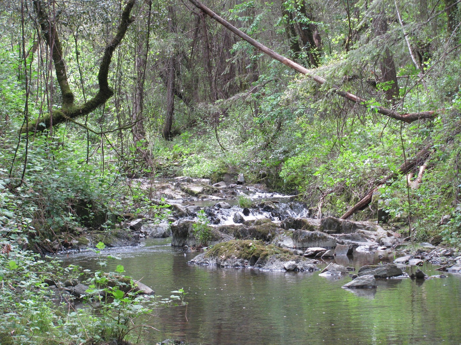
Soon we come upon a small creek flowing through ancient rock formations to feed a pond in the distance. Surprisingly, there isn't a great deal of water flowing. Given all of the precipitation this year, one would have thought otherwise. Though the trail is well maintained, we do encounter a few small patches of mud, but most are easily navigable.
Shortly thereafter, we come upon the first of about three steep uphill sections. Nothing too terrible, but they do get the heart going a little bit. All along the way, we have great conversations across a range of topics, including the wild flowers, the ski resorts, other hikes, craft beer, politics, etc. It's always fun being around such great people with so many similar interests.

As we enter the last section of the trail, I'm in awe of the openness of these rolling hills and the greenness of the grass that carpet them as far as the eye can see in many cases. An occasional flowering tree or patch of wild flowers provides some contrast to the green. Though the day started out very cloudy, some patches of blue sky start to peak through now, making these pictures a symphony of spring colors.
Finally, returning to the trailhead we rest at a picnic table and discuss visiting the nearby Moonraker Brewery, which I had suggested. Moonraker is producing some of the best beer in California right now and everyone seems excited to try it. We head over and enjoy some brews, food, and good company before driving back over the hill and saying our goodbyes. We put in about 8.8 easy miles today, but the company always makes it an even better trip.

No comments:
Post a Comment