
Of all of the preservation areas in Southern Utah, one of the few that I have not had the opportunity to visit in past years is Canyonlands National Park. Earlier in the year when I was planning my trips for the year, the extended memorial day weekend seemed like a perfect time to remedy this situation. With my friends Van and Bill, we planned a three-day two night backpacking trip into the Needles region of the large park. Months in advance, I reserved the necessary backcountry permits. We were all looking forward to the trip, as it was the first visit to the park for all three of us, and to Southern Utah at all for Bill. Finally, the day came and after meeting up and loading the Toyota Camry we rented to save some fuel costs, we were on the road by about noon Friday.
The drive from Reno to Canyonlands is nearly 800 miles and our plan was to take turns napping and driving to arrive at the park's backcountry office when they opened the next morning. Everything went to plan and we arrived in Moab, UT by about 2:30 AM. After some discussion, we found a parking lot to rest in for a couple of hours and then drove into the nearby Arches National Park to catch the sunrise at Window Arch. Coincidentally, I hiked to Delicate Arch (also in Arches National Park) almost exactly a year ago to see the sunrise. We pulled into the parking area and joined 20-30 other adventurers in the cool morning air, under the giant sandstone arch. The Sunrise was magnificent, but I failed to bring my camera with me to capture it. After a few short minutes, we got in the car and drove the remaining distance to the Needles Visitor Center in Canyonlands.
Discussing our backcountry permits with the rangers, it seems I had made a terrible mistake. The permit I got for the first night was for the section north of where we wanted to be and it would add an additional 20-miles to our trek - 20 miles we don't have the time or resources for. In my defense, the reservation system is based on zones, but these zones are not clearly defined on the website. If only the park service would post the map we were looking at in the backcountry office on the website, this confusion could have been eliminated. As this is a holiday weekend, the rangers were unable to issue the correct permit and we were left figuring out an alternative plan. Luckily, the original loop we were planning to backpack, the Salt Creek-Lavender Loop, was actually significantly shorter than we thought. We decided to hike and camp in Salt Creek-Horse Canyon the first night and visit some sites that Van was interested in, and then do our original loop plan tomorrow and Monday.
Arriving at the Salt Creek-Horse Canyon trailhead, we put on our packs and headed down the dry wash. Almost immediately, we were attacked by swarms of hungry mosquitoes. We put on some repellent and continued down the canyon. A short ways up the canyon, we encountered a friendly off-duty ranger out for a day hike. He offered somewhat confusing directions to our first planned destination. Hitting the fork of the two creek-carved canyons, we went to the right, but after passing the point where we thought we should have seen what we were looking for, we decided to regroup and take a look at the map. It turns out we had traveled about a mile and a half up the wrong canyon. We cursed our bad luck and returned to the fork.
The entire wash alternates between patches of completely dry sand and wet areas filled with schools of tadpoles. Timid of the unknown, the infant frogs scatter at any approach to the area they are swimming in. The walls of the canyon are made of steep layered sandstone. They alternate in bands of red, orange, and yellow, just as one would expect in this section of the great staircase that is Southern Utah and Northern Arizona.
After making our way up the canyon we intended to be in, we stopped for lunch on a small side trail to admire a small natural bridge. As the afternoon is wearing on, it gets noticeably warmer and there are only small patches of shade available on the edges of the canyon.


The trail wash snakes around back and forth with loose sand for footing, which makes it a bit more challenging to walk in. Luckily, someone has cut trail across the 'peninsulae' to form a much more straight path on slightly more solid soil. As we reach a sign for our next destination, we leave the main trail and head into a side canyon. Along the way, we note stand of trees and some large loose boulders along the side of the canyon. We think it might be a good place to camp for the night and head over to take a look. Deciding it looks ideal, we drop our packs and continue down the side trail.
The canyon floor is covered with sagebrush and as we make our way through it, we see a sandstone tower in the distance with some caves in the wall behind and above it. This turns out to be what we are looking for. In the cave, ancient Native Americans have build small cliff-dwellings. This particular dwelling is now known as Tower Ruin, presumably due to the tower which it overlooks. We search the wall for a place to climb up and eventually find a steep approach up the sandstone cliff and reach the area just below the dwelling. We consciously choose not to proceed any further, as we don't want to risk damaging the amazing architecture of this cultural treasure. This would have been an ideal home, with an amazing view of the wide canyon below and the sunrise. It's doubtful if any enemy could have approached without being spotted by the inhabitants.


As we get a little buzz on, we decide to do more rock scrambling in the cliffs above our camp. Reaching a sandstone pillar separated from its parent cliff by a sliver of space, we look down on how far we have climbed. We are about 75-feet above our camp and the combination of accomplishment and alcohol gives us all a sense of pride and grandeur. We yell at the world to take notice, before carefully making our way down the cliff.
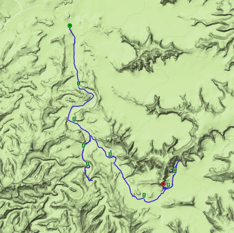

After a quick bite of breakfast, we make our way out of the canyon. Without detours, we make great time coming out of the canyon. Arriving back at the car, I check the GPS for distance. We covered about 8.1 miles on Saturday, including detours, and about 4.1 miles this morning for a total of 12.2 miles over the single-night backpacking trip.

No comments:
Post a Comment