Saturday, August 16, 2025

Raven Cliff Falls (White County, Georgia)


One of my friends in the Meetup group organized a short hike to do this morning before a water event that I organized later in the day. As we're both trying to get the miles in prior to a big trip coming up, it made sense for me to join her for these bonus miles. I've visited Raven Cliff Falls a couple of times in the past, but it's been a couple of years. I don't like to repeat hikes too often, but as this is near our second event and it is a nice trail with a rewarding waterfall at the end, I was easy to convince into making the exception.

The group of twelve or so hikers met at the parking area just before 8:00 am and after our customary round of introductions, we hit the trail. It's been raining a lot as of late and the trail is soft in a few areas, but nothing too drastic. Three of us get out ahead of the main group just due to keeping a faster pace. As we're chatting, I feel a sharp pain at my left ankle and one of my other friends mentions a yellowjacket buzzing around my legs. I didn't actually see the insect, but I certainly felt it as it stung me just above my sock. It's a little painful, but nothing too terrible and we continue on towards the waterfall.

Along the way, we see many other small plunges along Dodd Creek, which supplies the water for these waterfalls. With a couple of fairly steep uphills and just a minor amount of scrambling at the very end, we finally reach Raven Cliff Falls itself, which has cut a crevasse into the cliff over the eons. It's flowing pretty well today, but it's always kind of unique since the waterfall itself is several feet back into the crevasse. 

The three of us that arrived first decide to relax for a bit and wait for the others. When they do show up a few minutes later, it seems they encountered the yellowjackets as well and endured several stings. No one is badly injured, but certainly not pleased with the encounter. We check to ensure everyone is okay and then begin heading back the way we came. Knowing that we stirred up a nest somewhere, we push hard at a pace of over 4 mph and luckily don't encounter the nest on this return trip. 

Eventually, everyone arrives back at the cars. Between the stings and the humidity, this has not been an ideal way to start the morning, but visiting a beautiful waterfall and getting in almost exactly 5.0 miles is certainly not the worst way either. Now on to the next event.

Sunday, August 10, 2025

Kennesaw Mountain Battlefield - Full Loop (Cobb County, Georgia)

With a big hiking coming up in a few weeks, I'm taking every opportunity to get trail miles in. I hiked about 6.5 miles yesterday, but I have something a little more grand planned for today. About an hour from my house, likes Kennesaw Mountain, which was the site of a fierce Civil War battle as General Sherman pushed towards Atlanta. This area is now protected by the National Park Service as a National Battlefield and offers many miles of trails. I hike here fairly often, but I've only done what I intend to do today once before and that was about five years ago. My plan is to hike the entire 17ish mile loop around the park.

Arriving at the overflow lot around 9:15 am, there are already a lot of people here enjoying their day and visiting the historic site. After a quick stop in the visitors center restroom, I hit the trail, which almost immediately starts the steep incline towards the summit of Kennesaw Mountain. Climbing nearly 700 feet in just over a mile makes for a good challenge, but it's always worth it and I try to maintain a strong pace as I make my way up. 


Reaching the summit, I find one of my favorite markers, which is a slab of granite carved to say "Prepare to meet thy God", which is thought to have been carved by Confederate Soldiers as they prepared for battle against the Union troops. It's been sprinkling rain just a little bit on the way, but the forecast did not call for anything substantial today and so, I push onward. The wet granite at the top, does force me to slow myself just a little bit.

The area at the top of Kennesaw Mountain, through the saddle, and over towards Little Kennesaw Mountain is the roughest terrain of today's hike and requires a very minor amount of rock scrambling, but it does keep things interesting. Before too long, I'm making my way down the backside of secondary peak and headed southward towards the crossing of Noses Creek.


These next several miles should be pretty smooth sailing and once again, I decide to put my headphones in and enjoy my audio book. I'm on park lands and still within the Atlanta metropolitan area. Though I'm in the woods, it's pretty civilized and I feel comfortable with my headphones on.

Though it's cooler today, it's still very humid and the hard work to climb the mountains in combination with the light drizzle earlier has gotten me pretty wet and sticky. I'll be glad for that hot shower when I eventually get home, but that's still a few hours away. I have miles to put in before I've earned that luxury. 

Crossing state route 120, I begin the largest section of the loop. All along the way, there have been life-sized replicas of Civil War era cannons set up as if they were ready for the battle that took place here 160 years ago. They make for good scenery and remind us of the hallowed nature of the ground where roughly 4,000 men died. The park service also puts numerous informational placards around to describe historic events or locations from the battle. It's a history buff's dream and as a psuedo-history buff, I appreciate it quite a bit myself.

Finally hitting the far southern end of the trail, I pass by Kolb's Farm, which was the site of smaller battle just a few days before the main fighting just north of here. The farmhouse itself has been preserved. I don't take much time here though and pass through quickly. It's interesting, but I've visited in the past and today is more about miles than history.


Now headed north, I pass through miles of wooded areas and catch site of a doe and her two fawns (one larger than the other) out for some lunchtime grazing. It reminds me that I haven't eaten yet either and pull a peanut butter sandwich from my daypack. I don't stop to eat, but just consume it while I'm on the move. I'm not racing anyone, but I do want to keep my heart rate up.


Further up the trail, I pass by the Illinois Monument. This is a large marble structure memorializing the Illinois soldiers who fought and died here during the battle. Though fairly deep in the woods, it is well cared for by the park service, as it should be.

By now, I'm getting a little tired. I'm not sore or anything like that, but I've been walking for a few hours now and I'm just kind of wanting to be done. I still have a few miles to go though before that's going to happen. The last miles of the trail are pretty uneventful and I arrive back at my car at right about the 6.5 hour mark, having hiked a total of 17.7 miles. This is the longest hike I've done in a while and though, I'm a little tired, I'm extremely happy to have completed this trail once again.

Saturday, August 9, 2025

Little Mulberry Trail (Gwinnett County, Georgia)


Originally, I was planning to hike a short section of the Appalachian Trail this morning, but after re-evaluating the travel time, I decided to hike closer to home. I've got a concert to go to tonight and don't want to be late. I've got a very, big hike coming up in a few weeks and I'm trying to get trail miles in whenever I can. I decided to hike a few miles at the nearby Little Mulberry Park. Though I've been here many times, it's a good option as it is nearby and the trails are quite popular, which will allow me to continue listening to my audio book while I'm getting some exercise. 

The park seems especially busy on this rare August afternoon, where is is both not raining and a bit cooler. Many people are out taking advantage of the great weather. The trail begins on pavement, but at my first opportunity, I enter the woods. I'm breaking in some new hiking boots and pavement is not the best option. I pass a number of families out enjoying the day. Everyone is friendly and either offers a nod, a wave, or a hello.

Before too long, I've made my way to the lake and decide to follow the trail around it. There is a small island in the lake and though I don't know the story behind it, someone has erected a tyrannosaurus rex statue in the center of it and cleared the trees out to offer a unobstructed view. I've commented on this before, but it never ceases to amuse me.

As I being making my way back the parking area I decide to walk across the observation plateau, which I believe is the highest point in Gwinnett County. It's nothing more than a mowed field, with a slab of concrete poured and some park benches scattered around, but it does make for a nice astronomical viewing area when certain stellar events occur. Just as I begin down the hill towards the car, a light sprinkle begins. It's actually kind of nice, since I'm fairly sweaty from my fast pace. I was able to get in about 6.5 miles today. That's not much, but I have plans for substantially more miles tomorrow.

Saturday, July 26, 2025

The Caverns - Buckethead Concert (Grundy County, Tennessee)


A bit different from my normal write-ups, this one crosses between a few of my interests. Some years ago while visiting a friend in Nashville, TN, we attended a concert at one of the most unique venues I'm aware of - Bluegrass Underground. Since then, it has changed names to 'The Caverns', but it remains essentially the same. Part of a large natural limestone cave formation known as Cumberland Caverns on the National Landmark Register, one section plays host to multiple musical acts each season. Since that first trip nearly ten years ago and especially since moving to Georgia, I've monitored the season schedule to see if there were any acts that I would be interested in seeing. The virtuoso guitarist Buckethead fit that bill. As a long-time amateur guitarist myself, I enjoy seeing those that have mastered the instrument, and this was the perfect opportunity.

After spending the afternoon in Chattanooga sampling some breweries, I checked into my hotel, and then made the final short drive to The Caverns, which is literally out in the middle of nowhere. I followed the signs and was pointed towards the parking area. Parking my car, I headed down to stand in line until the gates opened at 7:00 pm while chatting with some of the other attendees. Passing through security, we made our way into the mouth of the large cave. I thought I remembered this being much deeper underground than it actually is, but it's still pretty amazing to walk into this chasm and see the light shows of a concert starting up. Restrooms, a merchandise stand, and a bar greet everyone as we enter. 

Finally at about 8:15 pm, the tall figure of Buckethead, complete with a KFC bucket on his head and Michael Meyers mask covering his face, made his way from the cave entrance to the stage. He immediately starting shredding and put on an intense display of technical guitar talent. I only know a few of his pieces, which are mostly instrumental, and I didn't recognize any of what he played, but there were still impressive. He continued for about 40 minutes at this rate, before being joined by a drummer and launching into a cover of Black Sabbath's 'War Pigs'. This was an obviously meant to be a tribute to Ozzy Osbourne, the godfather of metal, who passed away earlier this week. By 10:00 pm, my back was absolutely killing me from standing for more than three hours and I ended up leaving the show a little early. It was still an incredible experience and I'm glad I made the drive.

Sunday, July 13, 2025

Bull Mountain (Lumpkin County, Georgia)


Not ready to take off my hiking boots quite yet (yes, I'm breaking in some new hiking boots today), I joined my normal Meetup group for a hike around Bull Mountain in North Georgia. The hike was planned for nearby Jake Mountain, but once everyone arrived, our organizer had us carpool to another nearby trailhead. The road to get to it was a little bumpy, but my Outback Wilderness and the other vehicles made it without any issues.

Once we hit the trail, we were moving at a slightly slower pace than my earlier hike this morning, but that's okay. I'm here for distance, not necessarily speed. The trail was mostly double-track and our organizer commented about how poor the trail would be for mountain biking, which he leads another Meetup for. The heat and humidity were also pretty relentless, but thankfully, the trail is pretty well shaded. 

We meandered through some pretty, but standard forests of this region. At one point, I found a deer tick crawling up my leg and quickly put an end to her aspirations. Overall the rest of the trail was uneventful and not overly scenic. We did manage to get 7.7 miles in though, which brings my total for the day to 13.5 - not bad.

Kennesaw Mountain Sunrise (Cobb County, Georgia)


With my big hike for the year coming up in about six weeks, I'm trying to take every opportunity to get in some good trail miles. This morning, I chose to join the Atlanta Outdoor Club for a sunrise hike over Kennesaw Mountain. The leader of this particular hike has been doing a "seven sunrises in seven weeks" theme and I was able to join him for the Sawnee Mountain version a couple of weeks ago. They kept a great pace on that hike and I hope to do the same this morning.

Arriving at the visitors center at about 6:15 am, I had to pull off the side of the road to wait for the gates to open. Several other cars followed suit. Promptly at 6:30 am, the gate automatically opened and we pulled into the parking area and started gathering by the replica canon outside the visitor's center. By 6:50 am, we had done super quick round of introductions and were already making our way up the mountain. Sunrise was actually at 6:37am, but with the late gate opening, there was no way we could get to the summit by then. We'll settle for a 'slightly after sunrise' hike. 

Our group of ten or so hikers practically raced up the steep ascent to the top of Kennesaw Mountain, maintaining an average pace of over 3 mph for that difficult section. Once at the top, we stopped for a short break and to bask in the glory of the recently risen sun over downtown Atlanta in the distance. I also took a moment to find and photograph my favorite carving (sort of a tradition now whenever I'm atop Kennesaw). 

After a short break, we headed down the saddle and then climbed back up Little Kennesaw. From there, it was mostly downhill, but with a lot of rock scrambling. Cutting east near Pigeon Hill, we made our way back to the parking area. It was hot and humid, but the pace and sunrise were very nice. We got in about 5.8 miles this morning and completed our hike before 9:00 am. What a great way to start the day.

Wednesday, July 2, 2025

Apostle Islands Kayak Camping (Ashland and Bayfield Counties, Wisconsin)

 A year or more ago, I read an article about the Apostle Islands on Lake Superior, which have been designated a National Lakeshore by the National Park Service. After seeing some pictures of the region, I knew I had to visit and see these sites for myself. Not wanting to transport my Kayak all the way from Georgia to Wisconsin, I found Wilderness Inquiry, which is a local outfitter than leads guided kayak-camping trips through the islands. This seemed like the perfect for me and so, I made my arrangements to do one of their trips on the Fourth of July holiday week. 

Flying into Duluth, MN last night, the company provided a shuttle from my hotel to their base camp near Sand Bay, which is where the trip would end on Sunday afternoon. The drive took a couple of hours, which gave me a chance to get to know one of my guides as well as the other participants, two of whom were legally blind. As I would come to understand, Wilderness Inquiry focuses on making outdoor adventures accessible to anyone, including those with disabilities. Everyone seemed great and it felt like this would be a great trip. 

After arriving at base camp, we were shown to the large tents that would serve as our lodging for the evening. Our guides, prepared a late lunch and then helped us find the right fit for our wet suites and gave us time to settle. After a bit, we were ferried to nearby Sand Harbor for some roll practice to ensure everyone knew how to release their spray skirt in the event of a capsize. As I have done this many times, I chose not to get into the cold water this evening, but the guides were okay with this after discussing my overall kayaking experience.

Returning to base camp, we were treated to burgers and brats for dinner and then took a short hike through the woods back over to Sand Harbor to watch the sunset. While the others hung out around the campfire, I was exhausted and decided to just call it a night. 

Day 1

Waking fairly early, I crawled out of my tent to find the guides preparing breakfast burritos for our crew. It was pretty tasty, but didn't last long. Soon, we were packed and headed to Bayfield, which is an hour-and-a-half or so from base camp. This is where our journey would begin. We put our boats in the water and prepared to paddle to Oak Island. Our caravan would consist of three large tandem kayaks and one solo kayak. Each of the two blind participants were paired with a volunteer, one of the guides with me, and the second guide in the solo boat.

I was kind of questioning the need for wetsuits, but after feeling the cold water of Lake Superior, I understand why we use them. The water here is probably in the high 40° range, which is enough to induce hypothermia if exposure lasts long enough. Soon, we're making our way towards the first of our islands stops. 

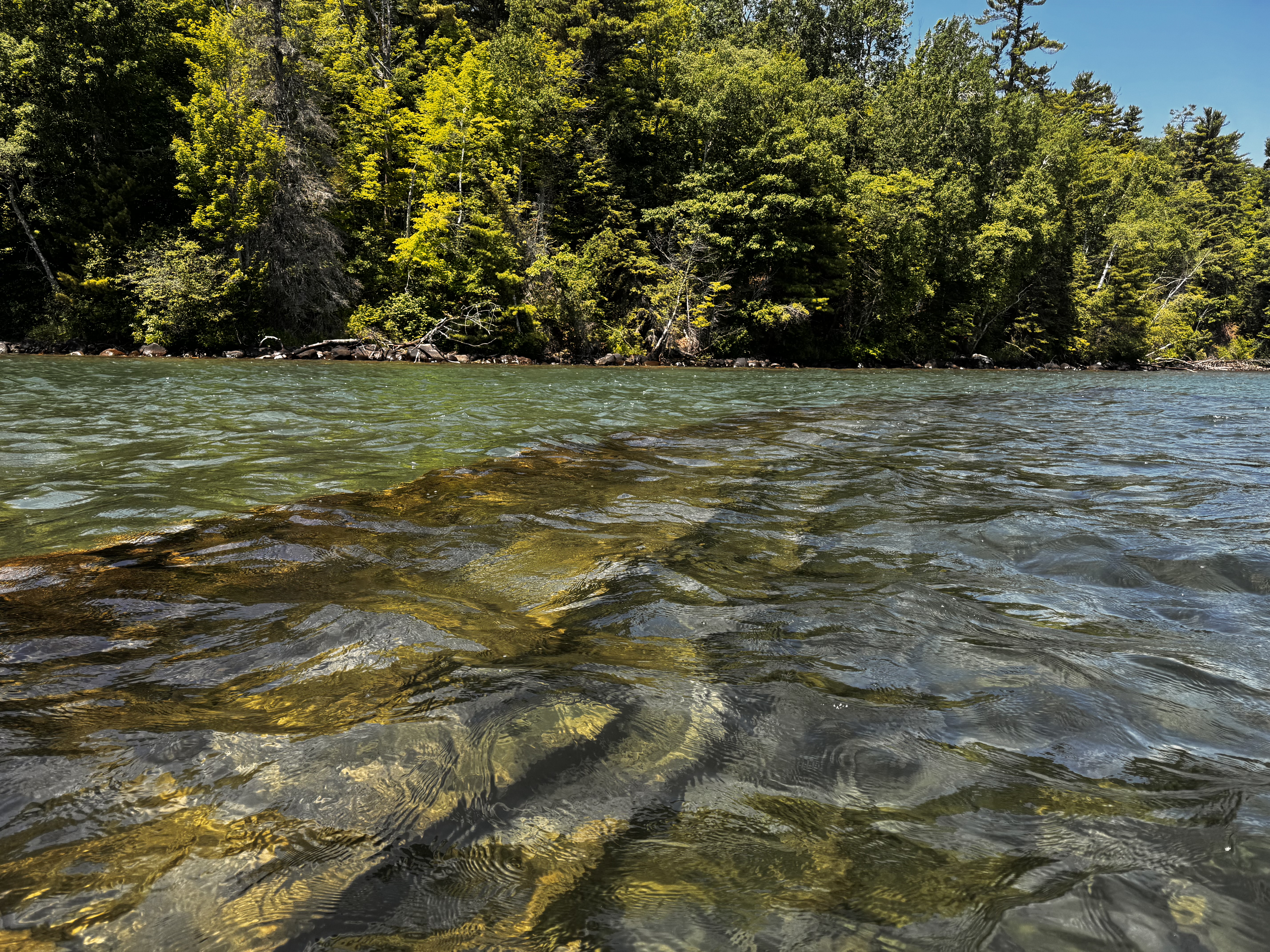
Along the way, we paddle over the mostly sunken remains of the Fedora. This 282' wood hull freighter sunk in shallow water in 1901 due to a fire. The wooden hull and iron ribs are obvious in the clear waters of the lake. Some remnant of one part of the ship rises slightly above the water, while the majority of the length remains safely under a few feet of water. As long as one is careful of the exposed portion, it is safe to paddle over the remains. I have to say that this is one of the more interesting things I've ever seen. I've seen shipwrecks before, but not on this scale. This boat is massive and clearly visible. 


Continuing towards Oak Island, the paddling is tough, but mostly uneventful. A lot of motorized craft and sailboats are on the water on this beautiful day. To get to the island, we have to cross a two-ish mile section of open water and stay pretty tightly grouped for this, but other than that there are no real challenges. 


We pull the boats ashore on Oak Island near our campsite in the early afternoon. Our guides quickly put together a selection of salami, cheeses, olives, and rehydrated hummus to give us some energy before we begin setting our tents up. The food hits the spot, as does getting out of the wet and smelly wet suit. We individually put our tents up and then I mention to one of the guides that I might explore one of the trails leading from camp. He asks how long I will be gone and I suggest less than an hour.

The trail I end up taking is the Sandpit Trail and I follow it for about a mile into the woods. I expected to eventually come across the islands lone dock, but after 20+ minutes of hiking, I decided to turn around. While I didn't see the dock, I did find lots of blowdowns, a rabbit, and tick crawling on my pants leg. Apparently, ticks are a real problem on the islands. Additionally, there are lots of mosquitos, biting black flies, and the most dense population of black bears in the US. At least we're in good company.


Getting back to camp, we enjoy a nice dinner around the campfire before calling it a night. We paddled 8.9 miles today. It's a good start to the trip.

Day 2

Bagel with cream cheese and fresh fruit are on the menu for breakfast this morning. I was up earlier than everyone, but the others rose pretty soon afterwards and we enjoyed a nice breakfast. I actually ate my in my tent as we had a light rain shower come through before we broke camp. It didn't amount to much, but did make packing a bit more of a pain. The mosquito bites on my legs didn't help much either.

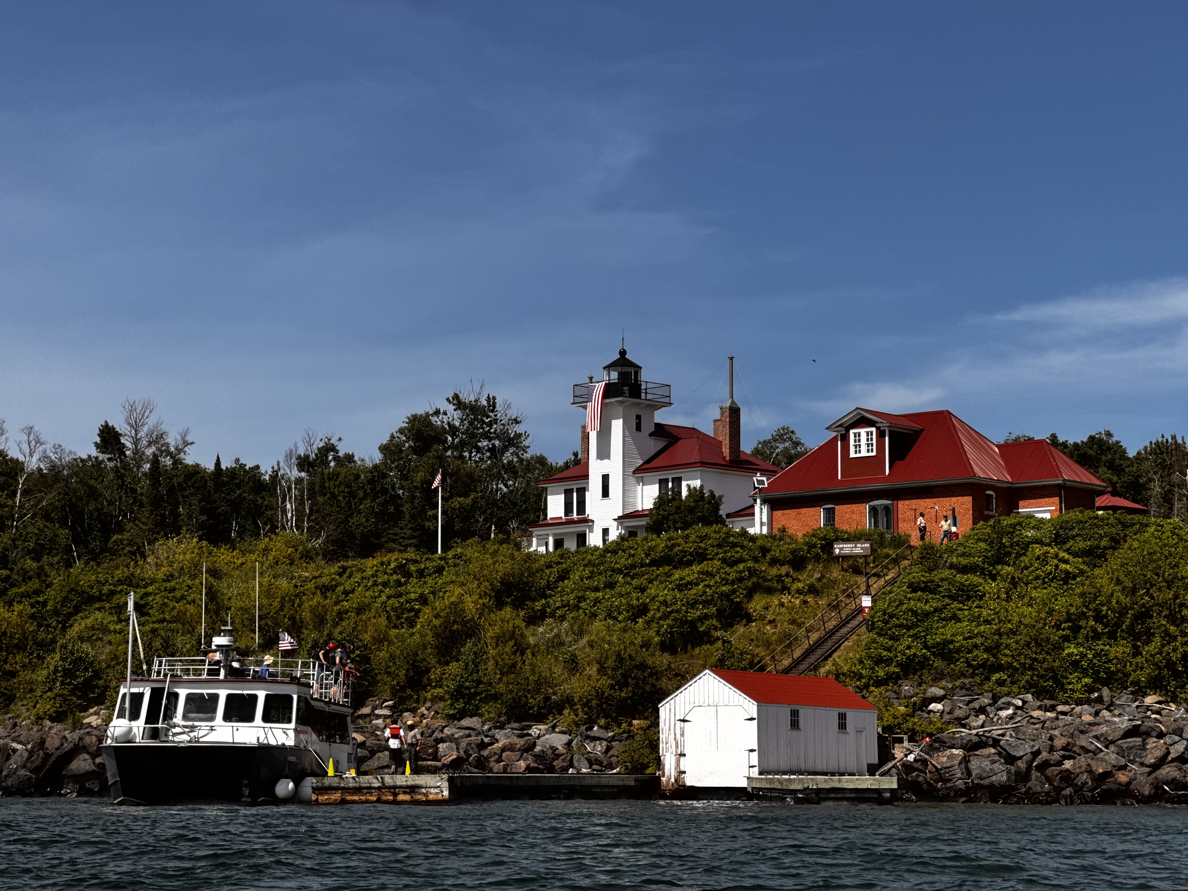
We hit the water around 10:00 am and paddled though choppy water and lots of rolling waves until we reached the southeastern corner of Raspberry Island. Here, we stopped for lunch with much of the same faire as yesterday. It was still a welcomed break though from the hard paddling. After lunch some of us hiked through the woods to the Raspberry Lighthouse, which is maintained by the Park Service. We were offered a tour of the facility, which we took and enjoyed. 


This lighthouse was built in 1862 to ward freighters off the rocky coast of the small Raspberry Island. Apparently, these areas were busy shipping lanes in decades past. Many of the islands in the archipelago have been fitted with lighthouses. It was interesting to learn about the facility and the families that lived here from the rangers. After our tour, we headed back to our boats, having hiked a total of 1.5 miles.

With that complete, we repacked our boats and got back on the water headed for York Island, which would be our home for the next two nights. Again, the paddle between the islands was pretty challenging with rolling waves reaching 8-10 feet tall and toss the boats all around.


Arriving on the backside of York Island, the waves were truly pounding the shore and the boat I was in nearly rolled as it got turned sideways along the shoreline and wave after wave pounded against its side. We eventually got everyone on land though without any injuries. 

Our campsite here is a bit more primitive and is nestled along the long narrow neck of the island. While there were a few spots at the edge of the woods to erect tents, I chose to put mine on the beach thinking the wind might keep the mosquitos under control a bit more. I'm not sure that worked, but it was worth a try.


As we got our campsite set up and dinner preparation was made, a large freighter could be seen in the distance. It's easy to forget, while on any of the islands, just how large Lake Superior truly is. It's really more of an inland sea, with the largest surface area of any fresh water lake in the world (and the third largest by volume). In fact, this lake contains approximately 10% of the worlds entire supply of fresh water. For all of its great size though, I've been sort of amazed at how little life there appears to be in it. There is little to no plant life to be seen below the surface and while I know there are fish in the lake, even as clear as the water is here, I never saw a single one. I think a big part of that is the northern latitude of the lake and related cold weather, which is dominate for more than half of the year.


For dinner, we enjoyed some chicken burrito bowls and then smores by the campfire. We paddled 9.2 miles through rough seas today and everyone is pretty tired. I think we were all in our tents by 10:00 pm or so. It's also worth noting that there is only about six hours of darkness here this time of year, so close to the summer solstice. It doesn't get truly dark until after 10:00 pm and the light returns shortly around 4:30 am.

Day 3

Around 7:30 am, a rainstorm rolled in. This one was more severe than the one yesterday morning and we experienced heavy rain for a couple of hours. Luckily, we weren't planning to paddle today and everyone congregated under a hung tarp while our guides prepared some loaded hash browns for breakfast - pretty tasty.

After getting my fill, I returned to my tent and listened to an audio book to wait out the rain. In the distance, we could hear fog horns notifying ships of each other's presence on the water. My roomy tent was comfortable enough and I shifted between laying on my sleeping pad and sitting in my camp chair (which I'm very glad to have brought with me). 


At about 12:30 pm, I crawled out of the tent and headed over to the camp kitchen to enjoy some spicy couscous and check in with my fellow adventurers. Everyone seemed to be doing well, but due to the high chance for further storms, our guides made the call to not get on the water today and suggested checking out the island on foot. As I was standing there enjoying my lunch, the damnable black flies continually bit my legs, which was actually pretty painful. After I finished eating, I chose to return to tent.

While the tent became like a sauna after the sun was directly overhead, it was a trade off between being hot in tent or being fly and mosquito food outside the tent. While most of my companions chose to walk the beach, I decided to remain in the tent and continue my book. It wasn't an ideal way to spend the day, but given the weather, danger of being on the water in a thunderstorm, and predatory insects, I think I made the right decision for me. 

I crawled back out of the tent for dinner, which consisted of a pesto-orzo pasta and a strawberry rice pudding for desert. I sat at the campfire for a little bit, but knowing that our plan was to get up early in order to a slight detour and visit some sea caves along Sand Island, I wanted to get to sleep at a reasonable hour. I was asleep before the sun was fully down.

Day 4

I awoke about 4:30 am to the sound of large waves crashing into the shore. My tent was only about fifty feet from the shoreline and they seemed massive. While not leaving my tent, I began getting dressed and packing for today's adventure. Once I crawled out, I saw that the waves were a bit more manageable than their soundtrack would lead one to believe. I managed to capture the spectacular sunrise, which always brings a since of hope and renewal for a great day to come.


We had a quick breakfast of oatmeal and then quickly broke down our campsite and loaded the boats. Everyone had planned the night before, which made getting ready and on the water much more efficient today. We were on the water by 7:00 am. Getting into my boat was pretty tough though with the waves crash against me. We all made it though.


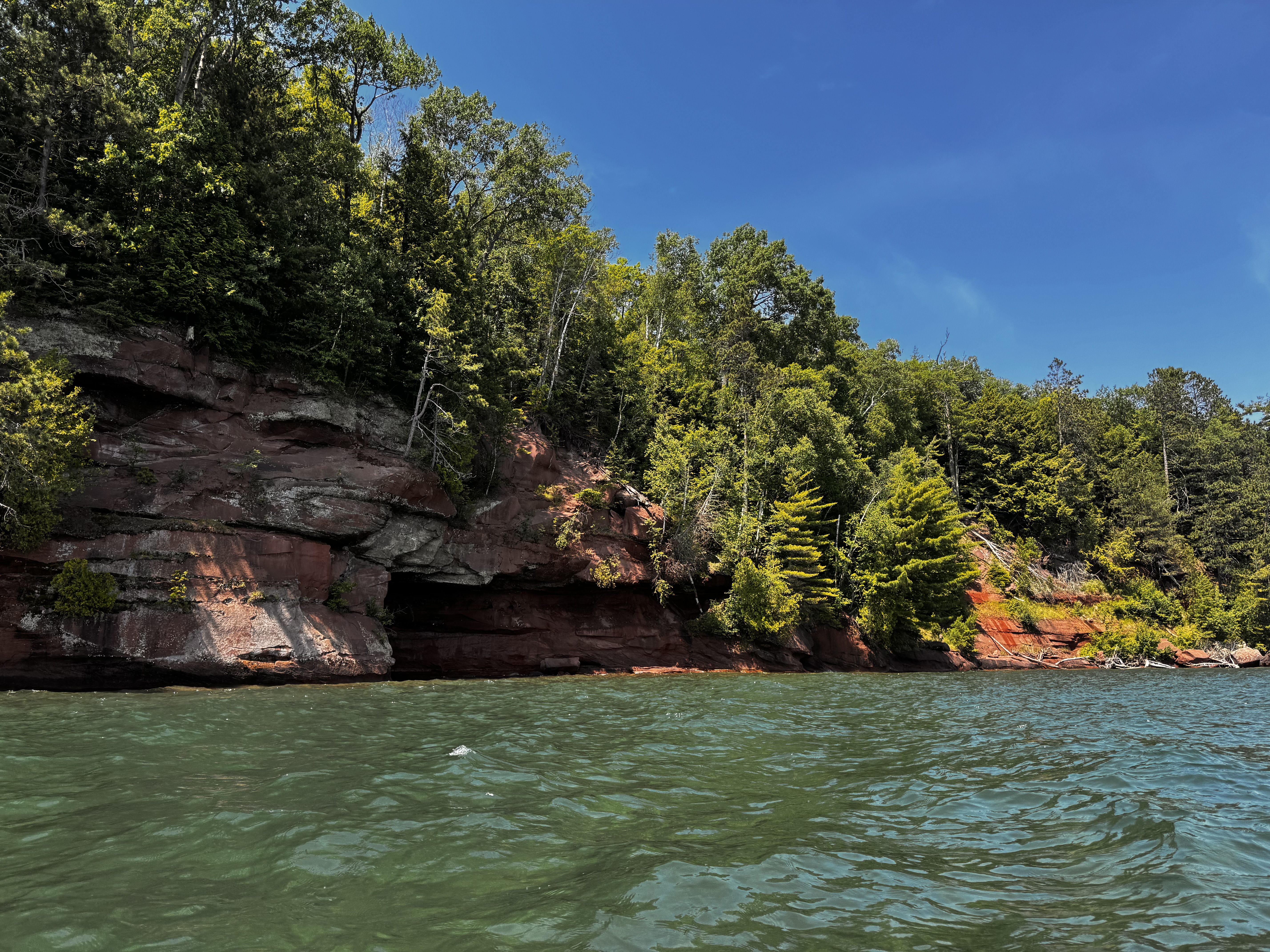
York Island itself is one of the smaller islands, but paddling around the western end provided some nice views of the rocky sandstone shore with the waves crashing up against it. From here, we paddled almost due west across open water towards Sand Island. This is really what I came to see. The eastern shore of Sand Island is dotted with sea caves that have been carved out of the sandstone by eons of choppy waters and terrible storms. We first paddled alongside the caves of Justice Harbor. 

As we approached, the loud boom of the water hitting the back of the shallow caves could be heard for some distance. The water is far from calm today and the rolling waves make it somewhat difficult to get pictures, but I managed to get a few. This is the highlight of the trip for me. In calmer waters, it would be possible to paddle into the caves, but given that we are paddling over 8-10 foot waves, I suspect the fiberglass shells of our kayaks would be shattered against the rocks of the shoreline if we were to try to get any closer. 

Heading south, we find more sea caves along the shoreline of East Bay. These are not quite a expansive as the ones to the north, but still very impressive. It's also interesting to see the trees clinging to the tops of the cliffs for dear life. Some surviving, while others fall into the lake to their eventual death - almost as if they are walking the plank.

The sea caves really were extraordinary and kind of made the whole trip worthwhile, but now it's time to return to the mainland and real life once again. Though with the winds picking up that may be easier said than done. 

As we turn our vessels southeast towards Sand Bay, the true adventure begins. We are now paddling into a 10-15 mph headwind, which doesn't seem like much and wouldn't be for a motorized boat, but when your only power source is the strength in your arms, that might as well be a hurricane. Huge waves (some 15 feet tall) crash against our small fleet of boats as we fight our way to our take out.

It feels like 95% of our effort is keeping us in place and only the remaining 5% is adding to our forward progress. If at any point, the nose of the boat gets unaligned with the headwind, we are quickly turned almost sideways and pushed backwards. My partner and I are paddling for all we are worth and still barely making any gains. The other boats, including our guides aren't managing much better. 

This final stretch of about 3.5 miles takes us nearly three hours to paddle. Eventually, we get into a position out of main headwind and that allows us to finish out the trip in a much easier fashion. That section though was without a doubt the most challenging paddling I have ever done. Wow - I'm exhausted.

Once we're finally on land, we take a minute to rest. I can barely stand. My legs and arms are numb from the incredible workout I've just undergone trying to return to the mainland. After I get some feeling back, I help the others and our base camp crew unload the gear and load the boats onto the trailer. Someone mentions that the Coast Guard had just issued a small craft advisory due to the winds and choppy water. Good timing, lol. This last leg of the journey was about 7.6 miles, but the most difficult without question. 

Back at base camp, we strip out of our wet suits and I take advantage the camp's hot showers to get some of the funk off of me. I'm sure my companions will appreciate that once we're stuck in the van for the ride back to Duluth. After lunch, we hop in the van and head back to our starting points. For me, that's the hotel in Duluth. Our total paddle trip was about 25.7 miles of rolling waves and challenging winds on this mighty lake, but it was well worth it.