Sunday, July 28, 2024

Burgess Falls Paddle (White County, Tennessee)


The crown jewel of this trip to Eastern Tennessee has always been a chance to paddle to the famous Burgess Falls. I had planned this trip last year, but it was cancelled due to bad weather and with a questionable forecast for this afternoon, I worry that may be my fate once again. I arrived at the group's meeting area about an hour early (or so I thought). 

I'm paddling with Cumberland Kayaking again today, and as I pull into the parking area, one of the guides asks my name. I give it and there seems to be some confusion. Just as I'm conversing with him, I receive a text notification that the trip has been cancelled. As it turns out, I got my schedule mixed up because of the time zone difference. There is no 10:00 am paddle, and I'm actually scheduled for the 11:00 am trip, which is being cancelled due to incoming thunderstorms. They are continuing with the 9:30 am trip though, which is getting ready to depart. I ask if there is a spot available and he transfers me to this departure time instead. I guess being early sometimes pays off.

This is a much larger group than yesterday and includes a couple of families. There are roughly twenty of us in total. We load ourselves into the two passenger vans and are ferried down to the boat ramp, which is just down the hill. After unloading the kayaks and hearing a short safety talk, we're quickly on the water. It seems I'm one of the more experienced paddlers and quickly end up at the front of the pack. Our guide calls out for me to wait, which I do. I never intended to get too far ahead, but it just seemed to happen. Once he catches up, he tells me of a couple of turns I'll need to make and tells me to go at my own pace. I do my best to stay mostly with the group. 

Soon, we hit some flooded forests. It seems the lake level was lowered some years ago while they did some work on the dam. This lasted a few years and during that time, a young forest group up in higher sections of the lake bottom. Once the water was released back into the lake, those forests flooded and now only the dead and dying trunks of those trees remain. They make for an interesting obstacle course in parts of today's paddle.

After about two miles, we reach the area of Burgess Falls. The remains of an old power plant on the right bank greet us. Apparently, they used to have a power generator station here, but it has long since fallen into disrepair. Just ahead, the impressive Burgess Falls rises into view. This is a somewhat unique waterfall in my experience. It's almost as if a finger of the cliff, probably made of harder stone than the rest, juts out into the canyon and the stream that makes the waterfall follows it. This all gives the appearance of an island in the sky with water coming off of it in every direction. It really is stunning and at 136 feet, is a fairly tall waterfall for this region.

We bank the kayaks and walk the final yards to the pool below the waterfall. I welcome the cold mist fills the air and take advantage of its cool effect. The members of our group fan out and begin swimming in the pool and climbing the lower sections of the waterfall. It all seems like fun, but knowing how slippery these algae-covered waterfalls can be, I'm not willing to risk injury for it. I'm content just basking in the glory of this one.

We hang out for nearly an hour before loading ourselves back into the boats. Just I launch, I get a weather notification that says a moderate rain will be starting in five minutes. Thunder in the distance confirms this. I hate being on the water during a thunderstorm. It's actually pretty dangerous as a lightning strike could electrify large sections of the lake, and those dead tree trunks sure would make good lightning rods. I paddle pretty hard to get back.

About a mile from the boat ramp, the rains begin and get increasingly harder. A few cracks of lightning shock the sky and thunder rolls. I'm soaking wet by now and my boat is beginning to fill with rain water. The raindrops beating on the surface of the lake make it harder to paddle. Almost like trying to kayak through mud, but knowing how dangerous this is, I do my best to keep a steady pace until I make it back to shore. Everyone else soon pulls in behind me and we reload ourselves into the vans, dripping water everywhere. We're soaked.

Since no one was injured, I'll say that the adventure through the storm was actually kind of fun, but I would not recommend doing it to anyone, as it is quite dangerous. Our total paddle for today was about 3.6 miles, but the stunning waterfall lived up to its reputation and made the entire outing worthwhile.

Cummins Falls (Jackson County, Tennessee)


Continuing my waterfall chasing in eastern Tennessee, I start today by visiting Cummins Falls. After filling up on great barbeque and mediocre beer in Cookeville, TN last night followed by a good night's sleep at my hotel, I get an early start and drive the short distance to Cummins Falls State Park. 

While the park signs say it doesn't open until 8:00 am, I'm here about fifteen minutes early and everything appears to be open. I pull into the large parking lot and notice that the trail is paved. I decide to just stick with the flip-flops I'm wearing instead of changing into my hiking shoes. Just a few yards into the hike, I realize my mistake as the pavement ends and the trail surface changes to dry soil with an abundance of tree roots growing through it. I'm already here now though and decide just to continue.

The trail to the waterfall overlook is less than a mile and I arrive quickly to a railed concrete deck offering a spectacular view of this beautiful waterfall. This cascading waterfall is made up of two sections. The first is a tall single drop, which then levels out to a wide platform before plummeting once again over a series of smaller stone steps. On the platform, a long tree trunk has been stood almost upright against the waterfall. So much so, that at first glance I though it had actually grown out of the rock, but that's not the case. I take a few more pictures and head back to my car for the next adventure.

Saturday, July 27, 2024

Fancher Falls Paddle (DeKalb County, Tennessee)


Leaving the area of Rock Island State Park and driving another hour or so north, I head for my next stop and primary for the day. I'll be joining Cumberland Kayaking to paddle to Fancher Falls on a branch of the dammed rivers and creeks that form Center Hill Lake. I arrived a little early and so take time to explore the facilities around the Cookeville Boat Dock, which includes a gift shop and restaurant. I consider getting some food, but I don't have that much time and decide to head back to my car and put some sunscreen on in anticipation of a couple of hours on the water. I own a kayak, but I find it's sometimes easier just to rent one from local outfitters on this trips, depending on the price. That's what I'll be doing today.

Just as I leave the main office of the marina, I see a truck pull into the parking area pulling a trailer of yellow and orange sit-on-top kayaks. This appears to be my crew. I finish my preparation, grab my personal gear, and then head down to meet the gentleman driving the truck. Two couples approach as I introduce myself to the guide. With all five of us here, our guide begins explaining the plan and we start unloading some boats. 

Before long, we're on the water. It's a hot and sunny day, but the water is a bit cooler and it's really nice to be paddling. All of us do attempt to do some shade hopping though when it's available. From the dock, we paddle east as the river narrows and tall cliffs rise on either side of us. In the distance, I see a long-legged heron or crane find a perch on a tree branch high above the water, and then a short time later dive majestically to find its next meal.

Soon, we reach Fancher Falls. With the water level down a bit, we pull our kayaks into the river bank and traverse the final few yards on foot. It's not far, but does require a little scrambling. I expect many of these rocks are mostly submerged in the springtime. The waterfall itself is pretty impressive with its single stream plummeting about 110 feet into the cold pool below. The top of this waterfall is private property and the owner has placed their home near the edge. It's visible from below from some angles. 

Three of the other folks on this trip decide to take a dip in the cold waters of the pool, but not being much of a swimmer, I'm content to just sit here and take it all in while the mists of the falling waters cool me off. We stay at the waterfall for around 45 minutes before heading back the way we came.

The return trip is uneventful and a few passing motorboats provide us with some entertaining wakes to paddle through. After pulling into the dock, I lift my boat out of the water and thank our guide for such a great trip. I say my goodbyes to the other guests and head to my car. Our paddle distance was about 5.3 miles round trip and very easy on these flat waters.

Twin Falls and Downstream Trail (White County, Tennessee)


Continuing my exploration of waterfalls around Rock Island State Park, I cross the river and drive to a small parking lot. I'm unsure if this is actually part of the park or not, but when I arrive, there are several men dressed in rescue gear preparing for something. The lack of urgency in their movement, suggests to me that they are doing some training exercises. The presence of their vehicles forces me to park a bit further up the hill. No big deal. I appreciate that they go through these exercises to keep their skills sharp. You never know when you may need their help.

Walking down the gravel road, I come to a large dam and flume, with a long set of wooden stairs leading down to a natural overlook of this amazing waterfall. In the distance, Twin Falls appear a to explode from the forest and plummet eighty or ninety feet into the rocks and river below. While there are primarily two main streams (thus Twin Falls), the water actually appears to be coming from everywhere. This includes a geological stone step formation that is quite unique. I walk a ways down the Downstream Trail to it's end point. It offers some interesting views of the waterfall from different angles. After doing a little rock scrambling and taking a few pictures from those vantage points, I head back to the car. This one was definitely worth it - fabulous waterfall!

Rock Island - Great Falls (Warren County, Tennessee)


My next stop at Rock Island State Park is to an overlook of the Great Falls. The weather in this part of the country has been a bit strange lately with frequent, but short-lived thunderstorms. Overall, it's been pretty dry and I hope that doesn't impact all of the waterfalls I'll be visiting on this trip. After parking my car, I walk just a short distance to an overlook platform. 

Looking out over the Caney Fork River, I see a very unfamiliar landscape. The river, while at a low level currently, flows over a series of large stones. Unlike what I'm used to though, the stones are more like uneven tiles making up the river bed. Waters flow over the low-lying ones and culminate in a large arc of what is probably a wall of waterfalls. With the current water levels, there are only a couple of small waterfalls making the plummet. It's still quite pretty though and the uniqueness of this landscape makes it worth a visit.

Rock Island - Eagle Trail (Warren County, Tennessee)


I'm in for Eastern Tennessee this weekend for some kayaking and waterfall chasing. My first stop brings me to Rock Island State Park and an attempt to hike a trail to something called Blue Hole. Unfortunately, the trail is temporarily closed due to a collapsed piece of wooden deck or walkway beyond where I'm able to see. As an alternative, I drive a short distance down the road and find another trail that looks as though it may connect to this one. It's called the Eagle Trail.

The trail starts near a beach area overlooking the Caney Fork River and some tall bluffs on the far side, which are quite picturesque. From there, the trail heads into the woods up a moderate incline. It's incredibly humid this morning and combined with quite a bit of poison ivy and a lot of bugs, this is not the most enjoyable hike, but I'm determined to finish it now that I've started it.

The trail circumvents a small ravine that ends in a small waterfall and slide. I can hear the water rushing over the rock, but it's mostly obscured by the topography and the trees. I'm never really able to get a great shot. After a short distance, I reach the connection to the Blue Hole trail, but it's roped off. I guess I won't get to see this feature after all. Instead of wandering through the poison ivy again, I decide to walk back on the road. I didn't do a GPS track, but the trail was listed as about 1.4 miles. Hopefully, some of the other stops I have planned will go better than this one.

Sunday, July 14, 2024

Kennesaw Mountain (Cobb County, Georgia)


The owner of the Meetup group I most often hike with is out of town and had asked me a few weeks ago if I would organized and lead the standard Sunday hike this week. I decided to hit Kennesaw Mountain, which I haven't hiked in a year or more. Knowing the general ability of the Sunday group and expecting temperatures hovering around the century mark, I planned a slightly shorter outing. Additionally, the first section climbs a set of switchbacks as we ascend 800 or so feet up Kennesaw Mountain.

After walking from the overflow parking area to the visitor's center where I told everyone to meet, I see a medium sized group congregating near the entrance. I ask if they are here for the group's hike and they confirm the group's identity. I introduce myself as the organizer and let them know that we'll wait just a few more minutes until the schedule start time of noon, do a round of introductions, and then hit the trail.

Like clockwork, the twenty or so of us provide our names and I give a short rundown of the plan. I also strongly emphasize the need to have plenty of drinking water along, as I don't want anyone getting heat exhaustion or having a heat stroke on this blistering hot day. With that, we start the climb.

I amazed at just how much I'm sweating. I had put on a thick layer of sunscreen, but I feel like just drops of sweat are rolling off of my forehead as I climb the fairly steep incline. I explain that we'll take a couple of short breaks on the way up. At those break, I remind people to drink their water. We're all loosing so much moisture to the heat, that hydration is extremely important.

Soon, we arrive at the summit of Big Kennesaw Mountain and I tell the group that we'll stop here and allow people to get some pictures of the city in the distance as well as the Civil War error graffiti carved into the rocks, which includes a panel that has always caught my attention where a solider carved "Prepare to meet thy god!" into one of the rocks near the trail.

After a few minutes we continue on towards Little Kennesaw Mountain and at one point loose the trail for a brief moment, but I quickly locate it and we're back on the path. After ascending the second peak, it's pretty much all downhill from there, though there is a bit of rock scrambling to be done on the descent. 

I stop the group for a couple more water breaks along the way, but we arrive back at the parking area without incident. I group everyone up and do a short debrief and then wish them a good evening. In total, we hiked about 6.4 miles. It was a good day!

Saturday, July 13, 2024

Lower Etowah River Day Paddle (Bartow County, Georgia)


It's been a while since I've gone on any outings with the Georgia Conservancy, which is a non-profit advocating for protection of many of Georgia's natural areas. It's a great organization with a great purpose and I enjoy engaging on their events whenever possible. Last year, I wanted to do a paddle they organized along the Lower Etowah River, but due to scheduling conflicts, I was unable to participate. This year, I tried to make it a point of keeping that day clear.

While there was a little confusion on where we were suppose to meet and the time we would be hitting the water, I eventually got to the right spot and met several other participants while we waited for the stragglers to arrive. After a short safety briefing and a little discussion on why the organization hosts these outings, we put our boats into the near the mouth of Euharlee Creek, where it flows into the Etowah River. 

This first section was shallow due to the very limited rain we've had lately and required dodging numerous rocks both under and jutting out of the water. It gave the trip a little adventure, which was nice. After hitting the river, the water way opened up significantly, but was still dotted with rocks and shallow areas. We did our best to avoid the, but a few folks got stuck here and there. With a combination of 'rocking the boat' and in some cases, just stepping out of it and pulling the boat free, we managed to navigate this section of the river. It took us much longer than expected though.

When we finally arrived a little island that splits the river, we took our first break and exited the boats. Many of us wandered into the trees to find a place to relieve ourselves. Looking at the clock, it seems were are likely going to get back to our cars nearly two hours later than the original plan. The entire paddle trip was supposed to be about 10 miles, but as I and a few others had plans this evening, our guide contacted the outfitter and made arrangements for us to exit at a boat ramp just another mile or so up the river. I hate departing early and I really wanted to run the entire river, but it would just get home too late to get cleaned up and then get to my plans.


Just before the boat ramp, we passed the remains of support for a now-vanished bridge. I have no idea how old this is, but it's always interesting to see things like this on the rivers. It is just a few meters way from the newer version of Harden Bridge and probably was the predecessor to the current one.

Five of us exited the water and pulled our rental boats to the top of the boat ramp. A short time later, the outfitter arrived with two vans and trailers. We loaded the boats and were promptly returned to our cars. We only got about 4.5 miles in, but it was still a very nice day to be on the river. Given the recent heat wave and the humidity in this part of the world, anywhere that affords me a chance to get in the water is a welcomed trip.

Friday, July 5, 2024

Fort Clatsop - Lewis & Clark Expedition (Clatsop County, Oregon)


I'm flying home tomorrow after spending a week with my friend, Nick, exploring the Pacific Northwest. It's been a great trip so far, as my previous blogs should indicate. For our last stop, we decide to visit Fort Clatsop. This is a reconstruction of the last encampment of the Corps of Discovery, also known as the Lewis & Clark Expedition, made before returning east to St. Louis. They made this their home during the winter of 1805-1806. The National Park Service has used descriptions from their journals to reconstruct the fort as it very likely existed in their time.

Growing up in the St. Louis area, the Lewis & Clark Expedition to explore Jefferson's Louisiana Purchase lands is something I learned a great deal about. It's almost as if I've come full circle now by visiting the far terminus of their most successful journey. The fort itself is nothing more than some connected log cabins with a retaining wall built around the outside, but this was likely enough to keep them warm and safe during their time here. Several volunteers, dressed in period clothing, linger around the rooms and answer questions of visitors. It's really well done and I appreciate how well informed they are of the history and day-to-day of the Corps members. 

After walking around the area for a short time, I feel blessed to have been able to see this reconstruction and learn more about the climax of Lewis & Clark's Expedition. Their goal was to find a route to the Pacific and they did just that, with grit and determination. Now it's time for me to make my own journey back east.

Fort Stevens (Clatsop County, Oregon)


Our next stop takes us to Fort Stevens, which was built near the end of the Civil War to guard the mouth of the Columbia River. Later it during World War II, the fort became the first US military installation on the mainland to come under fire, when a Japanese submarine surfaced and fired shells from it's deck gun. This was in June 1942, but the shells only damaged a backstop of the posts baseball field. The fort was decommissioned in 1947 and is now an Oregon state park.

We take some time to walk through the visitor's center, which includes several information panels about the fort's history, both during the Civil War and World War II. From there, we head out and walk through several of the former gun batteries that stood guard. Unlike many forts that I have visited over the years, the tactical design of this is not readily apparent and it feels more like a bunch of ideas thrown together, rather than a unifying theme supporting a singular tactic. Either way, it's interesting to walk through the halls where brave souls once defended their nation.

Astoria Column (Clatsop County, Oregon)


The Astoria Column is a 125 foot column constructed of concrete and steel on top of Coxcomb Hill overlooking the city of Astoria, Oregon. It was built in 1926 to commemorate the city's role in the Astor's family history. A small park surrounds the column and offers terrific views of the city, the mouth of the Columbia River, and Cape Disappointment on the far side of the river.

After paying the entrance fee and parking the car, my friend Nick and I walked around the column to get some pictures. It's painted with murals that pay homage to the history of the state of Oregon and the individuals that brought it into being. Nick decides to walk up the spiral staircase inside to to the top of the column, while I spend more time examining the murals. All the while, I'm forced to dodge balsa wood airplanes that are sold nearby and that visitors let glide from the top. It's an interesting landmark and worthy of a stop if you're in Astoria, but for now, we're going to hit the road.

Cape Disappointment Lighthouse & Deadman's Cove (Pacific County, Washington)


 After leaving Mount Rainier, our next stop on this Pacific Northwest road trip took us towards Astoria, OR. Prior to the trip, I had looked over the area to see what interesting stops might await us. The first one we hit was still in Washington, but just across the Columbia River from Astoria. Cape Disappointment received it's unfortunate name from a late eighteenth century fur trader who initially thought mouth of the river was a bay, but discovering the shallow shoal that prevented his ship's entry and realized his mistake.

The cape is now a state park and includes two areas of interest. The first is Deadman's Cove, which requires us to make a short hike. When I had examined the topography of this cove, I thought it might be where they had filmed some parts of the movie "The Goonies", which I knew had been filmed in and around Astoria. The cove lies beneath high rises on three sides, with the ocean entering from the narrow slit on the fourth. Wooden steps lead down to the white sand area at the head of the cove. It's actually a beautiful little area, but I don't think it was the location of the scenes I was thinking of from the movie.

From the cove, we next walked up a paved path to the top of one of the rises surrounding the cove. Here, a tall, white lighthouse guards the coast. IT was constructed and put into service in 1856, as the first lighthouse in the Pacific Northwest. It's 53 tall and includes a small attached room that likely functioned as living quarters. The structure is currently maintained by the US Coast Guard. We spend a little time walking around the top of the hill and examining the lighthouse before heading back the way we came and continuing on our journey.

Thursday, July 4, 2024

Narada Falls (Mount Rainier National Park, Washington)

Though the park is absolutely packed on this holiday, Nick and I were able to find a spot and take the very short hike to a view overlooking Narada Falls. There are so many people on the short trail that it's difficult to navigate, but soon we are at the overlook. The waterfall is actually a really beautiful one. As it plunges 188 feet over the cliff, the rising mists have created a prism effect and rainbow has appeared . . . magical! After just a short stay, we head back up the bumpy trail and depart.

Mount Rainier National Park (Mount Rainier National Park, Washington)


I've visited so many National Parks over the years, but seeing Mount Rainier up close and personal for the first time is something special. This 14,400 volcanic member of the Cascade Range is the tallest mountain in the state of Washington and the fifth tallest in the lower 48 states. So stunning is it's presence on any nearby horizon that a national park was created to protect it. 

Nick and I had planned on doing significantly more hiking while in the park, but with today being Independence Day and the weather being so warm, the park is absolutely packed and it takes forever to get anyway and find a parking spot. That said, we forgo several of the hikes we had planned and just satiate ourselves with the majestic views of this majestic snow-capped mountain and a few other stops we can access along the way.

Wednesday, July 3, 2024

Cape Flattery - Miracle Point (Clallam County, Washington)


Cape Flattery is the most northwesterly point on the mainland of the lower forty-eight states, and it's our next stop on this long Pacific Northwest road trip. Before going out onto the coast though, we stop at the small Makah Village of Neah Bay to get our permit and some tasty lunch. Since we're on the coast, I took advantage of the fresh seafood and had one of the best fish and chip plates I've ever had. Delicious.

After Nick and I finished our meal, we drove out to to Cape Flattery and explore the short 1.4 mile trail out to the various observation decks overlooking the endless Pacific beyond. The trail and boardwalks are well maintained and quite popular. There are a lot of people here, all taking in the views and those views are breathtaking. 

The geographic significance of this place is nothing really special to me, as it's just something someone decided on a map, but the beauty of these high cliffs with wave-eroded sea caves below them and the blue waters beyond make the short hike more than worthwhile. It really is quite beautiful here. We take the time to hit each of the several observation decks and snap some pictures from each before heading back to the car. 

Makah Petroglyphs - Wedding Rocks (Clallam County, Washington)


Continuing up the coast of Washington State, Nick and I decide to get some more trail miles in at our next stop. We've both always been very interested in Native American Rock art and the chance to visit some examples in this part of the country is just too good to pass up. It will be about a 4.5 mile hike each way though. So, we'll get our exercise in.

The trail starts at the Cape Alava parking area and heads into the temperate rainforest. The trail has a lot of ups and downs, but is primarily along rotting board walks and stairs. It looks as though the Forest Service, or whichever entity is responsible for maintenance here, does a reasonably good job of repairing the board walks, but the moisture here makes it a loosing battle.

After backpacking nearly thirty miles over the previous two days, Nick and I are both in great shape and moving at a rapid pace along the board walks. I stop along the way a couple of times to examine a plant or a log, but there isn't a great deal to see until we finally reach the beach. Getting to the beach requires a steep decent down some very narrow trails, but we eventually pop out on the rocky shoreline with the Pacific Ocean in front of us as far as the eye can see. A number of small rocks and some larger ones dart out from the water like small islands as the waves roll in and crash to the shore

Once we hit the beach, we turn south and make our way over a carpet of dried and drying seaweed, which is actually quite comfortable to walk on. We have to navigate our way around, through, and over several washed up and bleached tree trunks, but we finally reach the area we believe the petroglyphs to be.

After looking around a bit, we find a singular example, but we were expecting many more. This rock art is supposed to be located near a point of white rock cliff called Wedding Rocks. Nick and I spend the better part of half-an-hour climbing around and looking for more examples. Just as our frustration starts to surface, a mother and daughter we had spoken too on the way here call out that they have found more rock art. We carefully make our way over to what they are looing at and see a couple of really nice panels. These panels include fertility symbols, as well some human faces with decorative headdresses. There are actually some pretty great specimen here.

We finally decide to head back to the car. We spend more time there than we had planned to and probably would have been irritated had we not found more examples, but the treasure horde of beautiful rock art quells that irritation and I think we are both glad we made the hike. Our total distance for this one was about 9.1 miles.

Kalaloch Big Cedar (Jefferson County, Washington)


Another interesting tree along our path up the Washington coastline is the Kalaloch Big Cedar. A short gravel road leads to a small parking area and the tree is just beyond. This massive western red cedar is an impressive site. Legend suggests that it may be more than 1,000 years old. What ever it's age, it's a gnarled mess of trunks and branches forming a ball of life that just persists through time. A large trunk has fallen from the center of the tree, reportedly caused by a storm in 2014, but the tree lives on through it's other sections and branches. It's actually difficult to say whether this is single tree or a combination of many trees forming this visual cacophony. 

Tree of Life (Jefferson County, Washington)


After completing our overnight backpacking trip into Olympic National Park, my friend, Nick and I are driving up the coast and hitting a few interesting stops along the way. Our next stop takes us to the Tree of Life, overlooking the beach near the Kalaloch Lodge. This amazing specimen is a Sitka Spruce, but what makes it so special is how it is situated. The tree is roughly forty feet tall and 'stands' on the high-ground at the edge of the beach, but over time, the soil has eroded out from beneath it creating something of a tree root cave. The tree now sags into the cave, while it's root system desperately struggles to keep it upright. 

The walk to the tree is very short and once we hit the beach from the campground parking lot, we're basically there. As we approach, we see an attractive woman in a green satin dress perched on the root system and having some photos taken. I guess this would be a pretty cool place for some dating app pics. She sees us waiting to snap our own pictures and explains that she'll be coming down momentarily. We tell her not to rush and hurt herself, but we're obviously glad we'll be able to take our own pictures. A couple of minutes later and she has finished and departed. Nick and I take our own pictures of this natural wonder. I wonder how much longer it will sustain itself like this. With each passing day and each drop of rain, more and more of the soil erodes out from under it. It's only a matter of time before the tree of life is no more, which is perhaps analogous to the journey we are all on.

Monday, July 1, 2024

Enchanted Valley (Olympic National Park, Washington)


And so it begins . . . the planned highlight of my trip to the Pacific Northwest is an overnight backpacking trip with my friend, Nick into the heart of Olympic National Park to the Enchanted Valley. I often browse trips that REI and other outfitters and guide services offer. I saw this one posted several months ago and was interested in checking it out, but after reading up on it, there didn't seem to be any great challenges and I simply decided to plan the trip myself. After mentioning it to Nick, he was excited to get back out into nature as well and we planned the whole trip around this adventure.

Day 1

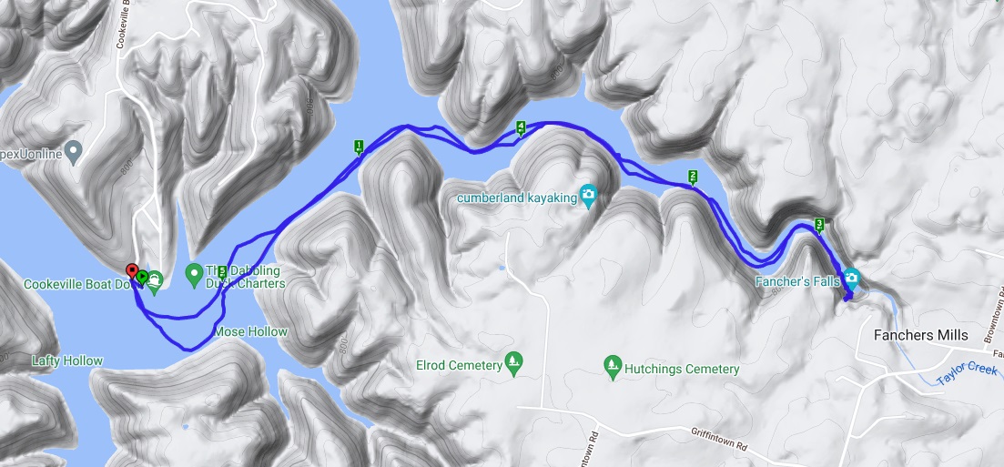
We drove into the park and followed a gravel road along the Quinault River a few miles until we reached the Graves Creek Campground. Our trailhead is just around the corner from here. It seems this area is pretty popular as there are a lot of cars, but we're able to find a parking spot without issue. It's also worth noting that we only encounter one other group of people, despite all of the cars. This isn't so much a day-hiking area as it is a backpacking area, implying that most of the car owners are probably deep in the backcountry, where we'll be soon.

After taking few minutes to get our gear packed and readied, we begin the adventure. This trail travels slowly up hill over the next fourteen-ish miles as we approach ever more closely to the Enchanted Valley and the now abandoned chalet that once provided refuge to weary travelers and horseback riders. 

The first part of the trail is gravel with just a few larger stones and takes us deep into the lush rainforest. Everything is so wet here and the morning dew covers absolutely everything. As I mentioned in my last post about the park itself, trees grow out of their fallen brethren. I note some of the plants that I'm unfamiliar with. One small plant has leaves similar to a gingko tree, but in groups of three, each jutting out in a different direction so as to form a near circle. It's all quite beautiful.


Though I'm sweating profusely with all of this humidity, I'm still feeling pretty good. My pack is a little heavier than normal with the requirement for bear cannisters in force. I also brought a couple of other luxuries and learning that tonight will be a bit colder than originally expected, a little extra to keep warm.

Soon, we reach the first of the river crossings that we'll need to make as we hike our way up the east fork of the river. A well-constructed bridge traverses some thirty feet or so above the raging blue waters of the river below. We encounter our the first of the few other backpackers we'll see while crossing the bridge. These ladies are on their way out and speak of how gorgeous the whole area has been for them.


Continuing, the trail becomes single track and though the overhead sun has tried it's best to dry out the mud, a few puddles remain. Within these muddy areas, we can clearly see the tracks of elk. I hope we get to seem some of the large beasts, but from a distance. I've seen plenty of them in various places on past trips, but the majestic animals never cease to inspire.

As we stop to refill water at a rocky outcropping into the river, Nick ends up loosing one of his water bottles to the stream. It's unfortunate to litter like this (even though it was accidental), but it's also going to cause some issues with the water carry. Luckily, I have plenty and with several places along the route to purify and refill, I don't think it will be too much of an issue.

The day goes on and we begin to get progressively more tired. We probably should have stopped for lunch, but for whatever reason, we just kept hiking. Now, we're starting to pay the price of that decision. It can't be much further though and we tell ourselves that we'll just fix dinner when we arrive.

We encounter a middle-aged man with his two sons while we're taking short break on a log. He tells us that it's still two to three more miles to the chalet, which is a little disheartening. We thought we were within a half-a-mile. Ah well, nothing left to do, but push on.

Finally, we encounter a narrow one-railed bridge built over a a long steel beam that crosses the raging river once again. I'm not really scared of heights, but as I'm getting older, my sense of balance is not nearly as good as it used to be and I carefully make my way across the bridge, a little nervous the whole time. Nick starts across once I reach the far side. I think we have just entered the Enchanted Valley, but I can't see the chalet just yet.

As we round a corner, the trees start to thin out and a grassy meadow opens up before us. In the distance, I can see the roof of the chalet with a magnificent cliff of waterfalls in the distance. We've arrived. The remaining walk to the chalet itself crosses a couple of small tributary creeks, which have carved deep gorges in the meadow, but is otherwise very easy.

Now starting at the chalet, we start looking for a place to pitch our tents. As Nick is still a little behind me, I make the executive decision to camp near the chalet building on a little point sticking out into the one of the creeks. It's an established campsite complete with a firepit and logs set up as a chairs. I think this will do well. When Nick arrives a few minutes later, he agrees. On the other side of the structure, I see a couple of other tents, though we're all spread out pretty nicely.

With quite a bit of light still remaining, we decide to get dinner going first and then to set up our tents. Nick gets the stove fired up and I pull out my freeze-dried pad-thai. The water boils quickly and soon, we're both face first into our meals. I've always thought this one was particularly tasty as it includes peanuts, a pack of peanut butter, and a lime-sriracha powder on the noodles. The calories are just what I needed.

Finally filling our faces, we take note of the incredible beauty of this valley. This has got to be one of the most scenic places I've ever seen and I've seen a lot of places. The river cuts a path through the valley, separating this meadow and the chalet from the high cliffs on the opposite side. At the top of the cliffs, small patches of snow linger into the summer warmth and no less than six spindly waterfalls cascade their way over the drop of many hundreds of feet. It's truly breathtaking.

After enjoying a meal and the magic of our surroundings for a bit, we both start setting up our respective tents. As I'm well-versed with mine, it goes up very quickly and I end up having to give Nick a hand sorting his out. He uses one of the tents that is supported by a hiking pole, which I've never been a fan of. I prefer free-standing tents. 

Now that our tents are set up, we spend the next half-hour or so just breathing in the scenery. We also take some time to figure out where to stash our bear-cannisters and decide that over by the chalet structure (which is only hundred or so feet away) would be a good spot. As the sun drops behind the tall cliffs and the air cools, we decide to call it a night. We hiked about 15.4 miles today according to my GPS track. I think we've earned a good rest.


Day 2

When I camp, I generally toss and turn most of the night. Mostly, this is due to whichever side is on the ground starting to go numb and my needing to get circulation going again. I'm not sure what was different here, but I only woke once or twice through the night. It was nice. 

My first hint that morning had arrived was the symphony of bird songs that were playing in and around my tent. It never got too very dark this far north last night, but I could see through my tent's rainfly that the sun would rise soon. I don't think it got as cold as we were expecting last night and while it's till a little brisk, it's not totally uncomfortable for me as I crawl out of my sleeping bag and put on some fresh pieces of clothing.


After that, I crawl out of my tent and just take it all in for a few minutes. Nick seems to still be sleeping in his tent, which is dozen or so yards away and so, I just sit in my chair and stare wide-eyed at the waterfalls and the cliffs they run off of to our immediate west. A small cloudbank has set up shop towards the top and the river perpetually flows through the valley just a few yards from my chair. Across the meadow, I see two bull elk with their towering racks of antlers starting to stir. I watching them from a distance as they rise from the soft grasses, cross the meadow and enter the forest to the northeast.

Just as the elk disappear into the tree line, I hear Nick starting to stir. Once he's up and about, we fix a quick breakfast and start to breakdown our sleep systems and tents. With our gear packed snuggly into our backpacks and our bellies full, we hit the trail for the return trip. Our path back follows the exact same route, but this time it should be mostly downhill. With our early start (on the trail before 7:00 AM), we should be back to the car just after lunchtime.

As my feet hit the trail, I feel energized. Being out in beautiful places like this fills my soul and inspires every step. I wish I could stay forever, but that's not the case. The hiking seems a bit easier, but I'm still a little cautious as I cross back over the one-rail bridge. 


From there, the hike is just as I remember it from yesterday and the next few miles are uneventful. We do encounter a number of other hikers today though. It seems there were a lot of people in the backcountry last night. 

Eventually, we reach the parking area and celebrate the completion of our overnight trip to the Enchanted Valley, which fully lived up to its name. According to my GPS track, our total distance covered was 29.8 miles. This may be a little higher than what's listed, but I've used this app for many years and I'll stick with it. We're both pretty tired and food is high on the agenda. As we drive into the nearest town and sit down for a famous Dino Burger (3/4 patty, with grilled ham, Swiss and American cheeses, and lightly grilled onions on a sesame seed bun), we reflect on the trip and how enchanting the Enchanted Valley truly is.

Olympic National Park (Olympic National Park, Washington)


It's the first day of July. My friend, Nick and I are exploring the Pacific Northwest and will begin a backpacking adventure later this morning, but in the meantime and on our way, we take in a bit of what Olympic National Park has to offer. It's my first trip to this park and I want to make the most of it.

This is a temperate rainforest and it's incredibly wet here, but also very beautiful. Trees seem to sprout, grow, die, rot, and then become food for the next generation in just a few short years. Everything is so lush here. Trees grow out of the fallen trunks of other trees. Streams and waterfalls abound. There's a lot to take in and I suspect we'll see even more of it over the next several days, at least that's the plan.