Normal guy with a normal life tries to get out and see the world every chance he gets.
Sunday, July 8, 2018
Glen Alpine Falls (El Dorado County, California)
The Lake Tahoe Basin has so many waterfalls that even after living in the area for over 15 years, I still haven't visited them all. While in the Emerald Bay area, I decided to take the narrow, but popular one-lane road along Fallen Leaf Lake to Glen Alpine Falls.
While the drive is only a few miles, between summer residents, the marina, and the campground, the road is extremely busy this time of year. Which wouldn't be a problem, but as the road twists and turns through the tree-covered hillside it offers just a few wide spots that allow two cars to pass each other. Fortunately, my jeep allows me to go up on a bit rougher stuff than the passenger cars. Though, it takes a while, I finally make it to the falls and find a parking spot.
Knowing this will only be a quick visit, I hike out a few yards to a rock face overlooking the cascading waterfall. The water is flowing pretty well, but I'm sure it would have been a torrent a month ago. The waterfall is wide and takes several paths across the rock bed before reaching the creek below. It's quite a pretty waterfall, but with only little time to visit, I head back the way I came.
Vikingsholm (El Dorado County, California)
Nearly a century ago, a mansion was built at the base of Emerald Bay in they style of a ancient Viking castle. I've hiked and run past the castle a few times over the years, but today I finally decided to take the official tour offered by the California State Park system.
As the tour enters the main living room, the children in the group are invited to count the number of dragons worked into various design elements of the inside and outside of the home. Apparently, Mrs. Knight had an affinity for the Viking legends of dragons acting as guardians.
The tour completes with access to the rooms within the main house and connected structures. Most of the furnishings are all original and maintained by the park service. I love architecture and this was definitely trip worth making.
Wednesday, July 4, 2018
4th of July Fireworks from Incline Peak (Washoe County, Nevada)
Independence Day is always a big holiday here in the US, as it commemorates and celebrates the birth of our nation. All around the country, Americans celebrate with barbecues, picnics, and fireworks. One of the most spectacular places, in my experience, to see one of these fireworks shows is Lake Tahoe. Several of the towns and villages along the blue alpine lake's shoreline host extravagant spectacles. Most years, I head up to Nevada Beach, which offers an outstanding view of the South Lake Tahoe show, which is generally considered one of the best in the entire country. This year, however, I had the opportunity to do something a little different. A meetup group that I hike with occasionally, hosted night hike to the summit of Incline Peak, overlooking the entirety of Lake Tahoe, and with it several of the fireworks events. It seemed liked a unique experience and I jumped on it.
Meeting several of our group in South Reno at about 6:45pm we carpooled up to the trailhead at the far side of Tahoe Meadows. There, we met a few others and started the short 2-mile trek up the mountain. As there is a small lake and a number of snow-melt streams in this area, the mosquitoes were thick, but with layers and bug spray, the attacks were minimal. The sun would still be out for another hour or so, which made the trip much easier.
As we approached the saddle below the summit, we met up with still more of our group, who had decided to make a night of it and camp near the summit. The final push to the top was only another ten minutes or so, and we finally arrived at the small clearing overlooking the lake - quite a stunning view. Though, the clearing was small and slightly inclined, we did our best to set up chairs and get an entire smorgasbord of snacks passing around. There was cheese, crackers, smoked salmon, cookies, brownies, lettuce wraps, beer, wine, margaritas, and more food than we could possibly eat, though there were about 20 of us in the group by this point.
As darkness settled, we each found a comfortable spot sit for the shows that were about to start. At about 8:30, the first rockets and explosions could be seen on the north-western shore, coming from Tahoe City. Shortly thereafter, more fireworks started diagonally across the lake near Glenbrook. Next, we could see over the eastern mountains forming the rim of the lake to catch some of the show from Carson City, far below. The last two shows to start were South Lake Tahoe, the length of the lake from us, and Incline Village, directly below our vantage point.
While I've witnessed many fireworks displays in my life, this was a truly different experience. From where we sat, at about 9,600 feet, the rockets seemed to barely leave the ground before exploding in to magnificent, but from this distance, tiny flowers of light. And the opportunity to see five different shows all simultaneously with the blue waters of the lake between them, was simply amazing. It was as if we were watching the celebration from above - in fact, we were.
As always, the shows didn't last more than 15-20 minutes and afterwards, we immediately packed up and headed down the mountain. We said good by to our friends that were camping, donned our headlamps, and hit the trail. The return trip was uneventful, but seeing so many headlamps in a row passing through the treeline, must have been an interesting site for anyone on the highway below. In total, we hiked right at 4 miles, but the event in and of itself, was worth far more than the mileage.
Point Mariah overlooking Royal Gorge (Placer County, California)
What better way to start the 4th of July holiday off than with a hike to a gorgeous overlook. I first heard of Point Mariah late last fall, but as the trail is on the private property of a cross-country ski resort, I thought it best to wait until the snows had melted and the patrols had stopped patrolling for the year.
Finding the trail head was a little challenging, as many of the markers I was looking for were not to be found. The trail head and kiosk mentioned in the guide I was following must have been washed off the side of the mountain and down into the creek and the iron gate that blocks the road has been removed and deposited in some nearby bushes. After walking down the dirt road about a quarter-mile in the wrong direction though, I finally got my bearings and figured out where I should be headed.
The trail starts by crossing sturdy bridge over Serene Creek. The creek is nothing more than a dribble at this point in the season, but it is still running, albeit very slowly. From there, the trail undulates slowly as it traverses the side of the mountain. I suspect this would be a great snowshoe trip during the winter months. Milkweed and other wildflowers cover the hillsides and the occasional break in the trees offer a taste of what I expect will be a spectacular view at the end of the trail.
Finally reaching the clearing of the southern most outcropping overlooking the Royal Gorge of the North Fork of the American River, I have reached Point Mariah. The small tastes I captured earlier on the way up did not oversell the view. Looking west, I can see thirty or forty miles down the large valley cut by the river. It's actually reminiscent of Yosemite, but much more green and a lot less granite. This vista point alone makes the trail worth while.
The trip back to my jeep is uneventful, but when I finally reach the dirt road leading to the bridge, a truck passes me and stops to ask for directions to the trail. I had seen them pass in the other direction just a couple of minutes before. Apparently, they were confused by the same guide and lack of landmarks that I was. I provide them with a detailed description and wish them well. Finally back where I started, I see that I hiked about 5.9 miles, which includes my detour. A pretty easy trail that leads to an amazing view. Total worth it . . . especially since my trip was free of mountain lions.
Saturday, June 30, 2018
Sawtooth Loop Trail (Placer County, California)
Sometimes, you just want a trail to put a few miles in on. After reading about the Sawtooth Loop Trail near Truckee, CA, I thought I had found just such a trail. Leaving Reno about 8:30am and making the 40-ish mile drive across Donner Pass to Truckee, CA, I arrived at the trail head just a short time later and started the hike.
This is a popular mountain bike trail and the number of cars at the trail head with bike racks testify to that fact. That said, I get a couple of miles down the trail before encountering any of them. The trail is perhaps the most windy and twisting trail I have ever hiked and I'm forced to question why it was built this way. I would understand if the terrain or erosion control required it, but this area, while setting atop a the valley carved by the Truckee River, is on a nearly flat plateau. There is no good reason I can think of to cut the trail like this except to make it interesting for the mountain bikers. Oh well, it's easy going.
While there are a couple of spots granting a vista of the river valley below, they are few and far between. What this trail has a lot of is forest. Forest much like that which covers the Sierra Nevada is really the only environment here. Ponderosa pines, manzanita bushes, other trees and bushes I can't readily identify, and milkweed dominate the landscape. I'm especially happy to see the milkweed, as it is essentially for the survival of the monarch butterflies. I recently attended a lecture about the challenges this beautiful species faces. The more habitat we have for them, the better chance of their survival.
As make my way around the first major bend in the trail, I'm passed by a few friendly bikers. At the bend, a side trail leads to lookout, but just as much of the other trail has been, it seems to twist and weave through the level forest unnecessarily before reaching mediocre vista point over the valley.
I return to the main trail and continue around the second bend, encountering numerous other bikers along the way. All of them are friendly and greet me as they ride past. I do find it somewhat funny, that I end up catch up to some of the bikers that passed me earlier. Apparently, between their stops and my quick hiking pace, we're not that far apart.
Finally, reaching a multi-tined fork in the trial that sees the intersection of a forest road with the two forks of the trail, I get turned around slightly and walk a few yards down the wrong path before getting my bearings and returning to the proper path. From here, I'm simply retreading the first couple miles of the trail, which I hiked in on a couple of hours ago.
Finally reaching the jeep at the trail head, I note that I've covered right at 11.4 miles this morning. The trail was easy, but I must say, a little boring. There are really no overly interesting things to see along this trail. If you're simply looking for some quite time and some forest miles, this trail is probably for you, but otherwise, I would look for something a little more interesting.
Friday, June 22, 2018
Camping in the Santa Rosa Range (Humboldt County, Nevada)
For my adventure this weekend, I decided to join the meetup group I often hike with for a camping/hiking trip into the Santa Rosa Range north of Winnemucca, NV. Though most of the group drove out Thursday, I didn't want to burn any vacation days for the trip and so, I made the 3+ hour journey Friday after work. Another member of the group, Michael, asked if he could carpool out with me and I was happy to share the fuel costs and have some company for the long drive.
We drove across Hinkey Summit, which I had visited a few months back as dusk approached and finally reached the remote and somewhat hidden Lye Creek Campground just about 8:30 PM. Our friends greeted us and showed us to the sites they had saved for us. I quickly put up my tent and got my bedding ready. Michael did the same nearby and afterwards we joined the large group around the campfire they had going a few yards from where I parked.
After sharing a few beers, some snacks, and an ample amount of campfire chatter, we noticed the hour getting late and all decided to turn in for the night. As everyone departed for their nearby campsites, we agreed to meet back at the large fire ring at 8:00 am to start a day hike into the surrounding country.
While I do love the minimalist nature of backpacking, there is also something to be said for the comforts of car camping. Without the need to worry about ounces, I brought three sleeping pads and much much bulkier sleeping bag. A light cool breeze swept through my tent as I crawled into my warm bag and a moment or two later, I was out for the count.
There is something to be said about the way we awake to each day. In direct contrast to the obnoxious screaming alarm at home, I woke this morning to the sounds of a flowing creek a mere 10 yards from me and birdsong above. So serene it was, I decided to lay there for just a little bit and enjoy before getting up and fixing some breakfast.
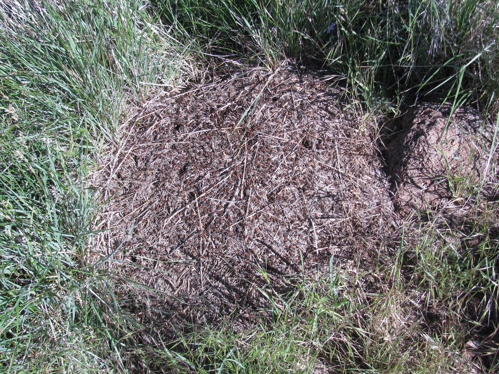
Along the way, we note a hill of harvester ants busy with activity. Hundreds of them packed into the small space, but they seem undisturbed by us. Though there is a bit of rock scrambling near the top, everyone makes it safe and without incident. From here, the views are majestic. In every direction, I can see at least fifty miles, perhaps more. We break for a quick snack while sitting on the loose talus, before starting the precarious scramble down and following the fence line until we reach another jeep trail, which we are pretty sure connects back to our original path out of the campground. Our suspicion is correct and after putting in about 5.7 miles on the trail, we find ourselves back at the campground.
Everyone returns to their respective sites to refresh and change, before reconvening at the campfire. My friend Vijay asks if not to tired from the morning hike, would I be willing to drive the jeep up to the natural arch, which I visited last winter, and possibly climb to the peak of the mountain above, the actual Hinkey Summit. As I'm not really tired at all, I'm actually rather excited to get in some more exercise this afternoon.
After hitting the high ridge on the road, I step off the jeep trail and begin to bushwhack my way up the steep northern slope of Hinkey Summit. Vijay follows a short distance behind, but Michael decides to head back to the jeep. It's slow going as there is no trail, ample rocks and bushes, and a heart-pounding incline. The final 30-ish feet to the peak is extremely precarious and I must place my feet extremely carefully as the talus is very brittle and subject to breaking under stress. At the top, I find and sign a small register that someone has placed into a glass jar and stashed under a rock for safe keeping. Vijay joins me a few minutes later and we take in the view from ~8,500 ft, before carefully making our way back down the slope and to the campground.
Returning to camp, we find our comrades enjoying each others company over beer, wine and table games. We join them at the campfire and enjoy dinner together. The fire rages deep into the evening and I eventually decide to turn in for the night.
I sleep in a bit later this morning, but again wake to the sounds of the creek and birdsong. Once awake, I start breaking down my camp. I had told Michael and the rest of the group that I wanted to get an early start and get back in Reno with some daylight left. As we make our way down the mountain, we encounter a small rattlesnake on the jeep trail. He coils and prepares to strike at the jeep, but allows us to pass without incident, though his fangs might have problems with my tires and/or undercarriage.
Our last view as we make our way down Hinkey Summit Road are hillsides covered with a sea of golden wildflowers - incredibly gorgeous. It was a fantastic weekend, full of beautiful countrysides, good friends, and lots of peace.
Saturday, June 16, 2018
Rock Tahoe Half-Marathon 2018 (Douglas County, Nevada)
Another year, another Rock Tahoe Half-Marathon. This will be my third year running this half along the gorgeously scenic eastern side of Lake Tahoe. I often choose not to repeat specific half-marathons, but I've always thought of this one as the best organized of any I have run and that helps to keep bringing me back.
Like last year, I decided to stay up at the lake instead of getting up at 3:00 am to make the trip. The Hard Rock Hotel, which serves as sponsor and finish line has pretty nice rooms and since the packet pickup, shuttle to the starting line, and the after party are all here, it makes everything nice and convenient. After getting a pretty nice night of sleep in my ninth floor room overlooking the lake, I wake at 5:15 to get ready to run. After getting a few calories in me, putting some sunscreen on, getting all of my running-wear on, and grabbing a bottle of water, I head outside to the shuttle pick up.
Unlike two years ago when it snowed on us a bit at the starting line, the temperature and weather are absolutely perfect. My weather app reports 49° and there isn't a cloud in the sky above us - perfect running weather! While we wait for the start of the race, I visit with some friends, both new and old. Runners are a pretty friendly crowd. As we approach the starting time, all 3,000 or so of us starting moving up towards the startling line and organizing ourselves into groups with the pacers. Though I'm nursing an ankle I rolled a week ago, I feel pretty strong this morning and put myself with the 2:15 group.
With a quick countdown and the sound of a air horn, we're off. The start is always congested, but as we make the turn out of the parking area and onto the highway, which has the right most lane closed to cars for this event, the pack starts to open up.
As always, the first 2-ish miles are down hill as we run down the highway from Donner Summit, loosing a few hundred feet of elevation as we go. I'm feeling really, really good along this stretch and note that I'm pushing a sub-nine minute mile pace. Finally, at about the three mile mark, the sapphire blue waters of Lake Tahoe become visible in the distance. As we continue putting miles in, the route hugs the eastern shore of the giant alpine lake.
After eight or so miles, I'm still feeling pretty strong, though I did decide to take it easy on many of the uphills. I do however need to stop for a bio-break at one of the aid stations. There is a short line for the two porta-potties and I loose 5-ish minutes waiting, but it's better than not-going. After relieving myself, I'm back on the trail and still feeling pretty good. The temperature has risen to what feels like about 65°, which is still great for running.
As we leave the highway to finish the last couple of miles on bike trails, I start feeling the fatigue and I'm forced to walk a few sections, especially the one with the steep uphill. For the remainder of the race, I alternate between running and walking, before finally making that last turn that brings the finish line into view. At this point, a fellow runner and I nod to each other and decide to finish strong. We both burst into a near-sprint and step through the finisher's arch.
Subscribe to:
Posts (Atom)